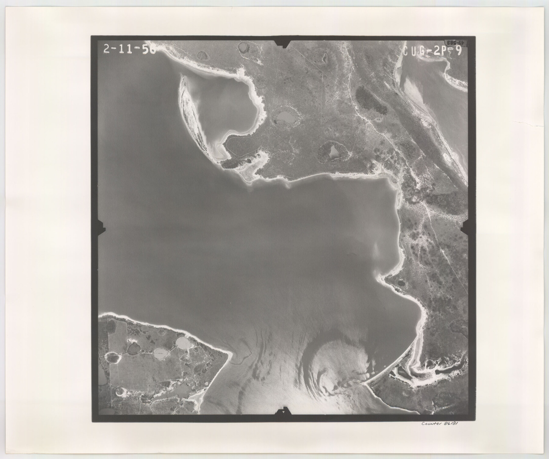
Flight Mission No. CUG-2P, Frame 9, Kleberg County
CUG-2P-9
-
Map/Doc
86181
-
Collection
General Map Collection
-
Object Dates
1956/2/11 (Creation Date)
-
People and Organizations
U. S. Department of Agriculture (Publisher)
-
Counties
Kleberg
-
Subjects
Aerial Photograph
-
Height x Width
18.6 x 22.2 inches
47.2 x 56.4 cm
-
Comments
Flown by V. L. Beavers and Associates of San Antonio, Texas.
Part of: General Map Collection
Mitchell County Sketch File 9

Print $8.00
- Digital $50.00
Mitchell County Sketch File 9
1909
Size 11.4 x 8.6 inches
Map/Doc 31694
Scurry County Sketch File 4

Print $26.00
- Digital $50.00
Scurry County Sketch File 4
1881
Size 13.1 x 8.5 inches
Map/Doc 36565
Henderson County Rolled Sketch 11

Print $20.00
- Digital $50.00
Henderson County Rolled Sketch 11
1915
Size 29.4 x 42.4 inches
Map/Doc 75957
Midland County Working Sketch Graphic Index

Print $20.00
- Digital $50.00
Midland County Working Sketch Graphic Index
1930
Size 43.3 x 35.3 inches
Map/Doc 76641
General Chart of the Coast No. XVI - Gulf Coast from Galveston to the Rio Grande

Print $20.00
- Digital $50.00
General Chart of the Coast No. XVI - Gulf Coast from Galveston to the Rio Grande
1883
Size 26.8 x 18.2 inches
Map/Doc 72736
Liberty County Working Sketch 51

Print $20.00
- Digital $50.00
Liberty County Working Sketch 51
1955
Size 17.5 x 38.5 inches
Map/Doc 70511
Flight Mission No. BRE-2P, Frame 26, Nueces County

Print $20.00
- Digital $50.00
Flight Mission No. BRE-2P, Frame 26, Nueces County
1956
Size 18.6 x 22.7 inches
Map/Doc 86735
Flight Mission No. CRE-2R, Frame 85, Jackson County

Print $20.00
- Digital $50.00
Flight Mission No. CRE-2R, Frame 85, Jackson County
1956
Size 18.4 x 22.3 inches
Map/Doc 85357
Bee County Sketch File 27

Print $8.00
- Digital $50.00
Bee County Sketch File 27
1886
Size 14.3 x 8.8 inches
Map/Doc 14331
Williamson County Rolled Sketch 5

Print $20.00
- Digital $50.00
Williamson County Rolled Sketch 5
1940
Size 23.7 x 34.5 inches
Map/Doc 8263

Jasper County Rolled Sketch 9

Print $83.00
- Digital $50.00
Jasper County Rolled Sketch 9
1932
Size 10.7 x 15.4 inches
Map/Doc 46171
You may also like
Coke County Sketch File 34

Print $20.00
- Digital $50.00
Coke County Sketch File 34
1888
Size 17.2 x 21.7 inches
Map/Doc 11116
Dickens County

Print $20.00
- Digital $50.00
Dickens County
1915
Size 42.4 x 39.3 inches
Map/Doc 4722
Crockett County Working Sketch 74

Print $20.00
- Digital $50.00
Crockett County Working Sketch 74
1964
Size 29.4 x 22.1 inches
Map/Doc 68407
Moore County Working Sketch 5

Print $20.00
- Digital $50.00
Moore County Working Sketch 5
1918
Size 19.2 x 15.3 inches
Map/Doc 71187
Edwards County Working Sketch 82

Print $20.00
- Digital $50.00
Edwards County Working Sketch 82
1964
Size 31.0 x 35.1 inches
Map/Doc 68958
North and South Sulphur Rivers, Sulphur Bluff Sheet

Print $20.00
- Digital $50.00
North and South Sulphur Rivers, Sulphur Bluff Sheet
1933
Size 37.6 x 37.2 inches
Map/Doc 65163
Jasper County Sketch File 5

Print $4.00
- Digital $50.00
Jasper County Sketch File 5
Size 8.4 x 12.1 inches
Map/Doc 27770
Duval County Rolled Sketch 48

Print $20.00
- Digital $50.00
Duval County Rolled Sketch 48
Size 21.8 x 18.5 inches
Map/Doc 5762
Arlington Street Map & Guide

Digital $50.00
Arlington Street Map & Guide
Size 35.5 x 23.2 inches
Map/Doc 94436
Flight Mission No. CGI-3N, Frame 121, Cameron County

Print $20.00
- Digital $50.00
Flight Mission No. CGI-3N, Frame 121, Cameron County
1954
Size 18.5 x 22.3 inches
Map/Doc 84594
Culberson County Sketch File 4

Print $56.00
- Digital $50.00
Culberson County Sketch File 4
1881
Size 14.3 x 8.8 inches
Map/Doc 20123
Kent County Working Sketch 23

Print $20.00
- Digital $50.00
Kent County Working Sketch 23
1987
Size 47.2 x 43.0 inches
Map/Doc 70030