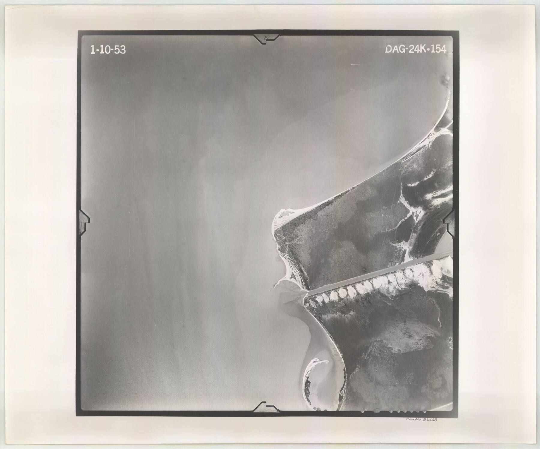
Flight Mission No. DAG-24K, Frame 154, Matagorda County
DAG-24K-154
-
Map/Doc
86568
-
Collection
General Map Collection
-
Object Dates
1953/1/10 (Creation Date)
-
People and Organizations
U. S. Department of Agriculture (Publisher)
-
Counties
Matagorda
-
Subjects
Aerial Photograph
-
Height x Width
18.5 x 22.2 inches
47.0 x 56.4 cm
-
Comments
Flown by Aero Exploration Company of Tulsa, Oklahoma.
Part of: General Map Collection
Motley County Sketch File 7 (N)

Print $20.00
- Digital $50.00
Motley County Sketch File 7 (N)
1901
Size 16.0 x 19.8 inches
Map/Doc 42140
San Jacinto County Sketch File 21

Print $2.00
San Jacinto County Sketch File 21
1873
Size 10.4 x 8.4 inches
Map/Doc 35802
Red River County Sketch File 3

Print $4.00
- Digital $50.00
Red River County Sketch File 3
Size 10.4 x 8.3 inches
Map/Doc 35098
Chambers County Rolled Sketch 24A

Print $40.00
- Digital $50.00
Chambers County Rolled Sketch 24A
1940
Size 36.5 x 49.0 inches
Map/Doc 8595
[Right of Way & Track Map, The Texas & Pacific Ry. Co. Main Line]
![64680, [Right of Way & Track Map, The Texas & Pacific Ry. Co. Main Line], General Map Collection](https://historictexasmaps.com/wmedia_w700/maps/64680.tif.jpg)
Print $20.00
- Digital $50.00
[Right of Way & Track Map, The Texas & Pacific Ry. Co. Main Line]
Size 11.0 x 19.0 inches
Map/Doc 64680

Real County Working Sketch 7

Print $20.00
- Digital $50.00
Real County Working Sketch 7
1928
Size 18.4 x 19.4 inches
Map/Doc 71899
McMullen County Working Sketch 34

Print $20.00
- Digital $50.00
McMullen County Working Sketch 34
1959
Size 25.9 x 26.0 inches
Map/Doc 70735
Crockett County Rolled Sketch 52

Print $20.00
- Digital $50.00
Crockett County Rolled Sketch 52
Size 36.7 x 44.7 inches
Map/Doc 8715
Parker County Working Sketch 17

Print $20.00
- Digital $50.00
Parker County Working Sketch 17
1996
Map/Doc 71467
Cameron County Rolled Sketch 30

Print $20.00
- Digital $50.00
Cameron County Rolled Sketch 30
1930
Size 36.3 x 24.4 inches
Map/Doc 5394
Corpus Christi Bay

Print $20.00
- Digital $50.00
Corpus Christi Bay
1975
Size 36.1 x 47.5 inches
Map/Doc 73475
You may also like
![94181, San Antonio [Recto], General Map Collection](https://historictexasmaps.com/wmedia_w700/maps/94181.tif.jpg)
Comanche County

Print $20.00
- Digital $50.00
Comanche County
1896
Size 41.7 x 44.8 inches
Map/Doc 4736
[Map of Texas showing Counties, County Seats, Rivers and Location of State Boundary Line Markers]
![60304, [Map of Texas showing Counties, County Seats, Rivers and Location of State Boundary Line Markers], General Map Collection](https://historictexasmaps.com/wmedia_w700/maps/60304.tif.jpg)
Print $20.00
- Digital $50.00
[Map of Texas showing Counties, County Seats, Rivers and Location of State Boundary Line Markers]
1950
Size 30.2 x 32.9 inches
Map/Doc 60304
Newton County Working Sketch 16

Print $20.00
- Digital $50.00
Newton County Working Sketch 16
1950
Size 15.8 x 15.5 inches
Map/Doc 71262
Frio County Working Sketch 20

Print $20.00
- Digital $50.00
Frio County Working Sketch 20
1985
Size 36.3 x 36.0 inches
Map/Doc 69294
Garza County Rolled Sketch 6E

Print $20.00
- Digital $50.00
Garza County Rolled Sketch 6E
1913
Size 19.2 x 15.6 inches
Map/Doc 5999
Karnes County Working Sketch Graphic Index

Print $20.00
- Digital $50.00
Karnes County Working Sketch Graphic Index
1921
Size 45.0 x 40.3 inches
Map/Doc 76600
San Jacinto County Sketch File A

Print $5.00
San Jacinto County Sketch File A
1895
Size 8.5 x 11.3 inches
Map/Doc 35716
[Panhandle Counties]
![89951, [Panhandle Counties], Twichell Survey Records](https://historictexasmaps.com/wmedia_w700/maps/89951-1.tif.jpg)
Print $20.00
- Digital $50.00
[Panhandle Counties]
Size 41.8 x 43.2 inches
Map/Doc 89951
Aransas County Rolled Sketch 27A

Print $2.00
- Digital $50.00
Aransas County Rolled Sketch 27A
1930
Size 8.9 x 7.2 inches
Map/Doc 5058
Laneer vs. Bivins, Potter County, Texas

Print $20.00
- Digital $50.00
Laneer vs. Bivins, Potter County, Texas
Size 21.2 x 18.8 inches
Map/Doc 93100
Freestone County Sketch File 10

Print $40.00
- Digital $50.00
Freestone County Sketch File 10
Size 13.0 x 13.5 inches
Map/Doc 23058