Harris County Rolled Sketch 69
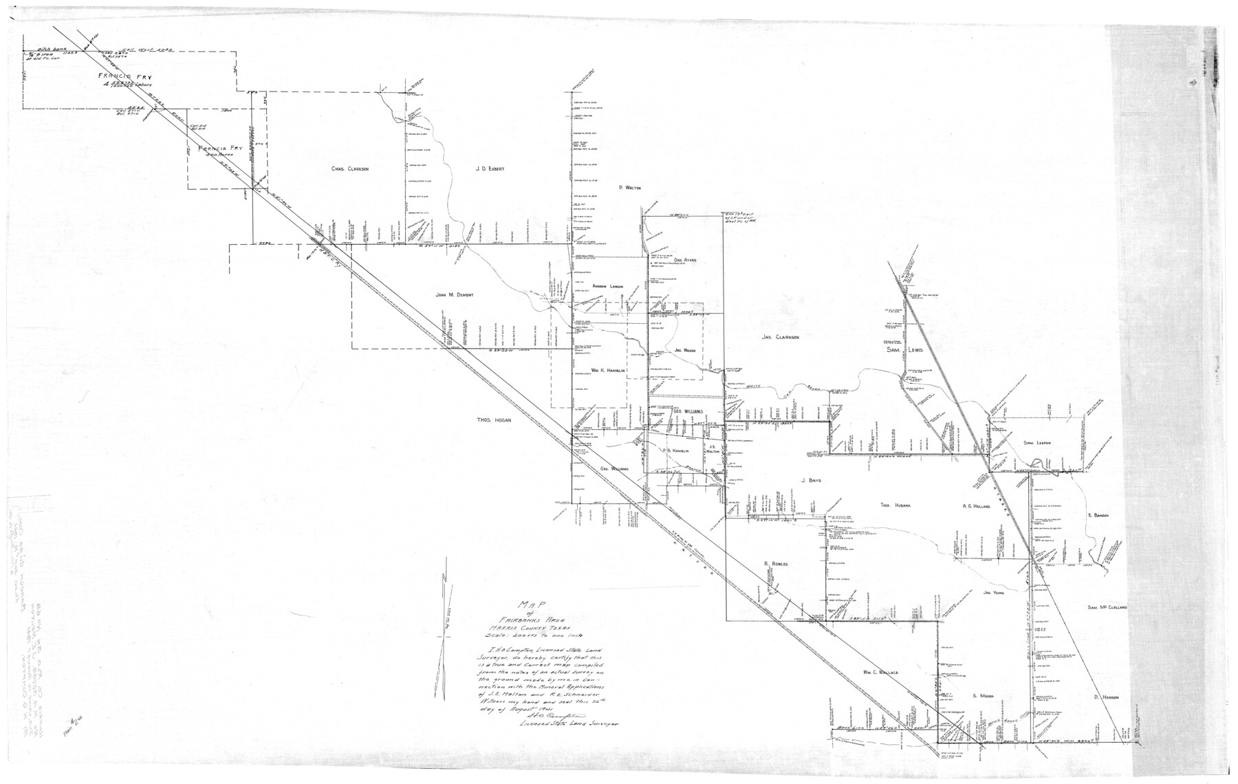
Map of Fairbanks Area Harris County Texas
- 
                          Map/Doc9131
- 
                            CollectionGeneral Map Collection
- 
                            CountiesHarris
- 
                            Height x Width37.0 x 58.5 inches94.0 x 148.6 cm
Part of: General Map Collection
            Flight Mission No. BRA-16M, Frame 87, Jefferson County


                                            Print $20.00                    
                                             -                         Digital $50.00                                    
                Flight Mission No. BRA-16M, Frame 87, Jefferson County
1953
Size 18.6 x 22.3 inches
                                Map/Doc 85699
            
            Flight Mission No. BRE-2P, Frame 74, Nueces County


                                            Print $20.00                    
                                             -                         Digital $50.00                                    
                Flight Mission No. BRE-2P, Frame 74, Nueces County
1956
Size 18.5 x 22.3 inches
                                Map/Doc 86769
            
            Flight Mission No. BRE-2P, Frame 110, Nueces County


                                            Print $20.00                    
                                             -                         Digital $50.00                                    
                Flight Mission No. BRE-2P, Frame 110, Nueces County
1956
Size 18.6 x 22.6 inches
                                Map/Doc 86796
            
            Brazoria County Rolled Sketch 33


                                            Print $133.00                    
                                             -                         Digital $50.00                                    
                Brazoria County Rolled Sketch 33
Size 10.3 x 15.4 inches
                                Map/Doc 42960
            
            Wharton County Sketch File 2


                                            Print $40.00                    
                                             -                         Digital $50.00                                    
                Wharton County Sketch File 2
1875
Size 13.6 x 12.6 inches
                                Map/Doc 39913
            
            Uvalde County Sketch File 23A


                                            Print $20.00                    
                                             -                         Digital $50.00                                    
                Uvalde County Sketch File 23A
1923
Size 18.4 x 23.0 inches
                                Map/Doc 12535
            
            Hudspeth County Working Sketch 14


                                            Print $20.00                    
                                             -                         Digital $50.00                                    
                Hudspeth County Working Sketch 14
1953
Size 24.2 x 41.2 inches
                                Map/Doc 66296
            
            Liberty County Working Sketch 6


                                            Print $20.00                    
                                             -                         Digital $50.00                                    
                Liberty County Working Sketch 6
1903
Size 17.2 x 19.5 inches
                                Map/Doc 70465
            
            [Surveys in Milam's Colony along the Colorado River, Onion Creek, Cedar Creek, and north of the San Antonio Road]
            
                                    ![88, [Surveys in Milam's Colony along the Colorado River, Onion Creek, Cedar Creek, and north of the San Antonio Road], General Map Collection](https://historictexasmaps.com/wmedia_w700/maps/88-1.tif.jpg) 


    ![88, [Surveys in Milam's Colony along the Colorado River, Onion Creek, Cedar Creek, and north of the San Antonio Road], General Map Collection](https://historictexasmaps.com/wmedia_w700/maps/88-1.tif.jpg) 
                                
            
                                            Print $20.00                    
                                             -                         Digital $50.00                                    
                [Surveys in Milam's Colony along the Colorado River, Onion Creek, Cedar Creek, and north of the San Antonio Road]
Size 13.4 x 26.8 inches
                                Map/Doc 88
            
            [F. W. & D. C. Ry. Co. Alignment and Right of Way Map, Clay County]
            
                                    ![64736, [F. W. & D. C. Ry. Co. Alignment and Right of Way Map, Clay County], General Map Collection](https://historictexasmaps.com/wmedia_w700/maps/64736-GC.tif.jpg) 


    ![64736, [F. W. & D. C. Ry. Co. Alignment and Right of Way Map, Clay County], General Map Collection](https://historictexasmaps.com/wmedia_w700/maps/64736-GC.tif.jpg) 
                                
            
                                            Print $20.00                    
                                             -                         Digital $50.00                                    
                [F. W. & D. C. Ry. Co. Alignment and Right of Way Map, Clay County]
1927
Size 18.6 x 11.7 inches
                                Map/Doc 64736
            
            Runnels County Rolled Sketch 33


                                            Print $20.00                    
                                             -                         Digital $50.00                                    
                Runnels County Rolled Sketch 33
Size 22.5 x 43.5 inches
                                Map/Doc 7520
            You may also like
            [Texas and Pacific Railway Company, Block 44, Township One South]
            
                                    ![89846, [Texas and Pacific Railway Company, Block 44, Township One South], Twichell Survey Records](https://historictexasmaps.com/wmedia_w700/maps/89846-1.tif.jpg) 


    ![89846, [Texas and Pacific Railway Company, Block 44, Township One South], Twichell Survey Records](https://historictexasmaps.com/wmedia_w700/maps/89846-1.tif.jpg) 
                                
            
                                            Print $40.00                    
                                             -                         Digital $50.00                                    
                [Texas and Pacific Railway Company, Block 44, Township One South]
1912
Size 41.1 x 56.4 inches
                                Map/Doc 89846
            
            Flight Mission No. DIX-7P, Frame 89, Aransas County


                                            Print $20.00                    
                                             -                         Digital $50.00                                    
                Flight Mission No. DIX-7P, Frame 89, Aransas County
1956
Size 18.7 x 22.4 inches
                                Map/Doc 83883
            
            Shelby County


                                            Print $20.00                    
                                             -                         Digital $50.00                                    
                Shelby County
1945
Size 42.7 x 46.9 inches
                                Map/Doc 95639
            
            United States Atlantic and Gulf Coasts Including Puerto Rico and the Virgin Islands


                                            Print $40.00                    
                                             -                         Digital $50.00                                    
                United States Atlantic and Gulf Coasts Including Puerto Rico and the Virgin Islands
1973
Size 21.5 x 60.4 inches
                                Map/Doc 76126
            
            Cameron County Working Sketch Graphic Index


                                            Print $20.00                    
                                             -                         Digital $50.00                                    
                Cameron County Working Sketch Graphic Index
1976
Size 32.0 x 39.4 inches
                                Map/Doc 76486
            
            Map of surveys 191 & 192 T. C. R.R. Co. in Travis County, Texas


                                            Print $20.00                    
                                             -                         Digital $50.00                                    
                Map of surveys 191 & 192 T. C. R.R. Co. in Travis County, Texas
1915
Size 20.7 x 12.9 inches
                                Map/Doc 75555
            
            Hamilton County Working Sketch 33


                                            Print $20.00                    
                                             -                         Digital $50.00                                    
                Hamilton County Working Sketch 33
Size 32.3 x 33.3 inches
                                Map/Doc 63371
            
            Hamilton County Working Sketch 15


                                            Print $40.00                    
                                             -                         Digital $50.00                                    
                Hamilton County Working Sketch 15
1949
Size 54.5 x 37.6 inches
                                Map/Doc 63353
            
            Flight Mission No. CUG-3P, Frame 167, Kleberg County


                                            Print $20.00                    
                                             -                         Digital $50.00                                    
                Flight Mission No. CUG-3P, Frame 167, Kleberg County
1956
Size 18.6 x 22.4 inches
                                Map/Doc 86287
            
            [Ft. W. & R. G. Ry. Right of Way Map, Chapin to Bluffdale, Hood County, Texas]
            
                                    ![64644, [Ft. W. & R. G. Ry. Right of Way Map, Chapin to Bluffdale, Hood County, Texas], General Map Collection](https://historictexasmaps.com/wmedia_w700/maps/64644.tif.jpg) 


    ![64644, [Ft. W. & R. G. Ry. Right of Way Map, Chapin to Bluffdale, Hood County, Texas], General Map Collection](https://historictexasmaps.com/wmedia_w700/maps/64644.tif.jpg) 
                                
            
                                            Print $40.00                    
                                             -                         Digital $50.00                                    
                [Ft. W. & R. G. Ry. Right of Way Map, Chapin to Bluffdale, Hood County, Texas]
1918
Size 37.7 x 84.3 inches
                                Map/Doc 64644
            
            Burnet County Working Sketch 13


                                            Print $40.00                    
                                             -                         Digital $50.00                                    
                Burnet County Working Sketch 13
1977
Size 40.5 x 49.2 inches
                                Map/Doc 67856
            
            Wilbarger County Sketch File 20


                                            Print $4.00                    
                                             -                         Digital $50.00                                    
                Wilbarger County Sketch File 20
1885
Size 12.7 x 8.2 inches
                                Map/Doc 40217
             
                        