![91904, [Sketch showing position of 287.2 acres of land surveyed for W. D. Twichell], Twichell Survey Records](https://historictexasmaps.com/wmedia_w1800h1800/maps/91904-2.tif.jpg)
[Sketch showing position of 287.2 acres of land surveyed for W. D. Twichell]
215-11
-
Map/Doc
91904
-
Collection
Twichell Survey Records
-
Object Dates
11/29/1919 (Creation Date)
-
People and Organizations
T.H. Seay (Surveyor/Engineer)
-
Counties
Stephens
-
Height x Width
15.2 x 7.3 inches
38.6 x 18.5 cm
Part of: Twichell Survey Records
Whitehead Addition, City of Lubbock

Print $20.00
- Digital $50.00
Whitehead Addition, City of Lubbock
Size 17.9 x 24.6 inches
Map/Doc 92779
[Map of Lubbock showing Sears Addition, Sunset Place, Loma Linda Place, University Place, Webb Addition, Ellwood Place, Del Mar Addition and Del Mar Annex]
![92729, [Map of Lubbock showing Sears Addition, Sunset Place, Loma Linda Place, University Place, Webb Addition, Ellwood Place, Del Mar Addition and Del Mar Annex], Twichell Survey Records](https://historictexasmaps.com/wmedia_w700/maps/92729-1.tif.jpg)
Print $20.00
- Digital $50.00
[Map of Lubbock showing Sears Addition, Sunset Place, Loma Linda Place, University Place, Webb Addition, Ellwood Place, Del Mar Addition and Del Mar Annex]
Size 30.8 x 30.8 inches
Map/Doc 92729
[Part of Block GG]
![90314, [Part of Block GG], Twichell Survey Records](https://historictexasmaps.com/wmedia_w700/maps/90314-1.tif.jpg)
Print $20.00
- Digital $50.00
[Part of Block GG]
Size 15.2 x 21.5 inches
Map/Doc 90314
[H.& G.N. Block B3 in NE corner of County]
![90272, [H.& G.N. Block B3 in NE corner of County], Twichell Survey Records](https://historictexasmaps.com/wmedia_w700/maps/90272-1.tif.jpg)
Print $3.00
- Digital $50.00
[H.& G.N. Block B3 in NE corner of County]
Size 13.8 x 9.7 inches
Map/Doc 90272
[West Half of the State of Kansas]
![93159, [West Half of the State of Kansas], Twichell Survey Records](https://historictexasmaps.com/wmedia_w700/maps/93159-1.tif.jpg)
Print $40.00
- Digital $50.00
[West Half of the State of Kansas]
Size 60.8 x 54.0 inches
Map/Doc 93159
[Leagues 615 ,616, and 242]
![91064, [Leagues 615 ,616, and 242], Twichell Survey Records](https://historictexasmaps.com/wmedia_w700/maps/91064-1.tif.jpg)
Print $20.00
- Digital $50.00
[Leagues 615 ,616, and 242]
Size 12.9 x 13.5 inches
Map/Doc 91064
Plat Showing Survey made for J. M. Teague, Jr. Gaines County, Texas

Print $20.00
- Digital $50.00
Plat Showing Survey made for J. M. Teague, Jr. Gaines County, Texas
1956
Size 12.7 x 18.7 inches
Map/Doc 92672
[B. S. & F. Block 9 and surrounding area]
![93070, [B. S. & F. Block 9 and surrounding area], Twichell Survey Records](https://historictexasmaps.com/wmedia_w700/maps/93070-1.tif.jpg)
Print $20.00
- Digital $50.00
[B. S. & F. Block 9 and surrounding area]
Size 18.3 x 26.1 inches
Map/Doc 93070
[Sketch Between Wheeler County and Oklahoma]
![89665, [Sketch Between Wheeler County and Oklahoma], Twichell Survey Records](https://historictexasmaps.com/wmedia_w700/maps/89665-1.tif.jpg)
Print $40.00
- Digital $50.00
[Sketch Between Wheeler County and Oklahoma]
Size 8.8 x 62.7 inches
Map/Doc 89665
Seagraves Chamber of Commerce Subdivision of Northeast Quarter of Southeast Quarter of Section 9, Block C-34, Gaines County, Texas

Print $20.00
- Digital $50.00
Seagraves Chamber of Commerce Subdivision of Northeast Quarter of Southeast Quarter of Section 9, Block C-34, Gaines County, Texas
1955
Size 16.7 x 18.2 inches
Map/Doc 92684
North Line Garza County/South Line Crosby County

Print $20.00
- Digital $50.00
North Line Garza County/South Line Crosby County
1887
Size 8.3 x 35.1 inches
Map/Doc 90904
[Blocks T1, T2, and T3]
![90995, [Blocks T1, T2, and T3], Twichell Survey Records](https://historictexasmaps.com/wmedia_w700/maps/90995-1.tif.jpg)
Print $20.00
- Digital $50.00
[Blocks T1, T2, and T3]
1888
Size 16.0 x 25.9 inches
Map/Doc 90995
You may also like
Current Miscellaneous File 35

Print $10.00
- Digital $50.00
Current Miscellaneous File 35
Size 14.2 x 8.7 inches
Map/Doc 73947
Tom Green County
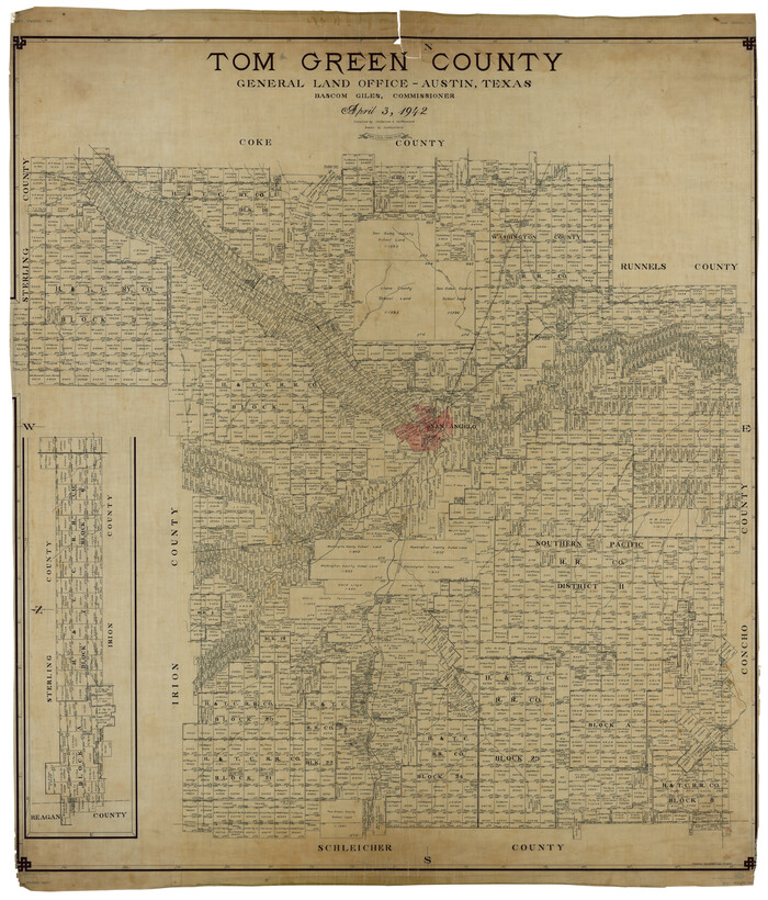
Print $40.00
- Digital $50.00
Tom Green County
1942
Size 55.4 x 47.6 inches
Map/Doc 63073
Neel's Creek of North Bosque

Print $2.00
- Digital $50.00
Neel's Creek of North Bosque
1847
Size 8.9 x 7.9 inches
Map/Doc 69755
Galveston County Sketch File 21

Print $4.00
- Digital $50.00
Galveston County Sketch File 21
1838
Size 13.3 x 8.3 inches
Map/Doc 23392
Flight Mission No. BRE-2P, Frame 135, Nueces County

Print $20.00
- Digital $50.00
Flight Mission No. BRE-2P, Frame 135, Nueces County
1956
Size 18.5 x 22.7 inches
Map/Doc 86808
Flight Mission No. DQO-1K, Frame 21, Galveston County

Print $20.00
- Digital $50.00
Flight Mission No. DQO-1K, Frame 21, Galveston County
1952
Size 18.8 x 22.6 inches
Map/Doc 84980
General Highway Map, Jim Hogg County, Texas

Print $20.00
General Highway Map, Jim Hogg County, Texas
1961
Size 24.6 x 18.2 inches
Map/Doc 79541
[A. Dubois Survey and vicinity]
![91524, [A. Dubois Survey and vicinity], Twichell Survey Records](https://historictexasmaps.com/wmedia_w700/maps/91524-1.tif.jpg)
Print $3.00
- Digital $50.00
[A. Dubois Survey and vicinity]
Size 11.4 x 14.6 inches
Map/Doc 91524
Kaufman County Working Sketch 5

Print $20.00
- Digital $50.00
Kaufman County Working Sketch 5
1922
Size 31.8 x 46.0 inches
Map/Doc 66668
Galveston County Sketch File 10

Print $4.00
- Digital $50.00
Galveston County Sketch File 10
1869
Size 12.8 x 8.0 inches
Map/Doc 23372
Tom Green County Sketch File 46

Print $82.00
- Digital $50.00
Tom Green County Sketch File 46
1883
Size 28.4 x 28.6 inches
Map/Doc 10402
Titus County Sketch File 5

Print $4.00
- Digital $50.00
Titus County Sketch File 5
1853
Size 11.7 x 8.2 inches
Map/Doc 38138