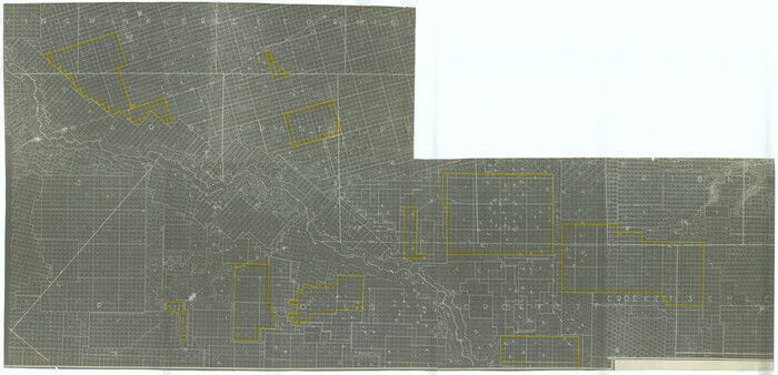
Ward County Rolled Sketch 4

Print $20.00
- Digital $50.00
Ward County Rolled Sketch 4
Size: 39.3 x 47.2 inches
10102
Ward County Rolled Sketch 22

Print $40.00
- Digital $50.00
Ward County Rolled Sketch 22
1873
Size: 69.2 x 18.0 inches
10110
Winkler County Rolled Sketch 9

Print $40.00
- Digital $50.00
Winkler County Rolled Sketch 9
1937
Size: 50.7 x 21.1 inches
10150
Winkler County Rolled Sketch 13

Print $40.00
- Digital $50.00
Winkler County Rolled Sketch 13
1902
Size: 39.5 x 48.7 inches
10153
Winkler County Rolled Sketch 15

Print $20.00
- Digital $50.00
Winkler County Rolled Sketch 15
1968
Size: 25.1 x 37.8 inches
10305
Reeves County Sketch File 12

Print $20.00
- Digital $50.00
Reeves County Sketch File 12
Size: 42.7 x 31.3 inches
10588
Crane County Sketch File 3a

Print $20.00
- Digital $50.00
Crane County Sketch File 3a
Size: 20.8 x 13.0 inches
11205
Loving County Sketch File 4

Print $40.00
- Digital $50.00
Loving County Sketch File 4
1961
Size: 20.6 x 24.7 inches
12014
[Letters to and from Maj. W. J. Powell regarding surveys of Texas and Pacific Ry. Lands west of the Pecos. Blks 53-55, Township 1 & 2 map within]
![2249, [Letters to and from Maj. W. J. Powell regarding surveys of Texas and Pacific Ry. Lands west of the Pecos. Blks 53-55, Township 1 & 2 map within], General Map Collection](https://historictexasmaps.com/wmedia_w700/pdf_converted_jpg/qi_pdf_thumbnail_1039.jpg)
Print $124.00
- Digital $50.00
[Letters to and from Maj. W. J. Powell regarding surveys of Texas and Pacific Ry. Lands west of the Pecos. Blks 53-55, Township 1 & 2 map within]
1934
Size: 10.2 x 15.4 inches
2249
University Land Loving-Ward-Winkler Counties

Print $40.00
- Digital $50.00
University Land Loving-Ward-Winkler Counties
1931
Size: 47.9 x 63.2 inches
2415
[University Land in Loving, Ward, Winkler, Pecos, Crane, Ector, Upton, Crockett, Schleicher, Irion and Reagan Counties]
Print $40.00
- Digital $50.00
[University Land in Loving, Ward, Winkler, Pecos, Crane, Ector, Upton, Crockett, Schleicher, Irion and Reagan Counties]
1938
Size: 37.9 x 78.5 inches
2424
University Land Loving-Ward-Winkler Counties

Print $20.00
- Digital $50.00
University Land Loving-Ward-Winkler Counties
1931
Size: 24.7 x 33.2 inches
2448
Loving County Sketch File 1

Print $4.00
- Digital $50.00
Loving County Sketch File 1
1931
Size: 11.2 x 8.6 inches
30407
Loving County Sketch File 3

Print $6.00
- Digital $50.00
Loving County Sketch File 3
1952
Size: 11.2 x 8.7 inches
30409
Loving County Sketch File 5

Print $10.00
- Digital $50.00
Loving County Sketch File 5
Size: 9.7 x 8.3 inches
30412
Loving County Sketch File 7

Print $2.00
- Digital $50.00
Loving County Sketch File 7
1977
Size: 12.1 x 8.8 inches
30417
Jacob Kuechler's Field Notes (Field Book), Texas & Pacific Ry. Co. 80 Mile Reserve

Print $222.00
- Digital $50.00
Jacob Kuechler's Field Notes (Field Book), Texas & Pacific Ry. Co. 80 Mile Reserve
1879
Size: 7.9 x 5.4 inches
3050
Loving County Sketch File 6

Print $10.00
- Digital $50.00
Loving County Sketch File 6
1963
Size: 7.2 x 5.9 inches
41451
Revised Sectional Map No. 3 showing land surveys in counties of Loving, Reeves and Culberson and portions of Winkler, Ward, Pecos and Jeff Davis, Texas

Print $20.00
- Digital $50.00
Revised Sectional Map No. 3 showing land surveys in counties of Loving, Reeves and Culberson and portions of Winkler, Ward, Pecos and Jeff Davis, Texas
Size: 19.0 x 24.7 inches
4478
Loving County State of Texas

Print $20.00
- Digital $50.00
Loving County State of Texas
1889
Size: 20.5 x 24.5 inches
4581
Loving County State of Texas

Print $20.00
- Digital $50.00
Loving County State of Texas
1889
Size: 20.6 x 24.3 inches
4582
Loving County Rolled Sketch 11

Print $146.00
- Digital $50.00
Loving County Rolled Sketch 11
Size: 10.4 x 15.5 inches
46605
Revised Sectional Map showing land surveys in counties of Loving and Reeves

Print $20.00
- Digital $50.00
Revised Sectional Map showing land surveys in counties of Loving and Reeves
Size: 18.0 x 17.7 inches
5053
Loving County Boundary File 1

Print $6.00
- Digital $50.00
Loving County Boundary File 1
Size: 11.2 x 8.7 inches
56452
Reeves County Working Sketch 4a

Print $20.00
- Digital $50.00
Reeves County Working Sketch 4a
1933
Size: 26.0 x 34.6 inches
63447
Loving County, Texas

Print $20.00
- Digital $50.00
Loving County, Texas
1889
Size: 18.8 x 23.8 inches
638
Loving County Rolled Sketch 6

Print $20.00
- Digital $50.00
Loving County Rolled Sketch 6
Size: 21.2 x 17.5 inches
6637
Ward County Rolled Sketch 4
Print $20.00
- Digital $50.00
Ward County Rolled Sketch 4
-
Size
39.3 x 47.2 inches
-
Map/Doc
10102
Ward County Rolled Sketch 22
Print $40.00
- Digital $50.00
Ward County Rolled Sketch 22
1873
-
Size
69.2 x 18.0 inches
-
Map/Doc
10110
-
Creation Date
1873
Winkler County Rolled Sketch 9
Print $40.00
- Digital $50.00
Winkler County Rolled Sketch 9
1937
-
Size
50.7 x 21.1 inches
-
Map/Doc
10150
-
Creation Date
1937
Winkler County Rolled Sketch 13
Print $40.00
- Digital $50.00
Winkler County Rolled Sketch 13
1902
-
Size
39.5 x 48.7 inches
-
Map/Doc
10153
-
Creation Date
1902
Winkler County Rolled Sketch 15
Print $20.00
- Digital $50.00
Winkler County Rolled Sketch 15
1968
-
Size
25.1 x 37.8 inches
-
Map/Doc
10305
-
Creation Date
1968
Reeves County Sketch File 12
Print $20.00
- Digital $50.00
Reeves County Sketch File 12
-
Size
42.7 x 31.3 inches
-
Map/Doc
10588
Crane County Sketch File 3a
Print $20.00
- Digital $50.00
Crane County Sketch File 3a
-
Size
20.8 x 13.0 inches
-
Map/Doc
11205
Loving County Sketch File 4
Print $40.00
- Digital $50.00
Loving County Sketch File 4
1961
-
Size
20.6 x 24.7 inches
-
Map/Doc
12014
-
Creation Date
1961
Loving Co.

Print $20.00
- Digital $50.00
Loving Co.
1902
-
Size
31.2 x 45.0 inches
-
Map/Doc
16884
-
Creation Date
1902
[Letters to and from Maj. W. J. Powell regarding surveys of Texas and Pacific Ry. Lands west of the Pecos. Blks 53-55, Township 1 & 2 map within]
Print $124.00
- Digital $50.00
[Letters to and from Maj. W. J. Powell regarding surveys of Texas and Pacific Ry. Lands west of the Pecos. Blks 53-55, Township 1 & 2 map within]
1934
-
Size
10.2 x 15.4 inches
-
Map/Doc
2249
-
Creation Date
1934
University Land Loving-Ward-Winkler Counties
Print $40.00
- Digital $50.00
University Land Loving-Ward-Winkler Counties
1931
-
Size
47.9 x 63.2 inches
-
Map/Doc
2415
-
Creation Date
1931
[University Land in Loving, Ward, Winkler, Pecos, Crane, Ector, Upton, Crockett, Schleicher, Irion and Reagan Counties]
Print $40.00
- Digital $50.00
[University Land in Loving, Ward, Winkler, Pecos, Crane, Ector, Upton, Crockett, Schleicher, Irion and Reagan Counties]
1938
-
Size
37.9 x 78.5 inches
-
Map/Doc
2424
-
Creation Date
1938
University Land Loving-Ward-Winkler Counties
Print $20.00
- Digital $50.00
University Land Loving-Ward-Winkler Counties
1931
-
Size
24.7 x 33.2 inches
-
Map/Doc
2448
-
Creation Date
1931
Loving County Sketch File 1
Print $4.00
- Digital $50.00
Loving County Sketch File 1
1931
-
Size
11.2 x 8.6 inches
-
Map/Doc
30407
-
Creation Date
1931
Loving County Sketch File 3
Print $6.00
- Digital $50.00
Loving County Sketch File 3
1952
-
Size
11.2 x 8.7 inches
-
Map/Doc
30409
-
Creation Date
1952
Loving County Sketch File 5
Print $10.00
- Digital $50.00
Loving County Sketch File 5
-
Size
9.7 x 8.3 inches
-
Map/Doc
30412
Loving County Sketch File 7
Print $2.00
- Digital $50.00
Loving County Sketch File 7
1977
-
Size
12.1 x 8.8 inches
-
Map/Doc
30417
-
Creation Date
1977
Jacob Kuechler's Field Notes (Field Book), Texas & Pacific Ry. Co. 80 Mile Reserve
Print $222.00
- Digital $50.00
Jacob Kuechler's Field Notes (Field Book), Texas & Pacific Ry. Co. 80 Mile Reserve
1879
-
Size
7.9 x 5.4 inches
-
Map/Doc
3050
-
Creation Date
1879
Loving County

Print $20.00
- Digital $50.00
Loving County
1890
-
Size
18.2 x 22.9 inches
-
Map/Doc
3827
-
Creation Date
1890
Loving County Sketch File 6
Print $10.00
- Digital $50.00
Loving County Sketch File 6
1963
-
Size
7.2 x 5.9 inches
-
Map/Doc
41451
-
Creation Date
1963
Revised Sectional Map No. 3 showing land surveys in counties of Loving, Reeves and Culberson and portions of Winkler, Ward, Pecos and Jeff Davis, Texas
Print $20.00
- Digital $50.00
Revised Sectional Map No. 3 showing land surveys in counties of Loving, Reeves and Culberson and portions of Winkler, Ward, Pecos and Jeff Davis, Texas
-
Size
19.0 x 24.7 inches
-
Map/Doc
4478
Loving County State of Texas
Print $20.00
- Digital $50.00
Loving County State of Texas
1889
-
Size
20.5 x 24.5 inches
-
Map/Doc
4581
-
Creation Date
1889
Loving County State of Texas
Print $20.00
- Digital $50.00
Loving County State of Texas
1889
-
Size
20.6 x 24.3 inches
-
Map/Doc
4582
-
Creation Date
1889
Loving County Rolled Sketch 11
Print $146.00
- Digital $50.00
Loving County Rolled Sketch 11
-
Size
10.4 x 15.5 inches
-
Map/Doc
46605
Loving Co.

Print $20.00
- Digital $50.00
Loving Co.
1902
-
Size
32.7 x 45.7 inches
-
Map/Doc
5026
-
Creation Date
1902
Revised Sectional Map showing land surveys in counties of Loving and Reeves
Print $20.00
- Digital $50.00
Revised Sectional Map showing land surveys in counties of Loving and Reeves
-
Size
18.0 x 17.7 inches
-
Map/Doc
5053
Loving County Boundary File 1
Print $6.00
- Digital $50.00
Loving County Boundary File 1
-
Size
11.2 x 8.7 inches
-
Map/Doc
56452
Reeves County Working Sketch 4a
Print $20.00
- Digital $50.00
Reeves County Working Sketch 4a
1933
-
Size
26.0 x 34.6 inches
-
Map/Doc
63447
-
Creation Date
1933
Loving County, Texas
Print $20.00
- Digital $50.00
Loving County, Texas
1889
-
Size
18.8 x 23.8 inches
-
Map/Doc
638
-
Creation Date
1889
Loving County Rolled Sketch 6
Print $20.00
- Digital $50.00
Loving County Rolled Sketch 6
-
Size
21.2 x 17.5 inches
-
Map/Doc
6637