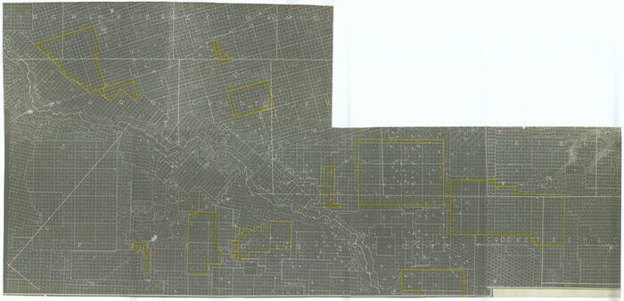
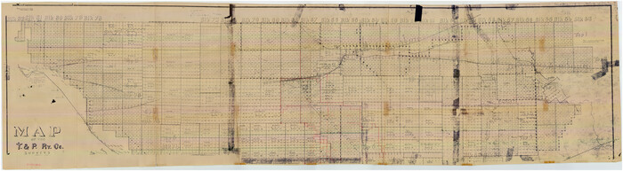
[University Land in Loving, Ward, Winkler, Pecos, Crane, Ector, Upton, Crockett, Schleicher, Irion and Reagan Counties]
Print $40.00
- Digital $50.00
[University Land in Loving, Ward, Winkler, Pecos, Crane, Ector, Upton, Crockett, Schleicher, Irion and Reagan Counties]
1938
Size: 37.9 x 78.5 inches
2424
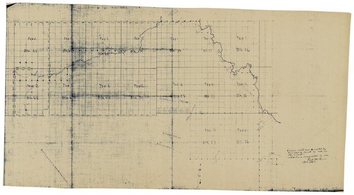
[Townships 1, 2, 3, Blocks, 62, 61, 60, 59, 58, 57, 56]
Print $20.00
- Digital $50.00
[Townships 1, 2, 3, Blocks, 62, 61, 60, 59, 58, 57, 56]
1885
Size: 19.1 x 10.3 inches
92884
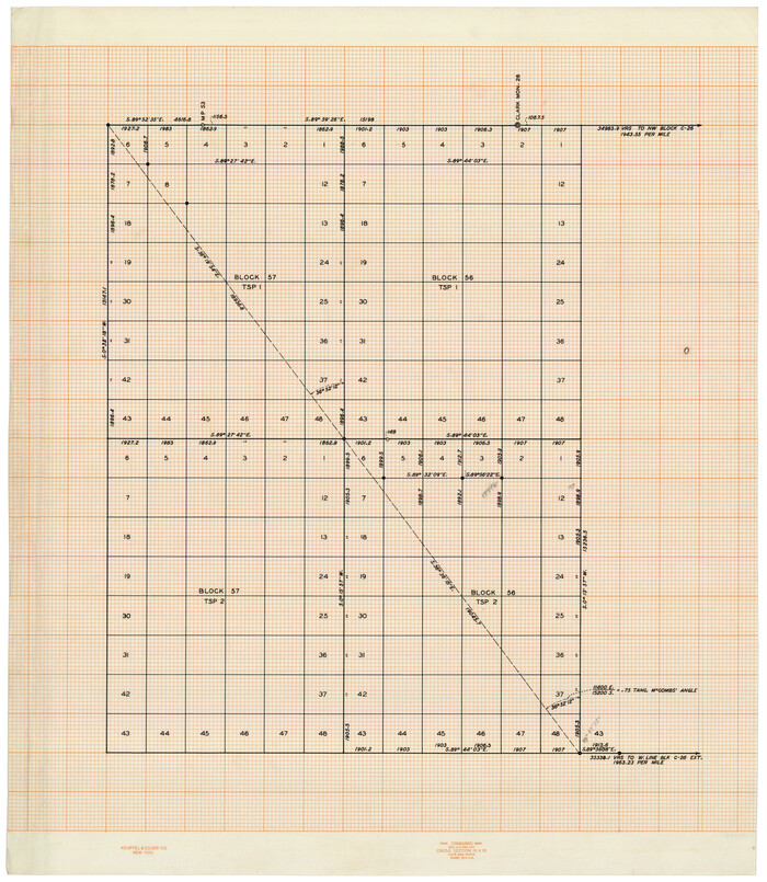
[Townships 1 & 2, Blocks 56, 57]
Print $20.00
- Digital $50.00
[Townships 1 & 2, Blocks 56, 57]
Size: 19.7 x 22.8 inches
92927
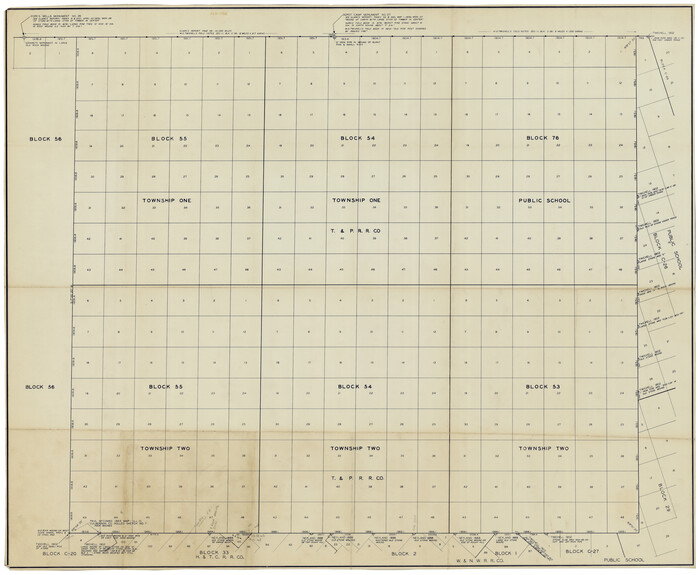
[Townships 1 & 2, Blocks 53, 54, 55, and 76]
Print $20.00
- Digital $50.00
[Townships 1 & 2, Blocks 53, 54, 55, and 76]
Size: 29.3 x 24.0 inches
92882
[Townships 1 & 2, Blocks 53, 54 & 55]
Print $20.00
- Digital $50.00
[Townships 1 & 2, Blocks 53, 54 & 55]
Size: 34.3 x 20.0 inches
92952
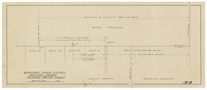
[Texas, New Mexico Clark's Monument #26]
Print $3.00
- Digital $50.00
[Texas, New Mexico Clark's Monument #26]
1941
Size: 16.1 x 7.4 inches
91309
[Texas and Pacific Railroad Co. Blocks 55, 54 and 76, Townships 1 & 2]
Print $20.00
- Digital $50.00
[Texas and Pacific Railroad Co. Blocks 55, 54 and 76, Townships 1 & 2]
Size: 46.2 x 41.5 inches
89882
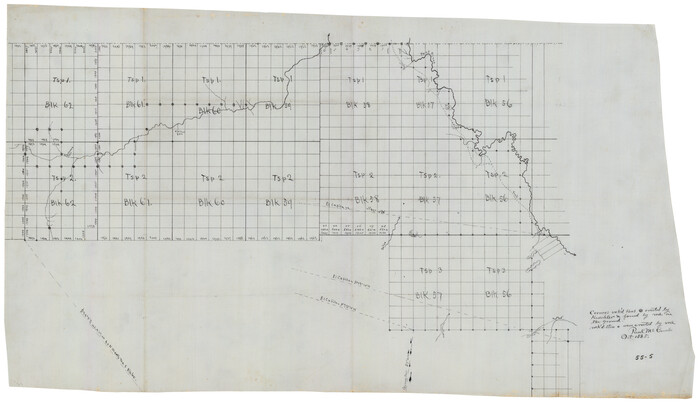
[Texas and Pacific Blocks 56-62, Townships 1-3]
Print $20.00
- Digital $50.00
[Texas and Pacific Blocks 56-62, Townships 1-3]
1885
Size: 28.4 x 15.9 inches
90501
[T. & P. RR. Co. Blocks 54, 55 and 76, Townships 1 and 2]
Print $20.00
- Digital $50.00
[T. & P. RR. Co. Blocks 54, 55 and 76, Townships 1 and 2]
Size: 44.2 x 36.2 inches
89888
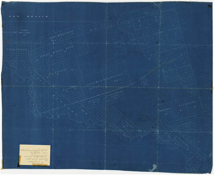
[Sketch showing unsurveyed land in West Texas as of 1902]
Print $20.00
- Digital $50.00
[Sketch showing unsurveyed land in West Texas as of 1902]
Size: 42.0 x 34.0 inches
89937
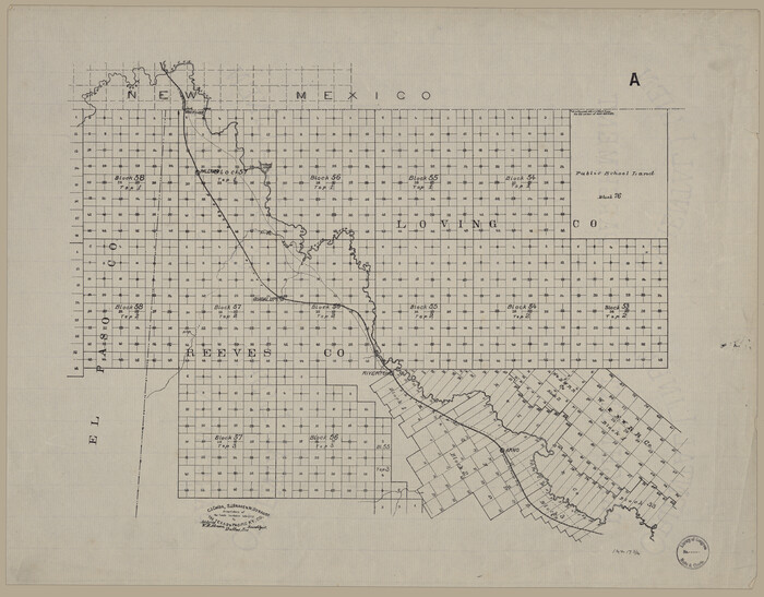
[Map showing T&P Lands in El Paso County]
Print $20.00
[Map showing T&P Lands in El Paso County]
Size: 17.5 x 22.3 inches
88930
[Letters to and from Maj. W. J. Powell regarding surveys of Texas and Pacific Ry. Lands west of the Pecos. Blks 53-55, Township 1 & 2 map within]
![2249, [Letters to and from Maj. W. J. Powell regarding surveys of Texas and Pacific Ry. Lands west of the Pecos. Blks 53-55, Township 1 & 2 map within], General Map Collection](https://historictexasmaps.com/wmedia_w700/pdf_converted_jpg/qi_pdf_thumbnail_1039.jpg)
Print $124.00
- Digital $50.00
[Letters to and from Maj. W. J. Powell regarding surveys of Texas and Pacific Ry. Lands west of the Pecos. Blks 53-55, Township 1 & 2 map within]
1934
Size: 10.2 x 15.4 inches
2249
[Index map of T. & P. Ry. Company’s 80-mile Trans-Pecos Reserve’s perpetuated corners - North Part]
Print $40.00
- Digital $50.00
[Index map of T. & P. Ry. Company’s 80-mile Trans-Pecos Reserve’s perpetuated corners - North Part]
Size: 25.4 x 92.1 inches
89622
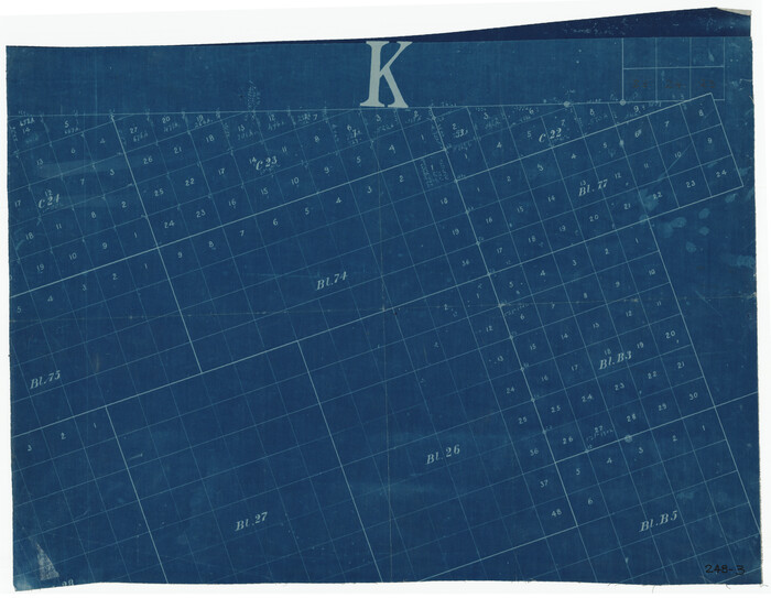
[Blocks C22, C23, C24, 77, B3, B5, 26, 27, 74, 75]
Print $20.00
- Digital $50.00
[Blocks C22, C23, C24, 77, B3, B5, 26, 27, 74, 75]
Size: 21.9 x 16.9 inches
91973
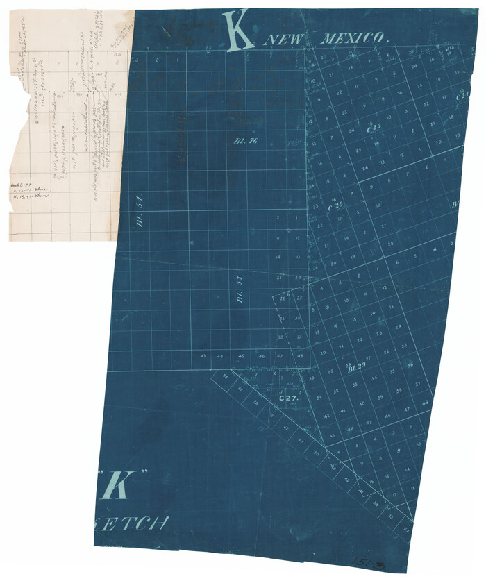
[Blocks C-25, C-26, C-27, and 29]
Print $20.00
- Digital $50.00
[Blocks C-25, C-26, C-27, and 29]
Size: 23.4 x 27.2 inches
91320
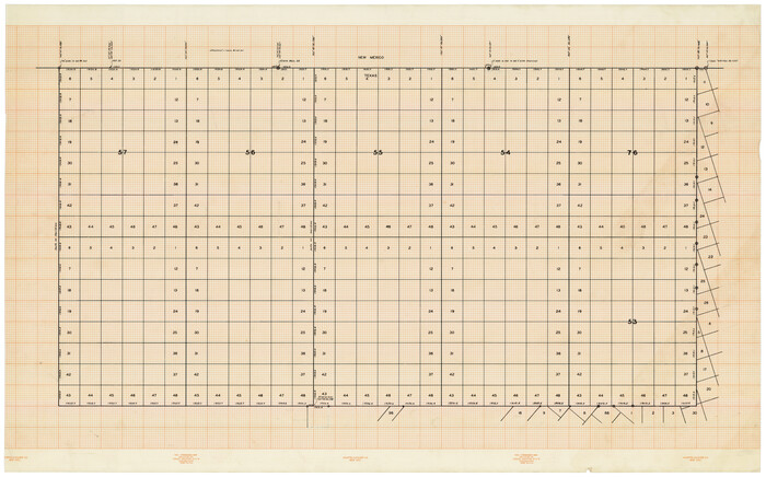
[Blocks 57, 56, 55, 54, 76, 53]
Print $20.00
- Digital $50.00
[Blocks 57, 56, 55, 54, 76, 53]
Size: 36.6 x 23.1 inches
92928
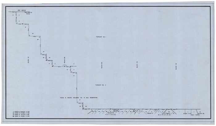
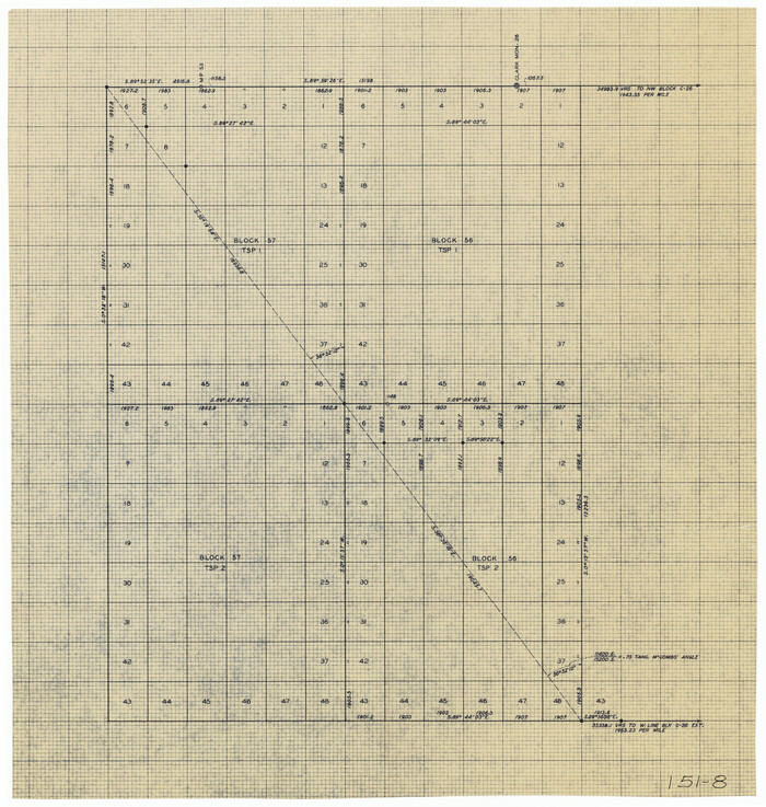
[Blocks 56 and 57, Townships 1 and 2]
Print $20.00
- Digital $50.00
[Blocks 56 and 57, Townships 1 and 2]
Size: 19.3 x 20.5 inches
91315
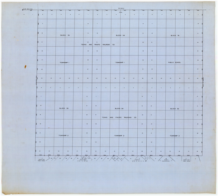
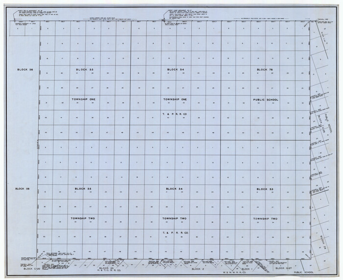
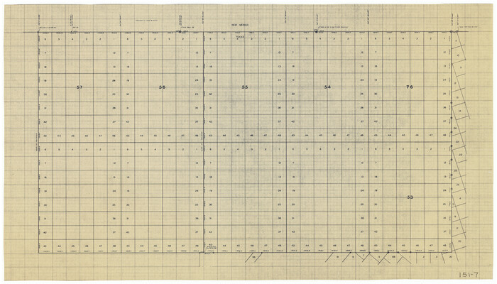
[Blocks 53, 54, 55, 56, 57, and 76]
Print $20.00
- Digital $50.00
[Blocks 53, 54, 55, 56, 57, and 76]
Size: 36.4 x 21.4 inches
91314
Winkler County Rolled Sketch 9

Print $40.00
- Digital $50.00
Winkler County Rolled Sketch 9
1937
Size: 50.7 x 21.1 inches
10150
Winkler County Rolled Sketch 15

Print $20.00
- Digital $50.00
Winkler County Rolled Sketch 15
1968
Size: 25.1 x 37.8 inches
10305
Winkler County Rolled Sketch 13

Print $40.00
- Digital $50.00
Winkler County Rolled Sketch 13
1902
Size: 39.5 x 48.7 inches
10153
Ward County Working Sketch 43

Print $40.00
- Digital $50.00
Ward County Working Sketch 43
Size: 57.3 x 36.8 inches
72349
Ward County Rolled Sketch 4

Print $20.00
- Digital $50.00
Ward County Rolled Sketch 4
Size: 39.3 x 47.2 inches
10102
Ward County Rolled Sketch 22

Print $40.00
- Digital $50.00
Ward County Rolled Sketch 22
1873
Size: 69.2 x 18.0 inches
10110
Ward County Rolled Sketch 1

Print $40.00
- Digital $50.00
Ward County Rolled Sketch 1
1888
Size: 42.6 x 120.4 inches
76165
Ward County Rolled Sketch 1

Print $20.00
- Digital $50.00
Ward County Rolled Sketch 1
1888
Size: 41.7 x 11.6 inches
76166
University of Texas System University Lands

Print $20.00
- Digital $50.00
University of Texas System University Lands
1931
Size: 23.2 x 17.5 inches
93241
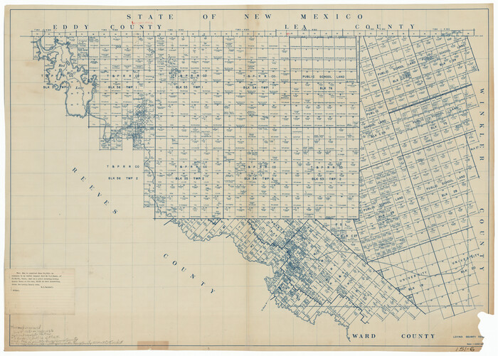
University Land Loving-Ward-Winkler Counties

Print $40.00
- Digital $50.00
University Land Loving-Ward-Winkler Counties
1931
Size: 47.9 x 63.2 inches
2415
University Land Loving-Ward-Winkler Counties

Print $20.00
- Digital $50.00
University Land Loving-Ward-Winkler Counties
1931
Size: 24.7 x 33.2 inches
2448
[University Land in Loving, Ward, Winkler, Pecos, Crane, Ector, Upton, Crockett, Schleicher, Irion and Reagan Counties]
Print $40.00
- Digital $50.00
[University Land in Loving, Ward, Winkler, Pecos, Crane, Ector, Upton, Crockett, Schleicher, Irion and Reagan Counties]
1938
-
Size
37.9 x 78.5 inches
-
Map/Doc
2424
-
Creation Date
1938
[Townships 1, 2, 3, Blocks, 62, 61, 60, 59, 58, 57, 56]
Print $20.00
- Digital $50.00
[Townships 1, 2, 3, Blocks, 62, 61, 60, 59, 58, 57, 56]
1885
-
Size
19.1 x 10.3 inches
-
Map/Doc
92884
-
Creation Date
1885
[Townships 1 & 2, Blocks 56, 57]
Print $20.00
- Digital $50.00
[Townships 1 & 2, Blocks 56, 57]
-
Size
19.7 x 22.8 inches
-
Map/Doc
92927
[Townships 1 & 2, Blocks 53, 54, 55, and 76]
Print $20.00
- Digital $50.00
[Townships 1 & 2, Blocks 53, 54, 55, and 76]
-
Size
29.3 x 24.0 inches
-
Map/Doc
92882
[Townships 1 & 2, Blocks 53, 54 & 55]
Print $20.00
- Digital $50.00
[Townships 1 & 2, Blocks 53, 54 & 55]
-
Size
34.3 x 20.0 inches
-
Map/Doc
92952
[Texas, New Mexico Clark's Monument #26]
Print $3.00
- Digital $50.00
[Texas, New Mexico Clark's Monument #26]
1941
-
Size
16.1 x 7.4 inches
-
Map/Doc
91309
-
Creation Date
1941
[Texas and Pacific Railroad Co. Blocks 55, 54 and 76, Townships 1 & 2]
Print $20.00
- Digital $50.00
[Texas and Pacific Railroad Co. Blocks 55, 54 and 76, Townships 1 & 2]
-
Size
46.2 x 41.5 inches
-
Map/Doc
89882
[Texas and Pacific Blocks 56-62, Townships 1-3]
Print $20.00
- Digital $50.00
[Texas and Pacific Blocks 56-62, Townships 1-3]
1885
-
Size
28.4 x 15.9 inches
-
Map/Doc
90501
-
Creation Date
1885
[T. & P. RR. Co. Blocks 54, 55 and 76, Townships 1 and 2]
Print $20.00
- Digital $50.00
[T. & P. RR. Co. Blocks 54, 55 and 76, Townships 1 and 2]
-
Size
44.2 x 36.2 inches
-
Map/Doc
89888
[Sketch showing unsurveyed land in West Texas as of 1902]
Print $20.00
- Digital $50.00
[Sketch showing unsurveyed land in West Texas as of 1902]
-
Size
42.0 x 34.0 inches
-
Map/Doc
89937
[Map showing T&P Lands in El Paso County]
Print $20.00
[Map showing T&P Lands in El Paso County]
-
Size
17.5 x 22.3 inches
-
Map/Doc
88930
[Letters to and from Maj. W. J. Powell regarding surveys of Texas and Pacific Ry. Lands west of the Pecos. Blks 53-55, Township 1 & 2 map within]
Print $124.00
- Digital $50.00
[Letters to and from Maj. W. J. Powell regarding surveys of Texas and Pacific Ry. Lands west of the Pecos. Blks 53-55, Township 1 & 2 map within]
1934
-
Size
10.2 x 15.4 inches
-
Map/Doc
2249
-
Creation Date
1934
[Index map of T. & P. Ry. Company’s 80-mile Trans-Pecos Reserve’s perpetuated corners - North Part]
Print $40.00
- Digital $50.00
[Index map of T. & P. Ry. Company’s 80-mile Trans-Pecos Reserve’s perpetuated corners - North Part]
-
Size
25.4 x 92.1 inches
-
Map/Doc
89622
[Blocks C22, C23, C24, 77, B3, B5, 26, 27, 74, 75]
Print $20.00
- Digital $50.00
[Blocks C22, C23, C24, 77, B3, B5, 26, 27, 74, 75]
-
Size
21.9 x 16.9 inches
-
Map/Doc
91973
[Blocks C-25, C-26, C-27, and 29]
Print $20.00
- Digital $50.00
[Blocks C-25, C-26, C-27, and 29]
-
Size
23.4 x 27.2 inches
-
Map/Doc
91320
[Blocks 57, 56, 55, 54, 76, 53]
Print $20.00
- Digital $50.00
[Blocks 57, 56, 55, 54, 76, 53]
-
Size
36.6 x 23.1 inches
-
Map/Doc
92928
[Blocks 56 and 57, Townships 1 and 2]
Print $20.00
- Digital $50.00
[Blocks 56 and 57, Townships 1 and 2]
-
Size
19.3 x 20.5 inches
-
Map/Doc
91315
[Blocks 53, 54, 55, 56, 57, and 76]
Print $20.00
- Digital $50.00
[Blocks 53, 54, 55, 56, 57, and 76]
-
Size
36.4 x 21.4 inches
-
Map/Doc
91314
Winkler County Rolled Sketch 9
Print $40.00
- Digital $50.00
Winkler County Rolled Sketch 9
1937
-
Size
50.7 x 21.1 inches
-
Map/Doc
10150
-
Creation Date
1937
Winkler County Rolled Sketch 15
Print $20.00
- Digital $50.00
Winkler County Rolled Sketch 15
1968
-
Size
25.1 x 37.8 inches
-
Map/Doc
10305
-
Creation Date
1968
Winkler County Rolled Sketch 13
Print $40.00
- Digital $50.00
Winkler County Rolled Sketch 13
1902
-
Size
39.5 x 48.7 inches
-
Map/Doc
10153
-
Creation Date
1902
Ward County Working Sketch 43
Print $40.00
- Digital $50.00
Ward County Working Sketch 43
-
Size
57.3 x 36.8 inches
-
Map/Doc
72349
Ward County Rolled Sketch 4
Print $20.00
- Digital $50.00
Ward County Rolled Sketch 4
-
Size
39.3 x 47.2 inches
-
Map/Doc
10102
Ward County Rolled Sketch 22
Print $40.00
- Digital $50.00
Ward County Rolled Sketch 22
1873
-
Size
69.2 x 18.0 inches
-
Map/Doc
10110
-
Creation Date
1873
Ward County Rolled Sketch 1
Print $40.00
- Digital $50.00
Ward County Rolled Sketch 1
1888
-
Size
42.6 x 120.4 inches
-
Map/Doc
76165
-
Creation Date
1888
Ward County Rolled Sketch 1
Print $20.00
- Digital $50.00
Ward County Rolled Sketch 1
1888
-
Size
41.7 x 11.6 inches
-
Map/Doc
76166
-
Creation Date
1888
University of Texas System University Lands
Print $20.00
- Digital $50.00
University of Texas System University Lands
1931
-
Size
23.2 x 17.5 inches
-
Map/Doc
93241
-
Creation Date
1931
University Land Loving-Ward-Winkler Counties
Print $40.00
- Digital $50.00
University Land Loving-Ward-Winkler Counties
1931
-
Size
47.9 x 63.2 inches
-
Map/Doc
2415
-
Creation Date
1931
University Land Loving-Ward-Winkler Counties
Print $20.00
- Digital $50.00
University Land Loving-Ward-Winkler Counties
1931
-
Size
24.7 x 33.2 inches
-
Map/Doc
2448
-
Creation Date
1931