The Republic County of Bastrop. Boundaries Defined, December 18, 1837

Print $20.00
The Republic County of Bastrop. Boundaries Defined, December 18, 1837
2020
Size: 14.7 x 21.7 inches
96089
The Republic County of Bastrop. May 24, 1838

Print $20.00
The Republic County of Bastrop. May 24, 1838
2020
Size: 17.8 x 21.7 inches
96090
The Republic County of Bastrop. January 25, 1840

Print $20.00
The Republic County of Bastrop. January 25, 1840
2020
Size: 14.7 x 21.6 inches
96091
The Republic County of Bastrop. December 29, 1845

Print $20.00
The Republic County of Bastrop. December 29, 1845
2020
Size: 14.8 x 21.7 inches
96092
Bastrop County Sketch File 14

Print $6.00
- Digital $50.00
Bastrop County Sketch File 14
2018
Size: 11.0 x 8.5 inches
95248
Bastrop County Rolled Sketch 5

Print $20.00
- Digital $50.00
Bastrop County Rolled Sketch 5
2013
Size: 24.9 x 36.9 inches
93715
Bastrop County Rolled Sketch 6

Print $20.00
- Digital $50.00
Bastrop County Rolled Sketch 6
2013
Size: 42.3 x 32.1 inches
93716
Bastrop County Rolled Sketch 4

Print $40.00
- Digital $50.00
Bastrop County Rolled Sketch 4
1999
Size: 130.2 x 30.8 inches
8443
Bastrop County Working Sketch 16

Print $20.00
- Digital $50.00
Bastrop County Working Sketch 16
1998
Size: 39.2 x 34.1 inches
67316
Bastrop County Working Sketch 15

Print $20.00
- Digital $50.00
Bastrop County Working Sketch 15
1993
Size: 23.5 x 21.1 inches
67315
Plat showing survey of tracts in the C. A. West survey A-337 and the Wm. Standiferd survey A-301 in Bastrop County as surveyed for the Veteran's Land Board

Print $20.00
- Digital $50.00
Plat showing survey of tracts in the C. A. West survey A-337 and the Wm. Standiferd survey A-301 in Bastrop County as surveyed for the Veteran's Land Board
1992
Size: 34.9 x 46.8 inches
61151
Fayette County Working Sketch 10

Print $20.00
- Digital $50.00
Fayette County Working Sketch 10
1985
Size: 27.1 x 38.5 inches
69174
Bastrop County Working Sketch 14

Print $20.00
- Digital $50.00
Bastrop County Working Sketch 14
1984
Size: 24.5 x 23.4 inches
67314
Bastrop County Working Sketch 9

Print $20.00
- Digital $50.00
Bastrop County Working Sketch 9
1981
Size: 44.9 x 43.7 inches
67309
Bastrop County Sketch File 10

Print $4.00
- Digital $50.00
Bastrop County Sketch File 10
1979
Size: 14.3 x 8.8 inches
14056
Bastrop County Rolled Sketch 2

Print $20.00
- Digital $50.00
Bastrop County Rolled Sketch 2
1979
Size: 26.3 x 18.4 inches
5123
Caldwell County Working Sketch 11

Print $20.00
- Digital $50.00
Caldwell County Working Sketch 11
1979
Size: 21.6 x 26.6 inches
67841
Bastrop County Working Sketch 13

Print $20.00
- Digital $50.00
Bastrop County Working Sketch 13
1979
Size: 23.6 x 30.0 inches
67313
Bastrop County Working Sketch 12

Print $40.00
- Digital $50.00
Bastrop County Working Sketch 12
1978
Size: 44.1 x 54.3 inches
67312
Bastrop County Working Sketch 11

Print $20.00
- Digital $50.00
Bastrop County Working Sketch 11
1968
Size: 31.2 x 25.1 inches
67311
Bastrop County Working Sketch 10

Print $20.00
- Digital $50.00
Bastrop County Working Sketch 10
1968
Size: 31.9 x 37.7 inches
67310
Travis County Working Sketch 53

Print $40.00
- Digital $50.00
Travis County Working Sketch 53
1964
Size: 42.7 x 53.0 inches
69437
General Highway Map, Bastrop County, Texas

Print $20.00
General Highway Map, Bastrop County, Texas
1961
Size: 18.3 x 24.8 inches
79361
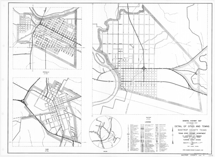
General Highway Map. Detail of Cities and Towns in Bastrop County, Texas [Bastrop, Smithville, Elgin, etc.]
Print $20.00
General Highway Map. Detail of Cities and Towns in Bastrop County, Texas [Bastrop, Smithville, Elgin, etc.]
1961
Size: 18.3 x 25.0 inches
79362
Bastrop County Working Sketch Graphic Index

Print $40.00
- Digital $50.00
Bastrop County Working Sketch Graphic Index
1955
Size: 49.6 x 40.9 inches
76462
Bastrop County Sketch File 9

Print $40.00
- Digital $50.00
Bastrop County Sketch File 9
1943
Size: 46.5 x 20.6 inches
10320
The Republic County of Bastrop. Boundaries Defined, December 18, 1837
Print $20.00
The Republic County of Bastrop. Boundaries Defined, December 18, 1837
2020
-
Size
14.7 x 21.7 inches
-
Map/Doc
96089
-
Creation Date
2020
The Republic County of Bastrop. May 24, 1838
Print $20.00
The Republic County of Bastrop. May 24, 1838
2020
-
Size
17.8 x 21.7 inches
-
Map/Doc
96090
-
Creation Date
2020
The Republic County of Bastrop. January 25, 1840
Print $20.00
The Republic County of Bastrop. January 25, 1840
2020
-
Size
14.7 x 21.6 inches
-
Map/Doc
96091
-
Creation Date
2020
The Republic County of Bastrop. December 29, 1845
Print $20.00
The Republic County of Bastrop. December 29, 1845
2020
-
Size
14.8 x 21.7 inches
-
Map/Doc
96092
-
Creation Date
2020
Bastrop County Sketch File 14
Print $6.00
- Digital $50.00
Bastrop County Sketch File 14
2018
-
Size
11.0 x 8.5 inches
-
Map/Doc
95248
-
Creation Date
2018
Bastrop County Rolled Sketch 5
Print $20.00
- Digital $50.00
Bastrop County Rolled Sketch 5
2013
-
Size
24.9 x 36.9 inches
-
Map/Doc
93715
-
Creation Date
2013
Bastrop County Rolled Sketch 6
Print $20.00
- Digital $50.00
Bastrop County Rolled Sketch 6
2013
-
Size
42.3 x 32.1 inches
-
Map/Doc
93716
-
Creation Date
2013
Bastrop County Rolled Sketch 4
Print $40.00
- Digital $50.00
Bastrop County Rolled Sketch 4
1999
-
Size
130.2 x 30.8 inches
-
Map/Doc
8443
-
Creation Date
1999
Bastrop County Working Sketch 16
Print $20.00
- Digital $50.00
Bastrop County Working Sketch 16
1998
-
Size
39.2 x 34.1 inches
-
Map/Doc
67316
-
Creation Date
1998
Bastrop County Working Sketch 15
Print $20.00
- Digital $50.00
Bastrop County Working Sketch 15
1993
-
Size
23.5 x 21.1 inches
-
Map/Doc
67315
-
Creation Date
1993
Plat showing survey of tracts in the C. A. West survey A-337 and the Wm. Standiferd survey A-301 in Bastrop County as surveyed for the Veteran's Land Board
Print $20.00
- Digital $50.00
Plat showing survey of tracts in the C. A. West survey A-337 and the Wm. Standiferd survey A-301 in Bastrop County as surveyed for the Veteran's Land Board
1992
-
Size
34.9 x 46.8 inches
-
Map/Doc
61151
-
Creation Date
1992
Fayette County Working Sketch 10
Print $20.00
- Digital $50.00
Fayette County Working Sketch 10
1985
-
Size
27.1 x 38.5 inches
-
Map/Doc
69174
-
Creation Date
1985
Bastrop County Working Sketch 14
Print $20.00
- Digital $50.00
Bastrop County Working Sketch 14
1984
-
Size
24.5 x 23.4 inches
-
Map/Doc
67314
-
Creation Date
1984
Bastrop County Working Sketch 9
Print $20.00
- Digital $50.00
Bastrop County Working Sketch 9
1981
-
Size
44.9 x 43.7 inches
-
Map/Doc
67309
-
Creation Date
1981
Bastrop County Sketch File 10
Print $4.00
- Digital $50.00
Bastrop County Sketch File 10
1979
-
Size
14.3 x 8.8 inches
-
Map/Doc
14056
-
Creation Date
1979
Bastrop County Rolled Sketch 2
Print $20.00
- Digital $50.00
Bastrop County Rolled Sketch 2
1979
-
Size
26.3 x 18.4 inches
-
Map/Doc
5123
-
Creation Date
1979
Caldwell County Working Sketch 11
Print $20.00
- Digital $50.00
Caldwell County Working Sketch 11
1979
-
Size
21.6 x 26.6 inches
-
Map/Doc
67841
-
Creation Date
1979
Bastrop County Working Sketch 13
Print $20.00
- Digital $50.00
Bastrop County Working Sketch 13
1979
-
Size
23.6 x 30.0 inches
-
Map/Doc
67313
-
Creation Date
1979
Bastrop County Working Sketch 12
Print $40.00
- Digital $50.00
Bastrop County Working Sketch 12
1978
-
Size
44.1 x 54.3 inches
-
Map/Doc
67312
-
Creation Date
1978
Bastrop County Working Sketch 11
Print $20.00
- Digital $50.00
Bastrop County Working Sketch 11
1968
-
Size
31.2 x 25.1 inches
-
Map/Doc
67311
-
Creation Date
1968
Bastrop County Working Sketch 10
Print $20.00
- Digital $50.00
Bastrop County Working Sketch 10
1968
-
Size
31.9 x 37.7 inches
-
Map/Doc
67310
-
Creation Date
1968
Travis County Working Sketch 53
Print $40.00
- Digital $50.00
Travis County Working Sketch 53
1964
-
Size
42.7 x 53.0 inches
-
Map/Doc
69437
-
Creation Date
1964
General Highway Map, Bastrop County, Texas
Print $20.00
General Highway Map, Bastrop County, Texas
1961
-
Size
18.3 x 24.8 inches
-
Map/Doc
79361
-
Creation Date
1961
General Highway Map. Detail of Cities and Towns in Bastrop County, Texas [Bastrop, Smithville, Elgin, etc.]
Print $20.00
General Highway Map. Detail of Cities and Towns in Bastrop County, Texas [Bastrop, Smithville, Elgin, etc.]
1961
-
Size
18.3 x 25.0 inches
-
Map/Doc
79362
-
Creation Date
1961
Bastrop Co.

Print $40.00
- Digital $50.00
Bastrop Co.
1955
-
Size
50.2 x 41.5 inches
-
Map/Doc
73076
-
Creation Date
1955
Bastrop Co.

Print $40.00
- Digital $50.00
Bastrop Co.
1955
-
Size
50.8 x 42.3 inches
-
Map/Doc
95425
-
Creation Date
1955
Bastrop Co.

Print $40.00
- Digital $50.00
Bastrop Co.
1955
-
Size
50.6 x 41.7 inches
-
Map/Doc
1778
-
Creation Date
1955
Bastrop County Working Sketch Graphic Index
Print $40.00
- Digital $50.00
Bastrop County Working Sketch Graphic Index
1955
-
Size
49.6 x 40.9 inches
-
Map/Doc
76462
-
Creation Date
1955
Bastrop Co.

Print $40.00
- Digital $50.00
Bastrop Co.
1955
-
Size
48.9 x 40.3 inches
-
Map/Doc
77208
-
Creation Date
1955
Bastrop County Sketch File 9
Print $40.00
- Digital $50.00
Bastrop County Sketch File 9
1943
-
Size
46.5 x 20.6 inches
-
Map/Doc
10320
-
Creation Date
1943