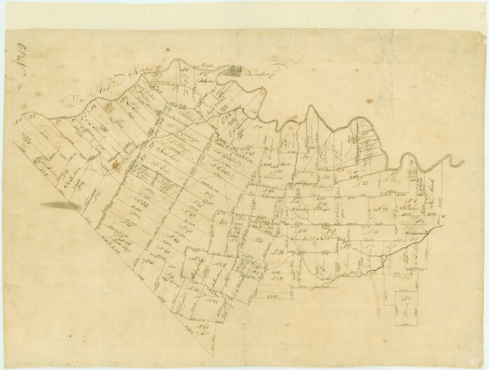
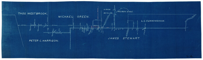
[Traverse up the Brazos and Colorado River showing distance from county site to county site]
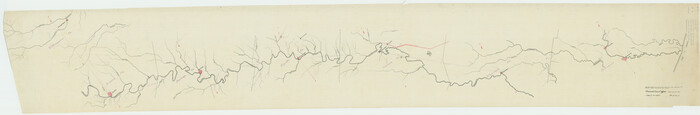
Print $40.00
- Digital $50.00
[Traverse up the Brazos and Colorado River showing distance from county site to county site]
1871
Size: 16.2 x 98.8 inches
2054
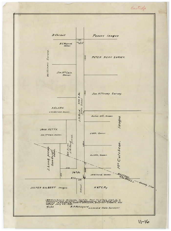
[Surveys near the city of Bastrop]
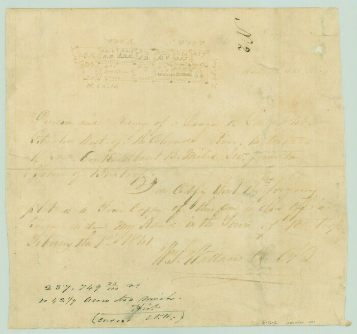
Print $2.00
- Digital $50.00
[Surveys near the city of Bastrop]
1841
Size: 6.5 x 7.0 inches
107
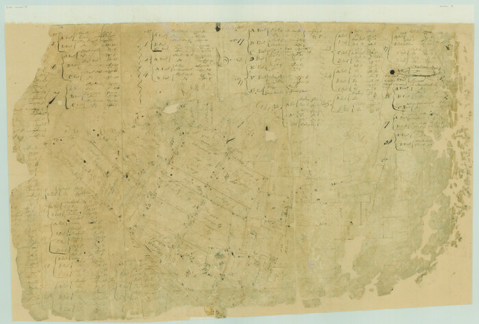
[Surveys in Milam's Colony between the Colorado River and northwest of the San Antonio Road]
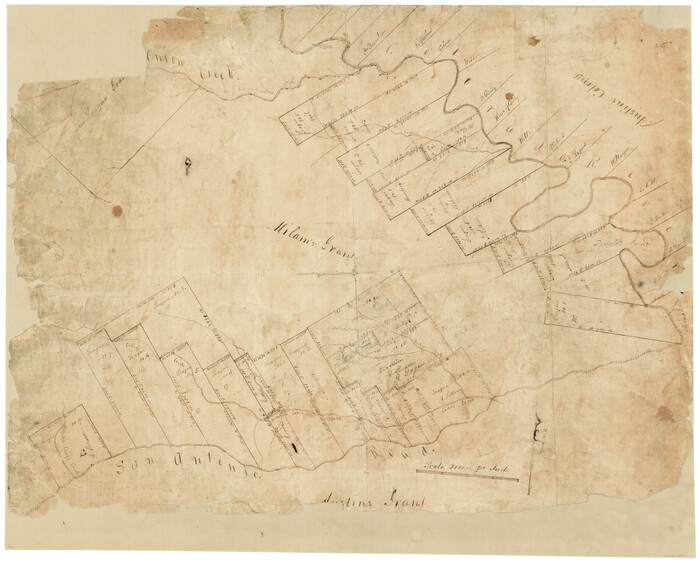
Print $20.00
- Digital $50.00
[Surveys in Milam's Colony between the Colorado River and northwest of the San Antonio Road]
Size: 22.0 x 27.4 inches
29
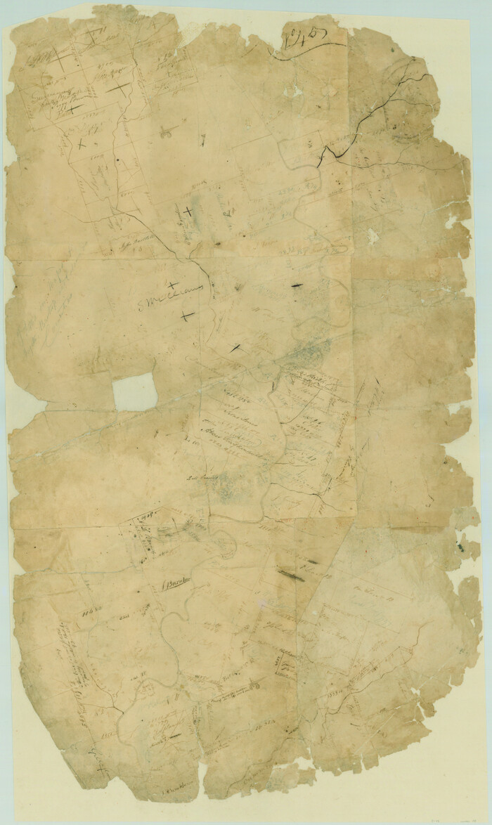
[Surveys in Milam's Colony along the Colorado River, Onion Creek, Cedar Creek, and north of the San Antonio Road]
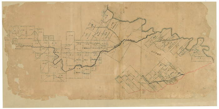
Print $20.00
- Digital $50.00
[Surveys in Milam's Colony along the Colorado River, Onion Creek, Cedar Creek, and north of the San Antonio Road]
Size: 13.4 x 26.8 inches
88
[Surveys in Bastrop County]
Print $2.00
- Digital $50.00
[Surveys in Bastrop County]
1841
Size: 11.3 x 8.4 inches
3179
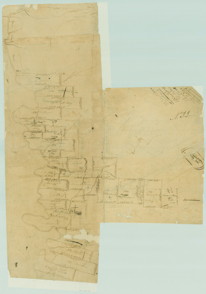
[Surveys in Austin's Colony south of the San Antonio Road and west of the Colorado River]
Print $20.00
- Digital $50.00
[Surveys in Austin's Colony south of the San Antonio Road and west of the Colorado River]
1840
Size: 16.8 x 22.2 inches
50
[Surveys in Austin's Colony along the San Antonio Road and the Colorado River]
Print $20.00
- Digital $50.00
[Surveys in Austin's Colony along the San Antonio Road and the Colorado River]
1821
Size: 17.3 x 25.6 inches
15
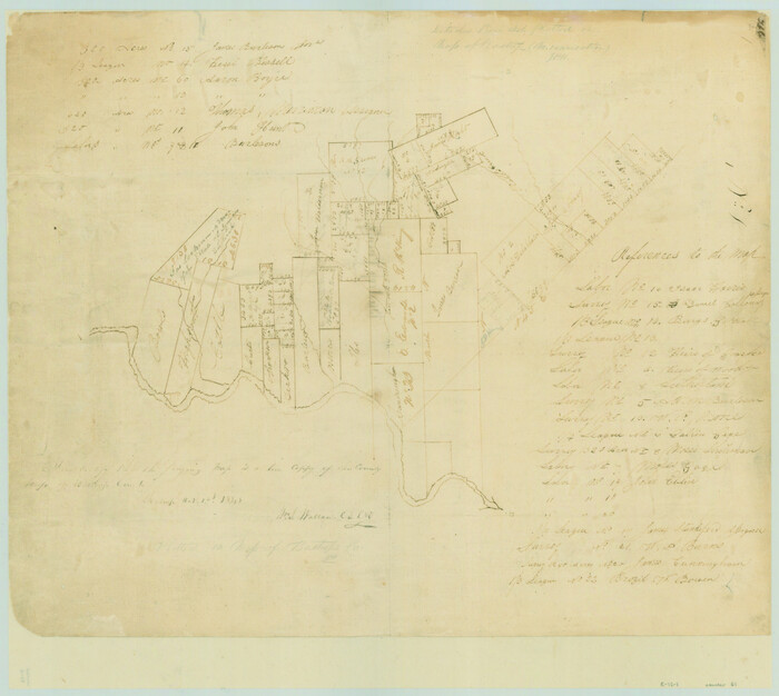
[Surveys in Austin's Colony along the Colorado River]
Print $20.00
- Digital $50.00
[Surveys in Austin's Colony along the Colorado River]
1830
Size: 38.9 x 23.2 inches
198
[Surveys by Brown in Austin's Little Colony along the Colorado River and Walnut Creek]
Print $20.00
- Digital $50.00
[Surveys by Brown in Austin's Little Colony along the Colorado River and Walnut Creek]
1832
Size: 33.2 x 23.3 inches
196
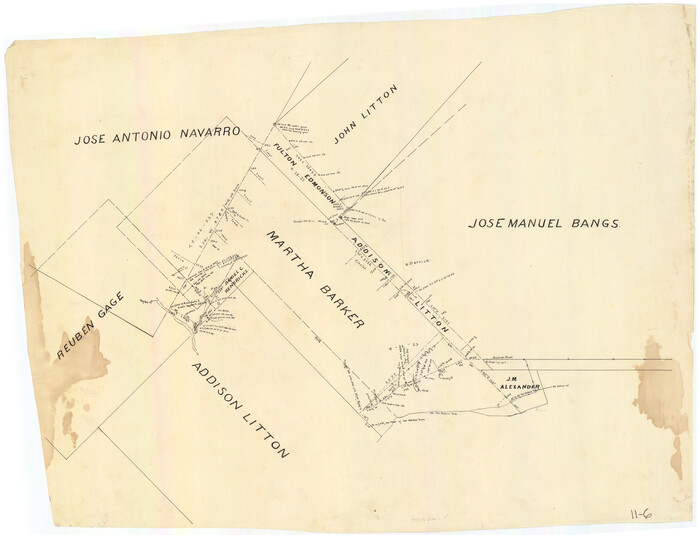
[Surveys around the Martha Barker survey]
Print $20.00
- Digital $50.00
[Surveys around the Martha Barker survey]
Size: 26.8 x 20.2 inches
90235
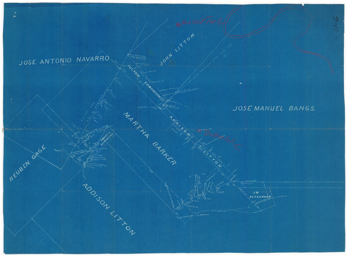
[Surveys around the Martha Barker survey]
Print $20.00
- Digital $50.00
[Surveys around the Martha Barker survey]
Size: 24.5 x 18.1 inches
90236
[Surveys along the Colorado River]
Print $20.00
- Digital $50.00
[Surveys along the Colorado River]
1841
Size: 14.4 x 16.1 inches
61
[Surveys along San Antonio Road]
Print $20.00
- Digital $50.00
[Surveys along San Antonio Road]
Size: 23.0 x 13.7 inches
90110
[Subdivision surveys of the McCutcheon League near the Bastrop-Caldwell County Line]
Print $20.00
- Digital $50.00
[Subdivision surveys of the McCutcheon League near the Bastrop-Caldwell County Line]
1923
Size: 12.5 x 16.9 inches
90148
[Sketch showing vicinity of Wm. McCutcheon League near the Bastrop-Caldwell County Line]
Print $2.00
- Digital $50.00
[Sketch showing vicinity of Wm. McCutcheon League near the Bastrop-Caldwell County Line]
1923
Size: 7.7 x 12.9 inches
90144
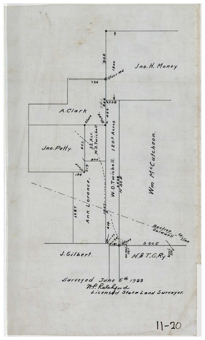
[Sketch showing North line of James Stewart survey and vicinity]
Print $20.00
- Digital $50.00
[Sketch showing North line of James Stewart survey and vicinity]
Size: 30.0 x 9.0 inches
90116
[Sketch of area around C. & M. RR. Co. survey 171]
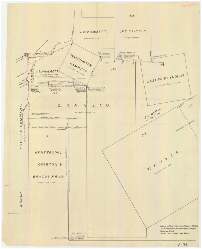
Print $20.00
- Digital $50.00
[Sketch of area around C. & M. RR. Co. survey 171]
1924
Size: 21.8 x 26.9 inches
90214
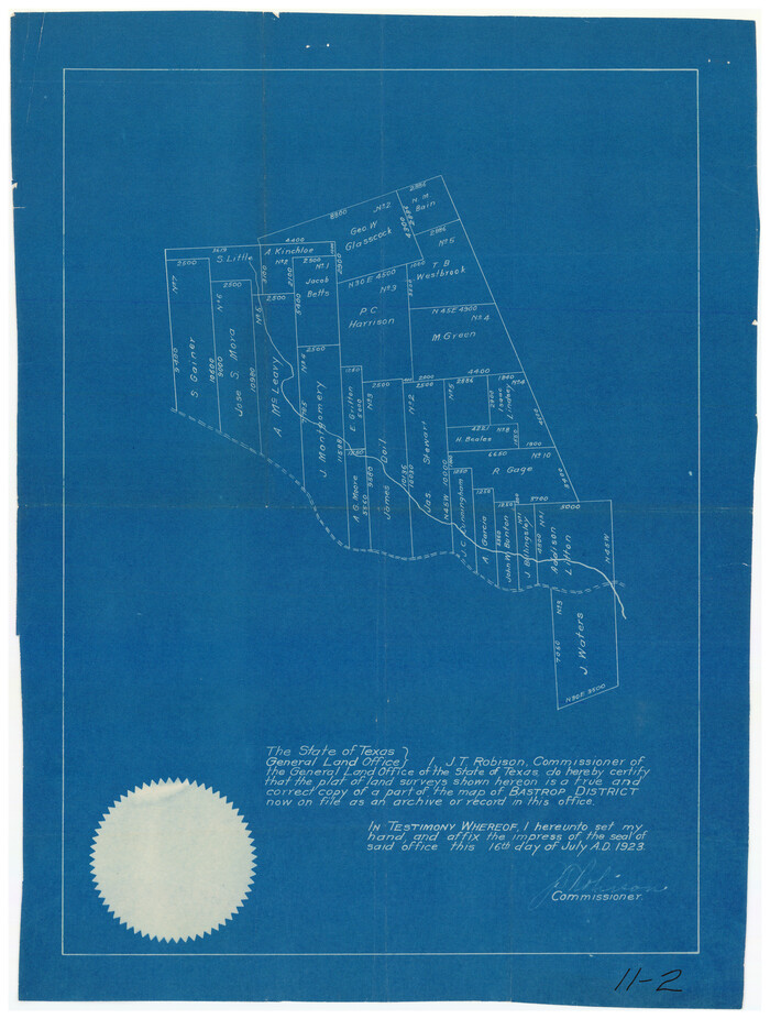
[Sketch of a portion of a Bastrop District GLO map]

Print $20.00
- Digital $50.00
[Sketch of a portion of a Bastrop District GLO map]
1923
Size: 12.1 x 16.0 inches
90112
[Sketch of a portion of a Bastrop District GLO map]
Print $3.00
- Digital $50.00
[Sketch of a portion of a Bastrop District GLO map]
1923
Size: 11.4 x 15.1 inches
90240
[Sketch of Berry Doolittle, C. B. Emmons. R. D. Price and other surveys]
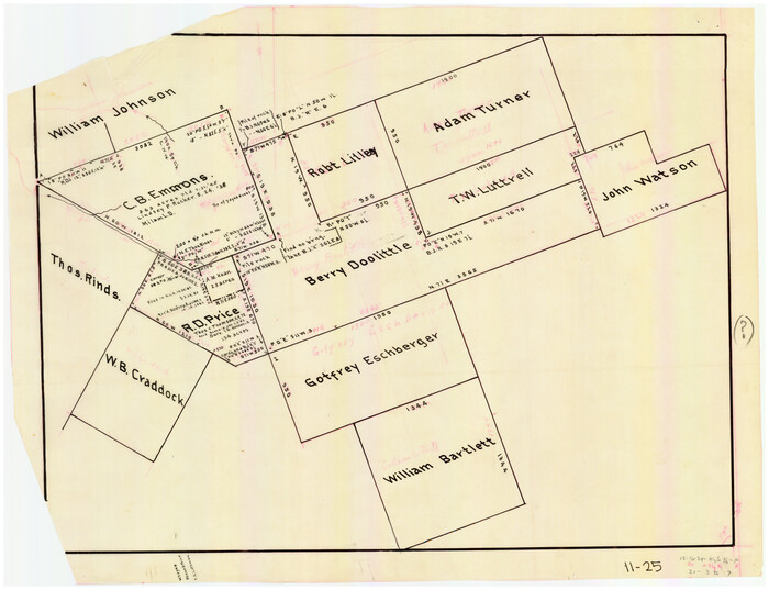
Print $20.00
- Digital $50.00
[Sketch of Berry Doolittle, C. B. Emmons. R. D. Price and other surveys]
Size: 25.8 x 19.7 inches
90213
[Sketch in vicinity of Wm. McCutcheon, S. H. Reid and John McGinley]
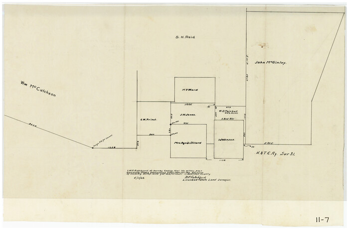
Print $20.00
- Digital $50.00
[Sketch in vicinity of Wm. McCutcheon, S. H. Reid and John McGinley]
1923
Size: 20.0 x 13.2 inches
90115
[Sketch in vicinity of Wm. McCutcheon, S. H. Reid and John McGinley]
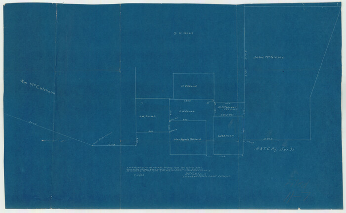
Print $20.00
- Digital $50.00
[Sketch in vicinity of Wm. McCutcheon, S. H. Reid and John McGinley]
1923
Size: 20.0 x 12.4 inches
92129
[Sketch centered around Thos. B. Bell survey 98 showing adjacent and nearby surveys]

Print $20.00
- Digital $50.00
[Sketch centered around Thos. B. Bell survey 98 showing adjacent and nearby surveys]
Size: 33.0 x 24.1 inches
90229
[Sketch Showing Wm. T. Brewer, John R. Taylor, Wm. F. Butler, Timothy DeVore, L. M. Thorn and adjoining surveys]
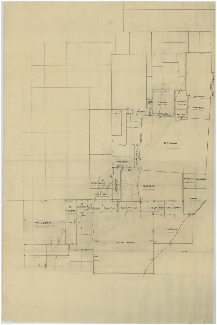
Print $40.00
- Digital $50.00
[Sketch Showing Wm. T. Brewer, John R. Taylor, Wm. F. Butler, Timothy DeVore, L. M. Thorn and adjoining surveys]
Size: 37.1 x 56.1 inches
89745
[Sketch Showing Wm. T. Brewer, John R. Taylor, Wm. F. Butler, Timothy DeVore, L. M. Thorn and adjoining surveys]
Print $20.00
- Digital $50.00
[Sketch Showing Wm. T. Brewer, John R. Taylor, Wm. F. Butler, Timothy DeVore, L. M. Thorn and adjoining surveys]
Size: 27.2 x 19.3 inches
90121
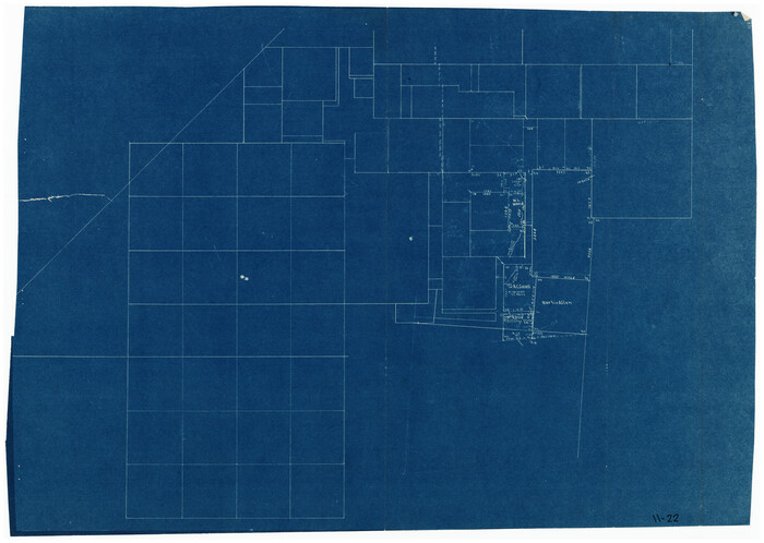
[Sketch Showing Wm. T. Brewer, John R. Taylor, Wm. F. Butler, Timothy DeVore, L. M. Thorn and adjoining surveys]
Print $20.00
- Digital $50.00
[Sketch Showing Wm. T. Brewer, John R. Taylor, Wm. F. Butler, Timothy DeVore, L. M. Thorn and adjoining surveys]
Size: 20.2 x 36.6 inches
90209
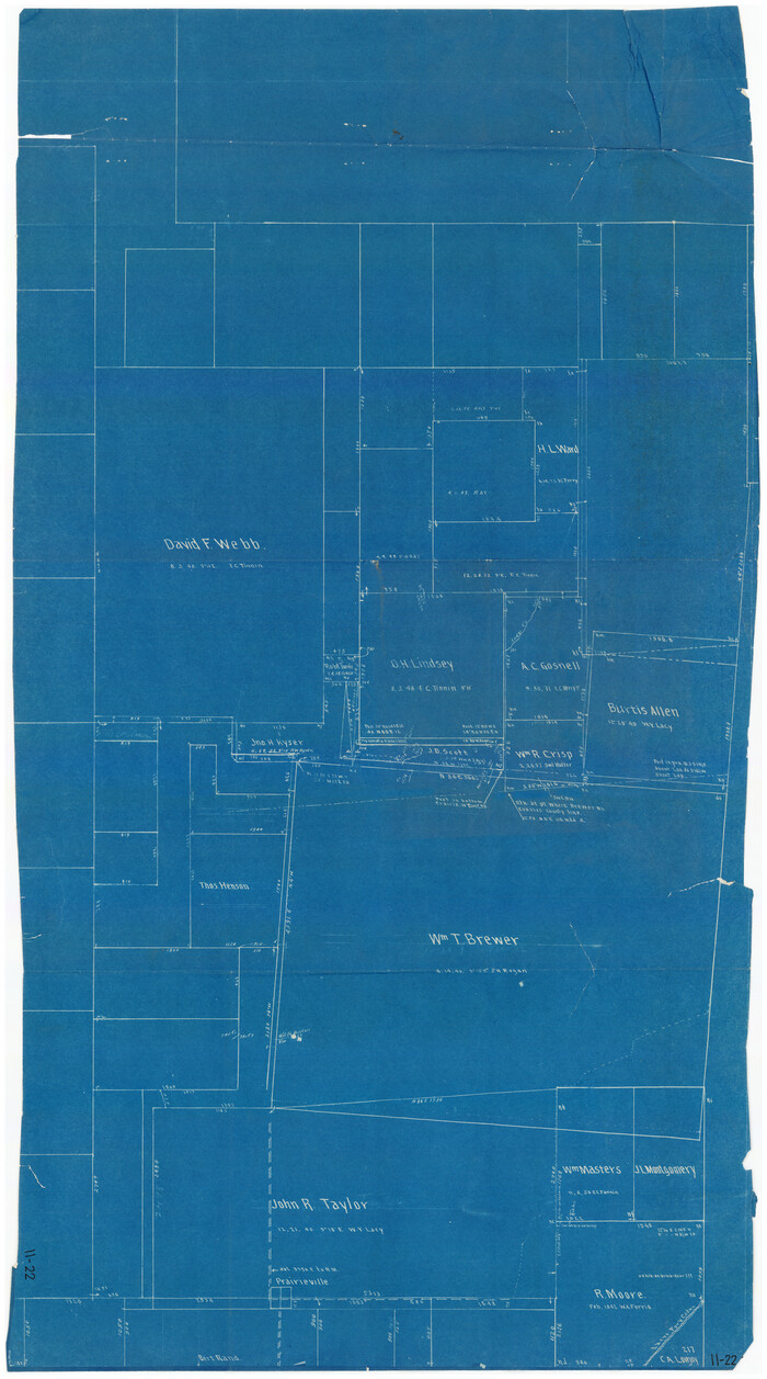
[Sketch Showing Wm. T. Brewer, John R. Taylor, Wm. F. Butler, Timothy DeVore, L. M. Thorn and adjoining surveys]
Print $20.00
- Digital $50.00
[Sketch Showing Wm. T. Brewer, John R. Taylor, Wm. F. Butler, Timothy DeVore, L. M. Thorn and adjoining surveys]
Size: 25.1 x 19.2 inches
90230
[Sketch Showing Wm. T. Brewer, John R. Taylor, Wm. F. Butler, Timothy DeVore, L. M. Thorn and adjoining surveys]
Print $20.00
- Digital $50.00
[Sketch Showing Wm. T. Brewer, John R. Taylor, Wm. F. Butler, Timothy DeVore, L. M. Thorn and adjoining surveys]
Size: 27.2 x 19.4 inches
90231
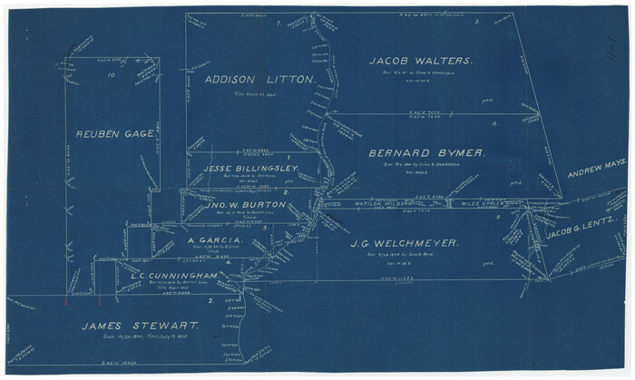
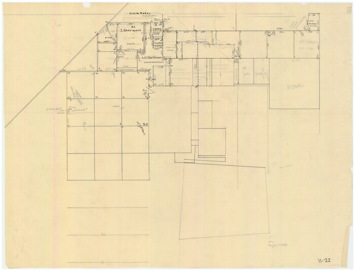
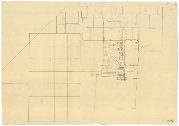
[Pencil sketch around J. Walters, J. G. Welchmeyer, R. Gage surveys]
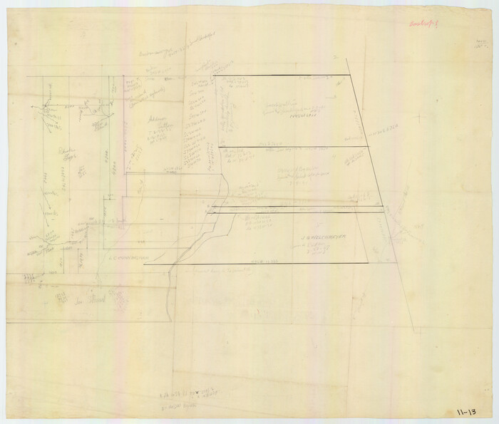
Print $20.00
- Digital $50.00
[Pencil sketch around J. Walters, J. G. Welchmeyer, R. Gage surveys]
Size: 25.5 x 21.7 inches
90206
[Part of Connected map of Stephen F. Austin's Colony on file at the GLO]
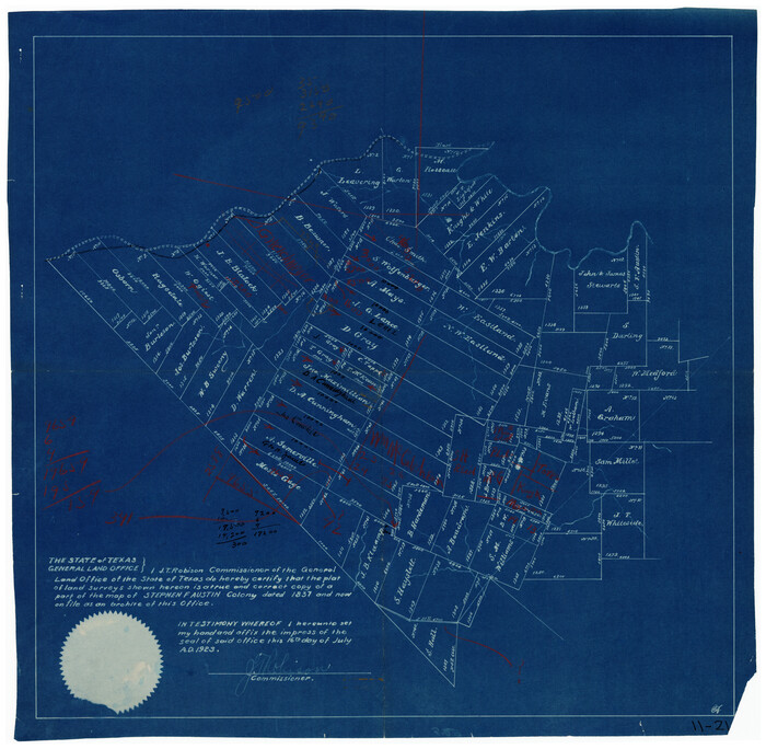
Print $20.00
- Digital $50.00
[Part of Connected map of Stephen F. Austin's Colony on file at the GLO]
1923
Size: 18.5 x 18.1 inches
90119
[Traverse up the Brazos and Colorado River showing distance from county site to county site]
Print $40.00
- Digital $50.00
[Traverse up the Brazos and Colorado River showing distance from county site to county site]
1871
-
Size
16.2 x 98.8 inches
-
Map/Doc
2054
-
Creation Date
1871
[Surveys near the city of Bastrop]
Print $2.00
- Digital $50.00
[Surveys near the city of Bastrop]
1841
-
Size
6.5 x 7.0 inches
-
Map/Doc
107
-
Creation Date
1841
[Surveys in Milam's Colony between the Colorado River and northwest of the San Antonio Road]
Print $20.00
- Digital $50.00
[Surveys in Milam's Colony between the Colorado River and northwest of the San Antonio Road]
-
Size
22.0 x 27.4 inches
-
Map/Doc
29
[Surveys in Milam's Colony along the Colorado River, Onion Creek, Cedar Creek, and north of the San Antonio Road]
Print $20.00
- Digital $50.00
[Surveys in Milam's Colony along the Colorado River, Onion Creek, Cedar Creek, and north of the San Antonio Road]
-
Size
13.4 x 26.8 inches
-
Map/Doc
88
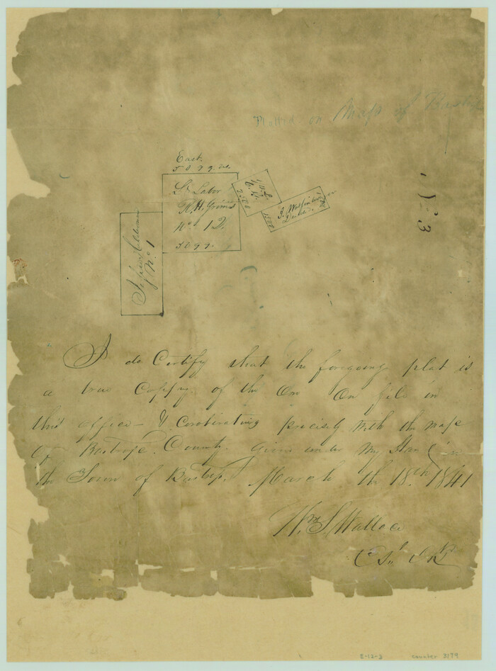
[Surveys in Bastrop County]
Print $2.00
- Digital $50.00
[Surveys in Bastrop County]
1841
-
Size
11.3 x 8.4 inches
-
Map/Doc
3179
-
Creation Date
1841
[Surveys in Austin's Colony south of the San Antonio Road and west of the Colorado River]
Print $20.00
- Digital $50.00
[Surveys in Austin's Colony south of the San Antonio Road and west of the Colorado River]
1840
-
Size
16.8 x 22.2 inches
-
Map/Doc
50
-
Creation Date
1840
[Surveys in Austin's Colony along the San Antonio Road and the Colorado River]
Print $20.00
- Digital $50.00
[Surveys in Austin's Colony along the San Antonio Road and the Colorado River]
1821
-
Size
17.3 x 25.6 inches
-
Map/Doc
15
-
Creation Date
1821
[Surveys in Austin's Colony along the Colorado River]
Print $20.00
- Digital $50.00
[Surveys in Austin's Colony along the Colorado River]
1830
-
Size
38.9 x 23.2 inches
-
Map/Doc
198
-
Creation Date
1830
[Surveys by Brown in Austin's Little Colony along the Colorado River and Walnut Creek]
Print $20.00
- Digital $50.00
[Surveys by Brown in Austin's Little Colony along the Colorado River and Walnut Creek]
1832
-
Size
33.2 x 23.3 inches
-
Map/Doc
196
-
Creation Date
1832
[Surveys around the Martha Barker survey]
Print $20.00
- Digital $50.00
[Surveys around the Martha Barker survey]
-
Size
26.8 x 20.2 inches
-
Map/Doc
90235
[Surveys around the Martha Barker survey]
Print $20.00
- Digital $50.00
[Surveys around the Martha Barker survey]
-
Size
24.5 x 18.1 inches
-
Map/Doc
90236
[Surveys along the Colorado River]
Print $20.00
- Digital $50.00
[Surveys along the Colorado River]
1841
-
Size
14.4 x 16.1 inches
-
Map/Doc
61
-
Creation Date
1841
[Surveys along San Antonio Road]
Print $20.00
- Digital $50.00
[Surveys along San Antonio Road]
-
Size
23.0 x 13.7 inches
-
Map/Doc
90110
[Subdivision surveys of the McCutcheon League near the Bastrop-Caldwell County Line]
Print $20.00
- Digital $50.00
[Subdivision surveys of the McCutcheon League near the Bastrop-Caldwell County Line]
1923
-
Size
12.5 x 16.9 inches
-
Map/Doc
90148
-
Creation Date
1923
[Sketch showing vicinity of Wm. McCutcheon League near the Bastrop-Caldwell County Line]
Print $2.00
- Digital $50.00
[Sketch showing vicinity of Wm. McCutcheon League near the Bastrop-Caldwell County Line]
1923
-
Size
7.7 x 12.9 inches
-
Map/Doc
90144
-
Creation Date
1923
[Sketch showing North line of James Stewart survey and vicinity]
Print $20.00
- Digital $50.00
[Sketch showing North line of James Stewart survey and vicinity]
-
Size
30.0 x 9.0 inches
-
Map/Doc
90116
[Sketch of area around C. & M. RR. Co. survey 171]
Print $20.00
- Digital $50.00
[Sketch of area around C. & M. RR. Co. survey 171]
1924
-
Size
21.8 x 26.9 inches
-
Map/Doc
90214
-
Creation Date
1924
[Sketch of a portion of a Bastrop District GLO map]
Print $20.00
- Digital $50.00
[Sketch of a portion of a Bastrop District GLO map]
1923
-
Size
12.1 x 16.0 inches
-
Map/Doc
90112
-
Creation Date
1923
[Sketch of a portion of a Bastrop District GLO map]
Print $3.00
- Digital $50.00
[Sketch of a portion of a Bastrop District GLO map]
1923
-
Size
11.4 x 15.1 inches
-
Map/Doc
90240
-
Creation Date
1923
[Sketch of Berry Doolittle, C. B. Emmons. R. D. Price and other surveys]
Print $20.00
- Digital $50.00
[Sketch of Berry Doolittle, C. B. Emmons. R. D. Price and other surveys]
-
Size
25.8 x 19.7 inches
-
Map/Doc
90213
[Sketch in vicinity of Wm. McCutcheon, S. H. Reid and John McGinley]
Print $20.00
- Digital $50.00
[Sketch in vicinity of Wm. McCutcheon, S. H. Reid and John McGinley]
1923
-
Size
20.0 x 13.2 inches
-
Map/Doc
90115
-
Creation Date
1923
[Sketch in vicinity of Wm. McCutcheon, S. H. Reid and John McGinley]
Print $20.00
- Digital $50.00
[Sketch in vicinity of Wm. McCutcheon, S. H. Reid and John McGinley]
1923
-
Size
20.0 x 12.4 inches
-
Map/Doc
92129
-
Creation Date
1923
[Sketch centered around Thos. B. Bell survey 98 showing adjacent and nearby surveys]
Print $20.00
- Digital $50.00
[Sketch centered around Thos. B. Bell survey 98 showing adjacent and nearby surveys]
-
Size
33.0 x 24.1 inches
-
Map/Doc
90229
[Sketch Showing Wm. T. Brewer, John R. Taylor, Wm. F. Butler, Timothy DeVore, L. M. Thorn and adjoining surveys]
Print $40.00
- Digital $50.00
[Sketch Showing Wm. T. Brewer, John R. Taylor, Wm. F. Butler, Timothy DeVore, L. M. Thorn and adjoining surveys]
-
Size
37.1 x 56.1 inches
-
Map/Doc
89745
[Sketch Showing Wm. T. Brewer, John R. Taylor, Wm. F. Butler, Timothy DeVore, L. M. Thorn and adjoining surveys]
Print $20.00
- Digital $50.00
[Sketch Showing Wm. T. Brewer, John R. Taylor, Wm. F. Butler, Timothy DeVore, L. M. Thorn and adjoining surveys]
-
Size
27.2 x 19.3 inches
-
Map/Doc
90121
[Sketch Showing Wm. T. Brewer, John R. Taylor, Wm. F. Butler, Timothy DeVore, L. M. Thorn and adjoining surveys]
Print $20.00
- Digital $50.00
[Sketch Showing Wm. T. Brewer, John R. Taylor, Wm. F. Butler, Timothy DeVore, L. M. Thorn and adjoining surveys]
-
Size
20.2 x 36.6 inches
-
Map/Doc
90209
[Sketch Showing Wm. T. Brewer, John R. Taylor, Wm. F. Butler, Timothy DeVore, L. M. Thorn and adjoining surveys]
Print $20.00
- Digital $50.00
[Sketch Showing Wm. T. Brewer, John R. Taylor, Wm. F. Butler, Timothy DeVore, L. M. Thorn and adjoining surveys]
-
Size
25.1 x 19.2 inches
-
Map/Doc
90230
[Sketch Showing Wm. T. Brewer, John R. Taylor, Wm. F. Butler, Timothy DeVore, L. M. Thorn and adjoining surveys]
Print $20.00
- Digital $50.00
[Sketch Showing Wm. T. Brewer, John R. Taylor, Wm. F. Butler, Timothy DeVore, L. M. Thorn and adjoining surveys]
-
Size
27.2 x 19.4 inches
-
Map/Doc
90231
[Pencil sketch around J. Walters, J. G. Welchmeyer, R. Gage surveys]
Print $20.00
- Digital $50.00
[Pencil sketch around J. Walters, J. G. Welchmeyer, R. Gage surveys]
-
Size
25.5 x 21.7 inches
-
Map/Doc
90206
[Part of Connected map of Stephen F. Austin's Colony on file at the GLO]
Print $20.00
- Digital $50.00
[Part of Connected map of Stephen F. Austin's Colony on file at the GLO]
1923
-
Size
18.5 x 18.1 inches
-
Map/Doc
90119
-
Creation Date
1923