Coke County Sketch File 23

Print $20.00
- Digital $50.00
Coke County Sketch File 23
Size: 43.9 x 18.5 inches
10338
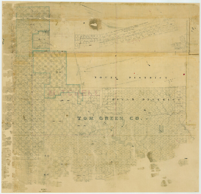
Tom Green County Sketch File 3

Print $20.00
- Digital $50.00
Tom Green County Sketch File 3
Size: 29.7 x 40.5 inches
10400
Mitchell County Sketch File 16b

Print $20.00
- Digital $50.00
Mitchell County Sketch File 16b
Size: 28.7 x 36.8 inches
10545
Nolan County Sketch File 1a

Print $20.00
- Digital $50.00
Nolan County Sketch File 1a
1882
Size: 20.7 x 39.4 inches
10554
Runnels County Sketch File 8

Print $40.00
Runnels County Sketch File 8
Size: 37.9 x 37.5 inches
10591
Runnels County Rolled Sketch 46

Print $20.00
- Digital $50.00
Runnels County Rolled Sketch 46
1954
Size: 32.3 x 38.5 inches
10622
Coke County Sketch File 7

Print $20.00
- Digital $50.00
Coke County Sketch File 7
Size: 18.9 x 22.4 inches
11105
Coke County Sketch File 8

Print $20.00
- Digital $50.00
Coke County Sketch File 8
Size: 20.2 x 27.8 inches
11106
Coke County Sketch File 13a

Print $20.00
- Digital $50.00
Coke County Sketch File 13a
Size: 20.3 x 19.5 inches
11107
Coke County Sketch File 16

Print $20.00
- Digital $50.00
Coke County Sketch File 16
1902
Size: 18.7 x 16.2 inches
11108
Coke County Sketch File 17-18

Print $24.00
- Digital $50.00
Coke County Sketch File 17-18
1902
Size: 16.6 x 14.2 inches
11109
Coke County Sketch File 19

Print $20.00
- Digital $50.00
Coke County Sketch File 19
Size: 18.5 x 25.0 inches
11110
Coke County Sketch File 22

Print $20.00
- Digital $50.00
Coke County Sketch File 22
1923
Size: 22.1 x 27.8 inches
11111
Coke County Sketch File 28

Print $20.00
- Digital $50.00
Coke County Sketch File 28
1886
Size: 36.4 x 26.5 inches
11113
Coke County Sketch File 29

Print $20.00
- Digital $50.00
Coke County Sketch File 29
Size: 10.9 x 21.8 inches
11114
Coke County Sketch File 33

Print $20.00
- Digital $50.00
Coke County Sketch File 33
Size: 22.0 x 26.6 inches
11115
Coke County Sketch File 34

Print $20.00
- Digital $50.00
Coke County Sketch File 34
1888
Size: 17.2 x 21.7 inches
11116
Runnels County Sketch File 14

Print $20.00
Runnels County Sketch File 14
1884
Size: 16.3 x 20.4 inches
12252
Runnels County Sketch File 25

Print $20.00
Runnels County Sketch File 25
1940
Size: 16.5 x 16.7 inches
12259
Sterling County Sketch File 12

Print $20.00
- Digital $50.00
Sterling County Sketch File 12
1930
Size: 14.4 x 28.4 inches
12358
Tom Green County Sketch File 63A

Print $20.00
- Digital $50.00
Tom Green County Sketch File 63A
1891
Size: 24.9 x 34.5 inches
12446
Tom Green County Sketch File 75

Print $20.00
- Digital $50.00
Tom Green County Sketch File 75
1950
Size: 18.1 x 22.5 inches
12449
[Tom Green County]
Print $20.00
- Digital $50.00
[Tom Green County]
1888
Size: 33.2 x 34.4 inches
16901
Coke County Sketch File 1

Print $8.00
- Digital $50.00
Coke County Sketch File 1
1858
Size: 8.3 x 7.7 inches
18562
Coke County Sketch File 2

Print $22.00
- Digital $50.00
Coke County Sketch File 2
Size: 9.1 x 7.8 inches
18565
Coke County Sketch File 4

Print $46.00
- Digital $50.00
Coke County Sketch File 4
1884
Size: 9.2 x 7.7 inches
18566
Coke County Sketch File 5

Print $8.00
- Digital $50.00
Coke County Sketch File 5
1886
Size: 12.4 x 8.2 inches
18578
Coke County Sketch File 6

Print $6.00
- Digital $50.00
Coke County Sketch File 6
1860
Size: 7.5 x 10.0 inches
18582
Coke County Sketch File 9

Print $4.00
- Digital $50.00
Coke County Sketch File 9
Size: 12.6 x 7.9 inches
18585
Coke County Sketch File 23
Print $20.00
- Digital $50.00
Coke County Sketch File 23
-
Size
43.9 x 18.5 inches
-
Map/Doc
10338
Tom Green County Sketch File 3
Print $20.00
- Digital $50.00
Tom Green County Sketch File 3
-
Size
29.7 x 40.5 inches
-
Map/Doc
10400
Mitchell County Sketch File 16b
Print $20.00
- Digital $50.00
Mitchell County Sketch File 16b
-
Size
28.7 x 36.8 inches
-
Map/Doc
10545
Nolan County Sketch File 1a
Print $20.00
- Digital $50.00
Nolan County Sketch File 1a
1882
-
Size
20.7 x 39.4 inches
-
Map/Doc
10554
-
Creation Date
1882
Runnels County Sketch File 8
Print $40.00
Runnels County Sketch File 8
-
Size
37.9 x 37.5 inches
-
Map/Doc
10591
Runnels County Rolled Sketch 46
Print $20.00
- Digital $50.00
Runnels County Rolled Sketch 46
1954
-
Size
32.3 x 38.5 inches
-
Map/Doc
10622
-
Creation Date
1954
Coke County Sketch File 7
Print $20.00
- Digital $50.00
Coke County Sketch File 7
-
Size
18.9 x 22.4 inches
-
Map/Doc
11105
Coke County Sketch File 8
Print $20.00
- Digital $50.00
Coke County Sketch File 8
-
Size
20.2 x 27.8 inches
-
Map/Doc
11106
Coke County Sketch File 13a
Print $20.00
- Digital $50.00
Coke County Sketch File 13a
-
Size
20.3 x 19.5 inches
-
Map/Doc
11107
Coke County Sketch File 16
Print $20.00
- Digital $50.00
Coke County Sketch File 16
1902
-
Size
18.7 x 16.2 inches
-
Map/Doc
11108
-
Creation Date
1902
Coke County Sketch File 17-18
Print $24.00
- Digital $50.00
Coke County Sketch File 17-18
1902
-
Size
16.6 x 14.2 inches
-
Map/Doc
11109
-
Creation Date
1902
Coke County Sketch File 19
Print $20.00
- Digital $50.00
Coke County Sketch File 19
-
Size
18.5 x 25.0 inches
-
Map/Doc
11110
Coke County Sketch File 22
Print $20.00
- Digital $50.00
Coke County Sketch File 22
1923
-
Size
22.1 x 27.8 inches
-
Map/Doc
11111
-
Creation Date
1923
Coke County Sketch File 28
Print $20.00
- Digital $50.00
Coke County Sketch File 28
1886
-
Size
36.4 x 26.5 inches
-
Map/Doc
11113
-
Creation Date
1886
Coke County Sketch File 29
Print $20.00
- Digital $50.00
Coke County Sketch File 29
-
Size
10.9 x 21.8 inches
-
Map/Doc
11114
Coke County Sketch File 33
Print $20.00
- Digital $50.00
Coke County Sketch File 33
-
Size
22.0 x 26.6 inches
-
Map/Doc
11115
Coke County Sketch File 34
Print $20.00
- Digital $50.00
Coke County Sketch File 34
1888
-
Size
17.2 x 21.7 inches
-
Map/Doc
11116
-
Creation Date
1888
Runnels County Sketch File 14
Print $20.00
Runnels County Sketch File 14
1884
-
Size
16.3 x 20.4 inches
-
Map/Doc
12252
-
Creation Date
1884
Runnels County Sketch File 25
Print $20.00
Runnels County Sketch File 25
1940
-
Size
16.5 x 16.7 inches
-
Map/Doc
12259
-
Creation Date
1940
Sterling County Sketch File 12
Print $20.00
- Digital $50.00
Sterling County Sketch File 12
1930
-
Size
14.4 x 28.4 inches
-
Map/Doc
12358
-
Creation Date
1930
Tom Green County Sketch File 63A
Print $20.00
- Digital $50.00
Tom Green County Sketch File 63A
1891
-
Size
24.9 x 34.5 inches
-
Map/Doc
12446
-
Creation Date
1891
Tom Green County Sketch File 75
Print $20.00
- Digital $50.00
Tom Green County Sketch File 75
1950
-
Size
18.1 x 22.5 inches
-
Map/Doc
12449
-
Creation Date
1950
[Tom Green County]
Print $20.00
- Digital $50.00
[Tom Green County]
1888
-
Size
33.2 x 34.4 inches
-
Map/Doc
16901
-
Creation Date
1888
Coke County

Print $20.00
- Digital $50.00
Coke County
1945
-
Size
39.9 x 41.9 inches
-
Map/Doc
1802
-
Creation Date
1945
Coke County Sketch File 1
Print $8.00
- Digital $50.00
Coke County Sketch File 1
1858
-
Size
8.3 x 7.7 inches
-
Map/Doc
18562
-
Creation Date
1858
Coke County Sketch File 2
Print $22.00
- Digital $50.00
Coke County Sketch File 2
-
Size
9.1 x 7.8 inches
-
Map/Doc
18565
Coke County Sketch File 4
Print $46.00
- Digital $50.00
Coke County Sketch File 4
1884
-
Size
9.2 x 7.7 inches
-
Map/Doc
18566
-
Creation Date
1884
Coke County Sketch File 5
Print $8.00
- Digital $50.00
Coke County Sketch File 5
1886
-
Size
12.4 x 8.2 inches
-
Map/Doc
18578
-
Creation Date
1886
Coke County Sketch File 6
Print $6.00
- Digital $50.00
Coke County Sketch File 6
1860
-
Size
7.5 x 10.0 inches
-
Map/Doc
18582
-
Creation Date
1860
Coke County Sketch File 9
Print $4.00
- Digital $50.00
Coke County Sketch File 9
-
Size
12.6 x 7.9 inches
-
Map/Doc
18585