82 results

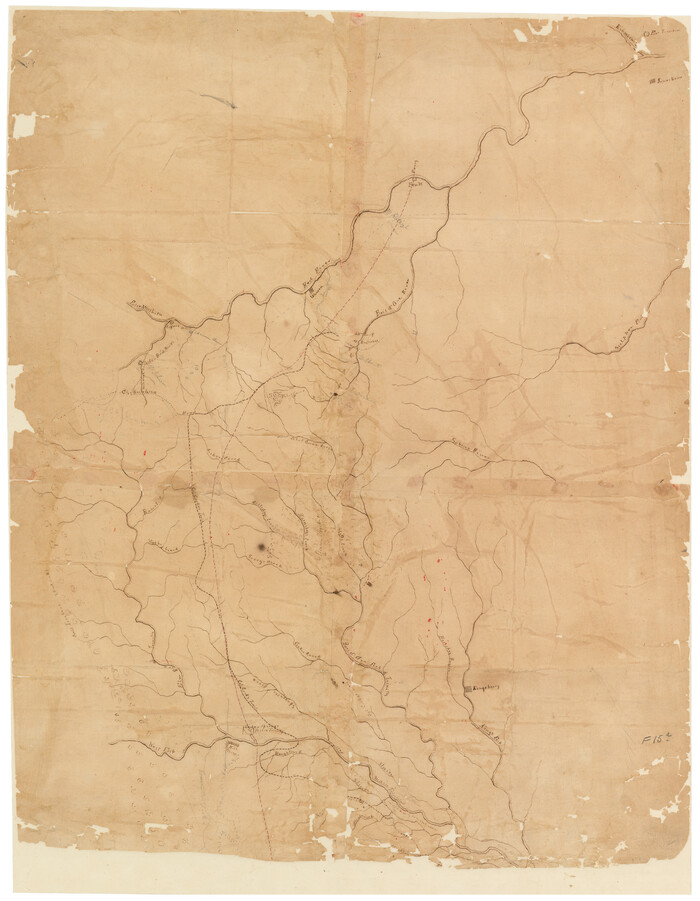
[Sketch of Col. Cooke's Military Road expedition from Red River to Austin]
166.tif
Print $20.00 - Digital $50.00

[Sketch of Col. Cooke's Military Road expedition from Red River to Austin]

Size: 29.4 x 22.9 inches
166
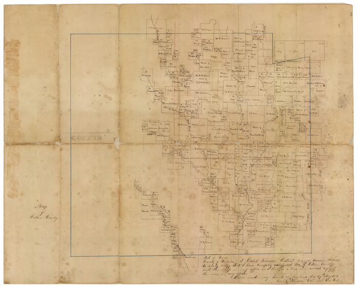
University and College Lands
169.tif
Print $20.00 - Digital $50.00

University and College Lands

1841

Size: 21.3 x 27.0 inches
169
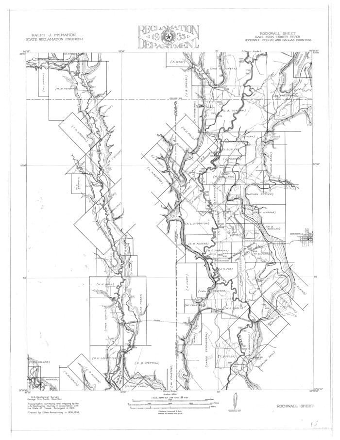
Trinity River, Rockwall Sheet/East Fork of Trinity River
65193.tif
Print $4.00 - Digital $50.00

Trinity River, Rockwall Sheet/East Fork of Trinity River

1936
Size: 29.6 x 22.9 inches
65193
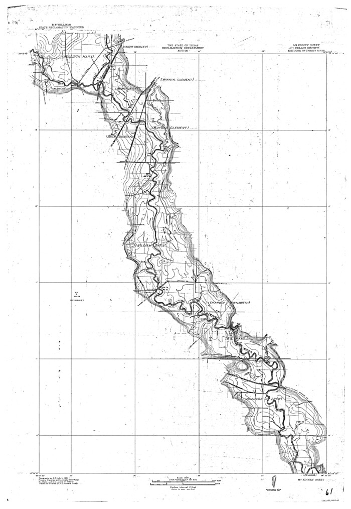
Trinity River, McKinney Sheet/East Fork of Trinity River
65241.tif
Print $20.00 - Digital $50.00

Trinity River, McKinney Sheet/East Fork of Trinity River

1931

Size: 40.6 x 28.0 inches
65241
Trinity River, Levee Improvement Districts, Widths of Floodways/Pilot Grove Creek and East Fork Trinity River
65259.tif
Print $6.00 - Digital $50.00

Trinity River, Levee Improvement Districts, Widths of Floodways/Pilot Grove Creek and East Fork Trinity River

1920
Size: 33.0 x 17.1 inches
65259
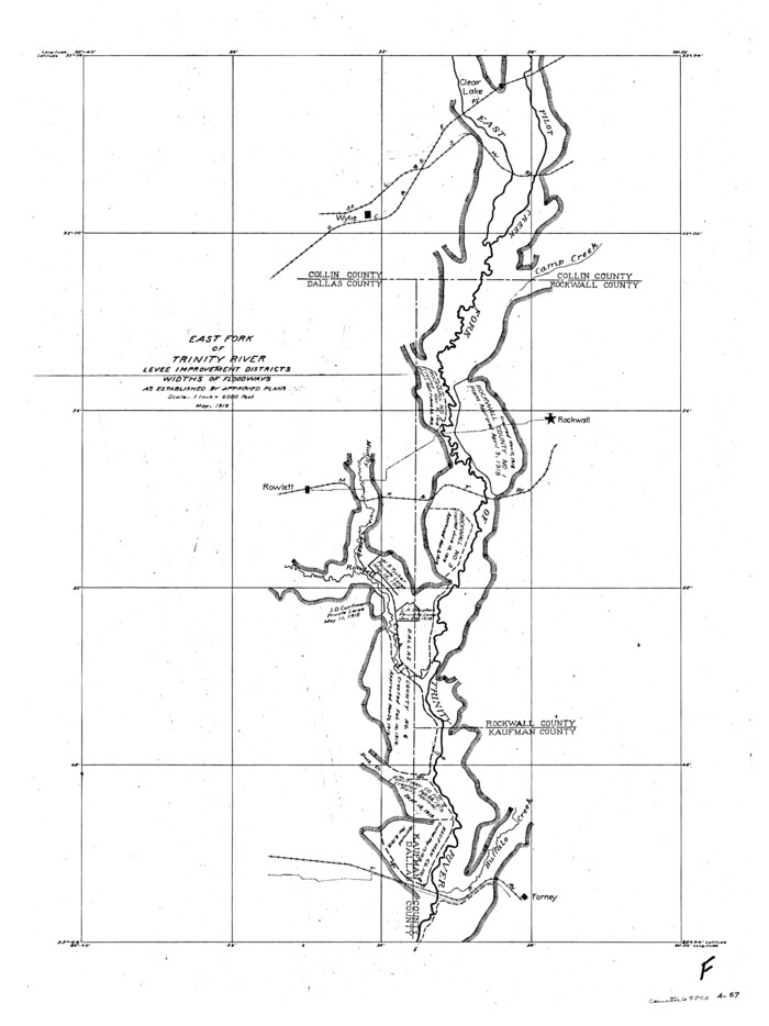
Trinity River, Levee Improvement Districts, Widths of Floodways
65250.tif
Print $4.00 - Digital $50.00

Trinity River, Levee Improvement Districts, Widths of Floodways

1919

Size: 23.5 x 17.6 inches
65250
Trinity River, Clear Lake Sheet/East Fork of Trinity River and Pilot Grove Creek
65194.tif
Print $6.00 - Digital $50.00

Trinity River, Clear Lake Sheet/East Fork of Trinity River and Pilot Grove Creek

1923

Size: 33.0 x 31.1 inches
65194
Trinity River, Branch Sheet/East Fork of Trinity River
65240.tif
Print $20.00 - Digital $50.00

Trinity River, Branch Sheet/East Fork of Trinity River

1931
Size: 41.4 x 19.6 inches
65240
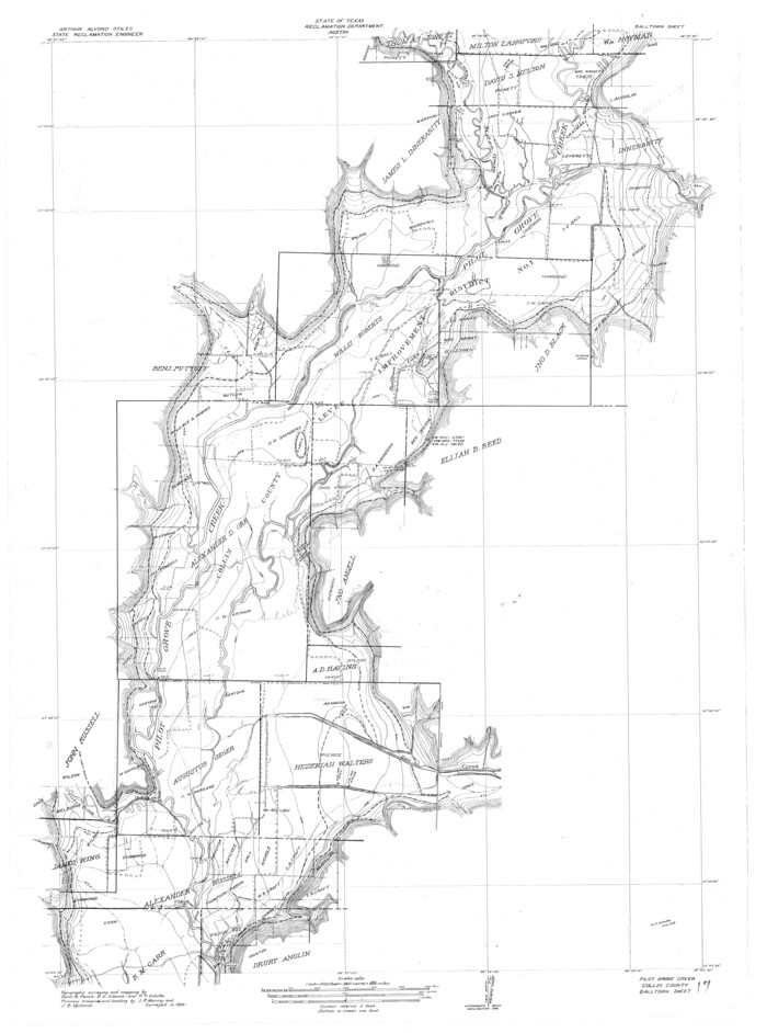
Trinity River, Balltown Sheet/Pilot Grove Creek
65195.tif
Print $20.00 - Digital $50.00

Trinity River, Balltown Sheet/Pilot Grove Creek

1916

Size: 36.9 x 27.5 inches
65195
Trinity River, Balltown Sheet/Pilot Grove Creek
65196.tif
Print $20.00 - Digital $50.00

Trinity River, Balltown Sheet/Pilot Grove Creek

1938

Size: 40.1 x 33.7 inches
65196
Sketch compiled from records of Collin County in General Land Office
0504.tif
Print $3.00 - Digital $50.00

Sketch compiled from records of Collin County in General Land Office

1878

Size: 11.5 x 13.5 inches
504
Sabine River, Watershed of the Sabine and Neches Rivers
65132.tif
Print $20.00 - Digital $50.00

Sabine River, Watershed of the Sabine and Neches Rivers

Size: 39.5 x 36.0 inches
65132
Rockwall County Sketch File 6
35425, Rockwall County Sketch File 6, General Map Collection
Print $4.00 - Digital $50.00

Rockwall County Sketch File 6

1862

Size: 8.5 x 9.4 inches
35425
Reclamation & Navigation Map of Trinity River Flood Plain
65178-GC.tif
Print $40.00 - Digital $50.00

Reclamation & Navigation Map of Trinity River Flood Plain

1930

Size: 24.3 x 75.8 inches
65178
Map of the Recognised Line, M. El. P. & P. RR. from Texas & Arkansas State Line to Milam & Bexar Land District Line
64638.tif
Print $40.00 - Digital $50.00

Map of the Recognised Line, M. El. P. & P. RR. from Texas & Arkansas State Line to Milam & Bexar Land District Line

Size: 15.3 x 89.4 inches
64638
Map of the Lands Surveyed by the Memphis, El Paso & Pacific R.R. Company
4846.tif
Print $20.00 - Digital $50.00

Map of the Lands Surveyed by the Memphis, El Paso & Pacific R.R. Company

1860
Size: 18.6 x 19.0 inches
4846
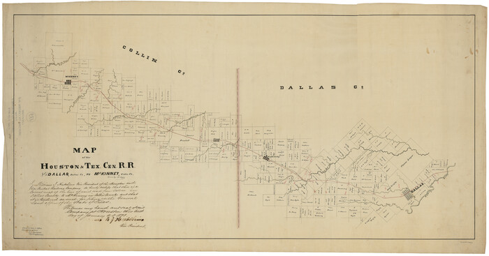
Map of the Houston & Tex. Cen. R.R. from Dallas, Dallas Co., to McKinney, Collin Co.
64474-1.tif
Print $20.00 - Digital $50.00

Map of the Houston & Tex. Cen. R.R. from Dallas, Dallas Co., to McKinney, Collin Co.

1873

Size: 23.0 x 43.8 inches
64474
Map of University Land part of Fifty League Grant Act of 1839
2430.tif
Print $20.00 - Digital $50.00

Map of University Land part of Fifty League Grant Act of 1839

1905

Size: 40.7 x 28.7 inches
2430
Map of The Surveyed Part of Peters Colony Texas
3155-1.tif
Print $40.00 - Digital $50.00

Map of The Surveyed Part of Peters Colony Texas

1852

Size: 54.0 x 28.8 inches
3155
Map of Main Line Houston & Tex. Centr. Railway from Dallas to Red River City
64089-1.tif
Print $40.00 - Digital $50.00

Map of Main Line Houston & Tex. Centr. Railway from Dallas to Red River City

Size: 37.1 x 84.9 inches
64089
Map of Fannin County
16827.tif
Print $20.00 - Digital $50.00

Map of Fannin County

1845

Size: 34.7 x 36.5 inches
16827
Map of Fannin County
87153-1.tif
Print $20.00 - Digital $50.00

Map of Fannin County

1845

Size: 34.7 x 47.0 inches
87153
Map of Collin County
1084-GC.tif
Print $20.00 - Digital $50.00

Map of Collin County

1862

Size: 24.4 x 20.5 inches
1084
Map of Collin County
4519.tif
Print $20.00 - Digital $50.00

Map of Collin County

1850

Size: 18.1 x 22.5 inches
4519
Map Showing Location of Dallas & Greenville Railway through Hunt County, Texas
64486.tif
Print $2.00 - Digital $50.00

Map Showing Location of Dallas & Greenville Railway through Hunt County, Texas

Size: 11.9 x 8.2 inches
64486
Map Showing Location of Dallas & Greenville Railroad through Rockwall County, Texas
64485.tif
Print $3.00 - Digital $50.00

Map Showing Location of Dallas & Greenville Railroad through Rockwall County, Texas

Size: 7.9 x 17.5 inches
64485
Map Exhibiting the line of the Southern Trans-Continental R.R. from Marshall to Texarkana from Texarkana to Forth Worth
64241-GC.tif
Print $20.00 - Digital $50.00

Map Exhibiting the line of the Southern Trans-Continental R.R. from Marshall to Texarkana from Texarkana to Forth Worth

1872

Size: 24.6 x 47.8 inches
64241
Grayson County Sketch File 10
24474, Grayson County Sketch File 10, General Map Collection
Print $4.00 - Digital $50.00

Grayson County Sketch File 10

1851

Size: 12.1 x 7.9 inches
24474
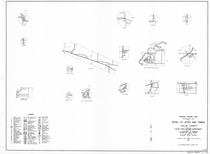
General Highway Map. Detail of Cities and Towns in Collin County, Texas
79414.tif
Print $20.00

General Highway Map. Detail of Cities and Towns in Collin County, Texas

1961

Size: 18.2 x 24.8 inches
79414
General Highway Map, Collin County, Texas
79052.tif
Print $20.00

General Highway Map, Collin County, Texas

1939

Size: 18.6 x 25.0 inches
79052
[Sketch of Col. Cooke's Military Road expedition from Red River to Austin]
166, [Sketch of Col. Cooke's Military Road expedition from Red River to Austin], General Map Collection
Print $20.00 - Digital $50.00

[Sketch of Col. Cooke's Military Road expedition from Red River to Austin]

  • Size

    29.4 x 22.9 inches

  • Map/Doc

    166

University and College Lands
169, University and College Lands, General Map Collection
Print $20.00 - Digital $50.00

University and College Lands

1841

  • Size

    21.3 x 27.0 inches

  • Map/Doc

    169

  • Creation Date

    1841

Trinity River, Rockwall Sheet/East Fork of Trinity River
65193, Trinity River, Rockwall Sheet/East Fork of Trinity River, General Map Collection
Print $4.00 - Digital $50.00

Trinity River, Rockwall Sheet/East Fork of Trinity River

1936

  • Size

    29.6 x 22.9 inches

  • Map/Doc

    65193

  • Creation Date

    1936

Trinity River, McKinney Sheet/East Fork of Trinity River
65241, Trinity River, McKinney Sheet/East Fork of Trinity River, General Map Collection
Print $20.00 - Digital $50.00

Trinity River, McKinney Sheet/East Fork of Trinity River

1931

  • Size

    40.6 x 28.0 inches

  • Map/Doc

    65241

  • Creation Date

    1931

Trinity River, Levee Improvement Districts, Widths of Floodways/Pilot Grove Creek and East Fork Trinity River
65259, Trinity River, Levee Improvement Districts, Widths of Floodways/Pilot Grove Creek and East Fork Trinity River, General Map Collection
Print $6.00 - Digital $50.00

Trinity River, Levee Improvement Districts, Widths of Floodways/Pilot Grove Creek and East Fork Trinity River

1920

  • Size

    33.0 x 17.1 inches

  • Map/Doc

    65259

  • Creation Date

    1920

Trinity River, Levee Improvement Districts, Widths of Floodways
65250, Trinity River, Levee Improvement Districts, Widths of Floodways, General Map Collection
Print $4.00 - Digital $50.00

Trinity River, Levee Improvement Districts, Widths of Floodways

1919

  • Size

    23.5 x 17.6 inches

  • Map/Doc

    65250

  • Creation Date

    1919

Trinity River, Clear Lake Sheet/East Fork of Trinity River and Pilot Grove Creek
65194, Trinity River, Clear Lake Sheet/East Fork of Trinity River and Pilot Grove Creek, General Map Collection
Print $6.00 - Digital $50.00

Trinity River, Clear Lake Sheet/East Fork of Trinity River and Pilot Grove Creek

1923

  • Size

    33.0 x 31.1 inches

  • Map/Doc

    65194

  • Creation Date

    1923

Trinity River, Branch Sheet/East Fork of Trinity River
65240, Trinity River, Branch Sheet/East Fork of Trinity River, General Map Collection
Print $20.00 - Digital $50.00

Trinity River, Branch Sheet/East Fork of Trinity River

1931

  • Size

    41.4 x 19.6 inches

  • Map/Doc

    65240

  • Creation Date

    1931

Trinity River, Balltown Sheet/Pilot Grove Creek
65195, Trinity River, Balltown Sheet/Pilot Grove Creek, General Map Collection
Print $20.00 - Digital $50.00

Trinity River, Balltown Sheet/Pilot Grove Creek

1916

  • Size

    36.9 x 27.5 inches

  • Map/Doc

    65195

  • Creation Date

    1916

Trinity River, Balltown Sheet/Pilot Grove Creek
65196, Trinity River, Balltown Sheet/Pilot Grove Creek, General Map Collection
Print $20.00 - Digital $50.00

Trinity River, Balltown Sheet/Pilot Grove Creek

1938

  • Size

    40.1 x 33.7 inches

  • Map/Doc

    65196

  • Creation Date

    1938

Sketch compiled from records of Collin County in General Land Office
504, Sketch compiled from records of Collin County in General Land Office, Maddox Collection
Print $3.00 - Digital $50.00

Sketch compiled from records of Collin County in General Land Office

1878

  • Size

    11.5 x 13.5 inches

  • Map/Doc

    504

  • Creation Date

    1878

Sabine River, Watershed of the Sabine and Neches Rivers
65132, Sabine River, Watershed of the Sabine and Neches Rivers, General Map Collection
Print $20.00 - Digital $50.00

Sabine River, Watershed of the Sabine and Neches Rivers

  • Size

    39.5 x 36.0 inches

  • Map/Doc

    65132

Rockwall County Sketch File 6
35425, Rockwall County Sketch File 6, General Map Collection
Print $4.00 - Digital $50.00

Rockwall County Sketch File 6

1862

  • Size

    8.5 x 9.4 inches

  • Map/Doc

    35425

  • Creation Date

    1862

Reclamation & Navigation Map of Trinity River Flood Plain
65178, Reclamation & Navigation Map of Trinity River Flood Plain, General Map Collection
Print $40.00 - Digital $50.00

Reclamation & Navigation Map of Trinity River Flood Plain

1930

  • Size

    24.3 x 75.8 inches

  • Map/Doc

    65178

  • Creation Date

    1930

Map of the Recognised Line, M. El. P. & P. RR. from Texas & Arkansas State Line to Milam & Bexar Land District Line
64638, Map of the Recognised Line, M. El. P. & P. RR. from Texas & Arkansas State Line to Milam & Bexar Land District Line, General Map Collection
Print $40.00 - Digital $50.00

Map of the Recognised Line, M. El. P. & P. RR. from Texas & Arkansas State Line to Milam & Bexar Land District Line

  • Size

    15.3 x 89.4 inches

  • Map/Doc

    64638

Map of the Lands Surveyed by the Memphis, El Paso & Pacific R.R. Company
4846, Map of the Lands Surveyed by the Memphis, El Paso & Pacific R.R. Company, General Map Collection
Print $20.00 - Digital $50.00

Map of the Lands Surveyed by the Memphis, El Paso & Pacific R.R. Company

1860

  • Size

    18.6 x 19.0 inches

  • Map/Doc

    4846

  • Creation Date

    1860

Map of the Houston & Tex. Cen. R.R. from Dallas, Dallas Co., to McKinney, Collin Co.
64474, Map of the Houston & Tex. Cen. R.R. from Dallas, Dallas Co., to McKinney, Collin Co., General Map Collection
Print $20.00 - Digital $50.00

Map of the Houston & Tex. Cen. R.R. from Dallas, Dallas Co., to McKinney, Collin Co.

1873

  • Size

    23.0 x 43.8 inches

  • Map/Doc

    64474

  • Creation Date

    1873

Map of University Land part of Fifty League Grant Act of 1839
2430, Map of University Land part of Fifty League Grant Act of 1839, General Map Collection
Print $20.00 - Digital $50.00

Map of University Land part of Fifty League Grant Act of 1839

1905

  • Size

    40.7 x 28.7 inches

  • Map/Doc

    2430

  • Creation Date

    1905

Map of The Surveyed Part of Peters Colony Texas
3155, Map of The Surveyed Part of Peters Colony Texas, General Map Collection
Print $40.00 - Digital $50.00

Map of The Surveyed Part of Peters Colony Texas

1852

  • Size

    54.0 x 28.8 inches

  • Map/Doc

    3155

  • Creation Date

    1852

Map of Main Line Houston & Tex. Centr. Railway from Dallas to Red River City
64089, Map of Main Line Houston & Tex. Centr. Railway from Dallas to Red River City, General Map Collection
Print $40.00 - Digital $50.00

Map of Main Line Houston & Tex. Centr. Railway from Dallas to Red River City

  • Size

    37.1 x 84.9 inches

  • Map/Doc

    64089

Map of Fannin County
16827, Map of Fannin County, General Map Collection
Print $20.00 - Digital $50.00

Map of Fannin County

1845

  • Size

    34.7 x 36.5 inches

  • Map/Doc

    16827

  • Creation Date

    1845

Map of Fannin County
87153, Map of Fannin County, General Map Collection
Print $20.00 - Digital $50.00

Map of Fannin County

1845

  • Size

    34.7 x 47.0 inches

  • Map/Doc

    87153

  • Creation Date

    1845

Map of Collin County
1084, Map of Collin County, General Map Collection
Print $20.00 - Digital $50.00

Map of Collin County

1862

  • Size

    24.4 x 20.5 inches

  • Map/Doc

    1084

  • Creation Date

    1862

Map of Collin County
4519, Map of Collin County, General Map Collection
Print $20.00 - Digital $50.00

Map of Collin County

1850

  • Size

    18.1 x 22.5 inches

  • Map/Doc

    4519

  • Creation Date

    1850

Map Showing Location of Dallas & Greenville Railway through Hunt County, Texas
64486, Map Showing Location of Dallas & Greenville Railway through Hunt County, Texas, General Map Collection
Print $2.00 - Digital $50.00

Map Showing Location of Dallas & Greenville Railway through Hunt County, Texas

  • Size

    11.9 x 8.2 inches

  • Map/Doc

    64486

Map Showing Location of Dallas & Greenville Railroad through Rockwall County, Texas
64485, Map Showing Location of Dallas & Greenville Railroad through Rockwall County, Texas, General Map Collection
Print $3.00 - Digital $50.00

Map Showing Location of Dallas & Greenville Railroad through Rockwall County, Texas

  • Size

    7.9 x 17.5 inches

  • Map/Doc

    64485

Map Exhibiting the line of the Southern Trans-Continental R.R. from Marshall to Texarkana from Texarkana to Forth Worth
64241, Map Exhibiting the line of the Southern Trans-Continental R.R. from Marshall to Texarkana from Texarkana to Forth Worth, General Map Collection
Print $20.00 - Digital $50.00

Map Exhibiting the line of the Southern Trans-Continental R.R. from Marshall to Texarkana from Texarkana to Forth Worth

1872

  • Size

    24.6 x 47.8 inches

  • Map/Doc

    64241

  • Creation Date

    1872

Grayson County Sketch File 10
24474, Grayson County Sketch File 10, General Map Collection
Print $4.00 - Digital $50.00

Grayson County Sketch File 10

1851

  • Size

    12.1 x 7.9 inches

  • Map/Doc

    24474

  • Creation Date

    1851

General Highway Map. Detail of Cities and Towns in Collin County, Texas
79414, General Highway Map.  Detail of Cities and Towns in Collin County, Texas, Texas State Library and Archives
Print $20.00

General Highway Map. Detail of Cities and Towns in Collin County, Texas

1961

  • Size

    18.2 x 24.8 inches

  • Map/Doc

    79414

  • Creation Date

    1961

General Highway Map, Collin County, Texas
79052, General Highway Map, Collin County, Texas, Texas State Library and Archives
Print $20.00

General Highway Map, Collin County, Texas

1939

  • Size

    18.6 x 25.0 inches

  • Map/Doc

    79052

  • Creation Date

    1939