Map of Collin County

Print $20.00
- Digital $50.00
Map of Collin County
1862
Size: 24.4 x 20.5 inches
1084
Collin County Sketch File 3

Print $20.00
- Digital $50.00
Collin County Sketch File 3
1852
Size: 19.5 x 21.4 inches
11126
Collin County Sketch File 12

Print $40.00
- Digital $50.00
Collin County Sketch File 12
1851
Size: 24.3 x 31.3 inches
11127
[Sketch of Col. Cooke's Military Road expedition from Red River to Austin]
Print $20.00
- Digital $50.00
[Sketch of Col. Cooke's Military Road expedition from Red River to Austin]
Size: 29.4 x 22.9 inches
166
Map of Fannin County

Print $20.00
- Digital $50.00
Map of Fannin County
1845
Size: 34.7 x 36.5 inches
16827
University and College Lands

Print $20.00
- Digital $50.00
University and College Lands
1841
Size: 21.3 x 27.0 inches
169
Collin County Sketch File 1

Print $6.00
- Digital $50.00
Collin County Sketch File 1
1853
Size: 6.4 x 8.2 inches
18855
Collin County Sketch File 2

Print $8.00
- Digital $50.00
Collin County Sketch File 2
1848
Size: 10.0 x 8.0 inches
18858
Collin County Sketch File 4

Print $4.00
- Digital $50.00
Collin County Sketch File 4
1856
Size: 10.0 x 8.0 inches
18862
Collin County Sketch File 5

Print $4.00
- Digital $50.00
Collin County Sketch File 5
1852
Size: 9.7 x 8.5 inches
18864
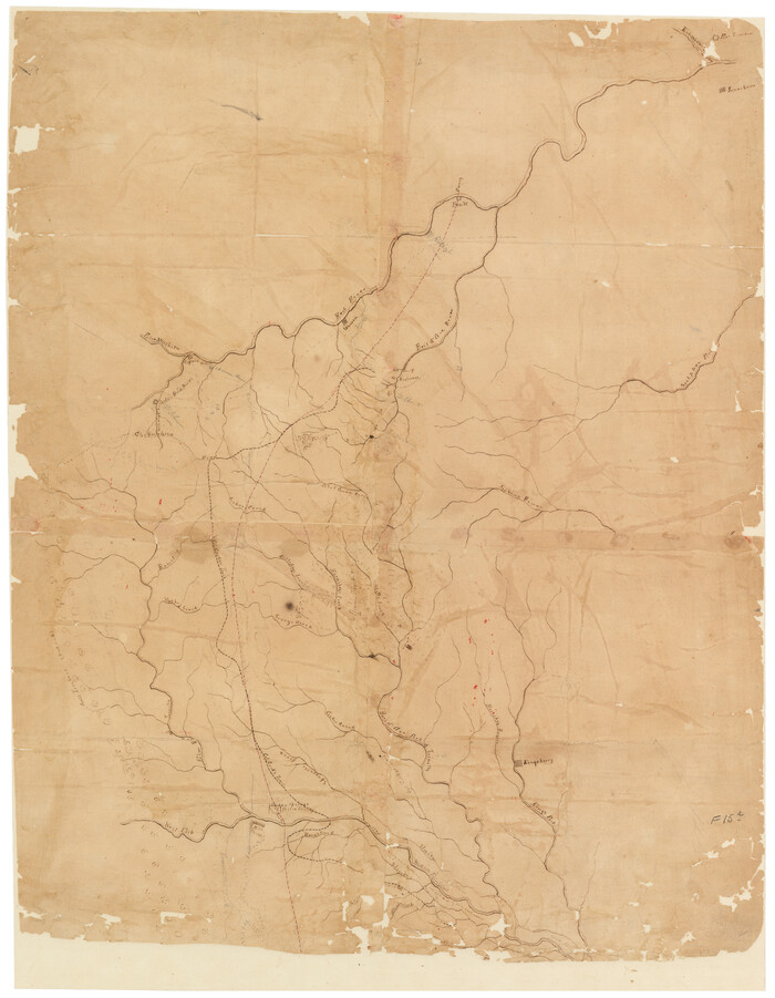
Collin County Sketch File 7

Print $40.00
- Digital $50.00
Collin County Sketch File 7
1852
Size: 17.3 x 14.0 inches
18866
Collin County Sketch File 8

Print $4.00
- Digital $50.00
Collin County Sketch File 8
1859
Size: 10.2 x 8.1 inches
18868
Collin County Sketch File 9

Print $4.00
- Digital $50.00
Collin County Sketch File 9
1878
Size: 8.3 x 10.1 inches
18870
Collin County Sketch File 13

Print $4.00
- Digital $50.00
Collin County Sketch File 13
1874
Size: 8.8 x 6.8 inches
18872
Collin County Sketch File 14

Print $12.00
- Digital $50.00
Collin County Sketch File 14
1953
Size: 11.2 x 8.7 inches
18874
Collin County Sketch File 15

Print $4.00
- Digital $50.00
Collin County Sketch File 15
1873
Size: 10.0 x 8.0 inches
18880
Dallas County Sketch File 20

Print $4.00
- Digital $50.00
Dallas County Sketch File 20
Size: 12.2 x 7.8 inches
20441
Dallas County Sketch File 22

Print $6.00
- Digital $50.00
Dallas County Sketch File 22
1891
Size: 9.5 x 10.9 inches
20454
Denton County Sketch File 21

Print $12.00
- Digital $50.00
Denton County Sketch File 21
1866
Size: 8.7 x 8.8 inches
20740
Fannin County Sketch File 7

Print $40.00
- Digital $50.00
Fannin County Sketch File 7
1857
Size: 16.8 x 13.5 inches
22451
Map of University Land part of Fifty League Grant Act of 1839

Print $20.00
- Digital $50.00
Map of University Land part of Fifty League Grant Act of 1839
1905
Size: 40.7 x 28.7 inches
2430
Grayson County Sketch File 10

Print $4.00
- Digital $50.00
Grayson County Sketch File 10
1851
Size: 12.1 x 7.9 inches
24474
Map of The Surveyed Part of Peters Colony Texas

Print $40.00
- Digital $50.00
Map of The Surveyed Part of Peters Colony Texas
1852
Size: 54.0 x 28.8 inches
3155
Rockwall County Sketch File 6

Print $4.00
- Digital $50.00
Rockwall County Sketch File 6
1862
Size: 8.5 x 9.4 inches
35425
Map of Collin County

Print $20.00
- Digital $50.00
Map of Collin County
1850
Size: 18.1 x 22.5 inches
4519
Map of the Lands Surveyed by the Memphis, El Paso & Pacific R.R. Company

Print $20.00
- Digital $50.00
Map of the Lands Surveyed by the Memphis, El Paso & Pacific R.R. Company
1860
Size: 18.6 x 19.0 inches
4846
Map of Collin County
Print $20.00
- Digital $50.00
Map of Collin County
1862
-
Size
24.4 x 20.5 inches
-
Map/Doc
1084
-
Creation Date
1862
Collin County Sketch File 3
Print $20.00
- Digital $50.00
Collin County Sketch File 3
1852
-
Size
19.5 x 21.4 inches
-
Map/Doc
11126
-
Creation Date
1852
Collin County Sketch File 12
Print $40.00
- Digital $50.00
Collin County Sketch File 12
1851
-
Size
24.3 x 31.3 inches
-
Map/Doc
11127
-
Creation Date
1851
[Sketch of Col. Cooke's Military Road expedition from Red River to Austin]
Print $20.00
- Digital $50.00
[Sketch of Col. Cooke's Military Road expedition from Red River to Austin]
-
Size
29.4 x 22.9 inches
-
Map/Doc
166
Map of Fannin County
Print $20.00
- Digital $50.00
Map of Fannin County
1845
-
Size
34.7 x 36.5 inches
-
Map/Doc
16827
-
Creation Date
1845
University and College Lands
Print $20.00
- Digital $50.00
University and College Lands
1841
-
Size
21.3 x 27.0 inches
-
Map/Doc
169
-
Creation Date
1841
Collin County

Print $20.00
- Digital $50.00
Collin County
1916
-
Size
42.6 x 38.6 inches
-
Map/Doc
1804
-
Creation Date
1916
Collin County Sketch File 1
Print $6.00
- Digital $50.00
Collin County Sketch File 1
1853
-
Size
6.4 x 8.2 inches
-
Map/Doc
18855
-
Creation Date
1853
Collin County Sketch File 2
Print $8.00
- Digital $50.00
Collin County Sketch File 2
1848
-
Size
10.0 x 8.0 inches
-
Map/Doc
18858
-
Creation Date
1848
Collin County Sketch File 4
Print $4.00
- Digital $50.00
Collin County Sketch File 4
1856
-
Size
10.0 x 8.0 inches
-
Map/Doc
18862
-
Creation Date
1856
Collin County Sketch File 5
Print $4.00
- Digital $50.00
Collin County Sketch File 5
1852
-
Size
9.7 x 8.5 inches
-
Map/Doc
18864
-
Creation Date
1852
Collin County Sketch File 7
Print $40.00
- Digital $50.00
Collin County Sketch File 7
1852
-
Size
17.3 x 14.0 inches
-
Map/Doc
18866
-
Creation Date
1852
Collin County Sketch File 8
Print $4.00
- Digital $50.00
Collin County Sketch File 8
1859
-
Size
10.2 x 8.1 inches
-
Map/Doc
18868
-
Creation Date
1859
Collin County Sketch File 9
Print $4.00
- Digital $50.00
Collin County Sketch File 9
1878
-
Size
8.3 x 10.1 inches
-
Map/Doc
18870
-
Creation Date
1878
Collin County Sketch File 13
Print $4.00
- Digital $50.00
Collin County Sketch File 13
1874
-
Size
8.8 x 6.8 inches
-
Map/Doc
18872
-
Creation Date
1874
Collin County Sketch File 14
Print $12.00
- Digital $50.00
Collin County Sketch File 14
1953
-
Size
11.2 x 8.7 inches
-
Map/Doc
18874
-
Creation Date
1953
Collin County Sketch File 15
Print $4.00
- Digital $50.00
Collin County Sketch File 15
1873
-
Size
10.0 x 8.0 inches
-
Map/Doc
18880
-
Creation Date
1873
Dallas County Sketch File 20
Print $4.00
- Digital $50.00
Dallas County Sketch File 20
-
Size
12.2 x 7.8 inches
-
Map/Doc
20441
Dallas County Sketch File 22
Print $6.00
- Digital $50.00
Dallas County Sketch File 22
1891
-
Size
9.5 x 10.9 inches
-
Map/Doc
20454
-
Creation Date
1891
Denton County Sketch File 21
Print $12.00
- Digital $50.00
Denton County Sketch File 21
1866
-
Size
8.7 x 8.8 inches
-
Map/Doc
20740
-
Creation Date
1866
Fannin County Sketch File 7
Print $40.00
- Digital $50.00
Fannin County Sketch File 7
1857
-
Size
16.8 x 13.5 inches
-
Map/Doc
22451
-
Creation Date
1857
Map of University Land part of Fifty League Grant Act of 1839
Print $20.00
- Digital $50.00
Map of University Land part of Fifty League Grant Act of 1839
1905
-
Size
40.7 x 28.7 inches
-
Map/Doc
2430
-
Creation Date
1905
Grayson County Sketch File 10
Print $4.00
- Digital $50.00
Grayson County Sketch File 10
1851
-
Size
12.1 x 7.9 inches
-
Map/Doc
24474
-
Creation Date
1851
Map of The Surveyed Part of Peters Colony Texas
Print $40.00
- Digital $50.00
Map of The Surveyed Part of Peters Colony Texas
1852
-
Size
54.0 x 28.8 inches
-
Map/Doc
3155
-
Creation Date
1852
Collin

Print $20.00
- Digital $50.00
Collin
1851
-
Size
22.0 x 19.0 inches
-
Map/Doc
3416
-
Creation Date
1851
Collin County

Print $20.00
- Digital $50.00
Collin County
1872
-
Size
20.1 x 18.5 inches
-
Map/Doc
3418
-
Creation Date
1872
Rockwall County Sketch File 6
Print $4.00
- Digital $50.00
Rockwall County Sketch File 6
1862
-
Size
8.5 x 9.4 inches
-
Map/Doc
35425
-
Creation Date
1862
Map of Collin County
Print $20.00
- Digital $50.00
Map of Collin County
1850
-
Size
18.1 x 22.5 inches
-
Map/Doc
4519
-
Creation Date
1850
Collin County

Print $20.00
- Digital $50.00
Collin County
1916
-
Size
41.8 x 37.3 inches
-
Map/Doc
4740
-
Creation Date
1916
Map of the Lands Surveyed by the Memphis, El Paso & Pacific R.R. Company
Print $20.00
- Digital $50.00
Map of the Lands Surveyed by the Memphis, El Paso & Pacific R.R. Company
1860
-
Size
18.6 x 19.0 inches
-
Map/Doc
4846
-
Creation Date
1860