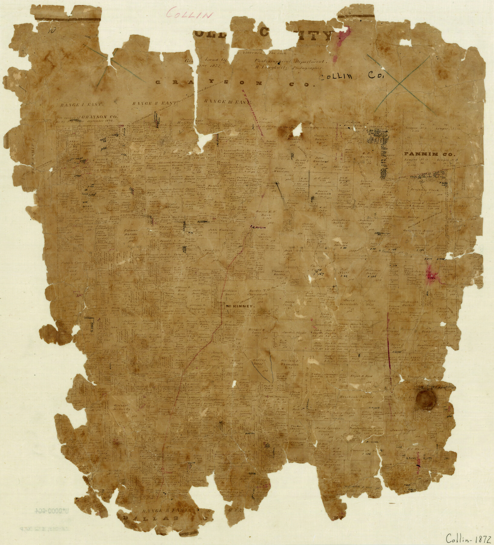
Collin County
-
Map/Doc
3418
-
Collection
General Map Collection
-
Object Dates
1872 (Creation Date)
-
People and Organizations
Herman Lungkwitz (Draftsman)
-
Counties
Collin
-
Subjects
County
-
Height x Width
20.1 x 18.5 inches
51.1 x 47.0 cm
-
Features
Clair Creek
H&TC
Plano
Price Creek
Wilson's Creek
McKinney
Altoga
MEP&P
Melissa
Six Mile Creek
Little Elm Creek
Harren Creek
Honey Creek
Desert Creek
Pilot Grove Creek
Indian Creek
Little Bear Creek
Part of: General Map Collection
Webb County Rolled Sketch 29

Print $20.00
- Digital $50.00
Webb County Rolled Sketch 29
1932
Size 16.5 x 15.3 inches
Map/Doc 8187
Cass County Working Sketch 42

Print $20.00
- Digital $50.00
Cass County Working Sketch 42
1986
Size 36.4 x 37.5 inches
Map/Doc 67945
Flight Mission No. BRA-7M, Frame 189, Jefferson County

Print $20.00
- Digital $50.00
Flight Mission No. BRA-7M, Frame 189, Jefferson County
1953
Size 18.5 x 22.3 inches
Map/Doc 85557
Gregg County Boundary File 6

Print $6.00
- Digital $50.00
Gregg County Boundary File 6
Size 8.5 x 5.8 inches
Map/Doc 54001
Angelina County Working Sketch 55

Print $20.00
- Digital $50.00
Angelina County Working Sketch 55
1989
Size 33.7 x 30.0 inches
Map/Doc 67139
Parker County Sketch File 39

Print $4.00
- Digital $50.00
Parker County Sketch File 39
Size 8.0 x 12.7 inches
Map/Doc 33583
Leon County Working Sketch 35

Print $20.00
- Digital $50.00
Leon County Working Sketch 35
1978
Size 43.8 x 38.3 inches
Map/Doc 70434
Fractional Township No. 8 South Range No. 19 East of the Indian Meridian, Indian Territory

Print $20.00
- Digital $50.00
Fractional Township No. 8 South Range No. 19 East of the Indian Meridian, Indian Territory
1897
Size 19.1 x 24.2 inches
Map/Doc 75234
Plot of surveys on Sims Bayou

Print $2.00
- Digital $50.00
Plot of surveys on Sims Bayou
1844
Size 6.8 x 8.3 inches
Map/Doc 26
No. 2 Chart of Corpus Christi Pass, Texas

Print $20.00
- Digital $50.00
No. 2 Chart of Corpus Christi Pass, Texas
1878
Size 18.2 x 27.3 inches
Map/Doc 73027
Mills County Boundary File 4

Print $40.00
- Digital $50.00
Mills County Boundary File 4
Size 52.1 x 13.3 inches
Map/Doc 57293
Matagorda County NRC Article 33.136 Sketch 22

Print $24.00
Matagorda County NRC Article 33.136 Sketch 22
2025
Map/Doc 97486
You may also like
Travis County Sketch File 27

Print $8.00
- Digital $50.00
Travis County Sketch File 27
1872
Size 12.9 x 8.3 inches
Map/Doc 38338
Brooks County Sketch File 10

Print $2.00
- Digital $50.00
Brooks County Sketch File 10
1988
Size 14.4 x 9.0 inches
Map/Doc 16572
Galveston County NRC Article 33.136 Sketch 10

Print $48.00
- Digital $50.00
Galveston County NRC Article 33.136 Sketch 10
2000
Size 29.8 x 41.9 inches
Map/Doc 61592
Midland County, Texas

Print $20.00
- Digital $50.00
Midland County, Texas
1880
Size 20.8 x 17.7 inches
Map/Doc 437
Flight Mission No. CRC-3R, Frame 35, Chambers County

Print $20.00
- Digital $50.00
Flight Mission No. CRC-3R, Frame 35, Chambers County
1956
Size 18.5 x 22.2 inches
Map/Doc 84808
Ward County Sketch File L

Print $20.00
- Digital $50.00
Ward County Sketch File L
Size 23.8 x 29.6 inches
Map/Doc 12601
[Blocks O5, O2, O, JD, A1, A2, A3, A4, B, T, D10, and vicinity]
![90717, [Blocks O5, O2, O, JD, A1, A2, A3, A4, B, T, D10, and vicinity], Twichell Survey Records](https://historictexasmaps.com/wmedia_w700/maps/90717-1.tif.jpg)
Print $20.00
- Digital $50.00
[Blocks O5, O2, O, JD, A1, A2, A3, A4, B, T, D10, and vicinity]
Size 34.7 x 29.3 inches
Map/Doc 90717
Stephens County Sketch File 7

Print $4.00
- Digital $50.00
Stephens County Sketch File 7
1875
Size 8.1 x 9.9 inches
Map/Doc 37025
[Worksheets related to the Wilson Strickland survey and vicinity]
![91267, [Vicinity and related to the Wilson Strickland Survey], Twichell Survey Records](https://historictexasmaps.com/wmedia_w700/maps/91267-1.tif.jpg)
Print $20.00
- Digital $50.00
[Worksheets related to the Wilson Strickland survey and vicinity]
Size 21.7 x 19.4 inches
Map/Doc 91267
Hudspeth County Rolled Sketch 69

Print $20.00
- Digital $50.00
Hudspeth County Rolled Sketch 69
1973
Size 12.3 x 19.2 inches
Map/Doc 7718
Flight Mission No. DQO-7K, Frame 110, Galveston County

Print $20.00
- Digital $50.00
Flight Mission No. DQO-7K, Frame 110, Galveston County
1952
Size 18.7 x 22.3 inches
Map/Doc 85125
Garza County Sketch File 20

Print $20.00
- Digital $50.00
Garza County Sketch File 20
1905
Size 8.7 x 7.8 inches
Map/Doc 24068