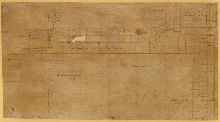
[Sketch Showing Surveys in Schleicher, Menard & Concho Counties, Texas]
Print $20.00
- Digital $50.00
[Sketch Showing Surveys in Schleicher, Menard & Concho Counties, Texas]
Size: 16.1 x 28.9 inches
75782
Water-Shed of the Colorado River

Print $40.00
- Digital $50.00
Water-Shed of the Colorado River
1925
Size: 37.1 x 79.8 inches
65261
Tom Green County Sketch File 5

Print $42.00
- Digital $50.00
Tom Green County Sketch File 5
1849
Size: 8.5 x 7.1 inches
38167
Tom Green County Sketch File 46 1/2

Print $40.00
- Digital $50.00
Tom Green County Sketch File 46 1/2
1882
Size: 12.7 x 19.6 inches
12440
Tom Green County Sketch File 35

Print $6.00
- Digital $50.00
Tom Green County Sketch File 35
Size: 10.2 x 15.9 inches
38192
Runnels County Sketch File 34

Print $20.00
Runnels County Sketch File 34
1889
Size: 16.6 x 26.7 inches
12265
Runnels County Sketch File 24

Print $20.00
Runnels County Sketch File 24
1930
Size: 25.2 x 21.3 inches
12258
Runnels County Sketch File 23

Print $20.00
Runnels County Sketch File 23
1924
Size: 21.2 x 19.9 inches
12257
Runnels County Sketch File 17

Print $6.00
Runnels County Sketch File 17
Size: 11.0 x 13.6 inches
35474
Runnels County Rolled Sketch 23

Print $20.00
- Digital $50.00
Runnels County Rolled Sketch 23
Size: 21.8 x 27.0 inches
7514
Runnels County Rolled Sketch 18

Print $20.00
- Digital $50.00
Runnels County Rolled Sketch 18
Size: 23.1 x 25.3 inches
7513
Menard County Working Sketch 4

Print $20.00
- Digital $50.00
Menard County Working Sketch 4
1914
Size: 19.8 x 16.2 inches
70951
Menard County Working Sketch 31

Print $20.00
- Digital $50.00
Menard County Working Sketch 31
1980
Size: 25.6 x 24.5 inches
70978
Menard County Working Sketch 25

Print $20.00
- Digital $50.00
Menard County Working Sketch 25
1952
Size: 32.2 x 42.8 inches
70972
Menard County Sketch File 8

Print $20.00
- Digital $50.00
Menard County Sketch File 8
Size: 19.7 x 28.5 inches
12073
Menard County Sketch File 4

Print $20.00
- Digital $50.00
Menard County Sketch File 4
Size: 18.3 x 25.5 inches
12072
Menard County Sketch File 26

Print $8.00
- Digital $50.00
Menard County Sketch File 26
1936
Size: 8.7 x 14.3 inches
31560
Menard County Sketch File 25b

Print $6.00
- Digital $50.00
Menard County Sketch File 25b
1936
Size: 14.2 x 8.6 inches
31557
Menard County Sketch File 25A

Print $20.00
- Digital $50.00
Menard County Sketch File 25A
1936
Size: 23.0 x 17.8 inches
12078
Menard County Sketch File 24

Print $20.00
- Digital $50.00
Menard County Sketch File 24
1932
Size: 17.0 x 26.5 inches
12077
Menard County Sketch File 21

Print $40.00
- Digital $50.00
Menard County Sketch File 21
1913
Size: 14.1 x 14.8 inches
31551
Menard County Sketch File 2

Print $22.00
- Digital $50.00
Menard County Sketch File 2
1881
Size: 7.9 x 12.8 inches
31486
Menard County Sketch File 18

Print $62.00
- Digital $50.00
Menard County Sketch File 18
1893
Size: 8.7 x 8.1 inches
31516
Menard County Sketch File 17

Print $20.00
- Digital $50.00
Menard County Sketch File 17
1914
Size: 35.4 x 20.1 inches
12075
Menard County Sketch File 16

Print $6.00
- Digital $50.00
Menard County Sketch File 16
1892
Size: 12.8 x 8.4 inches
31513
Menard County Sketch File 15

Print $8.00
- Digital $50.00
Menard County Sketch File 15
1892
Size: 12.9 x 8.3 inches
31510
Menard County Rolled Sketch 9

Print $20.00
- Digital $50.00
Menard County Rolled Sketch 9
Size: 36.0 x 34.1 inches
6756
Map of South Brady Ranch, Concho County, Texas

Print $3.00
- Digital $50.00
Map of South Brady Ranch, Concho County, Texas
1880
Size: 12.9 x 10.5 inches
424
Map of Runnels County, Texas

Print $20.00
- Digital $50.00
Map of Runnels County, Texas
1879
Size: 28.7 x 22.5 inches
604
Map of Fisher and Miller's Colony made from the records in the Office of the District Surveyor of Bexar comprising also all the recent surveys

Print $20.00
- Digital $50.00
Map of Fisher and Miller's Colony made from the records in the Office of the District Surveyor of Bexar comprising also all the recent surveys
1855
Size: 23.7 x 35.2 inches
1971
[Sketch Showing Surveys in Schleicher, Menard & Concho Counties, Texas]
Print $20.00
- Digital $50.00
[Sketch Showing Surveys in Schleicher, Menard & Concho Counties, Texas]
-
Size
16.1 x 28.9 inches
-
Map/Doc
75782
Water-Shed of the Colorado River
Print $40.00
- Digital $50.00
Water-Shed of the Colorado River
1925
-
Size
37.1 x 79.8 inches
-
Map/Doc
65261
-
Creation Date
1925
Tom Green County Sketch File 5
Print $42.00
- Digital $50.00
Tom Green County Sketch File 5
1849
-
Size
8.5 x 7.1 inches
-
Map/Doc
38167
-
Creation Date
1849
Tom Green County Sketch File 46 1/2
Print $40.00
- Digital $50.00
Tom Green County Sketch File 46 1/2
1882
-
Size
12.7 x 19.6 inches
-
Map/Doc
12440
-
Creation Date
1882
Tom Green County Sketch File 35
Print $6.00
- Digital $50.00
Tom Green County Sketch File 35
-
Size
10.2 x 15.9 inches
-
Map/Doc
38192
Runnels County Sketch File 34
Print $20.00
Runnels County Sketch File 34
1889
-
Size
16.6 x 26.7 inches
-
Map/Doc
12265
-
Creation Date
1889
Runnels County Sketch File 24
Print $20.00
Runnels County Sketch File 24
1930
-
Size
25.2 x 21.3 inches
-
Map/Doc
12258
-
Creation Date
1930
Runnels County Sketch File 23
Print $20.00
Runnels County Sketch File 23
1924
-
Size
21.2 x 19.9 inches
-
Map/Doc
12257
-
Creation Date
1924
Runnels County Sketch File 17
Print $6.00
Runnels County Sketch File 17
-
Size
11.0 x 13.6 inches
-
Map/Doc
35474
Runnels County Rolled Sketch 23
Print $20.00
- Digital $50.00
Runnels County Rolled Sketch 23
-
Size
21.8 x 27.0 inches
-
Map/Doc
7514
Runnels County Rolled Sketch 18
Print $20.00
- Digital $50.00
Runnels County Rolled Sketch 18
-
Size
23.1 x 25.3 inches
-
Map/Doc
7513
Menard County Working Sketch 4
Print $20.00
- Digital $50.00
Menard County Working Sketch 4
1914
-
Size
19.8 x 16.2 inches
-
Map/Doc
70951
-
Creation Date
1914
Menard County Working Sketch 31
Print $20.00
- Digital $50.00
Menard County Working Sketch 31
1980
-
Size
25.6 x 24.5 inches
-
Map/Doc
70978
-
Creation Date
1980
Menard County Working Sketch 25
Print $20.00
- Digital $50.00
Menard County Working Sketch 25
1952
-
Size
32.2 x 42.8 inches
-
Map/Doc
70972
-
Creation Date
1952
Menard County Sketch File 8
Print $20.00
- Digital $50.00
Menard County Sketch File 8
-
Size
19.7 x 28.5 inches
-
Map/Doc
12073
Menard County Sketch File 4
Print $20.00
- Digital $50.00
Menard County Sketch File 4
-
Size
18.3 x 25.5 inches
-
Map/Doc
12072
Menard County Sketch File 26
Print $8.00
- Digital $50.00
Menard County Sketch File 26
1936
-
Size
8.7 x 14.3 inches
-
Map/Doc
31560
-
Creation Date
1936
Menard County Sketch File 25b
Print $6.00
- Digital $50.00
Menard County Sketch File 25b
1936
-
Size
14.2 x 8.6 inches
-
Map/Doc
31557
-
Creation Date
1936
Menard County Sketch File 25A
Print $20.00
- Digital $50.00
Menard County Sketch File 25A
1936
-
Size
23.0 x 17.8 inches
-
Map/Doc
12078
-
Creation Date
1936
Menard County Sketch File 24
Print $20.00
- Digital $50.00
Menard County Sketch File 24
1932
-
Size
17.0 x 26.5 inches
-
Map/Doc
12077
-
Creation Date
1932
Menard County Sketch File 21
Print $40.00
- Digital $50.00
Menard County Sketch File 21
1913
-
Size
14.1 x 14.8 inches
-
Map/Doc
31551
-
Creation Date
1913
Menard County Sketch File 2
Print $22.00
- Digital $50.00
Menard County Sketch File 2
1881
-
Size
7.9 x 12.8 inches
-
Map/Doc
31486
-
Creation Date
1881
Menard County Sketch File 18
Print $62.00
- Digital $50.00
Menard County Sketch File 18
1893
-
Size
8.7 x 8.1 inches
-
Map/Doc
31516
-
Creation Date
1893
Menard County Sketch File 17
Print $20.00
- Digital $50.00
Menard County Sketch File 17
1914
-
Size
35.4 x 20.1 inches
-
Map/Doc
12075
-
Creation Date
1914
Menard County Sketch File 16
Print $6.00
- Digital $50.00
Menard County Sketch File 16
1892
-
Size
12.8 x 8.4 inches
-
Map/Doc
31513
-
Creation Date
1892
Menard County Sketch File 15
Print $8.00
- Digital $50.00
Menard County Sketch File 15
1892
-
Size
12.9 x 8.3 inches
-
Map/Doc
31510
-
Creation Date
1892
Menard County Rolled Sketch 9
Print $20.00
- Digital $50.00
Menard County Rolled Sketch 9
-
Size
36.0 x 34.1 inches
-
Map/Doc
6756
Map of South Brady Ranch, Concho County, Texas
Print $3.00
- Digital $50.00
Map of South Brady Ranch, Concho County, Texas
1880
-
Size
12.9 x 10.5 inches
-
Map/Doc
424
-
Creation Date
1880
Map of Runnels County, Texas
Print $20.00
- Digital $50.00
Map of Runnels County, Texas
1879
-
Size
28.7 x 22.5 inches
-
Map/Doc
604
-
Creation Date
1879
Map of Fisher and Miller's Colony made from the records in the Office of the District Surveyor of Bexar comprising also all the recent surveys
Print $20.00
- Digital $50.00
Map of Fisher and Miller's Colony made from the records in the Office of the District Surveyor of Bexar comprising also all the recent surveys
1855
-
Size
23.7 x 35.2 inches
-
Map/Doc
1971
-
Creation Date
1855