[West part of H. T. & B. Block A and surrounding surveys]
Print $2.00
- Digital $50.00
[West part of H. T. & B. Block A and surrounding surveys]
Size: 13.8 x 9.2 inches
90811
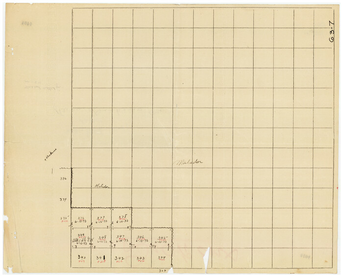
[Tie line between Indianola RR. Co. Block H and H. & G. N. RR. Co. Block G and vicinity]
Print $20.00
- Digital $50.00
[Tie line between Indianola RR. Co. Block H and H. & G. N. RR. Co. Block G and vicinity]
1904
Size: 21.9 x 10.1 inches
93007
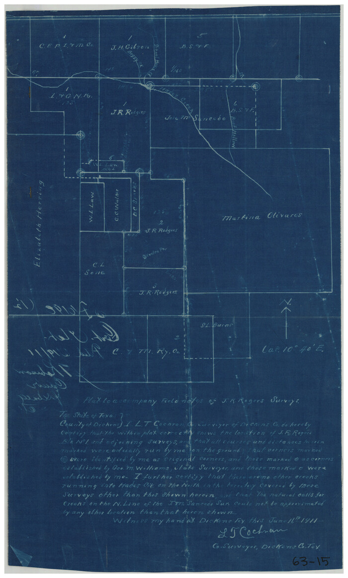
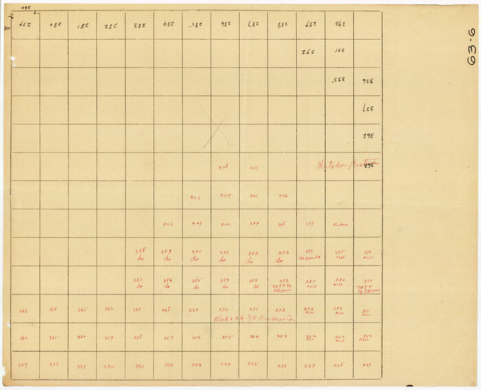
[Surveys in the vicinity of the Martina Olivares survey]
Print $3.00
- Digital $50.00
[Surveys in the vicinity of the Martina Olivares survey]
1911
Size: 10.3 x 16.9 inches
90891
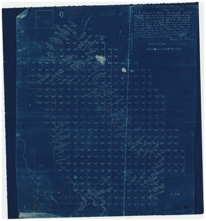
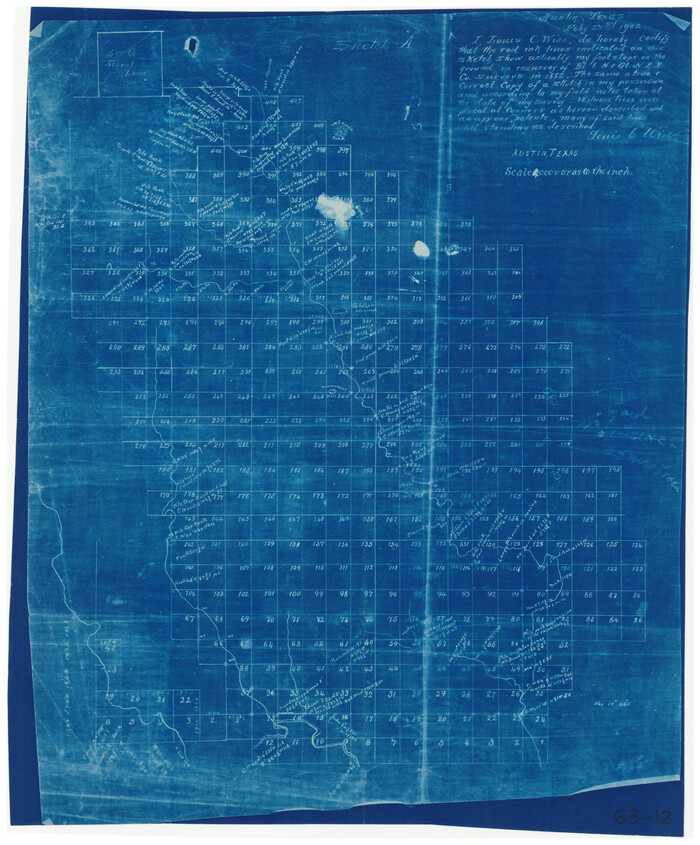
[Sketch showing part of H. & G. N. Block 1]
Print $40.00
- Digital $50.00
[Sketch showing part of H. & G. N. Block 1]
Size: 20.0 x 54.4 inches
89633
[Sketch showing H. & G. N. Blk. 1]
Print $40.00
- Digital $50.00
[Sketch showing H. & G. N. Blk. 1]
Size: 27.1 x 60.6 inches
89634
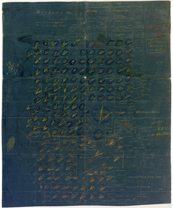
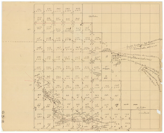
[Sketch of Surveys in Cottle, Dickens, King & Motley Counties, Texas]
Print $20.00
- Digital $50.00
[Sketch of Surveys in Cottle, Dickens, King & Motley Counties, Texas]
1913
Size: 29.6 x 23.2 inches
75830
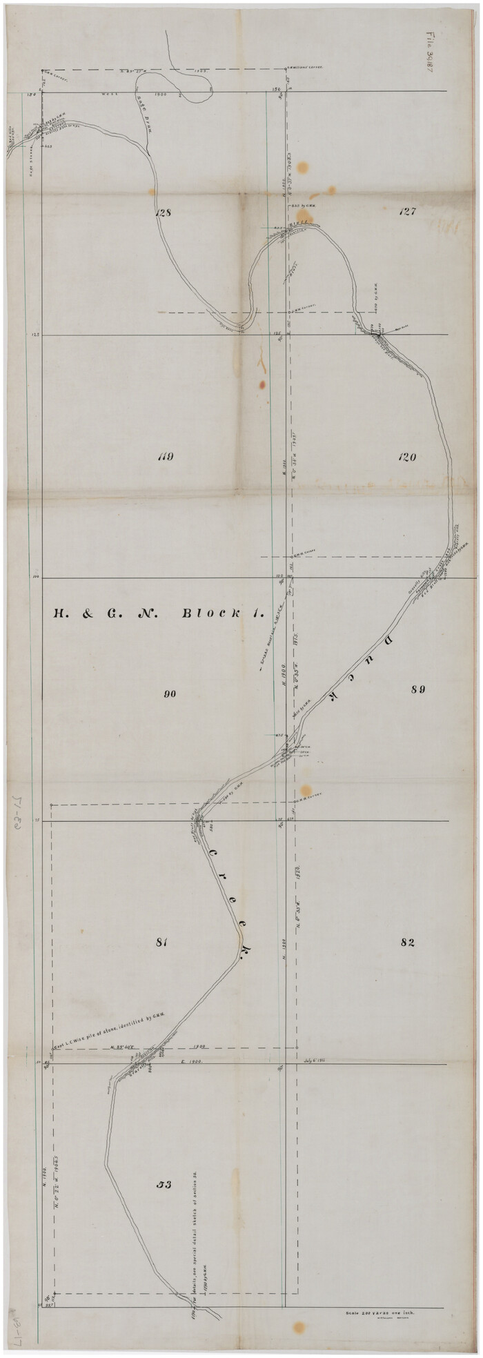
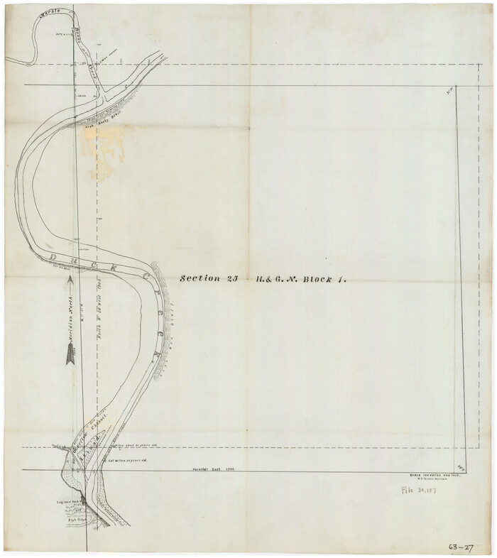
[Section 25, H. & G. N. Block 1 showing Duck Creek]
Print $20.00
- Digital $50.00
[Section 25, H. & G. N. Block 1 showing Duck Creek]
Size: 24.9 x 27.9 inches
90936
[Pitchfork Ranch]
Print $20.00
- Digital $50.00
[Pitchfork Ranch]
1915
Size: 20.8 x 17.2 inches
4480
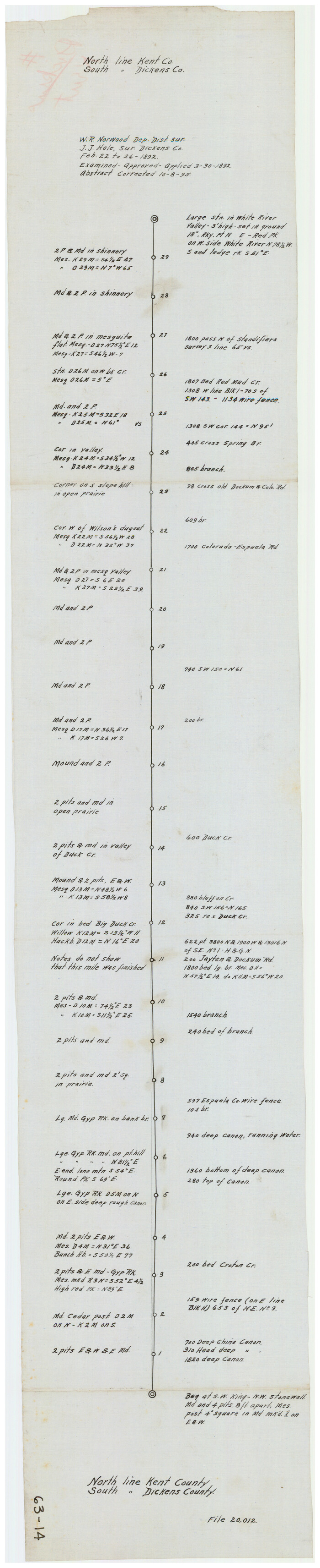
[North Line of Kent County/South Line of Dickens County]
Print $20.00
- Digital $50.00
[North Line of Kent County/South Line of Dickens County]
1892
Size: 8.4 x 38.1 inches
90937
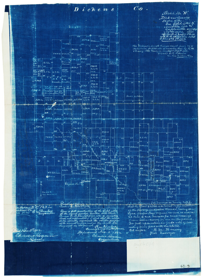
[North Central Part of County]
Print $20.00
- Digital $50.00
[North Central Part of County]
1902
Size: 21.0 x 28.3 inches
90812
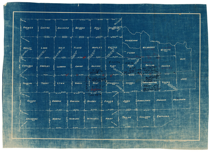
[Map of Counties South of Panhandle from Parmer to Childress in North to Andrews to Eastland in the South]
Print $3.00
- Digital $50.00
[Map of Counties South of Panhandle from Parmer to Childress in North to Andrews to Eastland in the South]
Size: 14.9 x 10.7 inches
92098
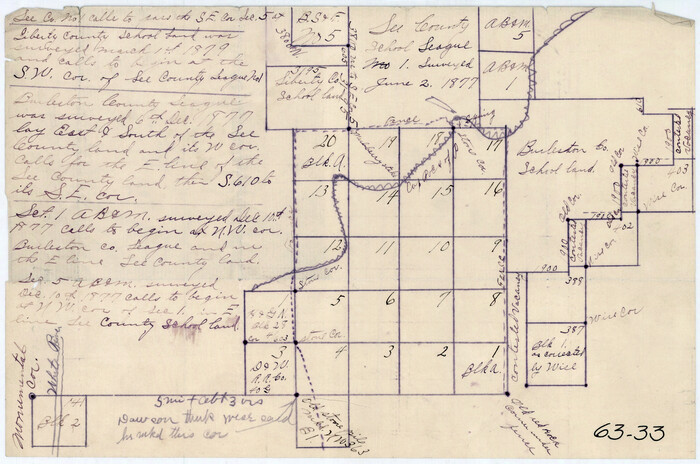
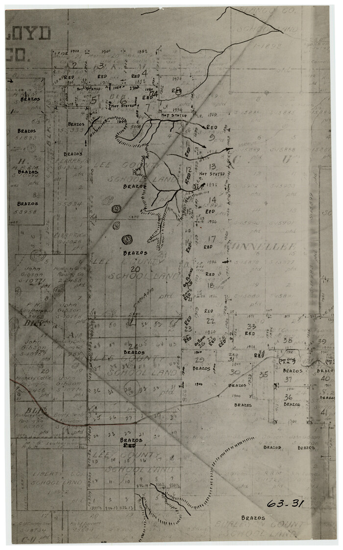
[Lee County School Land and vicinity]
Print $2.00
- Digital $50.00
[Lee County School Land and vicinity]
Size: 9.0 x 14.8 inches
90886
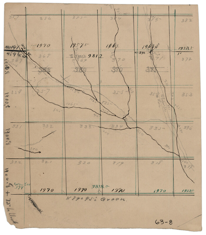
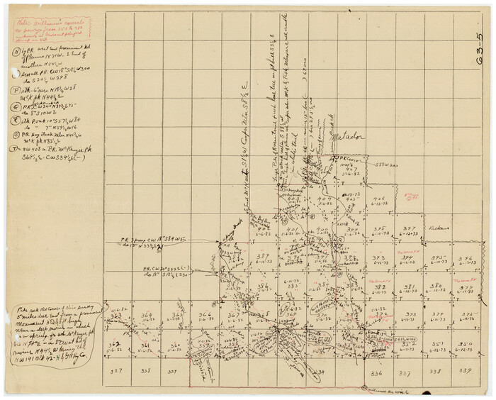
[Kenney's sketch of the surveys in Dickens and Motley Counties]

Print $20.00
- Digital $50.00
[Kenney's sketch of the surveys in Dickens and Motley Counties]
1905
Size: 20.1 x 15.7 inches
367
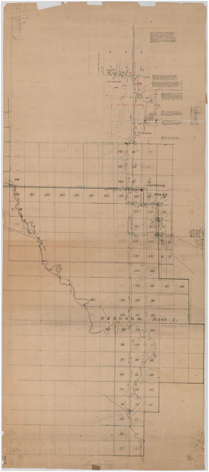
[H. & G. N. RR. Co. Block 1]
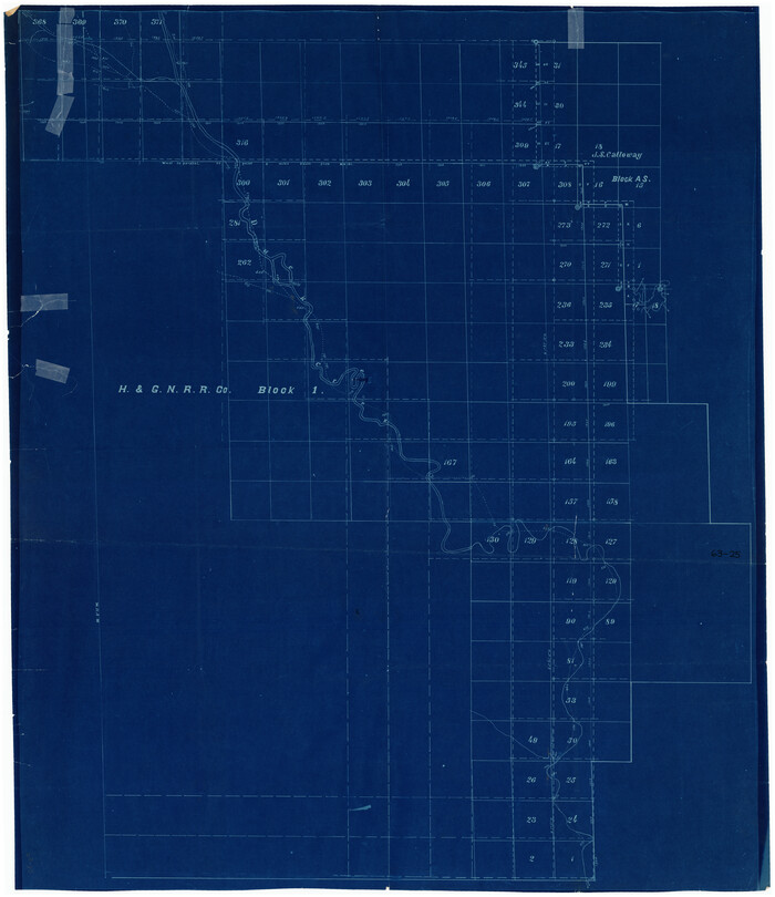
Print $20.00
- Digital $50.00
[H. & G. N. RR. Co. Block 1]
Size: 37.1 x 43.6 inches
90888
[H. & G. N. RR. Co. Block 1]
Print $20.00
- Digital $50.00
[H. & G. N. RR. Co. Block 1]
Size: 16.5 x 27.9 inches
90889
[H. & G. N. RR. Co. Block 1]
Print $20.00
- Digital $50.00
[H. & G. N. RR. Co. Block 1]
Size: 17.1 x 28.0 inches
90890
[H. & G. N. RR. Co. Block 1]
Print $20.00
- Digital $50.00
[H. & G. N. RR. Co. Block 1]
1902
Size: 14.9 x 15.8 inches
90892
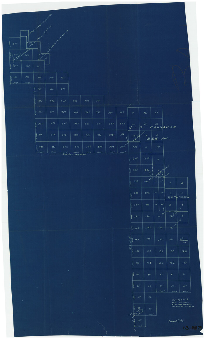
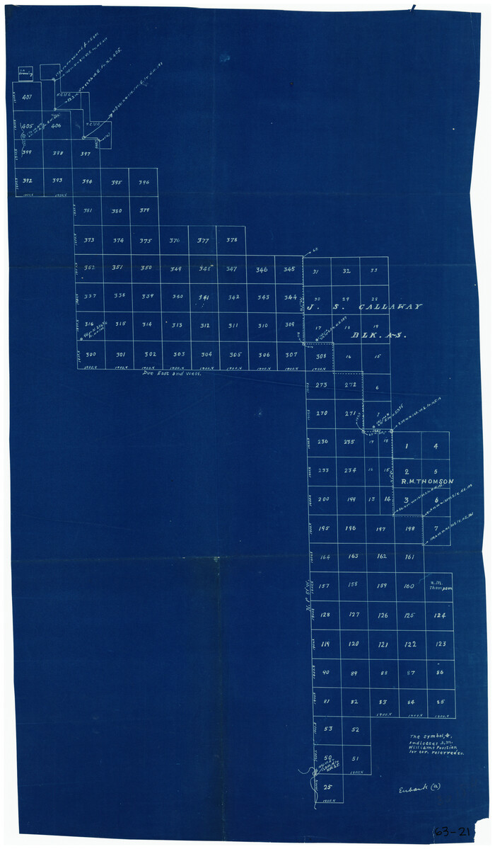
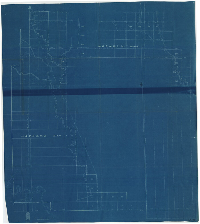
[H. & G. N. RR. Co. Blks. 1 & 2]
Print $20.00
- Digital $50.00
[H. & G. N. RR. Co. Blks. 1 & 2]
Size: 40.9 x 46.6 inches
89771
[H. & G. N. Block 1]
Print $3.00
- Digital $50.00
[H. & G. N. Block 1]
Size: 11.4 x 12.9 inches
90810
[H. & G. N. Block 1]
Print $20.00
- Digital $50.00
[H. & G. N. Block 1]
1902
Size: 13.5 x 16.4 inches
90939
[H. & G. N. Block 1]
Print $20.00
- Digital $50.00
[H. & G. N. Block 1]
1873
Size: 17.3 x 14.2 inches
90940
[H. & G. N. Block 1]
Print $20.00
- Digital $50.00
[H. & G. N. Block 1]
1873
Size: 17.5 x 14.3 inches
90941
[H. & G. N. Block 1]
Print $20.00
- Digital $50.00
[H. & G. N. Block 1]
1873
Size: 14.3 x 17.6 inches
90942
[H. & G. N. Block 1]
Print $20.00
- Digital $50.00
[H. & G. N. Block 1]
1873
Size: 14.3 x 17.6 inches
90943
[H. & G. N. Block 1]
Print $20.00
- Digital $50.00
[H. & G. N. Block 1]
1873
Size: 17.7 x 14.3 inches
90944
[H. & G. N. Block 1]
Print $20.00
- Digital $50.00
[H. & G. N. Block 1]
1873
Size: 17.4 x 14.1 inches
90945
[H. & G. N. Block 1]
Print $20.00
- Digital $50.00
[H. & G. N. Block 1]
1873
Size: 17.7 x 14.5 inches
90946
[H. & G. N. Block 1, Sections 128-130]
Print $20.00
- Digital $50.00
[H. & G. N. Block 1, Sections 128-130]
Size: 36.6 x 11.9 inches
90948
[County Line between Dickens and Kent Counties]
Print $20.00
- Digital $50.00
[County Line between Dickens and Kent Counties]
1891
Size: 42.4 x 7.4 inches
90938
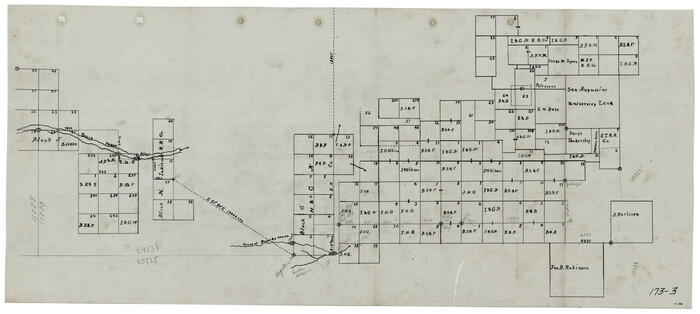
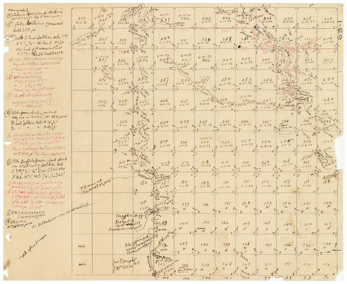
[Block G, Jonathan Burleson Survey, and vicinity]
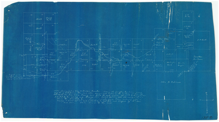
Print $20.00
- Digital $50.00
[Block G, Jonathan Burleson Survey, and vicinity]
Size: 26.4 x 14.6 inches
91042
[West part of H. T. & B. Block A and surrounding surveys]
Print $2.00
- Digital $50.00
[West part of H. T. & B. Block A and surrounding surveys]
-
Size
13.8 x 9.2 inches
-
Map/Doc
90811
[Tie line between Indianola RR. Co. Block H and H. & G. N. RR. Co. Block G and vicinity]
Print $20.00
- Digital $50.00
[Tie line between Indianola RR. Co. Block H and H. & G. N. RR. Co. Block G and vicinity]
1904
-
Size
21.9 x 10.1 inches
-
Map/Doc
93007
-
Creation Date
1904
[Surveys in the vicinity of the Martina Olivares survey]
Print $3.00
- Digital $50.00
[Surveys in the vicinity of the Martina Olivares survey]
1911
-
Size
10.3 x 16.9 inches
-
Map/Doc
90891
-
Creation Date
1911
[Sketch showing part of H. & G. N. Block 1]
Print $40.00
- Digital $50.00
[Sketch showing part of H. & G. N. Block 1]
-
Size
20.0 x 54.4 inches
-
Map/Doc
89633
[Sketch showing H. & G. N. Blk. 1]
Print $40.00
- Digital $50.00
[Sketch showing H. & G. N. Blk. 1]
-
Size
27.1 x 60.6 inches
-
Map/Doc
89634
[Sketch of Surveys in Cottle, Dickens, King & Motley Counties, Texas]
Print $20.00
- Digital $50.00
[Sketch of Surveys in Cottle, Dickens, King & Motley Counties, Texas]
1913
-
Size
29.6 x 23.2 inches
-
Map/Doc
75830
-
Creation Date
1913
[Section 25, H. & G. N. Block 1 showing Duck Creek]
Print $20.00
- Digital $50.00
[Section 25, H. & G. N. Block 1 showing Duck Creek]
-
Size
24.9 x 27.9 inches
-
Map/Doc
90936
[Pitchfork Ranch]
Print $20.00
- Digital $50.00
[Pitchfork Ranch]
1915
-
Size
20.8 x 17.2 inches
-
Map/Doc
4480
-
Creation Date
1915
[North Line of Kent County/South Line of Dickens County]
Print $20.00
- Digital $50.00
[North Line of Kent County/South Line of Dickens County]
1892
-
Size
8.4 x 38.1 inches
-
Map/Doc
90937
-
Creation Date
1892
[North Central Part of County]
Print $20.00
- Digital $50.00
[North Central Part of County]
1902
-
Size
21.0 x 28.3 inches
-
Map/Doc
90812
-
Creation Date
1902
[Map of Counties South of Panhandle from Parmer to Childress in North to Andrews to Eastland in the South]
Print $3.00
- Digital $50.00
[Map of Counties South of Panhandle from Parmer to Childress in North to Andrews to Eastland in the South]
-
Size
14.9 x 10.7 inches
-
Map/Doc
92098
[Lee County School Land and vicinity]
Print $2.00
- Digital $50.00
[Lee County School Land and vicinity]
-
Size
9.0 x 14.8 inches
-
Map/Doc
90886
[Kenney's sketch of the surveys in Dickens and Motley Counties]
Print $20.00
- Digital $50.00
[Kenney's sketch of the surveys in Dickens and Motley Counties]
1905
-
Size
20.1 x 15.7 inches
-
Map/Doc
367
-
Creation Date
1905
[H. & G. N. RR. Co. Block 1]
Print $20.00
- Digital $50.00
[H. & G. N. RR. Co. Block 1]
-
Size
37.1 x 43.6 inches
-
Map/Doc
90888
[H. & G. N. RR. Co. Block 1]
Print $20.00
- Digital $50.00
[H. & G. N. RR. Co. Block 1]
-
Size
16.5 x 27.9 inches
-
Map/Doc
90889
[H. & G. N. RR. Co. Block 1]
Print $20.00
- Digital $50.00
[H. & G. N. RR. Co. Block 1]
-
Size
17.1 x 28.0 inches
-
Map/Doc
90890
[H. & G. N. RR. Co. Block 1]
Print $20.00
- Digital $50.00
[H. & G. N. RR. Co. Block 1]
1902
-
Size
14.9 x 15.8 inches
-
Map/Doc
90892
-
Creation Date
1902
[H. & G. N. RR. Co. Blks. 1 & 2]
Print $20.00
- Digital $50.00
[H. & G. N. RR. Co. Blks. 1 & 2]
-
Size
40.9 x 46.6 inches
-
Map/Doc
89771
[H. & G. N. Block 1]
Print $3.00
- Digital $50.00
[H. & G. N. Block 1]
-
Size
11.4 x 12.9 inches
-
Map/Doc
90810
[H. & G. N. Block 1]
Print $20.00
- Digital $50.00
[H. & G. N. Block 1]
1902
-
Size
13.5 x 16.4 inches
-
Map/Doc
90939
-
Creation Date
1902
[H. & G. N. Block 1]
Print $20.00
- Digital $50.00
[H. & G. N. Block 1]
1873
-
Size
17.3 x 14.2 inches
-
Map/Doc
90940
-
Creation Date
1873
[H. & G. N. Block 1]
Print $20.00
- Digital $50.00
[H. & G. N. Block 1]
1873
-
Size
17.5 x 14.3 inches
-
Map/Doc
90941
-
Creation Date
1873
[H. & G. N. Block 1]
Print $20.00
- Digital $50.00
[H. & G. N. Block 1]
1873
-
Size
14.3 x 17.6 inches
-
Map/Doc
90942
-
Creation Date
1873
[H. & G. N. Block 1]
Print $20.00
- Digital $50.00
[H. & G. N. Block 1]
1873
-
Size
14.3 x 17.6 inches
-
Map/Doc
90943
-
Creation Date
1873
[H. & G. N. Block 1]
Print $20.00
- Digital $50.00
[H. & G. N. Block 1]
1873
-
Size
17.7 x 14.3 inches
-
Map/Doc
90944
-
Creation Date
1873
[H. & G. N. Block 1]
Print $20.00
- Digital $50.00
[H. & G. N. Block 1]
1873
-
Size
17.4 x 14.1 inches
-
Map/Doc
90945
-
Creation Date
1873
[H. & G. N. Block 1]
Print $20.00
- Digital $50.00
[H. & G. N. Block 1]
1873
-
Size
17.7 x 14.5 inches
-
Map/Doc
90946
-
Creation Date
1873
[H. & G. N. Block 1, Sections 128-130]
Print $20.00
- Digital $50.00
[H. & G. N. Block 1, Sections 128-130]
-
Size
36.6 x 11.9 inches
-
Map/Doc
90948
[County Line between Dickens and Kent Counties]
Print $20.00
- Digital $50.00
[County Line between Dickens and Kent Counties]
1891
-
Size
42.4 x 7.4 inches
-
Map/Doc
90938
-
Creation Date
1891
[Block G, Jonathan Burleson Survey, and vicinity]
Print $20.00
- Digital $50.00
[Block G, Jonathan Burleson Survey, and vicinity]
-
Size
26.4 x 14.6 inches
-
Map/Doc
91042