[T. & G. Ry. Main Line, Texas, Right of Way Map, Center to Gary]
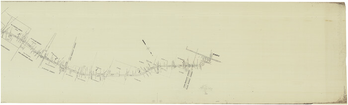
Print $40.00
- Digital $50.00
[T. & G. Ry. Main Line, Texas, Right of Way Map, Center to Gary]
1917
Size: 31.9 x 104.6 inches
64572
[Sketch of Col. Cooke's Military Road expedition from Red River to Austin]
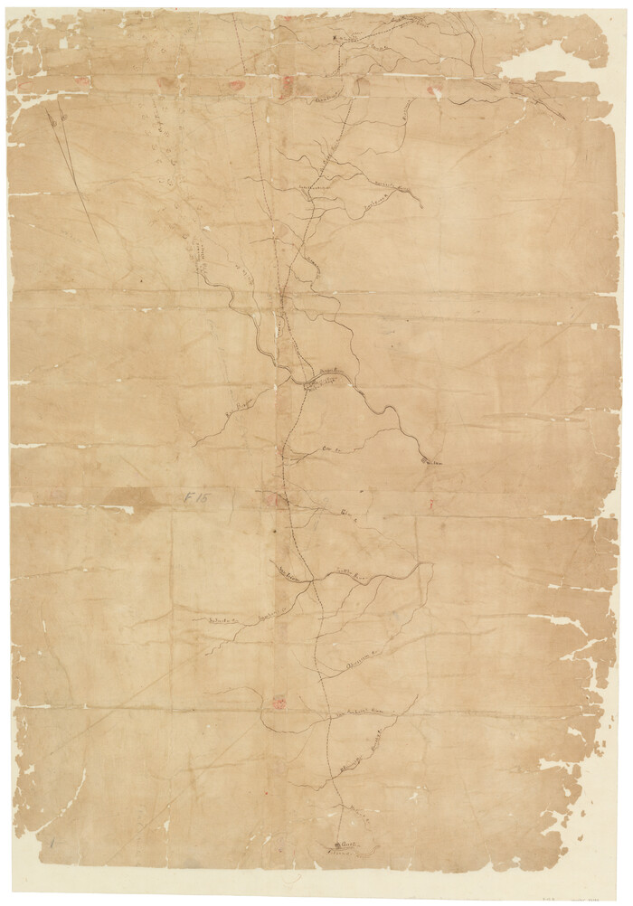
Print $20.00
- Digital $50.00
[Sketch of Col. Cooke's Military Road expedition from Red River to Austin]
Size: 33.4 x 23.4 inches
82146
[G.C. and S. F. R.R. Co. Through Bosque County from McLennan Co. and E. to Hill Co. Station M. P. 259 to M. P. 297]
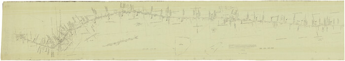
Print $40.00
- Digital $50.00
[G.C. and S. F. R.R. Co. Through Bosque County from McLennan Co. and E. to Hill Co. Station M. P. 259 to M. P. 297]
Size: 21.7 x 120.5 inches
64563
[G.C. and S. F. R.R. Co. Through Bosque County from McLennan Co. and E. to Hill Co. Station M. P. 259 to M. P. 297]
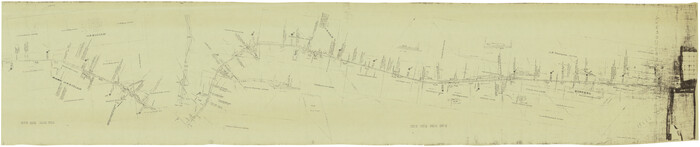
Print $40.00
- Digital $50.00
[G.C. and S. F. R.R. Co. Through Bosque County from McLennan Co. and E. to Hill Co. Station M. P. 259 to M. P. 297]
1898
Size: 22.4 x 101.5 inches
64564
Navarro County Sketch File 4

Print $6.00
- Digital $50.00
Navarro County Sketch File 4
1852
Size: 7.5 x 7.2 inches
32304
Navarro County Sketch File 20

Print $14.00
- Digital $50.00
Navarro County Sketch File 20
1967
Size: 14.3 x 8.8 inches
32343
Navarro County Sketch File 15

Print $4.00
- Digital $50.00
Navarro County Sketch File 15
1878
Size: 7.6 x 10.0 inches
32328
Navarro County Sketch File 12

Print $4.00
- Digital $50.00
Navarro County Sketch File 12
Size: 7.0 x 7.0 inches
32322
Navarro County Sketch File 1

Print $4.00
- Digital $50.00
Navarro County Sketch File 1
Size: 9.9 x 8.0 inches
32296
McLennan County Sketch File 7b

Print $6.00
- Digital $50.00
McLennan County Sketch File 7b
1857
Size: 8.0 x 10.1 inches
31248
McLennan County Sketch File 40

Print $8.00
- Digital $50.00
McLennan County Sketch File 40
1950
Size: 14.2 x 8.7 inches
31315
McLennan County Sketch File 18

Print $8.00
- Digital $50.00
McLennan County Sketch File 18
1880
Size: 12.8 x 8.3 inches
31280
Map of Hill County, Texas

Print $20.00
Map of Hill County, Texas
1886
Size: 22.4 x 28.3 inches
88955
Map of Hill County Texas

Print $20.00
- Digital $50.00
Map of Hill County Texas
1886
Size: 19.3 x 24.4 inches
3673
Map of Hill County

Print $20.00
- Digital $50.00
Map of Hill County
1884
Size: 47.2 x 36.8 inches
16851
Map of Hill County

Print $20.00
- Digital $50.00
Map of Hill County
1882
Size: 21.6 x 25.5 inches
3669
Map of Hill County

Print $20.00
- Digital $50.00
Map of Hill County
1862
Size: 22.1 x 24.7 inches
3671
Map of Hill County

Print $20.00
- Digital $50.00
Map of Hill County
1857
Size: 21.5 x 25.6 inches
3672
Map of Hill County

Print $40.00
- Digital $50.00
Map of Hill County
1884
Size: 48.4 x 37.7 inches
4979
Map of Hill County

Print $40.00
- Digital $50.00
Map of Hill County
1884
Size: 80.1 x 68.0 inches
82049
Map of Hill County

Print $40.00
- Digital $50.00
Map of Hill County
1884
Size: 80.0 x 36.8 inches
93378
Map of Hill County

Print $40.00
- Digital $50.00
Map of Hill County
1884
Size: 80.0 x 35.2 inches
93379
Limestone County Sketch File 10b

Print $22.00
- Digital $50.00
Limestone County Sketch File 10b
1875
Size: 15.0 x 14.1 inches
30175
Johnson County Working Sketch 24

Print $20.00
- Digital $50.00
Johnson County Working Sketch 24
1996
Size: 47.5 x 34.5 inches
66637
Johnson County Working Sketch 15

Print $20.00
- Digital $50.00
Johnson County Working Sketch 15
1974
Size: 21.6 x 23.8 inches
66628
Johnson County Sketch File 23

Print $22.00
- Digital $50.00
Johnson County Sketch File 23
1857
Size: 8.1 x 12.6 inches
28456
Johnson County Sketch File 10a

Print $4.00
- Digital $50.00
Johnson County Sketch File 10a
1877
Size: 6.7 x 10.6 inches
28445
Hill County Working Sketch Graphic Index

Print $20.00
- Digital $50.00
Hill County Working Sketch Graphic Index
1983
Size: 39.8 x 46.9 inches
76578
Hill County Working Sketch 5

Print $20.00
- Digital $50.00
Hill County Working Sketch 5
2008
Size: 32.2 x 31.6 inches
89013
Hill County Working Sketch 4

Print $20.00
- Digital $50.00
Hill County Working Sketch 4
1982
Size: 25.3 x 23.3 inches
66190
[T. & G. Ry. Main Line, Texas, Right of Way Map, Center to Gary]
Print $40.00
- Digital $50.00
[T. & G. Ry. Main Line, Texas, Right of Way Map, Center to Gary]
1917
-
Size
31.9 x 104.6 inches
-
Map/Doc
64572
-
Creation Date
1917
[Sketch of Col. Cooke's Military Road expedition from Red River to Austin]
Print $20.00
- Digital $50.00
[Sketch of Col. Cooke's Military Road expedition from Red River to Austin]
-
Size
33.4 x 23.4 inches
-
Map/Doc
82146
[G.C. and S. F. R.R. Co. Through Bosque County from McLennan Co. and E. to Hill Co. Station M. P. 259 to M. P. 297]
Print $40.00
- Digital $50.00
[G.C. and S. F. R.R. Co. Through Bosque County from McLennan Co. and E. to Hill Co. Station M. P. 259 to M. P. 297]
-
Size
21.7 x 120.5 inches
-
Map/Doc
64563
[G.C. and S. F. R.R. Co. Through Bosque County from McLennan Co. and E. to Hill Co. Station M. P. 259 to M. P. 297]
Print $40.00
- Digital $50.00
[G.C. and S. F. R.R. Co. Through Bosque County from McLennan Co. and E. to Hill Co. Station M. P. 259 to M. P. 297]
1898
-
Size
22.4 x 101.5 inches
-
Map/Doc
64564
-
Creation Date
1898
Navarro County Sketch File 4
Print $6.00
- Digital $50.00
Navarro County Sketch File 4
1852
-
Size
7.5 x 7.2 inches
-
Map/Doc
32304
-
Creation Date
1852
Navarro County Sketch File 20
Print $14.00
- Digital $50.00
Navarro County Sketch File 20
1967
-
Size
14.3 x 8.8 inches
-
Map/Doc
32343
-
Creation Date
1967
Navarro County Sketch File 15
Print $4.00
- Digital $50.00
Navarro County Sketch File 15
1878
-
Size
7.6 x 10.0 inches
-
Map/Doc
32328
-
Creation Date
1878
Navarro County Sketch File 12
Print $4.00
- Digital $50.00
Navarro County Sketch File 12
-
Size
7.0 x 7.0 inches
-
Map/Doc
32322
Navarro County Sketch File 1
Print $4.00
- Digital $50.00
Navarro County Sketch File 1
-
Size
9.9 x 8.0 inches
-
Map/Doc
32296
McLennan County Sketch File 7b
Print $6.00
- Digital $50.00
McLennan County Sketch File 7b
1857
-
Size
8.0 x 10.1 inches
-
Map/Doc
31248
-
Creation Date
1857
McLennan County Sketch File 40
Print $8.00
- Digital $50.00
McLennan County Sketch File 40
1950
-
Size
14.2 x 8.7 inches
-
Map/Doc
31315
-
Creation Date
1950
McLennan County Sketch File 18
Print $8.00
- Digital $50.00
McLennan County Sketch File 18
1880
-
Size
12.8 x 8.3 inches
-
Map/Doc
31280
-
Creation Date
1880
Map of Hill County, Texas
Print $20.00
Map of Hill County, Texas
1886
-
Size
22.4 x 28.3 inches
-
Map/Doc
88955
-
Creation Date
1886
Map of Hill County Texas
Print $20.00
- Digital $50.00
Map of Hill County Texas
1886
-
Size
19.3 x 24.4 inches
-
Map/Doc
3673
-
Creation Date
1886
Map of Hill County
Print $20.00
- Digital $50.00
Map of Hill County
1884
-
Size
47.2 x 36.8 inches
-
Map/Doc
16851
-
Creation Date
1884
Map of Hill County
Print $20.00
- Digital $50.00
Map of Hill County
1882
-
Size
21.6 x 25.5 inches
-
Map/Doc
3669
-
Creation Date
1882
Map of Hill County
Print $20.00
- Digital $50.00
Map of Hill County
1862
-
Size
22.1 x 24.7 inches
-
Map/Doc
3671
-
Creation Date
1862
Map of Hill County
Print $20.00
- Digital $50.00
Map of Hill County
1857
-
Size
21.5 x 25.6 inches
-
Map/Doc
3672
-
Creation Date
1857
Map of Hill County
Print $40.00
- Digital $50.00
Map of Hill County
1884
-
Size
48.4 x 37.7 inches
-
Map/Doc
4979
-
Creation Date
1884
Map of Hill County
Print $40.00
- Digital $50.00
Map of Hill County
1884
-
Size
80.1 x 68.0 inches
-
Map/Doc
82049
-
Creation Date
1884
Map of Hill County
Print $40.00
- Digital $50.00
Map of Hill County
1884
-
Size
80.0 x 36.8 inches
-
Map/Doc
93378
-
Creation Date
1884
Map of Hill County
Print $40.00
- Digital $50.00
Map of Hill County
1884
-
Size
80.0 x 35.2 inches
-
Map/Doc
93379
-
Creation Date
1884
Limestone County Sketch File 10b
Print $22.00
- Digital $50.00
Limestone County Sketch File 10b
1875
-
Size
15.0 x 14.1 inches
-
Map/Doc
30175
-
Creation Date
1875
Johnson County Working Sketch 24
Print $20.00
- Digital $50.00
Johnson County Working Sketch 24
1996
-
Size
47.5 x 34.5 inches
-
Map/Doc
66637
-
Creation Date
1996
Johnson County Working Sketch 15
Print $20.00
- Digital $50.00
Johnson County Working Sketch 15
1974
-
Size
21.6 x 23.8 inches
-
Map/Doc
66628
-
Creation Date
1974
Johnson County Sketch File 23
Print $22.00
- Digital $50.00
Johnson County Sketch File 23
1857
-
Size
8.1 x 12.6 inches
-
Map/Doc
28456
-
Creation Date
1857
Johnson County Sketch File 10a
Print $4.00
- Digital $50.00
Johnson County Sketch File 10a
1877
-
Size
6.7 x 10.6 inches
-
Map/Doc
28445
-
Creation Date
1877
Hill County Working Sketch Graphic Index
Print $20.00
- Digital $50.00
Hill County Working Sketch Graphic Index
1983
-
Size
39.8 x 46.9 inches
-
Map/Doc
76578
-
Creation Date
1983
Hill County Working Sketch 5
Print $20.00
- Digital $50.00
Hill County Working Sketch 5
2008
-
Size
32.2 x 31.6 inches
-
Map/Doc
89013
-
Creation Date
2008
Hill County Working Sketch 4
Print $20.00
- Digital $50.00
Hill County Working Sketch 4
1982
-
Size
25.3 x 23.3 inches
-
Map/Doc
66190
-
Creation Date
1982