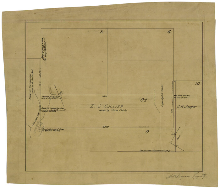
[Z. C. Collier survey owned by Pease Estate, Hutchinson County]
Print $20.00
- Digital $50.00
[Z. C. Collier survey owned by Pease Estate, Hutchinson County]
Size: 19.0 x 20.8 inches
4472
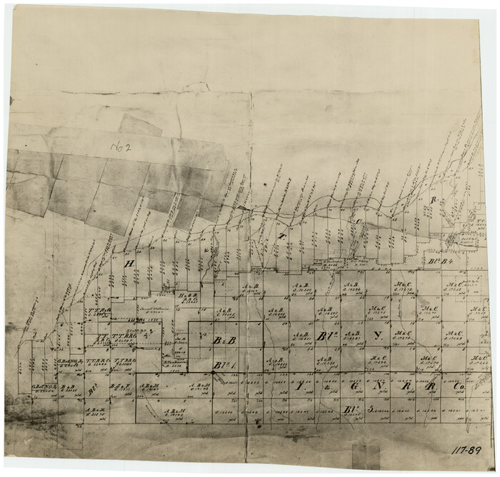
[Young Territory]

Print $40.00
- Digital $50.00
[Young Territory]
1875
Size: 49.0 x 87.4 inches
16784
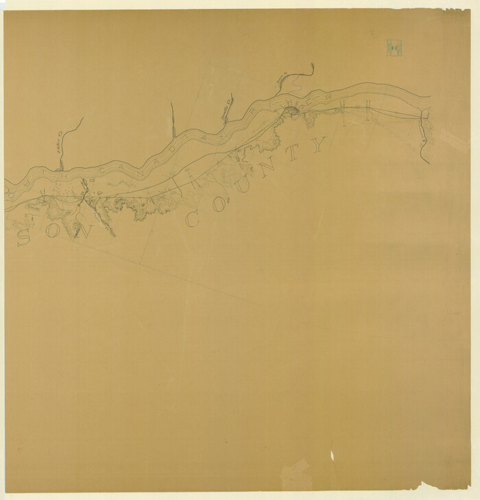
[West Half of Hutchinson County South of the Canadian River]
Print $20.00
- Digital $50.00
[West Half of Hutchinson County South of the Canadian River]
Size: 18.4 x 17.0 inches
91179
[T. & N. O. RR. Block T5]
Print $20.00
- Digital $50.00
[T. & N. O. RR. Block T5]
Size: 32.8 x 28.9 inches
91145
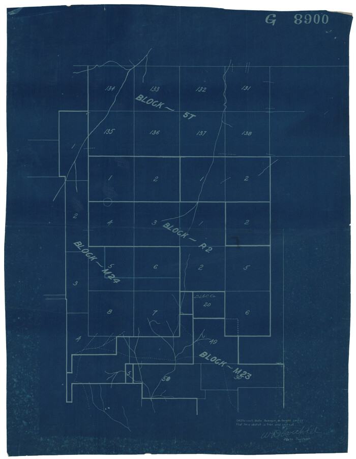
[Surveys covering parts of Blocks 5T, R2, M24, M23]
Print $20.00
- Digital $50.00
[Surveys covering parts of Blocks 5T, R2, M24, M23]
Size: 15.0 x 19.0 inches
92122
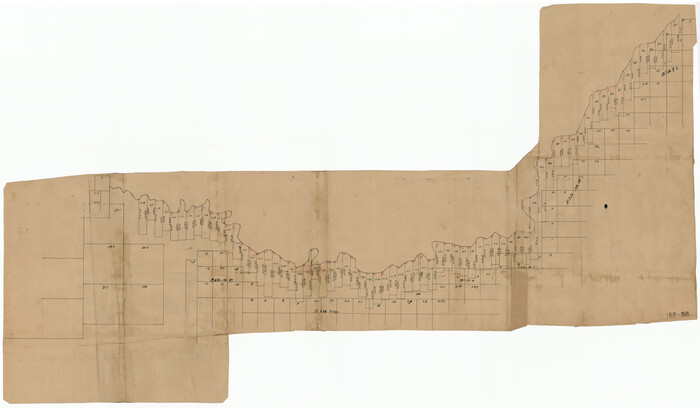
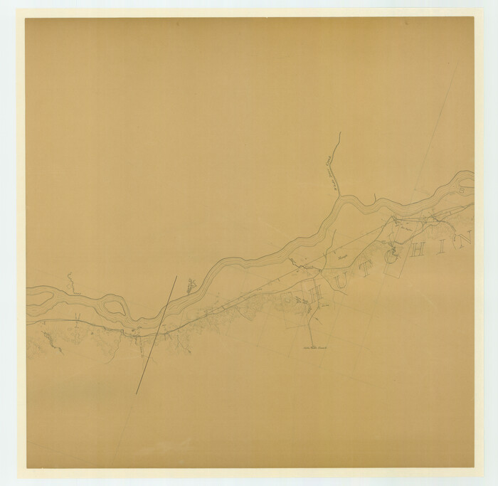
[Surveys Along Canadian River]
Print $20.00
- Digital $50.00
[Surveys Along Canadian River]
Size: 42.9 x 27.0 inches
92359
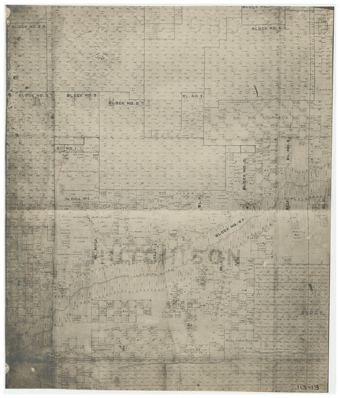
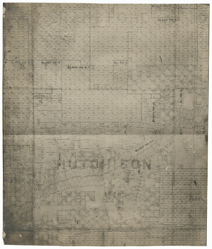
[Surveying Sketch of Northern Portion of Hutchinson County]
Print $20.00
- Digital $50.00
[Surveying Sketch of Northern Portion of Hutchinson County]
1890
Size: 26.5 x 42.5 inches
5065
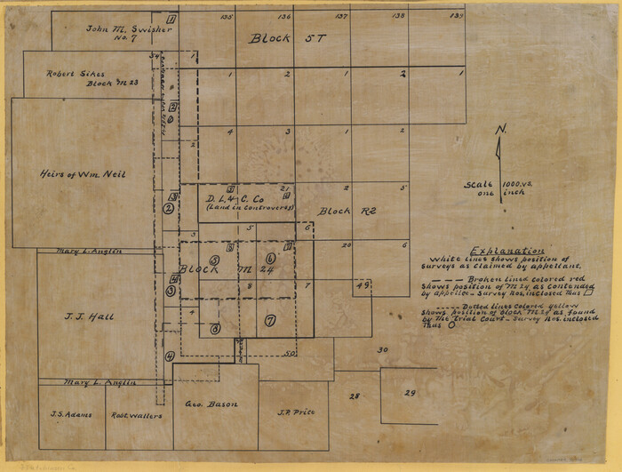
[Surveying Sketch of Heirs of Wm Neil, J.J. Hall, Robert Sikes, et al in Hutchinson County, Texas]
Print $20.00
- Digital $50.00
[Surveying Sketch of Heirs of Wm Neil, J.J. Hall, Robert Sikes, et al in Hutchinson County, Texas]
Size: 15.6 x 20.5 inches
75778
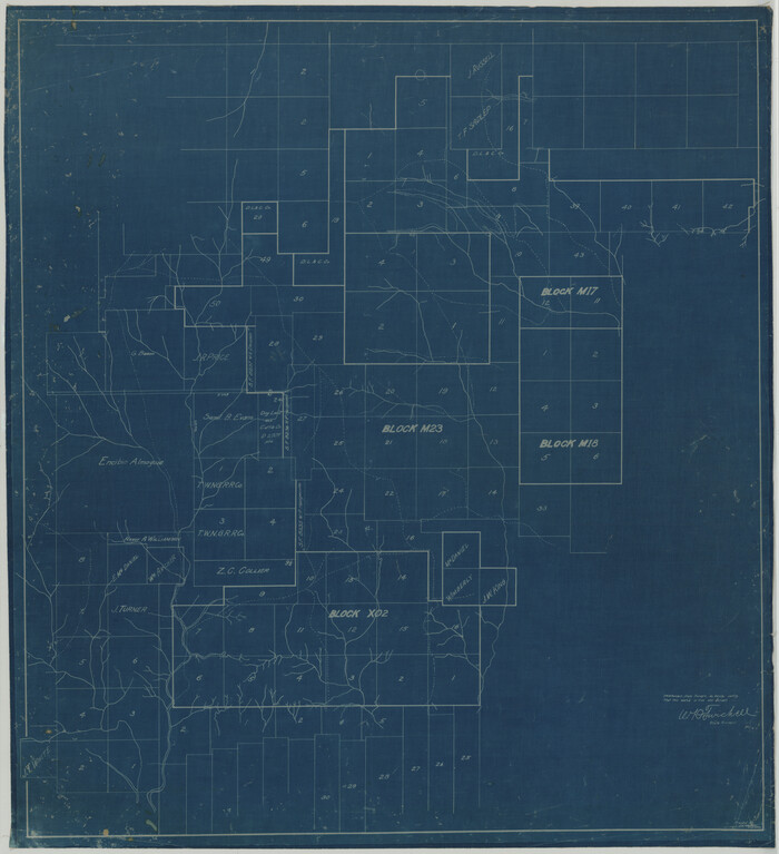
[Surveying Sketch of Encibio Almaguie, T. W. N. G. R. R. Co., et al in Hutchinson County, Texas]
Print $20.00
- Digital $50.00
[Surveying Sketch of Encibio Almaguie, T. W. N. G. R. R. Co., et al in Hutchinson County, Texas]
93791
[Sketch showing surveys on the south side of the Canadian River, Blocks 4, M-3, M-19, M-20, 21-W, and Y-2]
Print $20.00
- Digital $50.00
[Sketch showing surveys on the south side of the Canadian River, Blocks 4, M-3, M-19, M-20, 21-W, and Y-2]
Size: 43.4 x 25.1 inches
91740
[Sketch showing parts of Blocks 3, 5, 22, M-20, S, T and Block BB, surveys 1, 2 and 3]
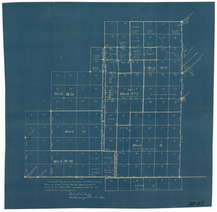
Print $20.00
- Digital $50.00
[Sketch showing parts of Blocks 3, 5, 22, M-20, S, T and Block BB, surveys 1, 2 and 3]
Size: 15.9 x 15.3 inches
91729
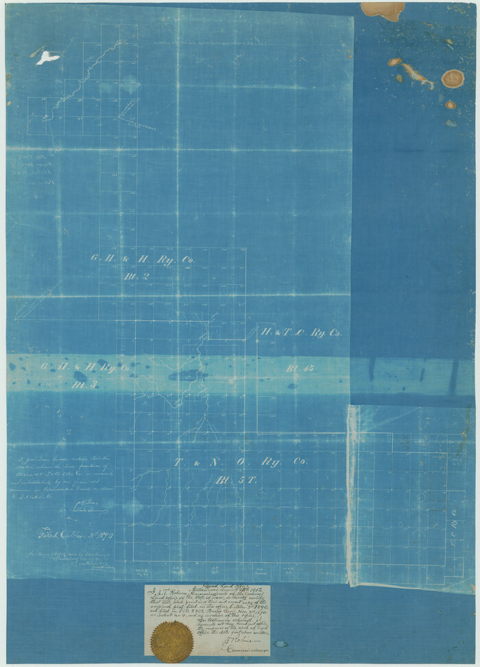
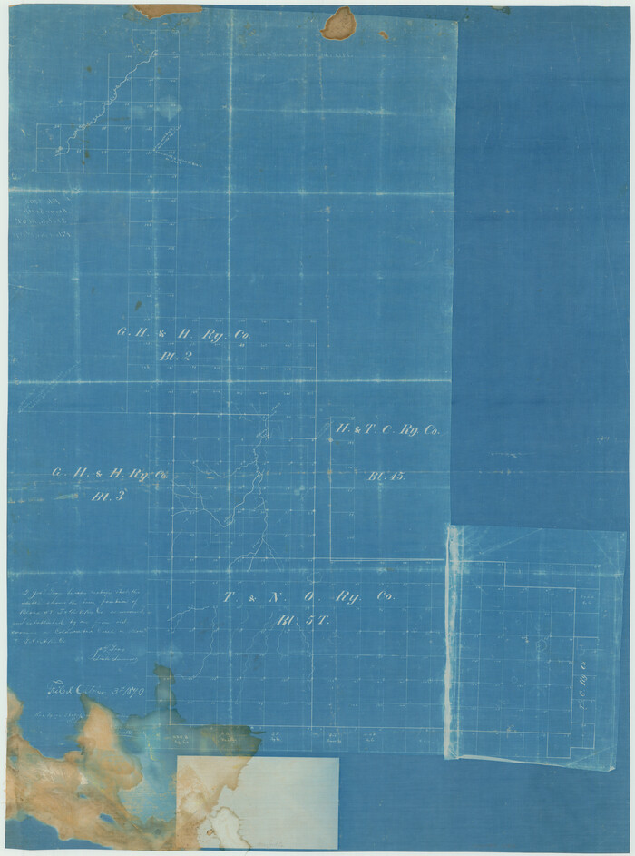
[Sketch showing G. H.& H. Ry. Co. Blks. 2 and 3, H. & T. C. Ry. Co. Blk. 45 and T. &N. O. Ry. Co. Blk. 5T]
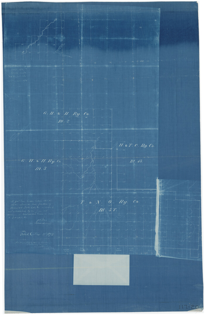
Print $20.00
- Digital $50.00
[Sketch showing G. H.& H. Ry. Co. Blks. 2 and 3, H. & T. C. Ry. Co. Blk. 45 and T. &N. O. Ry. Co. Blk. 5T]
1890
Size: 23.6 x 36.8 inches
89679
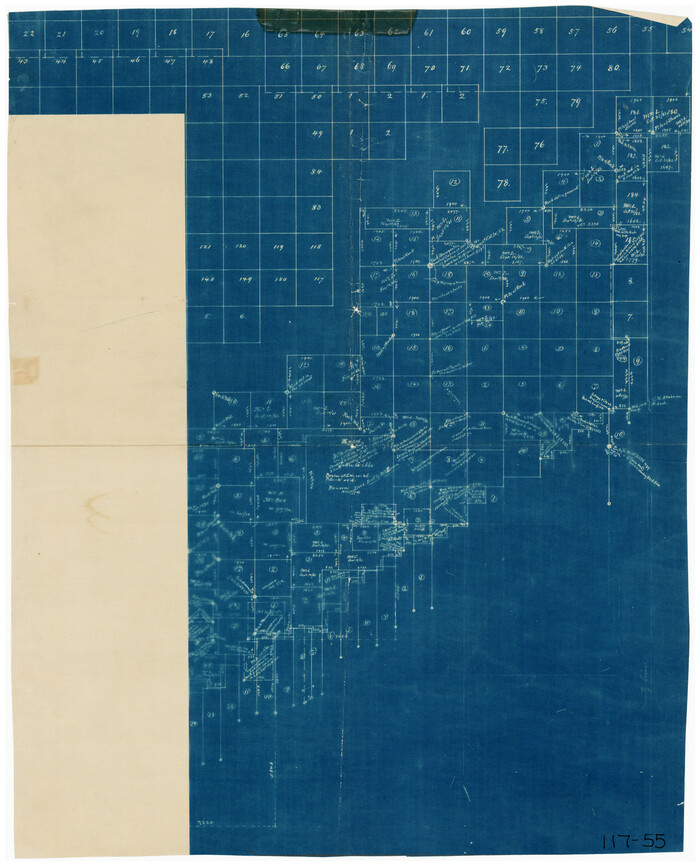
[Sketch showing Blocks B-11, G and M-2 and 3, L, and 47, Sections 77-102]
Print $20.00
- Digital $50.00
[Sketch showing Blocks B-11, G and M-2 and 3, L, and 47, Sections 77-102]
Size: 25.6 x 18.9 inches
91734
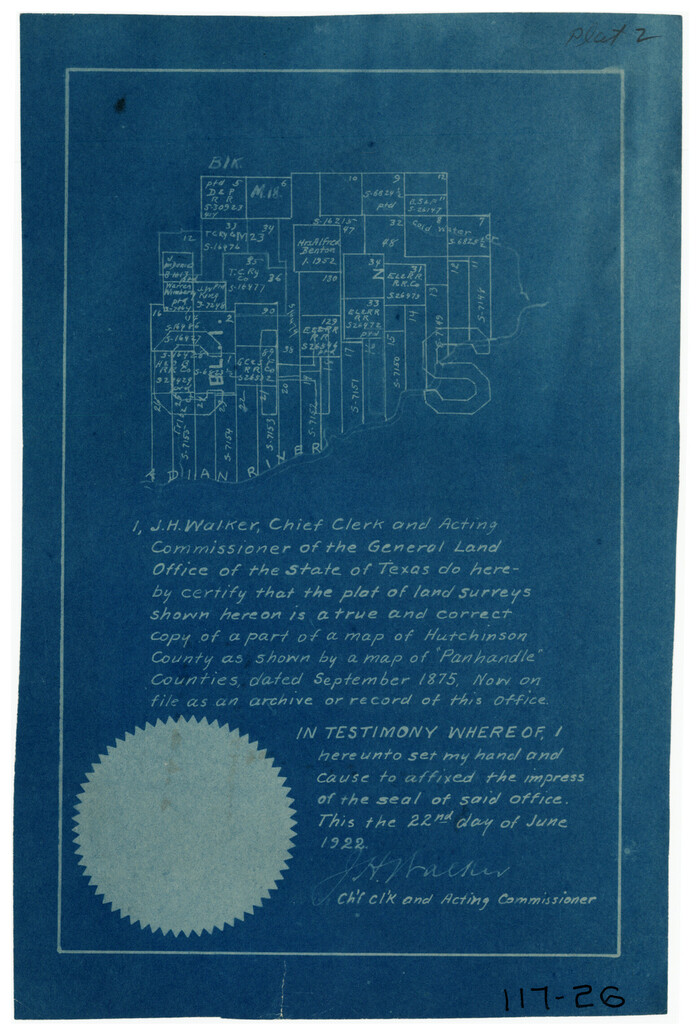
[Sketch of surveys in Hutchinson County]
Print $20.00
- Digital $50.00
[Sketch of surveys in Hutchinson County]
1912
Size: 25.0 x 26.8 inches
75817
[Sketch of a portion of Hutchinson County, Texas]
Print $20.00
- Digital $50.00
[Sketch of a portion of Hutchinson County, Texas]
1889
Size: 14.9 x 17.3 inches
413
[Sketch in Hutchinson County, Texas]
Print $20.00
- Digital $50.00
[Sketch in Hutchinson County, Texas]
Size: 36.2 x 31.1 inches
4491
[Sketch in Hutchinson County, Texas]
Print $20.00
- Digital $50.00
[Sketch in Hutchinson County, Texas]
Size: 26.5 x 35.3 inches
76016
[Sketch Showing G. H. & H. R.R. Co. Block 3B and A. B. & M. Block M16, Hutchinson County, Texas]
Print $20.00
- Digital $50.00
[Sketch Showing G. H. & H. R.R. Co. Block 3B and A. B. & M. Block M16, Hutchinson County, Texas]
Size: 20.7 x 21.5 inches
75813
[Sketch Showing Connections from Jeremiah McDonald resurvey]
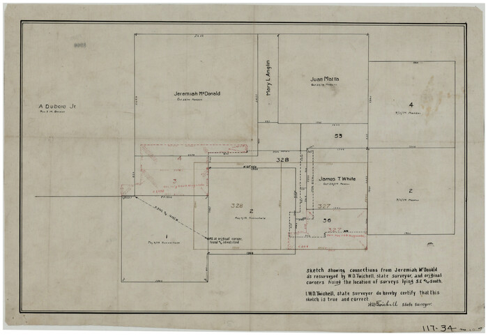
Print $20.00
- Digital $50.00
[Sketch Showing Connections from Jeremiah McDonald resurvey]
Size: 21.6 x 14.5 inches
91154
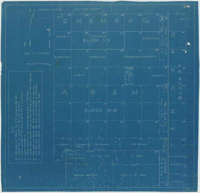
[Sketch Showing Blocks in Hansford County, Texas]
Print $20.00
- Digital $50.00
[Sketch Showing Blocks in Hansford County, Texas]
1890
Size: 34.3 x 24.6 inches
75818
[Sketch Showing Blocks in Hansford County, Texas]
Print $20.00
- Digital $50.00
[Sketch Showing Blocks in Hansford County, Texas]
1890
Size: 34.1 x 25.3 inches
75819
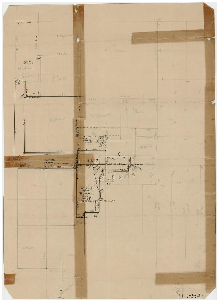
[R. Sikes and Surrounding Surveys]
Print $20.00
- Digital $50.00
[R. Sikes and Surrounding Surveys]
Size: 14.8 x 20.2 inches
91160
[Portions of Hansford and Hutchinson Counties]
Print $3.00
- Digital $50.00
[Portions of Hansford and Hutchinson Counties]
Size: 11.5 x 13.5 inches
91136
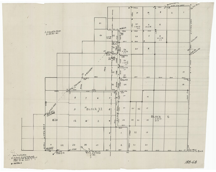
[Parts of Blocks M-20, 22 and S]
Print $20.00
- Digital $50.00
[Parts of Blocks M-20, 22 and S]
1921
Size: 23.3 x 18.3 inches
91825
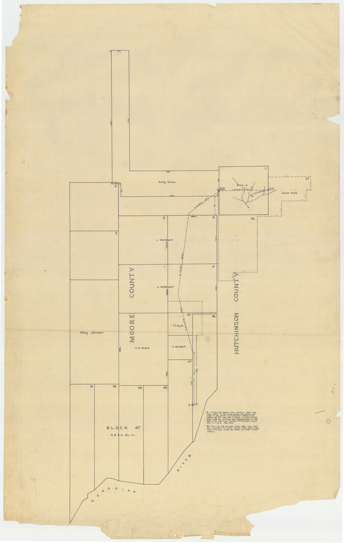
[Part of Hutchison County]
Print $2.00
- Digital $50.00
[Part of Hutchison County]
1875
Size: 7.5 x 11.5 inches
91144
[Map of North Half of Hutchinson and South Half of Hansford Counties]
Print $3.00
- Digital $50.00
[Map of North Half of Hutchinson and South Half of Hansford Counties]
Size: 11.6 x 13.5 inches
92114
[Location Survey of the Southern Kansas Railway, Kiowa Extension from a point in Drake's Location, in Indian Territory 100 miles from south line of Kansas, continuing up Wolf Creek and South Canadian River to Cottonwood Creek in Hutchinson County]
Print $20.00
- Digital $50.00
[Location Survey of the Southern Kansas Railway, Kiowa Extension from a point in Drake's Location, in Indian Territory 100 miles from south line of Kansas, continuing up Wolf Creek and South Canadian River to Cottonwood Creek in Hutchinson County]
1886
Size: 39.0 x 40.0 inches
88844
[Location Survey of the Southern Kansas Railway, Kiowa Extension from a point in Drake's Location, in Indian Territory 100 miles from south line of Kansas, continuing up Wolf Creek and South Canadian River to Cottonwood Creek in Hutchinson County]
Print $20.00
- Digital $50.00
[Location Survey of the Southern Kansas Railway, Kiowa Extension from a point in Drake's Location, in Indian Territory 100 miles from south line of Kansas, continuing up Wolf Creek and South Canadian River to Cottonwood Creek in Hutchinson County]
1886
Size: 37.5 x 36.0 inches
88845
[John Gibbs and surrounding surveys]
Print $20.00
- Digital $50.00
[John Gibbs and surrounding surveys]
Size: 18.8 x 22.8 inches
91161
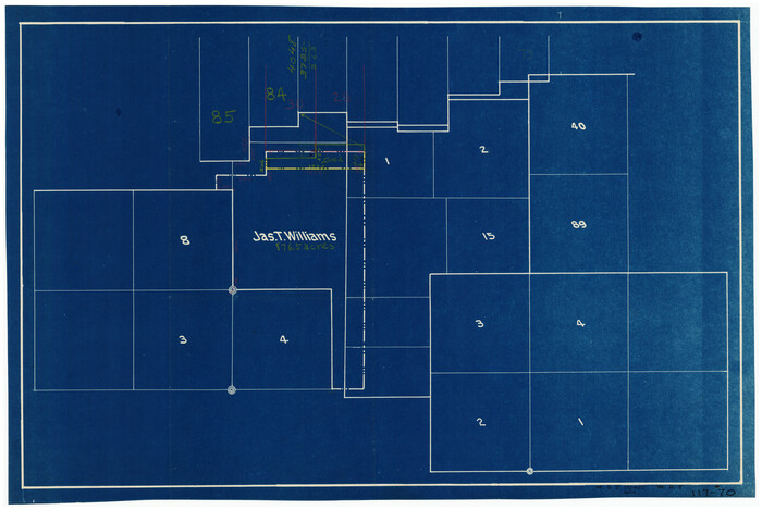
[Jas. T. Williams Survey]
Print $20.00
- Digital $50.00
[Jas. T. Williams Survey]
Size: 29.4 x 19.8 inches
91163
[Z. C. Collier survey owned by Pease Estate, Hutchinson County]
Print $20.00
- Digital $50.00
[Z. C. Collier survey owned by Pease Estate, Hutchinson County]
-
Size
19.0 x 20.8 inches
-
Map/Doc
4472
[Young Territory]
Print $40.00
- Digital $50.00
[Young Territory]
1875
-
Size
49.0 x 87.4 inches
-
Map/Doc
16784
-
Creation Date
1875
[West Half of Hutchinson County South of the Canadian River]
Print $20.00
- Digital $50.00
[West Half of Hutchinson County South of the Canadian River]
-
Size
18.4 x 17.0 inches
-
Map/Doc
91179
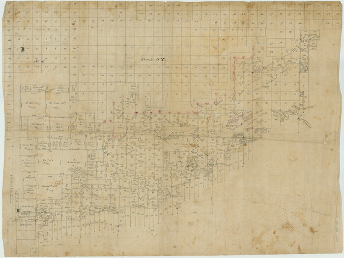
[T. & N. O. RR. Block T5]
Print $20.00
- Digital $50.00
[T. & N. O. RR. Block T5]
-
Size
32.8 x 28.9 inches
-
Map/Doc
91145
[Surveys covering parts of Blocks 5T, R2, M24, M23]
Print $20.00
- Digital $50.00
[Surveys covering parts of Blocks 5T, R2, M24, M23]
-
Size
15.0 x 19.0 inches
-
Map/Doc
92122
[Surveys Along Canadian River]
Print $20.00
- Digital $50.00
[Surveys Along Canadian River]
-
Size
42.9 x 27.0 inches
-
Map/Doc
92359
[Surveying Sketch of Northern Portion of Hutchinson County]
Print $20.00
- Digital $50.00
[Surveying Sketch of Northern Portion of Hutchinson County]
1890
-
Size
26.5 x 42.5 inches
-
Map/Doc
5065
-
Creation Date
1890
[Surveying Sketch of Heirs of Wm Neil, J.J. Hall, Robert Sikes, et al in Hutchinson County, Texas]
Print $20.00
- Digital $50.00
[Surveying Sketch of Heirs of Wm Neil, J.J. Hall, Robert Sikes, et al in Hutchinson County, Texas]
-
Size
15.6 x 20.5 inches
-
Map/Doc
75778
[Surveying Sketch of Encibio Almaguie, T. W. N. G. R. R. Co., et al in Hutchinson County, Texas]
Print $20.00
- Digital $50.00
[Surveying Sketch of Encibio Almaguie, T. W. N. G. R. R. Co., et al in Hutchinson County, Texas]
-
Map/Doc
93791
[Sketch showing surveys on the south side of the Canadian River, Blocks 4, M-3, M-19, M-20, 21-W, and Y-2]
Print $20.00
- Digital $50.00
[Sketch showing surveys on the south side of the Canadian River, Blocks 4, M-3, M-19, M-20, 21-W, and Y-2]
-
Size
43.4 x 25.1 inches
-
Map/Doc
91740
[Sketch showing parts of Blocks 3, 5, 22, M-20, S, T and Block BB, surveys 1, 2 and 3]
Print $20.00
- Digital $50.00
[Sketch showing parts of Blocks 3, 5, 22, M-20, S, T and Block BB, surveys 1, 2 and 3]
-
Size
15.9 x 15.3 inches
-
Map/Doc
91729
[Sketch showing G. H.& H. Ry. Co. Blks. 2 and 3, H. & T. C. Ry. Co. Blk. 45 and T. &N. O. Ry. Co. Blk. 5T]
Print $20.00
- Digital $50.00
[Sketch showing G. H.& H. Ry. Co. Blks. 2 and 3, H. & T. C. Ry. Co. Blk. 45 and T. &N. O. Ry. Co. Blk. 5T]
1890
-
Size
23.6 x 36.8 inches
-
Map/Doc
89679
-
Creation Date
1890
[Sketch showing Blocks B-11, G and M-2 and 3, L, and 47, Sections 77-102]
Print $20.00
- Digital $50.00
[Sketch showing Blocks B-11, G and M-2 and 3, L, and 47, Sections 77-102]
-
Size
25.6 x 18.9 inches
-
Map/Doc
91734
[Sketch of surveys in Hutchinson County]
Print $20.00
- Digital $50.00
[Sketch of surveys in Hutchinson County]
1912
-
Size
25.0 x 26.8 inches
-
Map/Doc
75817
-
Creation Date
1912
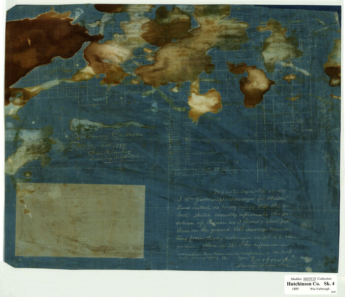
[Sketch of a portion of Hutchinson County, Texas]
Print $20.00
- Digital $50.00
[Sketch of a portion of Hutchinson County, Texas]
1889
-
Size
14.9 x 17.3 inches
-
Map/Doc
413
-
Creation Date
1889
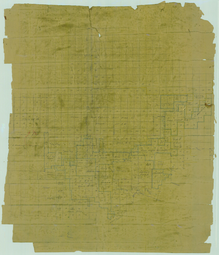
[Sketch in Hutchinson County, Texas]
Print $20.00
- Digital $50.00
[Sketch in Hutchinson County, Texas]
-
Size
36.2 x 31.1 inches
-
Map/Doc
4491
[Sketch in Hutchinson County, Texas]
Print $20.00
- Digital $50.00
[Sketch in Hutchinson County, Texas]
-
Size
26.5 x 35.3 inches
-
Map/Doc
76016
[Sketch Showing G. H. & H. R.R. Co. Block 3B and A. B. & M. Block M16, Hutchinson County, Texas]
Print $20.00
- Digital $50.00
[Sketch Showing G. H. & H. R.R. Co. Block 3B and A. B. & M. Block M16, Hutchinson County, Texas]
-
Size
20.7 x 21.5 inches
-
Map/Doc
75813
[Sketch Showing Connections from Jeremiah McDonald resurvey]
Print $20.00
- Digital $50.00
[Sketch Showing Connections from Jeremiah McDonald resurvey]
-
Size
21.6 x 14.5 inches
-
Map/Doc
91154
[Sketch Showing Blocks in Hansford County, Texas]
Print $20.00
- Digital $50.00
[Sketch Showing Blocks in Hansford County, Texas]
1890
-
Size
34.3 x 24.6 inches
-
Map/Doc
75818
-
Creation Date
1890
[Sketch Showing Blocks in Hansford County, Texas]
Print $20.00
- Digital $50.00
[Sketch Showing Blocks in Hansford County, Texas]
1890
-
Size
34.1 x 25.3 inches
-
Map/Doc
75819
-
Creation Date
1890
[R. Sikes and Surrounding Surveys]
Print $20.00
- Digital $50.00
[R. Sikes and Surrounding Surveys]
-
Size
14.8 x 20.2 inches
-
Map/Doc
91160
[Portions of Hansford and Hutchinson Counties]
Print $3.00
- Digital $50.00
[Portions of Hansford and Hutchinson Counties]
-
Size
11.5 x 13.5 inches
-
Map/Doc
91136
[Parts of Blocks M-20, 22 and S]
Print $20.00
- Digital $50.00
[Parts of Blocks M-20, 22 and S]
1921
-
Size
23.3 x 18.3 inches
-
Map/Doc
91825
-
Creation Date
1921
[Part of Hutchison County]
Print $2.00
- Digital $50.00
[Part of Hutchison County]
1875
-
Size
7.5 x 11.5 inches
-
Map/Doc
91144
-
Creation Date
1875
[Map of North Half of Hutchinson and South Half of Hansford Counties]
Print $3.00
- Digital $50.00
[Map of North Half of Hutchinson and South Half of Hansford Counties]
-
Size
11.6 x 13.5 inches
-
Map/Doc
92114
[Location Survey of the Southern Kansas Railway, Kiowa Extension from a point in Drake's Location, in Indian Territory 100 miles from south line of Kansas, continuing up Wolf Creek and South Canadian River to Cottonwood Creek in Hutchinson County]
Print $20.00
- Digital $50.00
[Location Survey of the Southern Kansas Railway, Kiowa Extension from a point in Drake's Location, in Indian Territory 100 miles from south line of Kansas, continuing up Wolf Creek and South Canadian River to Cottonwood Creek in Hutchinson County]
1886
-
Size
39.0 x 40.0 inches
-
Map/Doc
88844
-
Creation Date
1886
[Location Survey of the Southern Kansas Railway, Kiowa Extension from a point in Drake's Location, in Indian Territory 100 miles from south line of Kansas, continuing up Wolf Creek and South Canadian River to Cottonwood Creek in Hutchinson County]
Print $20.00
- Digital $50.00
[Location Survey of the Southern Kansas Railway, Kiowa Extension from a point in Drake's Location, in Indian Territory 100 miles from south line of Kansas, continuing up Wolf Creek and South Canadian River to Cottonwood Creek in Hutchinson County]
1886
-
Size
37.5 x 36.0 inches
-
Map/Doc
88845
-
Creation Date
1886
[John Gibbs and surrounding surveys]
Print $20.00
- Digital $50.00
[John Gibbs and surrounding surveys]
-
Size
18.8 x 22.8 inches
-
Map/Doc
91161
[Jas. T. Williams Survey]
Print $20.00
- Digital $50.00
[Jas. T. Williams Survey]
-
Size
29.4 x 19.8 inches
-
Map/Doc
91163