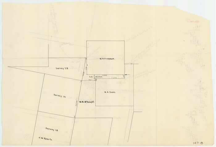
[W. H. Freeman, W. A. Eads, W. M. McKnight, Surveys 18, 19, and 28]
Print $20.00
- Digital $50.00
[W. H. Freeman, W. A. Eads, W. M. McKnight, Surveys 18, 19, and 28]
Size: 27.3 x 18.6 inches
91084
[Surveys along Tehuacano and Grindstone Creek, drawings X and Y]
Print $20.00
- Digital $50.00
[Surveys along Tehuacano and Grindstone Creek, drawings X and Y]
1846
Size: 12.4 x 18.3 inches
299
[Sketch of J.D. Brown survey and vicinity]
Print $40.00
- Digital $50.00
[Sketch of J.D. Brown survey and vicinity]
Size: 44.1 x 62.7 inches
89964
[Sketch of J.D. Brown survey and vicinity]
Print $40.00
- Digital $50.00
[Sketch of J.D. Brown survey and vicinity]
Size: 43.5 x 63.0 inches
89965
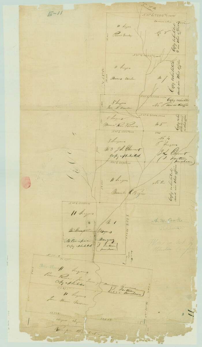
[Large surveys along the Navasota River]
Print $20.00
- Digital $50.00
[Large surveys along the Navasota River]
1840
Size: 24.5 x 14.3 inches
48
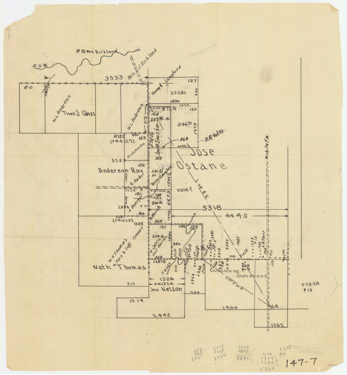
[Jose Ostane and Surrounding Surveys]
Print $20.00
- Digital $50.00
[Jose Ostane and Surrounding Surveys]
Size: 13.6 x 14.6 inches
91083
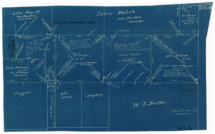
[John Welch, W. F. Butter, and surrounding surveys]
Print $3.00
- Digital $50.00
[John Welch, W. F. Butter, and surrounding surveys]
Size: 17.1 x 10.9 inches
91011
[John W. Carpenter and Surrounding Surveys]
Print $20.00
- Digital $50.00
[John W. Carpenter and Surrounding Surveys]
1922
Size: 17.7 x 29.6 inches
91085
[Jesse Folk and Surrounding Surveys]
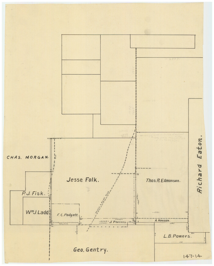
Print $20.00
- Digital $50.00
[Jesse Folk and Surrounding Surveys]
Size: 14.9 x 18.3 inches
91086
[Jesse Folk and Surrounding Surveys]
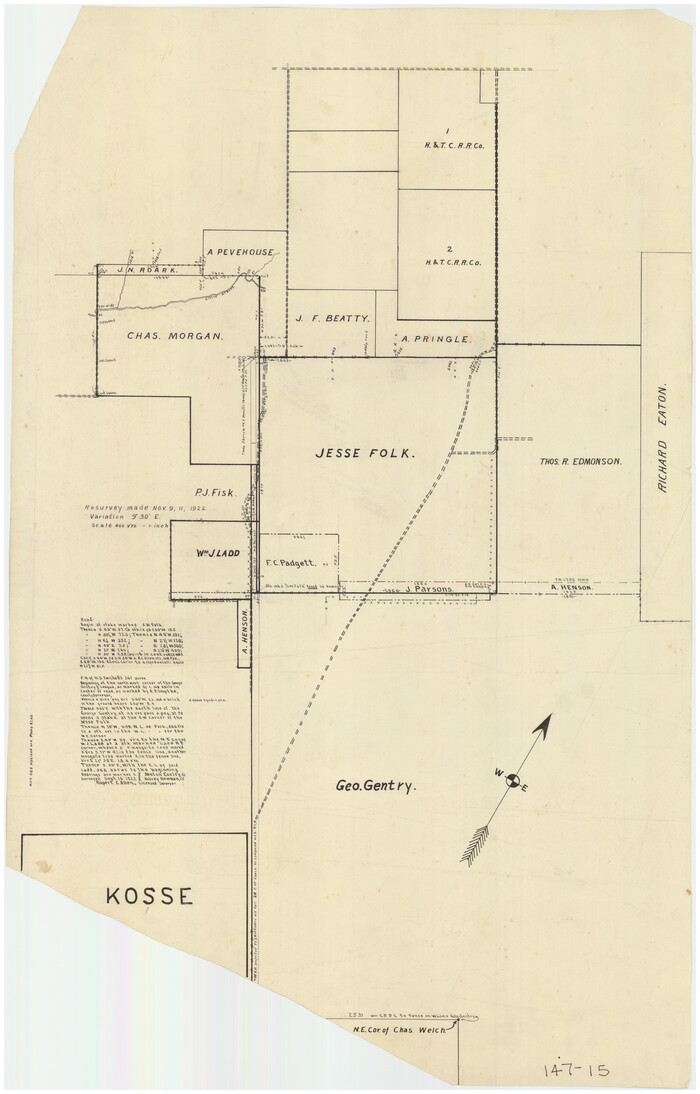
Print $20.00
- Digital $50.00
[Jesse Folk and Surrounding Surveys]
1922
Size: 21.8 x 33.7 inches
91087
[George Gentry, Wm. Williams, and surrounding surveys]
Print $2.00
- Digital $50.00
[George Gentry, Wm. Williams, and surrounding surveys]
Size: 8.3 x 12.6 inches
90973
[George Gentry, Charles Welch, and Surrounding Surveys]
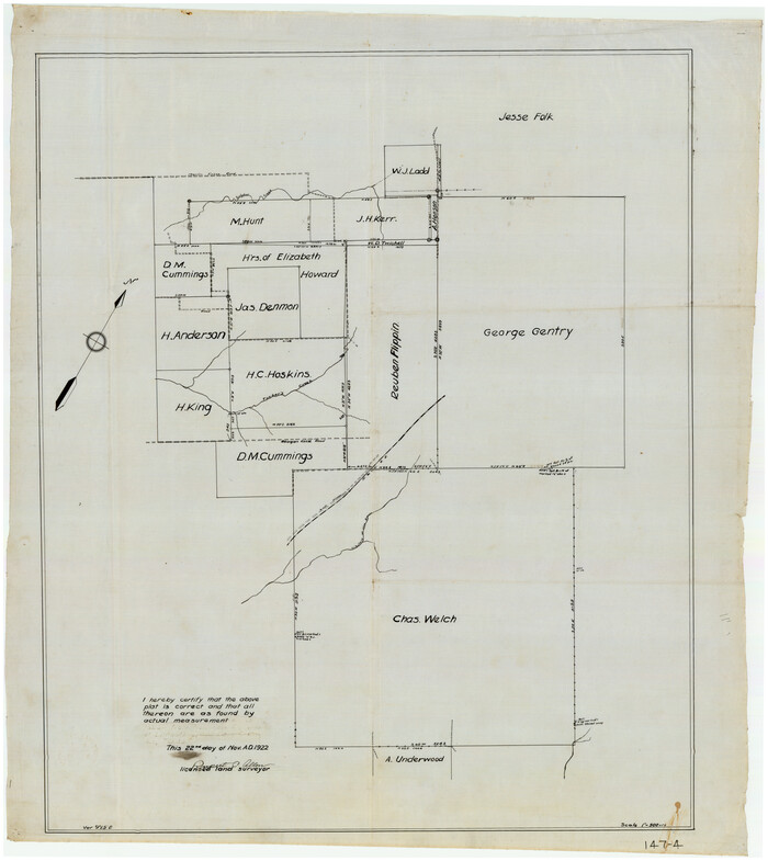
Print $20.00
- Digital $50.00
[George Gentry, Charles Welch, and Surrounding Surveys]
1922
Size: 28.6 x 32.0 inches
91082
[Charles Welch, J. D. Brown, and surrounding surveys]
Print $20.00
- Digital $50.00
[Charles Welch, J. D. Brown, and surrounding surveys]
Size: 37.4 x 24.0 inches
91010
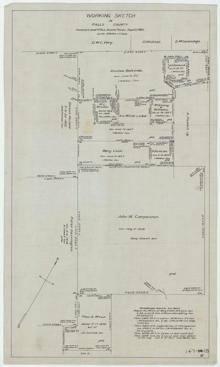
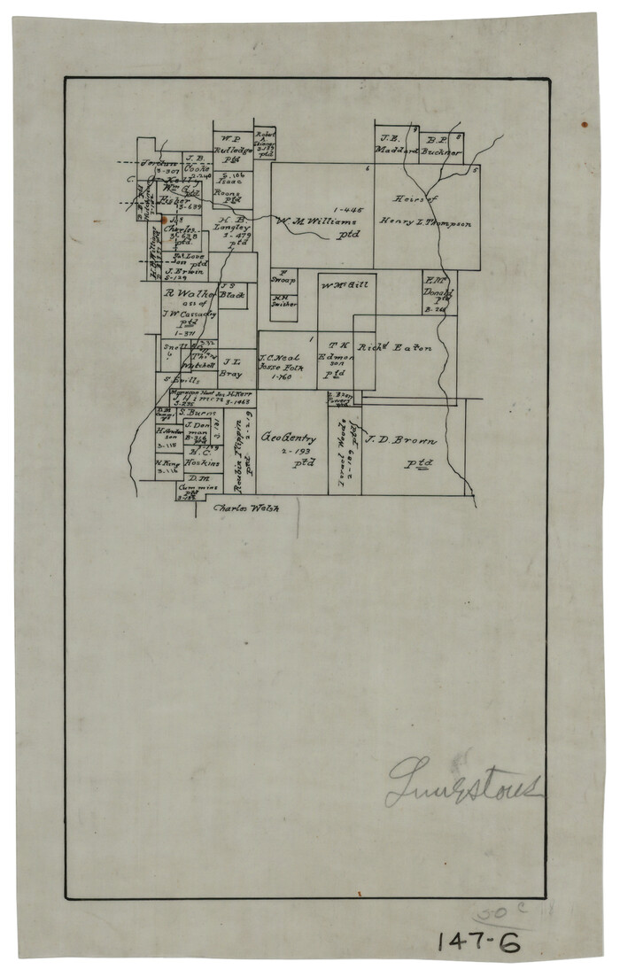
Working Sketch in Falls and Limestone Counties

Print $20.00
- Digital $50.00
Working Sketch in Falls and Limestone Counties
1922
Size: 15.9 x 34.8 inches
91088
Wayland Crossing Sheet Robertson, Limestone and Leon Counties, Navasota River

Print $20.00
- Digital $50.00
Wayland Crossing Sheet Robertson, Limestone and Leon Counties, Navasota River
1934
Size: 43.9 x 40.9 inches
65072
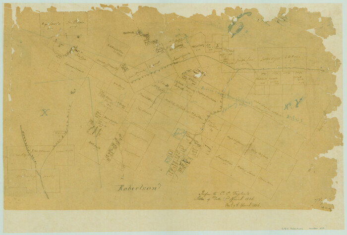
Sketch of Robertson Co., Tehuacana Creek

Print $3.00
- Digital $50.00
Sketch of Robertson Co., Tehuacana Creek
1846
Size: 10.3 x 16.4 inches
264
Robertson County Sketch File 6

Print $4.00
Robertson County Sketch File 6
1870
Size: 8.9 x 7.6 inches
35362
Robertson County Sketch File 5

Print $6.00
Robertson County Sketch File 5
1863
Size: 12.0 x 9.0 inches
35358
Robertson County Sketch File 2

Print $16.00
Robertson County Sketch File 2
1858
Size: 10.1 x 8.2 inches
35343
Navasota River, Springfield Sheet

Print $20.00
- Digital $50.00
Navasota River, Springfield Sheet
1934
Size: 41.5 x 37.8 inches
65074
Navasota River, Long Bridge Crossing Sheet

Print $20.00
- Digital $50.00
Navasota River, Long Bridge Crossing Sheet
1934
Size: 43.1 x 36.6 inches
65073
Navarro County Sketch File 4

Print $6.00
- Digital $50.00
Navarro County Sketch File 4
1852
Size: 7.5 x 7.2 inches
32304
Navarro County Sketch File 18

Print $3.00
- Digital $50.00
Navarro County Sketch File 18
1871
Size: 10.6 x 10.0 inches
32335
Navarro County Sketch File 13

Print $22.00
- Digital $50.00
Navarro County Sketch File 13
Size: 12.0 x 8.6 inches
32324
Map of the Line of the H. & Texas Cen. Railway from the Navasota River, 72 1/2 Miles from Houston, to Corsicana in Navarro Co., 211 mls from Houston

Print $40.00
- Digital $50.00
Map of the Line of the H. & Texas Cen. Railway from the Navasota River, 72 1/2 Miles from Houston, to Corsicana in Navarro Co., 211 mls from Houston
Size: 39.2 x 61.4 inches
64086
Map of Limestone County

Print $20.00
- Digital $50.00
Map of Limestone County
1869
Size: 22.1 x 22.4 inches
3818
Map of Limestone County

Print $20.00
- Digital $50.00
Map of Limestone County
1858
Size: 23.2 x 23.8 inches
3819
Map of Limestone County

Print $20.00
- Digital $50.00
Map of Limestone County
1877
Size: 24.1 x 26.9 inches
83012
Map Showing Survey of Navasota River Bed in Limestone County Texas Located North of Houston and Texas Central Railroad Bridge

Print $40.00
- Digital $50.00
Map Showing Survey of Navasota River Bed in Limestone County Texas Located North of Houston and Texas Central Railroad Bridge
1921
Size: 68.0 x 42.5 inches
65347
[W. H. Freeman, W. A. Eads, W. M. McKnight, Surveys 18, 19, and 28]
Print $20.00
- Digital $50.00
[W. H. Freeman, W. A. Eads, W. M. McKnight, Surveys 18, 19, and 28]
-
Size
27.3 x 18.6 inches
-
Map/Doc
91084
[Surveys along Tehuacano and Grindstone Creek, drawings X and Y]
Print $20.00
- Digital $50.00
[Surveys along Tehuacano and Grindstone Creek, drawings X and Y]
1846
-
Size
12.4 x 18.3 inches
-
Map/Doc
299
-
Creation Date
1846
[Sketch of J.D. Brown survey and vicinity]
Print $40.00
- Digital $50.00
[Sketch of J.D. Brown survey and vicinity]
-
Size
44.1 x 62.7 inches
-
Map/Doc
89964
[Sketch of J.D. Brown survey and vicinity]
Print $40.00
- Digital $50.00
[Sketch of J.D. Brown survey and vicinity]
-
Size
43.5 x 63.0 inches
-
Map/Doc
89965
[Large surveys along the Navasota River]
Print $20.00
- Digital $50.00
[Large surveys along the Navasota River]
1840
-
Size
24.5 x 14.3 inches
-
Map/Doc
48
-
Creation Date
1840
[Jose Ostane and Surrounding Surveys]
Print $20.00
- Digital $50.00
[Jose Ostane and Surrounding Surveys]
-
Size
13.6 x 14.6 inches
-
Map/Doc
91083
[John Welch, W. F. Butter, and surrounding surveys]
Print $3.00
- Digital $50.00
[John Welch, W. F. Butter, and surrounding surveys]
-
Size
17.1 x 10.9 inches
-
Map/Doc
91011
[John W. Carpenter and Surrounding Surveys]
Print $20.00
- Digital $50.00
[John W. Carpenter and Surrounding Surveys]
1922
-
Size
17.7 x 29.6 inches
-
Map/Doc
91085
-
Creation Date
1922
[Jesse Folk and Surrounding Surveys]
Print $20.00
- Digital $50.00
[Jesse Folk and Surrounding Surveys]
-
Size
14.9 x 18.3 inches
-
Map/Doc
91086
[Jesse Folk and Surrounding Surveys]
Print $20.00
- Digital $50.00
[Jesse Folk and Surrounding Surveys]
1922
-
Size
21.8 x 33.7 inches
-
Map/Doc
91087
-
Creation Date
1922
[George Gentry, Wm. Williams, and surrounding surveys]
Print $2.00
- Digital $50.00
[George Gentry, Wm. Williams, and surrounding surveys]
-
Size
8.3 x 12.6 inches
-
Map/Doc
90973
[George Gentry, Charles Welch, and Surrounding Surveys]
Print $20.00
- Digital $50.00
[George Gentry, Charles Welch, and Surrounding Surveys]
1922
-
Size
28.6 x 32.0 inches
-
Map/Doc
91082
-
Creation Date
1922
[Charles Welch, J. D. Brown, and surrounding surveys]
Print $20.00
- Digital $50.00
[Charles Welch, J. D. Brown, and surrounding surveys]
-
Size
37.4 x 24.0 inches
-
Map/Doc
91010
Working Sketch in Falls and Limestone Counties
Print $20.00
- Digital $50.00
Working Sketch in Falls and Limestone Counties
1922
-
Size
15.9 x 34.8 inches
-
Map/Doc
91088
-
Creation Date
1922
Wayland Crossing Sheet Robertson, Limestone and Leon Counties, Navasota River
Print $20.00
- Digital $50.00
Wayland Crossing Sheet Robertson, Limestone and Leon Counties, Navasota River
1934
-
Size
43.9 x 40.9 inches
-
Map/Doc
65072
-
Creation Date
1934
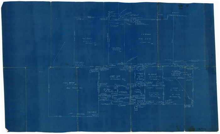
Thornton, Texas

Print $20.00
- Digital $50.00
Thornton, Texas
1922
-
Size
30.0 x 32.6 inches
-
Map/Doc
92143
-
Creation Date
1922
Sketch of Robertson Co., Tehuacana Creek
Print $3.00
- Digital $50.00
Sketch of Robertson Co., Tehuacana Creek
1846
-
Size
10.3 x 16.4 inches
-
Map/Doc
264
-
Creation Date
1846
Robertson County Sketch File 6
Print $4.00
Robertson County Sketch File 6
1870
-
Size
8.9 x 7.6 inches
-
Map/Doc
35362
-
Creation Date
1870
Robertson County Sketch File 5
Print $6.00
Robertson County Sketch File 5
1863
-
Size
12.0 x 9.0 inches
-
Map/Doc
35358
-
Creation Date
1863
Robertson County Sketch File 2
Print $16.00
Robertson County Sketch File 2
1858
-
Size
10.1 x 8.2 inches
-
Map/Doc
35343
-
Creation Date
1858
Navasota River, Springfield Sheet
Print $20.00
- Digital $50.00
Navasota River, Springfield Sheet
1934
-
Size
41.5 x 37.8 inches
-
Map/Doc
65074
-
Creation Date
1934
Navasota River, Long Bridge Crossing Sheet
Print $20.00
- Digital $50.00
Navasota River, Long Bridge Crossing Sheet
1934
-
Size
43.1 x 36.6 inches
-
Map/Doc
65073
-
Creation Date
1934
Navarro County Sketch File 4
Print $6.00
- Digital $50.00
Navarro County Sketch File 4
1852
-
Size
7.5 x 7.2 inches
-
Map/Doc
32304
-
Creation Date
1852
Navarro County Sketch File 18
Print $3.00
- Digital $50.00
Navarro County Sketch File 18
1871
-
Size
10.6 x 10.0 inches
-
Map/Doc
32335
-
Creation Date
1871
Navarro County Sketch File 13
Print $22.00
- Digital $50.00
Navarro County Sketch File 13
-
Size
12.0 x 8.6 inches
-
Map/Doc
32324
Map of the Line of the H. & Texas Cen. Railway from the Navasota River, 72 1/2 Miles from Houston, to Corsicana in Navarro Co., 211 mls from Houston
Print $40.00
- Digital $50.00
Map of the Line of the H. & Texas Cen. Railway from the Navasota River, 72 1/2 Miles from Houston, to Corsicana in Navarro Co., 211 mls from Houston
-
Size
39.2 x 61.4 inches
-
Map/Doc
64086
Map of Limestone County
Print $20.00
- Digital $50.00
Map of Limestone County
1869
-
Size
22.1 x 22.4 inches
-
Map/Doc
3818
-
Creation Date
1869
Map of Limestone County
Print $20.00
- Digital $50.00
Map of Limestone County
1858
-
Size
23.2 x 23.8 inches
-
Map/Doc
3819
-
Creation Date
1858
Map of Limestone County
Print $20.00
- Digital $50.00
Map of Limestone County
1877
-
Size
24.1 x 26.9 inches
-
Map/Doc
83012
-
Creation Date
1877
Map Showing Survey of Navasota River Bed in Limestone County Texas Located North of Houston and Texas Central Railroad Bridge
Print $40.00
- Digital $50.00
Map Showing Survey of Navasota River Bed in Limestone County Texas Located North of Houston and Texas Central Railroad Bridge
1921
-
Size
68.0 x 42.5 inches
-
Map/Doc
65347
-
Creation Date
1921