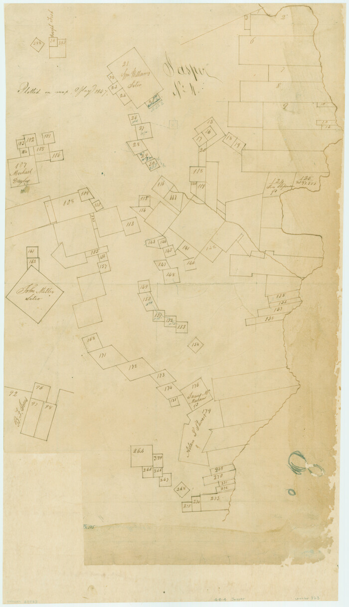
[Surveys near the Sabine River in the Jasper District]
Print $20.00
- Digital $50.00
[Surveys near the Sabine River in the Jasper District]
1847
Size: 18.1 x 10.4 inches
323
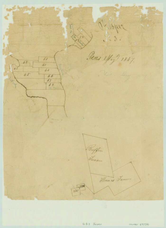
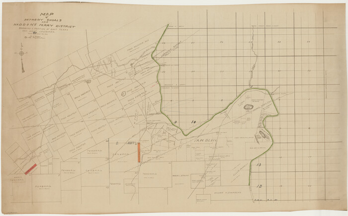
[Surveys in the Jasper District]
Print $2.00
- Digital $50.00
[Surveys in the Jasper District]
1847
Size: 9.4 x 6.9 inches
69734
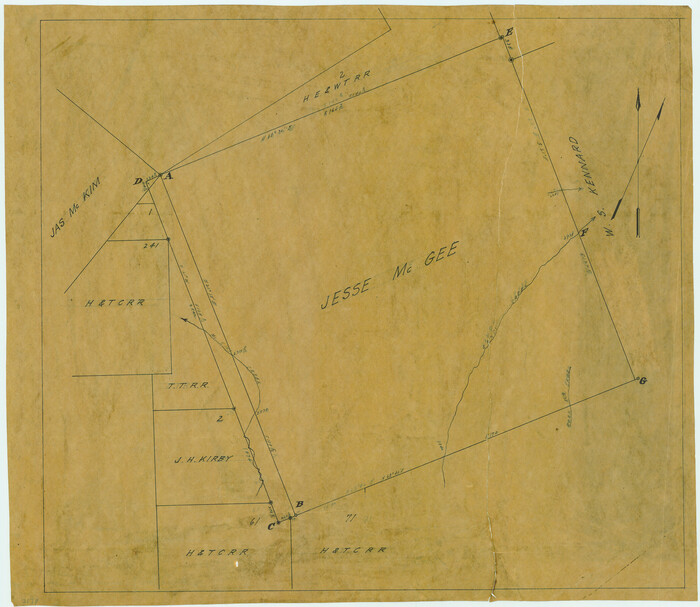
[Surveying Sketch of Jesse McGee, Jas McKim, W. S. Kennard, et al in Sabine and Newton Counties, Texas]
Print $20.00
- Digital $50.00
[Surveying Sketch of Jesse McGee, Jas McKim, W. S. Kennard, et al in Sabine and Newton Counties, Texas]
1916
Size: 32.0 x 37.5 inches
5066
[Surveying Sketch of Jesse McGee in Sabine and Newton Counties]
Print $20.00
- Digital $50.00
[Surveying Sketch of Jesse McGee in Sabine and Newton Counties]
Size: 17.1 x 19.7 inches
78480
[Sketch for Mineral Application 15273 - Sabine River Bed]
Print $20.00
- Digital $50.00
[Sketch for Mineral Application 15273 - Sabine River Bed]
1926
Size: 28.2 x 45.5 inches
65575
[Sketch for Mineral Application 15273 - Sabine River Bed]
Print $20.00
- Digital $50.00
[Sketch for Mineral Application 15273 - Sabine River Bed]
1926
Size: 45.4 x 28.1 inches
65576
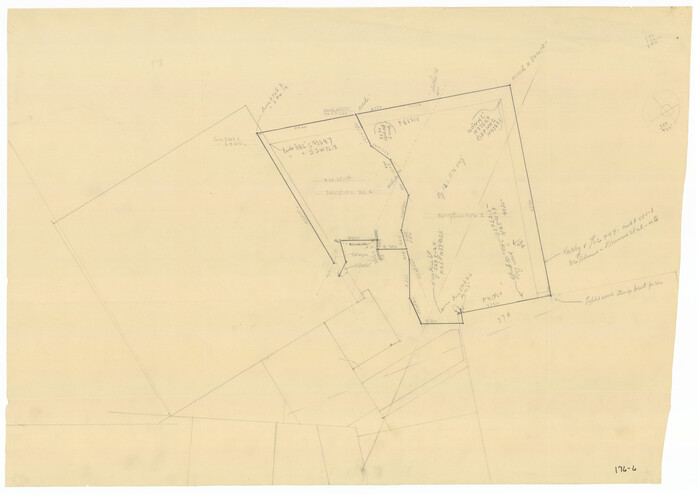
[Sketch Showing Exception Number 3 and Exception Number 4]
Print $20.00
- Digital $50.00
[Sketch Showing Exception Number 3 and Exception Number 4]
Size: 26.7 x 18.8 inches
91400
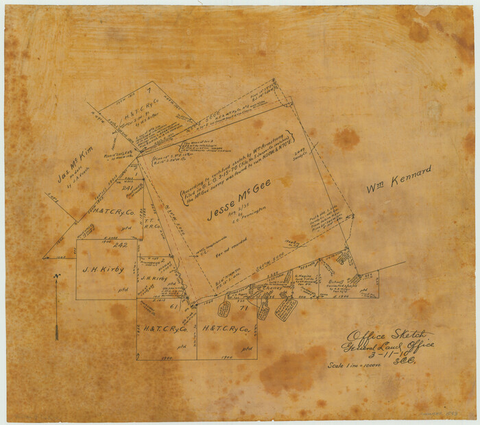
[Office Sketch of Jesse McGee survey in Sabine and Newton Counties]
Print $20.00
- Digital $50.00
[Office Sketch of Jesse McGee survey in Sabine and Newton Counties]
1910
Size: 13.4 x 15.1 inches
543
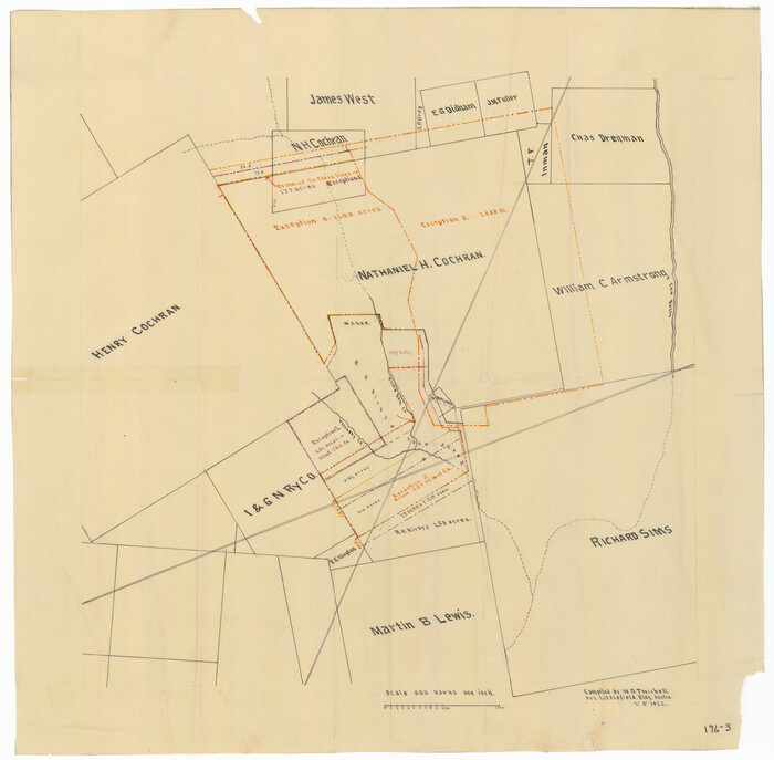
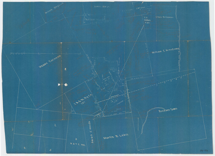
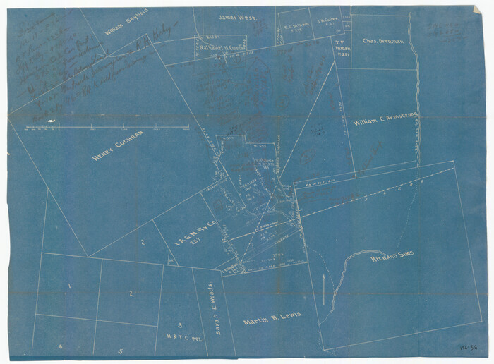
[Nathaniel H. Cochran Survey and Vicinity]
Print $20.00
- Digital $50.00
[Nathaniel H. Cochran Survey and Vicinity]
1922
Size: 22.4 x 22.0 inches
91399
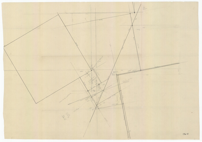
[Nathaniel H. Cochran Survey and Vicinity]
Print $20.00
- Digital $50.00
[Nathaniel H. Cochran Survey and Vicinity]
Size: 26.7 x 18.8 inches
91494
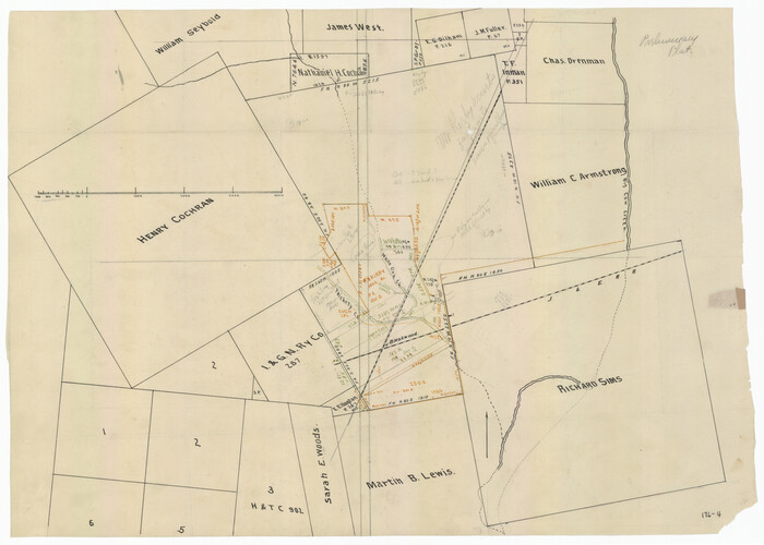
[Nathaniel H. Cochran Survey and Vicinity]
Print $20.00
- Digital $50.00
[Nathaniel H. Cochran Survey and Vicinity]
Size: 26.4 x 19.0 inches
91495
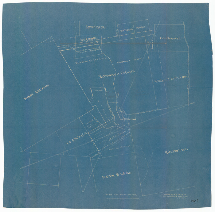
[Nathaniel H. Cochran Survey and Vicinity]
Print $20.00
- Digital $50.00
[Nathaniel H. Cochran Survey and Vicinity]
1922
Size: 22.5 x 21.9 inches
91496
[Nathaniel H. Cochran Survey and Vicinity]
Print $20.00
- Digital $50.00
[Nathaniel H. Cochran Survey and Vicinity]
Size: 25.5 x 18.8 inches
91497
[Nathaniel H. Cochran Survey and Vicinity]
Print $20.00
- Digital $50.00
[Nathaniel H. Cochran Survey and Vicinity]
Size: 25.4 x 18.7 inches
91498
Sabine County, Texas

Print $20.00
- Digital $50.00
Sabine County, Texas
1879
Size: 22.1 x 18.6 inches
751
Sabine County Working Sketch 14

Print $20.00
- Digital $50.00
Sabine County Working Sketch 14
1953
Size: 29.3 x 38.6 inches
63685
Sabine County Working Sketch 12

Print $20.00
- Digital $50.00
Sabine County Working Sketch 12
1935
Size: 39.2 x 45.9 inches
63683
Sabine County Sketch File 6b

Print $4.00
Sabine County Sketch File 6b
1879
Size: 8.1 x 9.0 inches
35617
Sabine County Sketch File 6a

Print $4.00
Sabine County Sketch File 6a
1878
Size: 8.1 x 12.5 inches
35615
Reconnoissance of Sabine River and Vicinty

Print $20.00
Reconnoissance of Sabine River and Vicinty
1863
Size: 30.4 x 42.3 inches
97497
Plat of Jasper, Sabine, San Augustine, Shelby, Harrison and South Part of Nacogdoches Counties

Print $2.00
- Digital $50.00
Plat of Jasper, Sabine, San Augustine, Shelby, Harrison and South Part of Nacogdoches Counties
1841
Size: 13.7 x 9.2 inches
3174
Orange County Working Sketch 17

Print $20.00
- Digital $50.00
Orange County Working Sketch 17
1930
Size: 35.6 x 26.1 inches
71349
Orange County Working Sketch 14

Print $40.00
- Digital $50.00
Orange County Working Sketch 14
1923
Size: 28.4 x 56.1 inches
71346
Orange County Working Sketch 13

Print $20.00
- Digital $50.00
Orange County Working Sketch 13
1922
Size: 12.9 x 15.5 inches
71345
Orange County Sketch File 25

Print $20.00
- Digital $50.00
Orange County Sketch File 25
1914
Size: 19.6 x 38.2 inches
12122
Orange County Sketch File 23

Print $36.00
- Digital $50.00
Orange County Sketch File 23
1911
Size: 9.2 x 5.9 inches
33344
Orange County Sketch File 22

Print $20.00
- Digital $50.00
Orange County Sketch File 22
1910
Size: 16.2 x 18.7 inches
12121
Orange County Sketch File 17a

Print $4.00
- Digital $50.00
Orange County Sketch File 17a
Size: 9.9 x 8.3 inches
33342
Newton County Working Sketch Graphic Index

Print $20.00
- Digital $50.00
Newton County Working Sketch Graphic Index
1946
Size: 47.5 x 41.0 inches
76653
[Surveys near the Sabine River in the Jasper District]
Print $20.00
- Digital $50.00
[Surveys near the Sabine River in the Jasper District]
1847
-
Size
18.1 x 10.4 inches
-
Map/Doc
323
-
Creation Date
1847
[Surveys in the Jasper District]
Print $2.00
- Digital $50.00
[Surveys in the Jasper District]
1847
-
Size
9.4 x 6.9 inches
-
Map/Doc
69734
-
Creation Date
1847
[Surveying Sketch of Jesse McGee, Jas McKim, W. S. Kennard, et al in Sabine and Newton Counties, Texas]
Print $20.00
- Digital $50.00
[Surveying Sketch of Jesse McGee, Jas McKim, W. S. Kennard, et al in Sabine and Newton Counties, Texas]
1916
-
Size
32.0 x 37.5 inches
-
Map/Doc
5066
-
Creation Date
1916
[Surveying Sketch of Jesse McGee in Sabine and Newton Counties]
Print $20.00
- Digital $50.00
[Surveying Sketch of Jesse McGee in Sabine and Newton Counties]
-
Size
17.1 x 19.7 inches
-
Map/Doc
78480
[Sketch for Mineral Application 15273 - Sabine River Bed]
Print $20.00
- Digital $50.00
[Sketch for Mineral Application 15273 - Sabine River Bed]
1926
-
Size
28.2 x 45.5 inches
-
Map/Doc
65575
-
Creation Date
1926
[Sketch for Mineral Application 15273 - Sabine River Bed]
Print $20.00
- Digital $50.00
[Sketch for Mineral Application 15273 - Sabine River Bed]
1926
-
Size
45.4 x 28.1 inches
-
Map/Doc
65576
-
Creation Date
1926
[Sketch Showing Exception Number 3 and Exception Number 4]
Print $20.00
- Digital $50.00
[Sketch Showing Exception Number 3 and Exception Number 4]
-
Size
26.7 x 18.8 inches
-
Map/Doc
91400
[Office Sketch of Jesse McGee survey in Sabine and Newton Counties]
Print $20.00
- Digital $50.00
[Office Sketch of Jesse McGee survey in Sabine and Newton Counties]
1910
-
Size
13.4 x 15.1 inches
-
Map/Doc
543
-
Creation Date
1910
[Nathaniel H. Cochran Survey and Vicinity]
Print $20.00
- Digital $50.00
[Nathaniel H. Cochran Survey and Vicinity]
1922
-
Size
22.4 x 22.0 inches
-
Map/Doc
91399
-
Creation Date
1922
[Nathaniel H. Cochran Survey and Vicinity]
Print $20.00
- Digital $50.00
[Nathaniel H. Cochran Survey and Vicinity]
-
Size
26.7 x 18.8 inches
-
Map/Doc
91494
[Nathaniel H. Cochran Survey and Vicinity]
Print $20.00
- Digital $50.00
[Nathaniel H. Cochran Survey and Vicinity]
-
Size
26.4 x 19.0 inches
-
Map/Doc
91495
[Nathaniel H. Cochran Survey and Vicinity]
Print $20.00
- Digital $50.00
[Nathaniel H. Cochran Survey and Vicinity]
1922
-
Size
22.5 x 21.9 inches
-
Map/Doc
91496
-
Creation Date
1922
[Nathaniel H. Cochran Survey and Vicinity]
Print $20.00
- Digital $50.00
[Nathaniel H. Cochran Survey and Vicinity]
-
Size
25.5 x 18.8 inches
-
Map/Doc
91497
[Nathaniel H. Cochran Survey and Vicinity]
Print $20.00
- Digital $50.00
[Nathaniel H. Cochran Survey and Vicinity]
-
Size
25.4 x 18.7 inches
-
Map/Doc
91498
Sabine County, Texas
Print $20.00
- Digital $50.00
Sabine County, Texas
1879
-
Size
22.1 x 18.6 inches
-
Map/Doc
751
-
Creation Date
1879
Sabine County Working Sketch 14
Print $20.00
- Digital $50.00
Sabine County Working Sketch 14
1953
-
Size
29.3 x 38.6 inches
-
Map/Doc
63685
-
Creation Date
1953
Sabine County Working Sketch 12
Print $20.00
- Digital $50.00
Sabine County Working Sketch 12
1935
-
Size
39.2 x 45.9 inches
-
Map/Doc
63683
-
Creation Date
1935
Sabine County Sketch File 6b
Print $4.00
Sabine County Sketch File 6b
1879
-
Size
8.1 x 9.0 inches
-
Map/Doc
35617
-
Creation Date
1879
Sabine County Sketch File 6a
Print $4.00
Sabine County Sketch File 6a
1878
-
Size
8.1 x 12.5 inches
-
Map/Doc
35615
-
Creation Date
1878
Sabine County Sketch File 6

Print $6.00
Sabine County Sketch File 6
-
Size
3.4 x 5.8 inches
-
Map/Doc
35612
Reconnoissance of Sabine River and Vicinty
Print $20.00
Reconnoissance of Sabine River and Vicinty
1863
-
Size
30.4 x 42.3 inches
-
Map/Doc
97497
-
Creation Date
1863
Plat of Jasper, Sabine, San Augustine, Shelby, Harrison and South Part of Nacogdoches Counties
Print $2.00
- Digital $50.00
Plat of Jasper, Sabine, San Augustine, Shelby, Harrison and South Part of Nacogdoches Counties
1841
-
Size
13.7 x 9.2 inches
-
Map/Doc
3174
-
Creation Date
1841
Orange County Working Sketch 17
Print $20.00
- Digital $50.00
Orange County Working Sketch 17
1930
-
Size
35.6 x 26.1 inches
-
Map/Doc
71349
-
Creation Date
1930
Orange County Working Sketch 14
Print $40.00
- Digital $50.00
Orange County Working Sketch 14
1923
-
Size
28.4 x 56.1 inches
-
Map/Doc
71346
-
Creation Date
1923
Orange County Working Sketch 13
Print $20.00
- Digital $50.00
Orange County Working Sketch 13
1922
-
Size
12.9 x 15.5 inches
-
Map/Doc
71345
-
Creation Date
1922
Orange County Sketch File 25
Print $20.00
- Digital $50.00
Orange County Sketch File 25
1914
-
Size
19.6 x 38.2 inches
-
Map/Doc
12122
-
Creation Date
1914
Orange County Sketch File 23
Print $36.00
- Digital $50.00
Orange County Sketch File 23
1911
-
Size
9.2 x 5.9 inches
-
Map/Doc
33344
-
Creation Date
1911
Orange County Sketch File 22
Print $20.00
- Digital $50.00
Orange County Sketch File 22
1910
-
Size
16.2 x 18.7 inches
-
Map/Doc
12121
-
Creation Date
1910
Orange County Sketch File 17a
Print $4.00
- Digital $50.00
Orange County Sketch File 17a
-
Size
9.9 x 8.3 inches
-
Map/Doc
33342
Newton County Working Sketch Graphic Index
Print $20.00
- Digital $50.00
Newton County Working Sketch Graphic Index
1946
-
Size
47.5 x 41.0 inches
-
Map/Doc
76653
-
Creation Date
1946