Hale County Sketch File 6

Print $20.00
- Digital $50.00
Hale County Sketch File 6
Size: 41.9 x 35.5 inches
10468
Hale County Sketch File 12

Print $20.00
- Digital $50.00
Hale County Sketch File 12
Size: 46.0 x 38.2 inches
10469
Hockley County Sketch File 3

Print $20.00
- Digital $50.00
Hockley County Sketch File 3
Size: 43.1 x 35.4 inches
10490
Briscoe County Sketch File 4

Print $40.00
- Digital $50.00
Briscoe County Sketch File 4
Size: 26.0 x 33.5 inches
10993
Briscoe County Sketch File 5

Print $40.00
- Digital $50.00
Briscoe County Sketch File 5
Size: 29.8 x 26.5 inches
10994
Hale County Sketch File 27

Print $20.00
- Digital $50.00
Hale County Sketch File 27
Size: 12.1 x 28.5 inches
11598
Swisher County Sketch File 6

Print $20.00
- Digital $50.00
Swisher County Sketch File 6
Size: 15.4 x 12.1 inches
12404
Briscoe County Sketch File 15

Print $26.00
- Digital $50.00
Briscoe County Sketch File 15
Size: 11.2 x 8.9 inches
16522
Floyd County Sketch File A1

Print $4.00
- Digital $50.00
Floyd County Sketch File A1
Size: 9.2 x 7.9 inches
22686
Hale County Sketch File 14

Print $8.00
- Digital $50.00
Hale County Sketch File 14
Size: 14.1 x 8.7 inches
24743
Hale County Sketch File 19

Print $4.00
- Digital $50.00
Hale County Sketch File 19
Size: 8.4 x 8.8 inches
24751
Lamb County Sketch File 1 and 1a

Print $30.00
- Digital $50.00
Lamb County Sketch File 1 and 1a
Size: 8.7 x 7.6 inches
29337
Castro County Rolled Sketch 8

Print $20.00
- Digital $50.00
Castro County Rolled Sketch 8
Size: 34.1 x 28.8 inches
5418
Swisher County Boundary File 1

Print $72.00
- Digital $50.00
Swisher County Boundary File 1
Size: 9.0 x 4.5 inches
59075
Swisher County Boundary File 2

Print $106.00
- Digital $50.00
Swisher County Boundary File 2
Size: 14.3 x 9.0 inches
59093
Water-Shed of the Pease River Drainage Area

Print $6.00
- Digital $50.00
Water-Shed of the Pease River Drainage Area
Size: 14.9 x 31.0 inches
65102
Castro County Working Sketch 2

Print $20.00
- Digital $50.00
Castro County Working Sketch 2
Size: 30.4 x 26.2 inches
67897
Castro County Working Sketch 3

Print $20.00
- Digital $50.00
Castro County Working Sketch 3
Size: 31.7 x 17.9 inches
67898
Hale County Rolled Sketch 10

Print $40.00
- Digital $50.00
Hale County Rolled Sketch 10
Size: 52.4 x 28.3 inches
76447
Swisher County Rolled Sketch 3

Print $20.00
- Digital $50.00
Swisher County Rolled Sketch 3
Size: 21.3 x 19.4 inches
7904
Swisher County Rolled Sketch B

Print $20.00
- Digital $50.00
Swisher County Rolled Sketch B
Size: 19.1 x 19.7 inches
7908
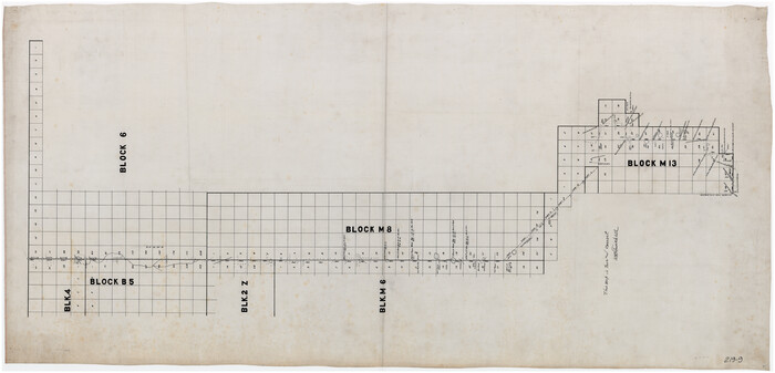
[Sketch of part of Blks. 4, 6, B5, 2Z, M6, M8, and M13]
Print $40.00
- Digital $50.00
[Sketch of part of Blks. 4, 6, B5, 2Z, M6, M8, and M13]
Size: 55.2 x 26.8 inches
89643
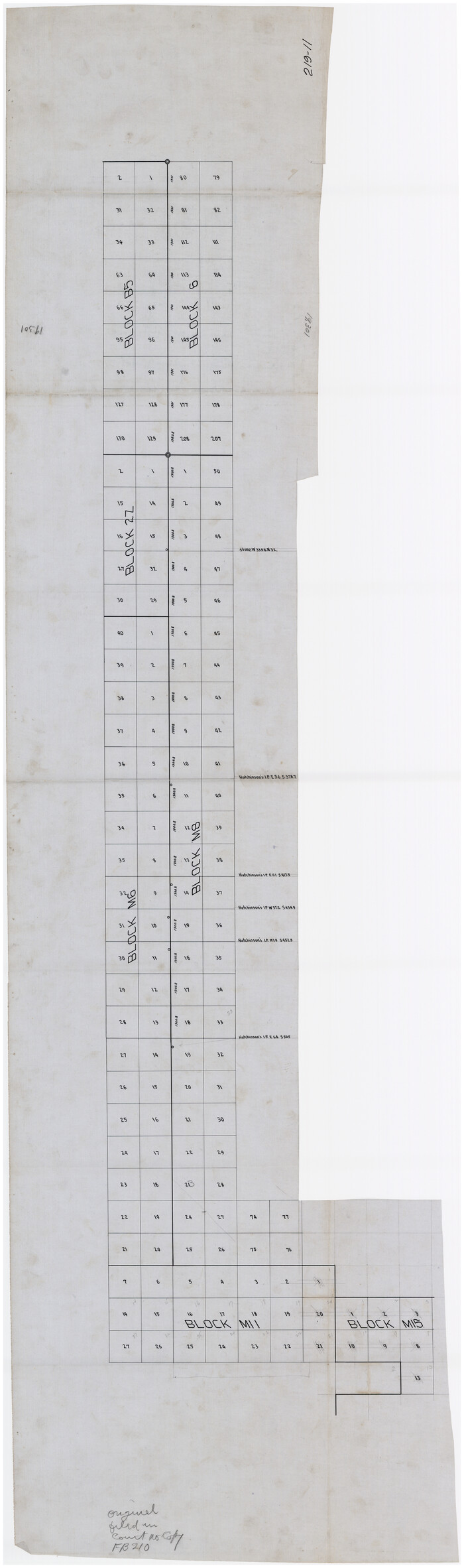
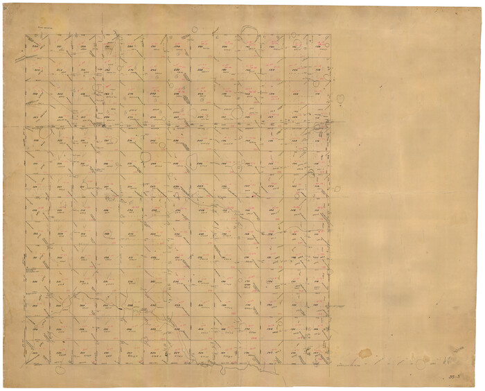
[Sketch of part of Blks. B5, 6, 2Z, M6, M8, M11 and M15]
Print $40.00
- Digital $50.00
[Sketch of part of Blks. B5, 6, 2Z, M6, M8, M11 and M15]
Size: 18.6 x 62.0 inches
89644
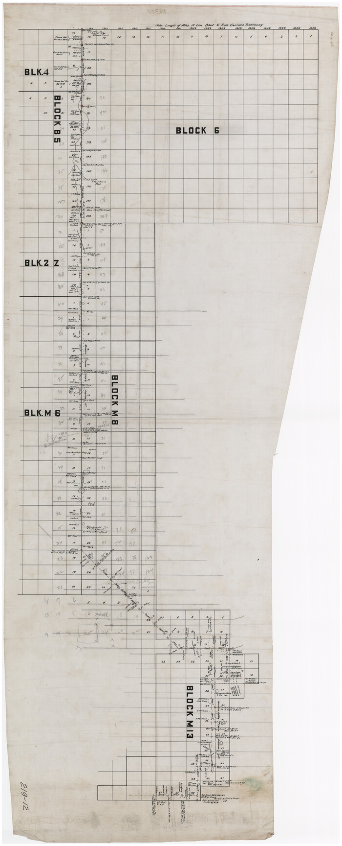
[Sketch of part of Blks. 4, B5, 6, 2Z, M6, M8, and M13]
Print $40.00
- Digital $50.00
[Sketch of part of Blks. 4, B5, 6, 2Z, M6, M8, and M13]
Size: 22.7 x 55.3 inches
89645
[Boundary Survey of County]
Print $40.00
- Digital $50.00
[Boundary Survey of County]
Size: 64.9 x 37.0 inches
89735
[B. S. & F. Blk. M10, D. & S. E. RR. Co. Secs. 138 thru 149]
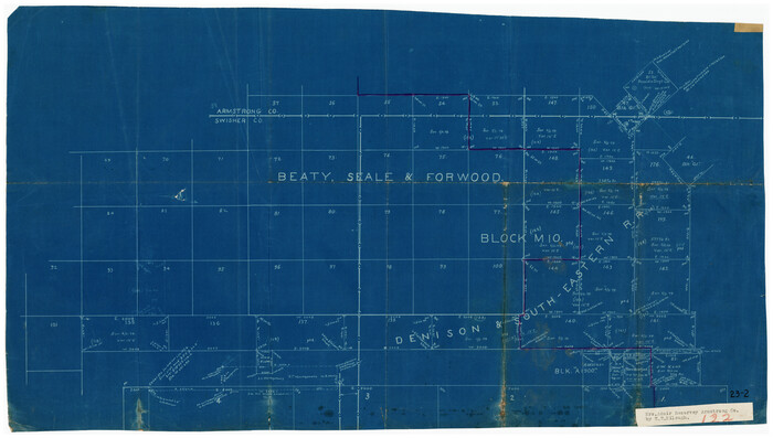
Print $20.00
- Digital $50.00
[B. S. & F. Blk. M10, D. & S. E. RR. Co. Secs. 138 thru 149]
Size: 26.4 x 15.5 inches
90133
[Stone, Kyle and Kyle Block M6]
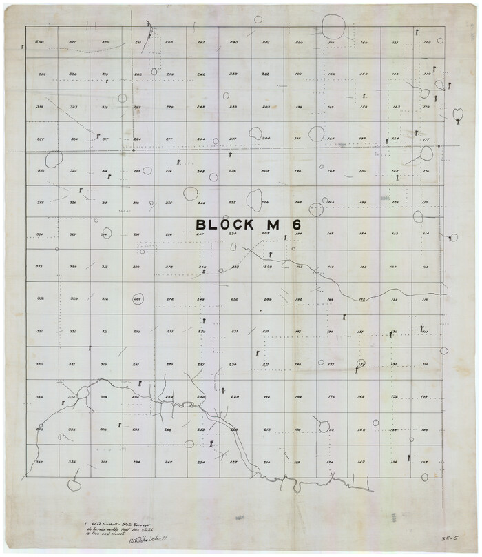
Print $20.00
- Digital $50.00
[Stone, Kyle and Kyle Block M6]
Size: 19.7 x 22.5 inches
90394
[Stone, Kyle and Kyle Block M6]
Print $20.00
- Digital $50.00
[Stone, Kyle and Kyle Block M6]
Size: 26.8 x 21.6 inches
90395
Block M6 in Castro, Swisher, and Randall Co's, Tex.

Print $20.00
- Digital $50.00
Block M6 in Castro, Swisher, and Randall Co's, Tex.
Size: 13.8 x 17.2 inches
90397
[Castro, Lamb, Hockley, Swisher, Hale, and Lubbock Counties]
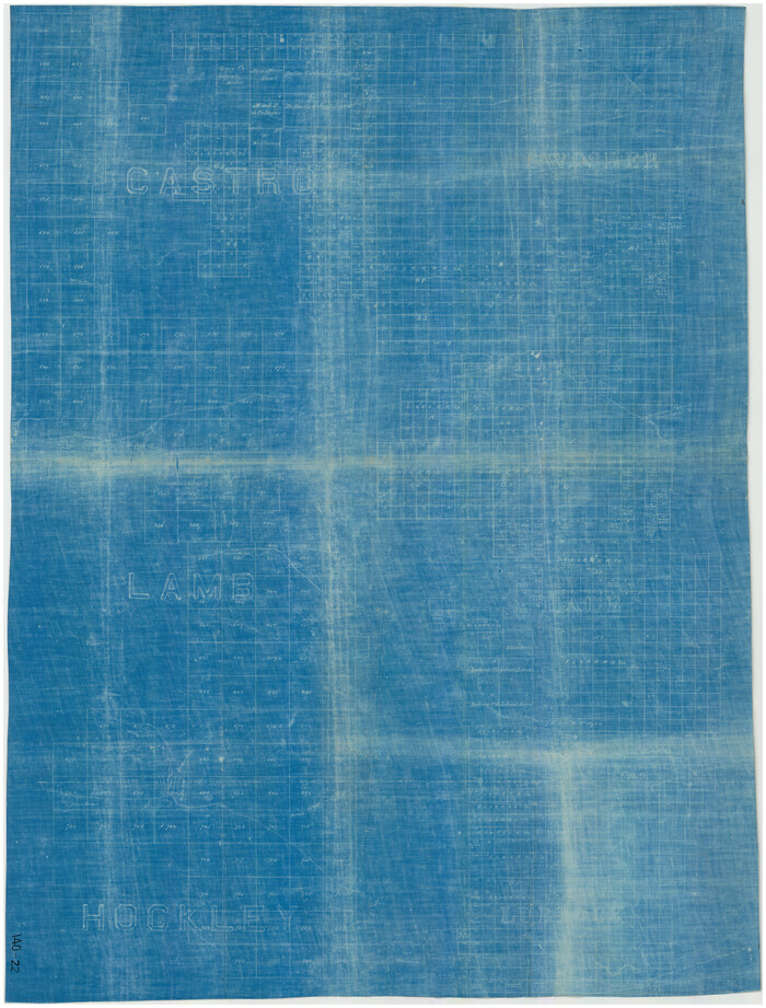
Print $20.00
- Digital $50.00
[Castro, Lamb, Hockley, Swisher, Hale, and Lubbock Counties]
Size: 28.7 x 37.6 inches
91026
Hale County Sketch File 6
Print $20.00
- Digital $50.00
Hale County Sketch File 6
-
Size
41.9 x 35.5 inches
-
Map/Doc
10468
Hale County Sketch File 12
Print $20.00
- Digital $50.00
Hale County Sketch File 12
-
Size
46.0 x 38.2 inches
-
Map/Doc
10469
Hockley County Sketch File 3
Print $20.00
- Digital $50.00
Hockley County Sketch File 3
-
Size
43.1 x 35.4 inches
-
Map/Doc
10490
Briscoe County Sketch File 4
Print $40.00
- Digital $50.00
Briscoe County Sketch File 4
-
Size
26.0 x 33.5 inches
-
Map/Doc
10993
Briscoe County Sketch File 5
Print $40.00
- Digital $50.00
Briscoe County Sketch File 5
-
Size
29.8 x 26.5 inches
-
Map/Doc
10994
Hale County Sketch File 27
Print $20.00
- Digital $50.00
Hale County Sketch File 27
-
Size
12.1 x 28.5 inches
-
Map/Doc
11598
Swisher County Sketch File 6
Print $20.00
- Digital $50.00
Swisher County Sketch File 6
-
Size
15.4 x 12.1 inches
-
Map/Doc
12404
Briscoe County Sketch File 15
Print $26.00
- Digital $50.00
Briscoe County Sketch File 15
-
Size
11.2 x 8.9 inches
-
Map/Doc
16522
Floyd County Sketch File A1
Print $4.00
- Digital $50.00
Floyd County Sketch File A1
-
Size
9.2 x 7.9 inches
-
Map/Doc
22686
Hale County Sketch File 14
Print $8.00
- Digital $50.00
Hale County Sketch File 14
-
Size
14.1 x 8.7 inches
-
Map/Doc
24743
Hale County Sketch File 19
Print $4.00
- Digital $50.00
Hale County Sketch File 19
-
Size
8.4 x 8.8 inches
-
Map/Doc
24751
Lamb County Sketch File 1 and 1a
Print $30.00
- Digital $50.00
Lamb County Sketch File 1 and 1a
-
Size
8.7 x 7.6 inches
-
Map/Doc
29337
Castro County Rolled Sketch 8
Print $20.00
- Digital $50.00
Castro County Rolled Sketch 8
-
Size
34.1 x 28.8 inches
-
Map/Doc
5418
Swisher County Boundary File 1
Print $72.00
- Digital $50.00
Swisher County Boundary File 1
-
Size
9.0 x 4.5 inches
-
Map/Doc
59075
Swisher County Boundary File 2
Print $106.00
- Digital $50.00
Swisher County Boundary File 2
-
Size
14.3 x 9.0 inches
-
Map/Doc
59093
Water-Shed of the Pease River Drainage Area
Print $6.00
- Digital $50.00
Water-Shed of the Pease River Drainage Area
-
Size
14.9 x 31.0 inches
-
Map/Doc
65102
Castro County Working Sketch 2
Print $20.00
- Digital $50.00
Castro County Working Sketch 2
-
Size
30.4 x 26.2 inches
-
Map/Doc
67897
Castro County Working Sketch 3
Print $20.00
- Digital $50.00
Castro County Working Sketch 3
-
Size
31.7 x 17.9 inches
-
Map/Doc
67898
Hale County Rolled Sketch 10
Print $40.00
- Digital $50.00
Hale County Rolled Sketch 10
-
Size
52.4 x 28.3 inches
-
Map/Doc
76447
Swisher County Rolled Sketch 3
Print $20.00
- Digital $50.00
Swisher County Rolled Sketch 3
-
Size
21.3 x 19.4 inches
-
Map/Doc
7904
Swisher County Rolled Sketch B
Print $20.00
- Digital $50.00
Swisher County Rolled Sketch B
-
Size
19.1 x 19.7 inches
-
Map/Doc
7908
[Sketch of part of Blks. 4, 6, B5, 2Z, M6, M8, and M13]
Print $40.00
- Digital $50.00
[Sketch of part of Blks. 4, 6, B5, 2Z, M6, M8, and M13]
-
Size
55.2 x 26.8 inches
-
Map/Doc
89643
[Sketch of part of Blks. B5, 6, 2Z, M6, M8, M11 and M15]
Print $40.00
- Digital $50.00
[Sketch of part of Blks. B5, 6, 2Z, M6, M8, M11 and M15]
-
Size
18.6 x 62.0 inches
-
Map/Doc
89644
[Sketch of part of Blks. 4, B5, 6, 2Z, M6, M8, and M13]
Print $40.00
- Digital $50.00
[Sketch of part of Blks. 4, B5, 6, 2Z, M6, M8, and M13]
-
Size
22.7 x 55.3 inches
-
Map/Doc
89645
[Boundary Survey of County]
Print $40.00
- Digital $50.00
[Boundary Survey of County]
-
Size
64.9 x 37.0 inches
-
Map/Doc
89735
[B. S. & F. Blk. M10, D. & S. E. RR. Co. Secs. 138 thru 149]
Print $20.00
- Digital $50.00
[B. S. & F. Blk. M10, D. & S. E. RR. Co. Secs. 138 thru 149]
-
Size
26.4 x 15.5 inches
-
Map/Doc
90133
[Stone, Kyle and Kyle Block M6]
Print $20.00
- Digital $50.00
[Stone, Kyle and Kyle Block M6]
-
Size
19.7 x 22.5 inches
-
Map/Doc
90394
[Stone, Kyle and Kyle Block M6]
Print $20.00
- Digital $50.00
[Stone, Kyle and Kyle Block M6]
-
Size
26.8 x 21.6 inches
-
Map/Doc
90395
Block M6 in Castro, Swisher, and Randall Co's, Tex.
Print $20.00
- Digital $50.00
Block M6 in Castro, Swisher, and Randall Co's, Tex.
-
Size
13.8 x 17.2 inches
-
Map/Doc
90397
[Castro, Lamb, Hockley, Swisher, Hale, and Lubbock Counties]
Print $20.00
- Digital $50.00
[Castro, Lamb, Hockley, Swisher, Hale, and Lubbock Counties]
-
Size
28.7 x 37.6 inches
-
Map/Doc
91026