Tyler County Working Sketch 24

Print $20.00
- Digital $50.00
Tyler County Working Sketch 24
1989
Size: 34.8 x 40.6 inches
69494
Tyler County Sketch File 30

Print $4.00
- Digital $50.00
Tyler County Sketch File 30
1989
Size: 14.3 x 8.8 inches
38721
Tyler County Rolled Sketch 12

Print $20.00
- Digital $50.00
Tyler County Rolled Sketch 12
1988
Size: 25.2 x 19.3 inches
8060
Tyler County Working Sketch 23

Print $20.00
- Digital $50.00
Tyler County Working Sketch 23
1988
Size: 28.2 x 22.8 inches
69493
Jasper County Sketch File 36

Print $32.00
- Digital $50.00
Jasper County Sketch File 36
1987
Size: 11.2 x 8.6 inches
27872
Tyler County Working Sketch 22

Print $20.00
- Digital $50.00
Tyler County Working Sketch 22
1987
Size: 42.0 x 35.5 inches
69492
Tyler County Working Sketch 21

Print $20.00
- Digital $50.00
Tyler County Working Sketch 21
1985
Size: 21.1 x 21.0 inches
69491
Tyler County Rolled Sketch 10

Print $40.00
- Digital $50.00
Tyler County Rolled Sketch 10
1982
Size: 48.7 x 35.4 inches
10032
Tyler County Working Sketch 20

Print $20.00
- Digital $50.00
Tyler County Working Sketch 20
1982
Size: 41.0 x 32.7 inches
69490
Tyler County Working Sketch 19

Print $20.00
- Digital $50.00
Tyler County Working Sketch 19
1967
Size: 47.8 x 42.9 inches
69489
Tyler County Rolled Sketch 8

Print $20.00
- Digital $50.00
Tyler County Rolled Sketch 8
1965
Size: 18.1 x 25.4 inches
8058
Tyler County Working Sketch 18

Print $20.00
- Digital $50.00
Tyler County Working Sketch 18
1965
Size: 31.4 x 27.3 inches
69488
Tyler County Working Sketch 17

Print $20.00
- Digital $50.00
Tyler County Working Sketch 17
1962
Size: 33.1 x 38.9 inches
69487
General Highway Map, Tyler County, Texas

Print $20.00
General Highway Map, Tyler County, Texas
1961
Size: 24.8 x 18.1 inches
79690
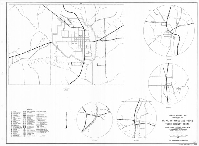
General Highway Map. Detail of Cities and Towns in Tyler County, Texas [Woodville and vicinity]
Print $20.00
General Highway Map. Detail of Cities and Towns in Tyler County, Texas [Woodville and vicinity]
1961
Size: 18.1 x 24.8 inches
79691
Tyler County Rolled Sketch 7

Print $20.00
- Digital $50.00
Tyler County Rolled Sketch 7
1960
Size: 40.0 x 46.5 inches
10030
Tyler County Sketch File 28

Print $46.00
- Digital $50.00
Tyler County Sketch File 28
1960
Size: 9.8 x 8.6 inches
38699
Tyler County Working Sketch 16

Print $20.00
- Digital $50.00
Tyler County Working Sketch 16
1960
Size: 46.0 x 41.8 inches
69486
Tyler County Working Sketch 15

Print $20.00
- Digital $50.00
Tyler County Working Sketch 15
1960
Size: 23.8 x 18.1 inches
69485
Tyler County Working Sketch 14

Print $20.00
- Digital $50.00
Tyler County Working Sketch 14
1959
Size: 24.8 x 30.9 inches
69484
Tyler County Working Sketch 13

Print $20.00
- Digital $50.00
Tyler County Working Sketch 13
1957
Size: 34.5 x 38.5 inches
69483
Tyler County Rolled Sketch 6

Print $40.00
- Digital $50.00
Tyler County Rolled Sketch 6
1956
Size: 76.1 x 43.2 inches
10029
Tyler County Sketch File 27

Print $6.00
- Digital $50.00
Tyler County Sketch File 27
1956
Size: 14.5 x 8.8 inches
38696
Tyler County Sketch File 26

Print $26.00
- Digital $50.00
Tyler County Sketch File 26
1955
Size: 14.5 x 8.8 inches
38693
Tyler County Rolled Sketch 5

Print $20.00
- Digital $50.00
Tyler County Rolled Sketch 5
1954
Size: 29.3 x 40.0 inches
8057
Tyler County Sketch File 25

Print $28.00
- Digital $50.00
Tyler County Sketch File 25
1953
Size: 14.5 x 9.0 inches
38689
Tyler County Rolled Sketch 4

Print $20.00
- Digital $50.00
Tyler County Rolled Sketch 4
1952
Size: 38.9 x 44.0 inches
10028
Hardin County Sketch File 66

Print $20.00
- Digital $50.00
Hardin County Sketch File 66
1948
Size: 19.5 x 35.8 inches
11639
Tyler County Rolled Sketch 3

Print $20.00
- Digital $50.00
Tyler County Rolled Sketch 3
1946
Size: 45.5 x 35.6 inches
10027
Tyler County Working Sketch 24
Print $20.00
- Digital $50.00
Tyler County Working Sketch 24
1989
-
Size
34.8 x 40.6 inches
-
Map/Doc
69494
-
Creation Date
1989
Tyler County Sketch File 30
Print $4.00
- Digital $50.00
Tyler County Sketch File 30
1989
-
Size
14.3 x 8.8 inches
-
Map/Doc
38721
-
Creation Date
1989
Tyler County Rolled Sketch 12
Print $20.00
- Digital $50.00
Tyler County Rolled Sketch 12
1988
-
Size
25.2 x 19.3 inches
-
Map/Doc
8060
-
Creation Date
1988
Tyler County Working Sketch 23
Print $20.00
- Digital $50.00
Tyler County Working Sketch 23
1988
-
Size
28.2 x 22.8 inches
-
Map/Doc
69493
-
Creation Date
1988
Jasper County Sketch File 36
Print $32.00
- Digital $50.00
Jasper County Sketch File 36
1987
-
Size
11.2 x 8.6 inches
-
Map/Doc
27872
-
Creation Date
1987
Tyler County Working Sketch 22
Print $20.00
- Digital $50.00
Tyler County Working Sketch 22
1987
-
Size
42.0 x 35.5 inches
-
Map/Doc
69492
-
Creation Date
1987
Tyler County Working Sketch 21
Print $20.00
- Digital $50.00
Tyler County Working Sketch 21
1985
-
Size
21.1 x 21.0 inches
-
Map/Doc
69491
-
Creation Date
1985
Tyler County Rolled Sketch 10
Print $40.00
- Digital $50.00
Tyler County Rolled Sketch 10
1982
-
Size
48.7 x 35.4 inches
-
Map/Doc
10032
-
Creation Date
1982
Tyler County Working Sketch 20
Print $20.00
- Digital $50.00
Tyler County Working Sketch 20
1982
-
Size
41.0 x 32.7 inches
-
Map/Doc
69490
-
Creation Date
1982
Tyler County Working Sketch 19
Print $20.00
- Digital $50.00
Tyler County Working Sketch 19
1967
-
Size
47.8 x 42.9 inches
-
Map/Doc
69489
-
Creation Date
1967
Tyler County Rolled Sketch 8
Print $20.00
- Digital $50.00
Tyler County Rolled Sketch 8
1965
-
Size
18.1 x 25.4 inches
-
Map/Doc
8058
-
Creation Date
1965
Tyler County Working Sketch 18
Print $20.00
- Digital $50.00
Tyler County Working Sketch 18
1965
-
Size
31.4 x 27.3 inches
-
Map/Doc
69488
-
Creation Date
1965
Tyler County Working Sketch 17
Print $20.00
- Digital $50.00
Tyler County Working Sketch 17
1962
-
Size
33.1 x 38.9 inches
-
Map/Doc
69487
-
Creation Date
1962
General Highway Map, Tyler County, Texas
Print $20.00
General Highway Map, Tyler County, Texas
1961
-
Size
24.8 x 18.1 inches
-
Map/Doc
79690
-
Creation Date
1961
General Highway Map. Detail of Cities and Towns in Tyler County, Texas [Woodville and vicinity]
Print $20.00
General Highway Map. Detail of Cities and Towns in Tyler County, Texas [Woodville and vicinity]
1961
-
Size
18.1 x 24.8 inches
-
Map/Doc
79691
-
Creation Date
1961
Tyler County Rolled Sketch 7
Print $20.00
- Digital $50.00
Tyler County Rolled Sketch 7
1960
-
Size
40.0 x 46.5 inches
-
Map/Doc
10030
-
Creation Date
1960
Tyler County Sketch File 28
Print $46.00
- Digital $50.00
Tyler County Sketch File 28
1960
-
Size
9.8 x 8.6 inches
-
Map/Doc
38699
-
Creation Date
1960
Tyler County Working Sketch 16
Print $20.00
- Digital $50.00
Tyler County Working Sketch 16
1960
-
Size
46.0 x 41.8 inches
-
Map/Doc
69486
-
Creation Date
1960
Tyler County Working Sketch 15
Print $20.00
- Digital $50.00
Tyler County Working Sketch 15
1960
-
Size
23.8 x 18.1 inches
-
Map/Doc
69485
-
Creation Date
1960
Tyler County Working Sketch 14
Print $20.00
- Digital $50.00
Tyler County Working Sketch 14
1959
-
Size
24.8 x 30.9 inches
-
Map/Doc
69484
-
Creation Date
1959
Tyler County Working Sketch 13
Print $20.00
- Digital $50.00
Tyler County Working Sketch 13
1957
-
Size
34.5 x 38.5 inches
-
Map/Doc
69483
-
Creation Date
1957
Tyler County Rolled Sketch 6
Print $40.00
- Digital $50.00
Tyler County Rolled Sketch 6
1956
-
Size
76.1 x 43.2 inches
-
Map/Doc
10029
-
Creation Date
1956
Tyler County Sketch File 27
Print $6.00
- Digital $50.00
Tyler County Sketch File 27
1956
-
Size
14.5 x 8.8 inches
-
Map/Doc
38696
-
Creation Date
1956
Tyler County Sketch File 26
Print $26.00
- Digital $50.00
Tyler County Sketch File 26
1955
-
Size
14.5 x 8.8 inches
-
Map/Doc
38693
-
Creation Date
1955
Tyler County Rolled Sketch 5
Print $20.00
- Digital $50.00
Tyler County Rolled Sketch 5
1954
-
Size
29.3 x 40.0 inches
-
Map/Doc
8057
-
Creation Date
1954
Tyler County Sketch File 25
Print $28.00
- Digital $50.00
Tyler County Sketch File 25
1953
-
Size
14.5 x 9.0 inches
-
Map/Doc
38689
-
Creation Date
1953
Tyler County Rolled Sketch 4
Print $20.00
- Digital $50.00
Tyler County Rolled Sketch 4
1952
-
Size
38.9 x 44.0 inches
-
Map/Doc
10028
-
Creation Date
1952
Hardin County Sketch File 66
Print $20.00
- Digital $50.00
Hardin County Sketch File 66
1948
-
Size
19.5 x 35.8 inches
-
Map/Doc
11639
-
Creation Date
1948
Tyler County Rolled Sketch 3
Print $20.00
- Digital $50.00
Tyler County Rolled Sketch 3
1946
-
Size
45.5 x 35.6 inches
-
Map/Doc
10027
-
Creation Date
1946
Tyler County

Print $40.00
- Digital $50.00
Tyler County
1944
-
Size
48.9 x 40.8 inches
-
Map/Doc
63083
-
Creation Date
1944