Walker County State Real Property Sketch 1

Print $20.00
- Digital $50.00
Walker County State Real Property Sketch 1
2003
Size: 35.8 x 30.3 inches
78585
Walker County Miscellaneous Sketch 1

Print $20.00
- Digital $50.00
Walker County Miscellaneous Sketch 1
2003
Size: 36.0 x 31.3 inches
88868
Walker County Working Sketch 18

Print $20.00
- Digital $50.00
Walker County Working Sketch 18
1991
Size: 29.4 x 31.5 inches
72298
Walker County Working Sketch 16

Print $20.00
- Digital $50.00
Walker County Working Sketch 16
1983
Size: 36.5 x 42.4 inches
72296
Walker County Rolled Sketch 1

Print $20.00
- Digital $50.00
Walker County Rolled Sketch 1
1982
Size: 36.3 x 23.6 inches
8154
Walker County Working Sketch 17

Print $20.00
- Digital $50.00
Walker County Working Sketch 17
1982
Size: 19.9 x 20.8 inches
72297
Grimes County Working Sketch 11

Print $20.00
- Digital $50.00
Grimes County Working Sketch 11
1981
Size: 22.7 x 22.6 inches
63302
Walker County Working Sketch 15

Print $20.00
- Digital $50.00
Walker County Working Sketch 15
1967
Size: 26.9 x 24.8 inches
72295
Madison County Rolled Sketch 1

Print $20.00
- Digital $50.00
Madison County Rolled Sketch 1
1966
Size: 36.7 x 46.0 inches
9485
Madison County Rolled Sketch 1A

Print $20.00
- Digital $50.00
Madison County Rolled Sketch 1A
1966
Size: 36.1 x 45.5 inches
9486
General Highway Map, Walker County, Texas

Print $20.00
General Highway Map, Walker County, Texas
1961
Size: 24.7 x 18.1 inches
79698
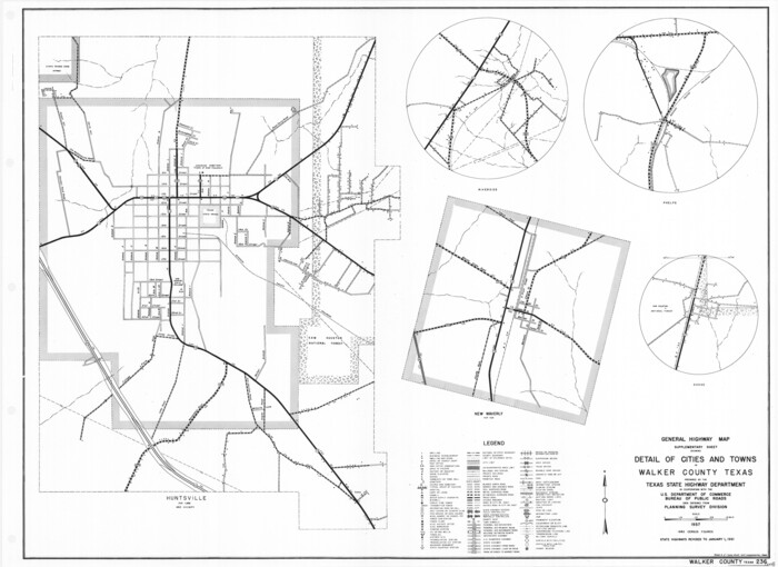
General Highway Map. Detail of Cities and Towns in Walker County, Texas [Huntsville and vicinity]
Print $20.00
General Highway Map. Detail of Cities and Towns in Walker County, Texas [Huntsville and vicinity]
1961
Size: 18.1 x 24.8 inches
79699
Houston County Rolled Sketch 5

Print $20.00
- Digital $50.00
Houston County Rolled Sketch 5
1960
Size: 28.3 x 40.8 inches
6227
Walker County Working Sketch 14

Print $40.00
- Digital $50.00
Walker County Working Sketch 14
1958
Size: 19.8 x 51.0 inches
72294
Walker County Working Sketch 13

Print $20.00
- Digital $50.00
Walker County Working Sketch 13
1950
Size: 18.0 x 16.6 inches
72293
Grimes County Working Sketch 5

Print $40.00
- Digital $50.00
Grimes County Working Sketch 5
1949
Size: 43.6 x 83.2 inches
63296
San Jacinto County Rolled Sketch 12

Print $20.00
- Digital $50.00
San Jacinto County Rolled Sketch 12
1948
Size: 24.2 x 32.5 inches
7561
Walker County Sketch File 8

Print $4.00
- Digital $50.00
Walker County Sketch File 8
1944
Size: 9.7 x 6.8 inches
39561
Walker County Working Sketch Graphic Index

Print $20.00
- Digital $50.00
Walker County Working Sketch Graphic Index
1944
Size: 43.3 x 36.8 inches
76729
Walker County Working Sketch 12

Print $20.00
- Digital $50.00
Walker County Working Sketch 12
1943
Size: 23.1 x 32.9 inches
72292
General Highway Map, Walker County, Texas

Print $20.00
General Highway Map, Walker County, Texas
1940
Size: 24.9 x 18.4 inches
79269
Huntsville State Park

Print $20.00
- Digital $50.00
Huntsville State Park
1937
Size: 24.1 x 34.8 inches
2077
San Jacinto River, Proposed Dam Site/Huntsville State Park

Print $6.00
- Digital $50.00
San Jacinto River, Proposed Dam Site/Huntsville State Park
1937
Size: 30.2 x 26.6 inches
65151
Walker County Working Sketch 10

Print $20.00
- Digital $50.00
Walker County Working Sketch 10
1935
Size: 19.3 x 19.9 inches
72290
San Jacinto County Working Sketch 13

Print $20.00
- Digital $50.00
San Jacinto County Working Sketch 13
1935
Size: 25.0 x 18.8 inches
63726
Walker County Working Sketch 9

Print $20.00
- Digital $50.00
Walker County Working Sketch 9
1935
Size: 23.7 x 27.0 inches
72289
Walker County State Real Property Sketch 1
Print $20.00
- Digital $50.00
Walker County State Real Property Sketch 1
2003
-
Size
35.8 x 30.3 inches
-
Map/Doc
78585
-
Creation Date
2003
Walker County Miscellaneous Sketch 1
Print $20.00
- Digital $50.00
Walker County Miscellaneous Sketch 1
2003
-
Size
36.0 x 31.3 inches
-
Map/Doc
88868
-
Creation Date
2003
Walker County Working Sketch 18
Print $20.00
- Digital $50.00
Walker County Working Sketch 18
1991
-
Size
29.4 x 31.5 inches
-
Map/Doc
72298
-
Creation Date
1991
Walker County Working Sketch 16
Print $20.00
- Digital $50.00
Walker County Working Sketch 16
1983
-
Size
36.5 x 42.4 inches
-
Map/Doc
72296
-
Creation Date
1983
Walker County Rolled Sketch 1
Print $20.00
- Digital $50.00
Walker County Rolled Sketch 1
1982
-
Size
36.3 x 23.6 inches
-
Map/Doc
8154
-
Creation Date
1982
Walker County Working Sketch 17
Print $20.00
- Digital $50.00
Walker County Working Sketch 17
1982
-
Size
19.9 x 20.8 inches
-
Map/Doc
72297
-
Creation Date
1982
Grimes County Working Sketch 11
Print $20.00
- Digital $50.00
Grimes County Working Sketch 11
1981
-
Size
22.7 x 22.6 inches
-
Map/Doc
63302
-
Creation Date
1981
Walker County Working Sketch 15
Print $20.00
- Digital $50.00
Walker County Working Sketch 15
1967
-
Size
26.9 x 24.8 inches
-
Map/Doc
72295
-
Creation Date
1967
Madison County Rolled Sketch 1
Print $20.00
- Digital $50.00
Madison County Rolled Sketch 1
1966
-
Size
36.7 x 46.0 inches
-
Map/Doc
9485
-
Creation Date
1966
Madison County Rolled Sketch 1A
Print $20.00
- Digital $50.00
Madison County Rolled Sketch 1A
1966
-
Size
36.1 x 45.5 inches
-
Map/Doc
9486
-
Creation Date
1966
General Highway Map, Walker County, Texas
Print $20.00
General Highway Map, Walker County, Texas
1961
-
Size
24.7 x 18.1 inches
-
Map/Doc
79698
-
Creation Date
1961
General Highway Map. Detail of Cities and Towns in Walker County, Texas [Huntsville and vicinity]
Print $20.00
General Highway Map. Detail of Cities and Towns in Walker County, Texas [Huntsville and vicinity]
1961
-
Size
18.1 x 24.8 inches
-
Map/Doc
79699
-
Creation Date
1961
Houston County Rolled Sketch 5
Print $20.00
- Digital $50.00
Houston County Rolled Sketch 5
1960
-
Size
28.3 x 40.8 inches
-
Map/Doc
6227
-
Creation Date
1960
Walker County Working Sketch 14
Print $40.00
- Digital $50.00
Walker County Working Sketch 14
1958
-
Size
19.8 x 51.0 inches
-
Map/Doc
72294
-
Creation Date
1958
Walker County Working Sketch 13
Print $20.00
- Digital $50.00
Walker County Working Sketch 13
1950
-
Size
18.0 x 16.6 inches
-
Map/Doc
72293
-
Creation Date
1950
Grimes County Working Sketch 5
Print $40.00
- Digital $50.00
Grimes County Working Sketch 5
1949
-
Size
43.6 x 83.2 inches
-
Map/Doc
63296
-
Creation Date
1949
San Jacinto County Rolled Sketch 12
Print $20.00
- Digital $50.00
San Jacinto County Rolled Sketch 12
1948
-
Size
24.2 x 32.5 inches
-
Map/Doc
7561
-
Creation Date
1948
Walker County

Print $20.00
- Digital $50.00
Walker County
1944
-
Size
44.8 x 38.5 inches
-
Map/Doc
63106
-
Creation Date
1944
Walker County

Print $20.00
- Digital $50.00
Walker County
1944
-
Size
45.7 x 38.4 inches
-
Map/Doc
73314
-
Creation Date
1944
Walker County

Print $20.00
- Digital $50.00
Walker County
1944
-
Size
40.4 x 34.4 inches
-
Map/Doc
77448
-
Creation Date
1944
Walker County

Print $20.00
- Digital $50.00
Walker County
1944
-
Size
46.1 x 38.2 inches
-
Map/Doc
95664
-
Creation Date
1944
Walker County Sketch File 8
Print $4.00
- Digital $50.00
Walker County Sketch File 8
1944
-
Size
9.7 x 6.8 inches
-
Map/Doc
39561
-
Creation Date
1944
Walker County Working Sketch Graphic Index
Print $20.00
- Digital $50.00
Walker County Working Sketch Graphic Index
1944
-
Size
43.3 x 36.8 inches
-
Map/Doc
76729
-
Creation Date
1944
Walker County Working Sketch 12
Print $20.00
- Digital $50.00
Walker County Working Sketch 12
1943
-
Size
23.1 x 32.9 inches
-
Map/Doc
72292
-
Creation Date
1943
General Highway Map, Walker County, Texas
Print $20.00
General Highway Map, Walker County, Texas
1940
-
Size
24.9 x 18.4 inches
-
Map/Doc
79269
-
Creation Date
1940
Huntsville State Park
Print $20.00
- Digital $50.00
Huntsville State Park
1937
-
Size
24.1 x 34.8 inches
-
Map/Doc
2077
-
Creation Date
1937
San Jacinto River, Proposed Dam Site/Huntsville State Park
Print $6.00
- Digital $50.00
San Jacinto River, Proposed Dam Site/Huntsville State Park
1937
-
Size
30.2 x 26.6 inches
-
Map/Doc
65151
-
Creation Date
1937
Walker County Working Sketch 10
Print $20.00
- Digital $50.00
Walker County Working Sketch 10
1935
-
Size
19.3 x 19.9 inches
-
Map/Doc
72290
-
Creation Date
1935
San Jacinto County Working Sketch 13
Print $20.00
- Digital $50.00
San Jacinto County Working Sketch 13
1935
-
Size
25.0 x 18.8 inches
-
Map/Doc
63726
-
Creation Date
1935
Walker County Working Sketch 9
Print $20.00
- Digital $50.00
Walker County Working Sketch 9
1935
-
Size
23.7 x 27.0 inches
-
Map/Doc
72289
-
Creation Date
1935