Atlas T - Titles to Frontier Settlers issued by the Commissioner Carlos S. Taylor

Atlas T - Titles to Frontier Settlers issued by the Commissioner Carlos S. Taylor
1834
94536
Caney Cr. of East San Jacinto

Print $2.00
- Digital $50.00
Caney Cr. of East San Jacinto
Size: 5.3 x 6.7 inches
69745
English Field Notes of the Spanish Archives - Book 4 & W

English Field Notes of the Spanish Archives - Book 4 & W
1836
96530
English Field Notes of the Spanish Archives - Book 6

English Field Notes of the Spanish Archives - Book 6
1836
96532
English Field Notes of the Spanish Archives - Book J. Strode

English Field Notes of the Spanish Archives - Book J. Strode
1835
96549
English Field Notes of the Spanish Archives - Books DB3 & WR

English Field Notes of the Spanish Archives - Books DB3 & WR
1835
96548
English Field Notes of the Spanish Archives - Books DBE, WBPS, GAN, WB3, and X

English Field Notes of the Spanish Archives - Books DBE, WBPS, GAN, WB3, and X
1835
96546
English Field Notes of the Spanish Archives - Books JMH, MCMCHB, TGI

English Field Notes of the Spanish Archives - Books JMH, MCMCHB, TGI
1835
96547
English Field Notes of the Spanish Archives - Books R & MC

English Field Notes of the Spanish Archives - Books R & MC
1835
96552
General Highway Map, Walker County, Texas

Print $20.00
General Highway Map, Walker County, Texas
1940
Size: 24.9 x 18.4 inches
79269
General Highway Map, Walker County, Texas

Print $20.00
General Highway Map, Walker County, Texas
1961
Size: 24.7 x 18.1 inches
79698
General Highway Map. Detail of Cities and Towns in Walker County, Texas [Huntsville and vicinity]
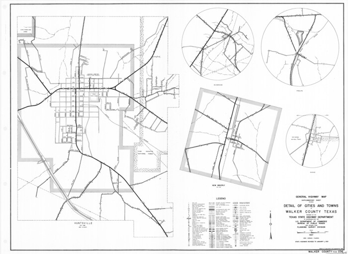
Print $20.00
General Highway Map. Detail of Cities and Towns in Walker County, Texas [Huntsville and vicinity]
1961
Size: 18.1 x 24.8 inches
79699
Grimes County Sketch File 3

Print $20.00
- Digital $50.00
Grimes County Sketch File 3
1871
Size: 10.6 x 12.1 inches
24626
Grimes County Sketch File 5

Print $4.00
- Digital $50.00
Grimes County Sketch File 5
1881
Size: 9.2 x 8.3 inches
24642
Grimes County Working Sketch 11

Print $20.00
- Digital $50.00
Grimes County Working Sketch 11
1981
Size: 22.7 x 22.6 inches
63302
Grimes County Working Sketch 5

Print $40.00
- Digital $50.00
Grimes County Working Sketch 5
1949
Size: 43.6 x 83.2 inches
63296
Houston County Rolled Sketch 5

Print $20.00
- Digital $50.00
Houston County Rolled Sketch 5
1960
Size: 28.3 x 40.8 inches
6227
Houston County Sketch File 26

Print $4.00
- Digital $50.00
Houston County Sketch File 26
1873
Size: 8.0 x 6.8 inches
26800
Huntsville State Park

Print $20.00
- Digital $50.00
Huntsville State Park
1937
Size: 24.1 x 34.8 inches
2077
Madison County Rolled Sketch 1

Print $20.00
- Digital $50.00
Madison County Rolled Sketch 1
1966
Size: 36.7 x 46.0 inches
9485
Madison County Rolled Sketch 1A

Print $20.00
- Digital $50.00
Madison County Rolled Sketch 1A
1966
Size: 36.1 x 45.5 inches
9486
Map of Ellis Farm Unit, Texas Department of Corrections, Walker County, Texas

Print $20.00
- Digital $50.00
Map of Ellis Farm Unit, Texas Department of Corrections, Walker County, Texas
Size: 36.3 x 27.1 inches
2284
Map of Prison Properties in Vicinity of Huntsville, Walker County, Texas

Print $20.00
- Digital $50.00
Map of Prison Properties in Vicinity of Huntsville, Walker County, Texas
1933
Size: 36.6 x 43.0 inches
62992
Map of Prison Property in Walker County, Texas

Print $20.00
- Digital $50.00
Map of Prison Property in Walker County, Texas
Size: 37.6 x 42.9 inches
62993
Map of Walker County

Print $20.00
- Digital $50.00
Map of Walker County
1858
Size: 22.9 x 34.1 inches
4120
Map of Walker County, Texas

Print $20.00
- Digital $50.00
Map of Walker County, Texas
1879
Size: 19.9 x 16.6 inches
655
Map showing location of Texas Prison Farms surveyed for the Texas Prison System

Print $20.00
- Digital $50.00
Map showing location of Texas Prison Farms surveyed for the Texas Prison System
1934
Size: 15.6 x 12.3 inches
94277
Montgomery County Sketch File 11

Print $4.00
- Digital $50.00
Montgomery County Sketch File 11
1872
Size: 6.7 x 7.9 inches
31800
Montgomery County Sketch File 13

Print $40.00
- Digital $50.00
Montgomery County Sketch File 13
1900
Size: 17.8 x 14.8 inches
31803
Montgomery County Sketch File 37

Print $6.00
- Digital $50.00
Montgomery County Sketch File 37
Size: 12.6 x 8.2 inches
31916
Atlas T - Titles to Frontier Settlers issued by the Commissioner Carlos S. Taylor
Atlas T - Titles to Frontier Settlers issued by the Commissioner Carlos S. Taylor
1834
-
Map/Doc
94536
-
Creation Date
1834
Caney Cr. of East San Jacinto
Print $2.00
- Digital $50.00
Caney Cr. of East San Jacinto
-
Size
5.3 x 6.7 inches
-
Map/Doc
69745
English Field Notes of the Spanish Archives - Book 4 & W
English Field Notes of the Spanish Archives - Book 4 & W
1836
-
Map/Doc
96530
-
Creation Date
1836
English Field Notes of the Spanish Archives - Book 6
English Field Notes of the Spanish Archives - Book 6
1836
-
Map/Doc
96532
-
Creation Date
1836
English Field Notes of the Spanish Archives - Book J. Strode
English Field Notes of the Spanish Archives - Book J. Strode
1835
-
Map/Doc
96549
-
Creation Date
1835
English Field Notes of the Spanish Archives - Books DB3 & WR
English Field Notes of the Spanish Archives - Books DB3 & WR
1835
-
Map/Doc
96548
-
Creation Date
1835
English Field Notes of the Spanish Archives - Books DBE, WBPS, GAN, WB3, and X
English Field Notes of the Spanish Archives - Books DBE, WBPS, GAN, WB3, and X
1835
-
Map/Doc
96546
-
Creation Date
1835
English Field Notes of the Spanish Archives - Books JMH, MCMCHB, TGI
English Field Notes of the Spanish Archives - Books JMH, MCMCHB, TGI
1835
-
Map/Doc
96547
-
Creation Date
1835
English Field Notes of the Spanish Archives - Books R & MC
English Field Notes of the Spanish Archives - Books R & MC
1835
-
Map/Doc
96552
-
Creation Date
1835
General Highway Map, Walker County, Texas
Print $20.00
General Highway Map, Walker County, Texas
1940
-
Size
24.9 x 18.4 inches
-
Map/Doc
79269
-
Creation Date
1940
General Highway Map, Walker County, Texas
Print $20.00
General Highway Map, Walker County, Texas
1961
-
Size
24.7 x 18.1 inches
-
Map/Doc
79698
-
Creation Date
1961
General Highway Map. Detail of Cities and Towns in Walker County, Texas [Huntsville and vicinity]
Print $20.00
General Highway Map. Detail of Cities and Towns in Walker County, Texas [Huntsville and vicinity]
1961
-
Size
18.1 x 24.8 inches
-
Map/Doc
79699
-
Creation Date
1961
Grimes County Sketch File 3
Print $20.00
- Digital $50.00
Grimes County Sketch File 3
1871
-
Size
10.6 x 12.1 inches
-
Map/Doc
24626
-
Creation Date
1871
Grimes County Sketch File 5
Print $4.00
- Digital $50.00
Grimes County Sketch File 5
1881
-
Size
9.2 x 8.3 inches
-
Map/Doc
24642
-
Creation Date
1881
Grimes County Working Sketch 11
Print $20.00
- Digital $50.00
Grimes County Working Sketch 11
1981
-
Size
22.7 x 22.6 inches
-
Map/Doc
63302
-
Creation Date
1981
Grimes County Working Sketch 5
Print $40.00
- Digital $50.00
Grimes County Working Sketch 5
1949
-
Size
43.6 x 83.2 inches
-
Map/Doc
63296
-
Creation Date
1949
Houston County Rolled Sketch 5
Print $20.00
- Digital $50.00
Houston County Rolled Sketch 5
1960
-
Size
28.3 x 40.8 inches
-
Map/Doc
6227
-
Creation Date
1960
Houston County Sketch File 26
Print $4.00
- Digital $50.00
Houston County Sketch File 26
1873
-
Size
8.0 x 6.8 inches
-
Map/Doc
26800
-
Creation Date
1873
Huntsville State Park
Print $20.00
- Digital $50.00
Huntsville State Park
1937
-
Size
24.1 x 34.8 inches
-
Map/Doc
2077
-
Creation Date
1937
Madison County Rolled Sketch 1
Print $20.00
- Digital $50.00
Madison County Rolled Sketch 1
1966
-
Size
36.7 x 46.0 inches
-
Map/Doc
9485
-
Creation Date
1966
Madison County Rolled Sketch 1A
Print $20.00
- Digital $50.00
Madison County Rolled Sketch 1A
1966
-
Size
36.1 x 45.5 inches
-
Map/Doc
9486
-
Creation Date
1966
Map of Ellis Farm Unit, Texas Department of Corrections, Walker County, Texas
Print $20.00
- Digital $50.00
Map of Ellis Farm Unit, Texas Department of Corrections, Walker County, Texas
-
Size
36.3 x 27.1 inches
-
Map/Doc
2284
Map of Prison Properties in Vicinity of Huntsville, Walker County, Texas
Print $20.00
- Digital $50.00
Map of Prison Properties in Vicinity of Huntsville, Walker County, Texas
1933
-
Size
36.6 x 43.0 inches
-
Map/Doc
62992
-
Creation Date
1933
Map of Prison Property in Walker County, Texas
Print $20.00
- Digital $50.00
Map of Prison Property in Walker County, Texas
-
Size
37.6 x 42.9 inches
-
Map/Doc
62993
Map of Walker County
Print $20.00
- Digital $50.00
Map of Walker County
1858
-
Size
22.9 x 34.1 inches
-
Map/Doc
4120
-
Creation Date
1858
Map of Walker County, Texas
Print $20.00
- Digital $50.00
Map of Walker County, Texas
1879
-
Size
19.9 x 16.6 inches
-
Map/Doc
655
-
Creation Date
1879
Map showing location of Texas Prison Farms surveyed for the Texas Prison System
Print $20.00
- Digital $50.00
Map showing location of Texas Prison Farms surveyed for the Texas Prison System
1934
-
Size
15.6 x 12.3 inches
-
Map/Doc
94277
-
Creation Date
1934
Montgomery County Sketch File 11
Print $4.00
- Digital $50.00
Montgomery County Sketch File 11
1872
-
Size
6.7 x 7.9 inches
-
Map/Doc
31800
-
Creation Date
1872
Montgomery County Sketch File 13
Print $40.00
- Digital $50.00
Montgomery County Sketch File 13
1900
-
Size
17.8 x 14.8 inches
-
Map/Doc
31803
-
Creation Date
1900
Montgomery County Sketch File 37
Print $6.00
- Digital $50.00
Montgomery County Sketch File 37
-
Size
12.6 x 8.2 inches
-
Map/Doc
31916