Ward County Rolled Sketch A

Print $40.00
- Digital $50.00
Ward County Rolled Sketch A
Size: 42.6 x 56.3 inches
10099
Ward County Rolled Sketch 4

Print $20.00
- Digital $50.00
Ward County Rolled Sketch 4
Size: 39.3 x 47.2 inches
10102
Winkler County Sketch File 3

Print $20.00
- Digital $50.00
Winkler County Sketch File 3
Size: 38.6 x 33.8 inches
10436
Winkler County Sketch File 13

Print $20.00
- Digital $50.00
Winkler County Sketch File 13
Size: 15.9 x 19.7 inches
12697
Winkler County Sketch File 14

Print $20.00
- Digital $50.00
Winkler County Sketch File 14
Size: 29.4 x 24.3 inches
12698
Winkler County Sketch File 4

Print $8.00
- Digital $50.00
Winkler County Sketch File 4
Size: 14.3 x 8.8 inches
40463

Revised Sectional Map No. 3 showing land surveys in counties of Loving, Reeves and Culberson and portions of Winkler, Ward, Pecos and Jeff Davis, Texas

Print $20.00
- Digital $50.00
Revised Sectional Map No. 3 showing land surveys in counties of Loving, Reeves and Culberson and portions of Winkler, Ward, Pecos and Jeff Davis, Texas
Size: 19.0 x 24.7 inches
4478
Revised Sectional Map showing land surveys in counties of Loving and Reeves

Print $20.00
- Digital $50.00
Revised Sectional Map showing land surveys in counties of Loving and Reeves
Size: 18.0 x 17.7 inches
5053
University Lands Blocks 1 to 11 Andrews-Martin-Gaines-Dawson-Winkler Counties

Print $6.00
- Digital $50.00
University Lands Blocks 1 to 11 Andrews-Martin-Gaines-Dawson-Winkler Counties
Size: 30.9 x 35.3 inches
62930
University Land, Winkler-Andrews-Gaines-Dawson-Martin Counties

Print $40.00
- Digital $50.00
University Land, Winkler-Andrews-Gaines-Dawson-Martin Counties
Size: 42.8 x 53.2 inches
62931
Reeves County Rolled Sketch 6

Print $20.00
- Digital $50.00
Reeves County Rolled Sketch 6
Size: 22.6 x 29.0 inches
7478
Texas Coordinate File 5

Print $4.00
- Digital $50.00
Texas Coordinate File 5
Size: 11.2 x 8.7 inches
75312
Lands of Gunter & Munson and Maddox Bros. & Anderson, Tom Green Co. Tex.

Print $20.00
- Digital $50.00
Lands of Gunter & Munson and Maddox Bros. & Anderson, Tom Green Co. Tex.
Size: 20.4 x 30.7 inches
75787
Andrews County Rolled Sketch 42

Print $20.00
- Digital $50.00
Andrews County Rolled Sketch 42
Size: 27.3 x 36.0 inches
77182
PSL Field Notes for Block B13 in Crane, Ector, Ward, and Winkler Counties, Blocks B14 and B16 in Crane and Ector Counties, Blocks B7 and B8 in Ector and Winkler Counties and Block B15 in Ector County

PSL Field Notes for Block B13 in Crane, Ector, Ward, and Winkler Counties, Blocks B14 and B16 in Crane and Ector Counties, Blocks B7 and B8 in Ector and Winkler Counties and Block B15 in Ector County
81651
State University and PSL Blocks 1 through 77 in Andrews, Culberson, Crane, Ector, El Paso, Gaines, Loving, Martin, Reeves, Tom Green, Ward County, and Winkler Counties

State University and PSL Blocks 1 through 77 in Andrews, Culberson, Crane, Ector, El Paso, Gaines, Loving, Martin, Reeves, Tom Green, Ward County, and Winkler Counties
81652
PSL Field Notes for Block B9 in Ector and Winkler Counties, Block B13 in Ector, Ward, and Winkler Counties, and Blocks A55, A56, A57, B1, B2, B3, B5, B6, B7, B10, B11, and B12 in Winkler County

PSL Field Notes for Block B9 in Ector and Winkler Counties, Block B13 in Ector, Ward, and Winkler Counties, and Blocks A55, A56, A57, B1, B2, B3, B5, B6, B7, B10, B11, and B12 in Winkler County
81676
PSL Field Notes for Block C24 in Loving and Winkler Counties, and Blocks C22 and C23 in Winkler County

PSL Field Notes for Block C24 in Loving and Winkler Counties, and Blocks C22 and C23 in Winkler County
81677
PSL Field Notes for Blocks 26 and 27 in Winkler County

PSL Field Notes for Blocks 26 and 27 in Winkler County
81678
PSL Field Notes for Blocks 77, B2, B3, and A56 in Winkler County

PSL Field Notes for Blocks 77, B2, B3, and A56 in Winkler County
81679
PSL Field Notes for Block C24 in Loving and Winkler Counties, and Blocks C25, C26, and C27 in Loving County

PSL Field Notes for Block C24 in Loving and Winkler Counties, and Blocks C25, C26, and C27 in Loving County
81680
University Land Field Notes for Block 19 in Loving and Ward Counties, Block 20 in Loving, Ward, and Winkler Counties, Blocks 16 and 18 in Ward County, Block 17 in Ward and Winkler Counties, and Block 21 in Winkler County

University Land Field Notes for Block 19 in Loving and Ward Counties, Block 20 in Loving, Ward, and Winkler Counties, Blocks 16 and 18 in Ward County, Block 17 in Ward and Winkler Counties, and Block 21 in Winkler County
81709
Winkler County Rolled Sketch 14

Print $20.00
- Digital $50.00
Winkler County Rolled Sketch 14
Size: 25.9 x 38.4 inches
8275
[Sketch showing Blocks B17-B29 and vicinity]
Print $40.00
- Digital $50.00
[Sketch showing Blocks B17-B29 and vicinity]
Size: 61.8 x 28.6 inches
89732
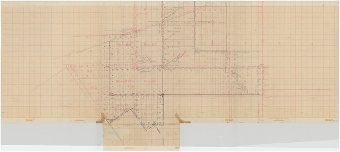
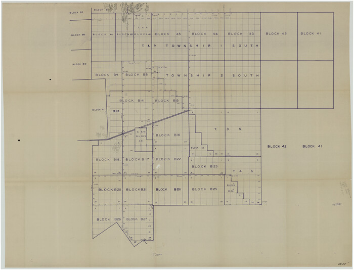
[T. & P. "B" Blocks, Tsp. 1S, Tsp. 2S, Tsp. 3S. And Tsp. 4S]
Print $40.00
- Digital $50.00
[T. & P. "B" Blocks, Tsp. 1S, Tsp. 2S, Tsp. 3S. And Tsp. 4S]
Size: 56.1 x 43.3 inches
89774
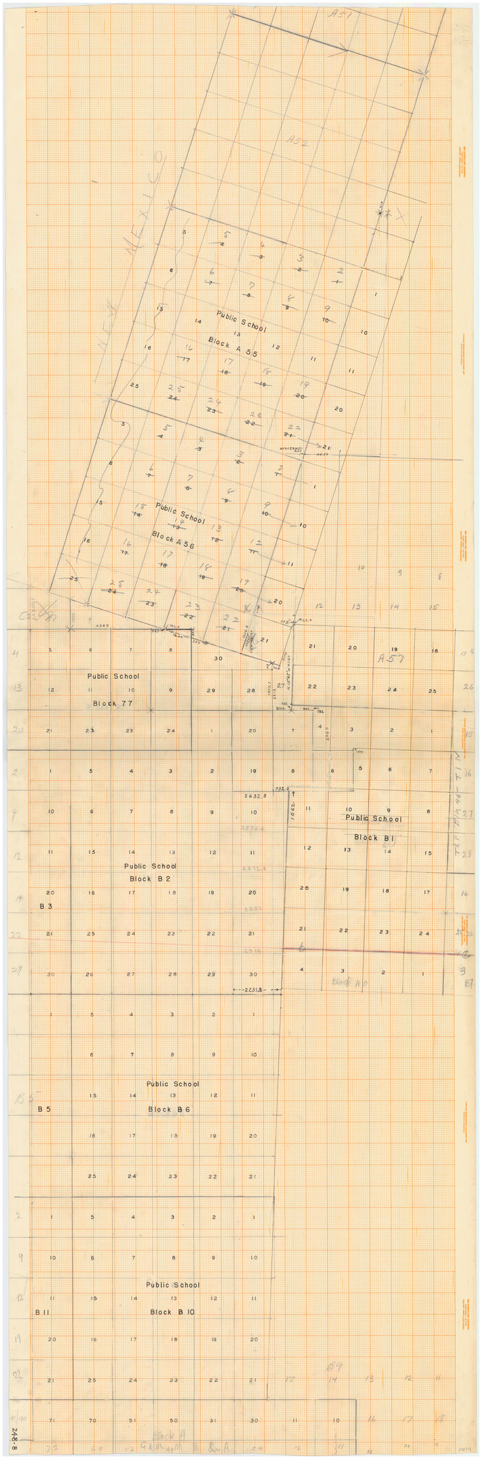
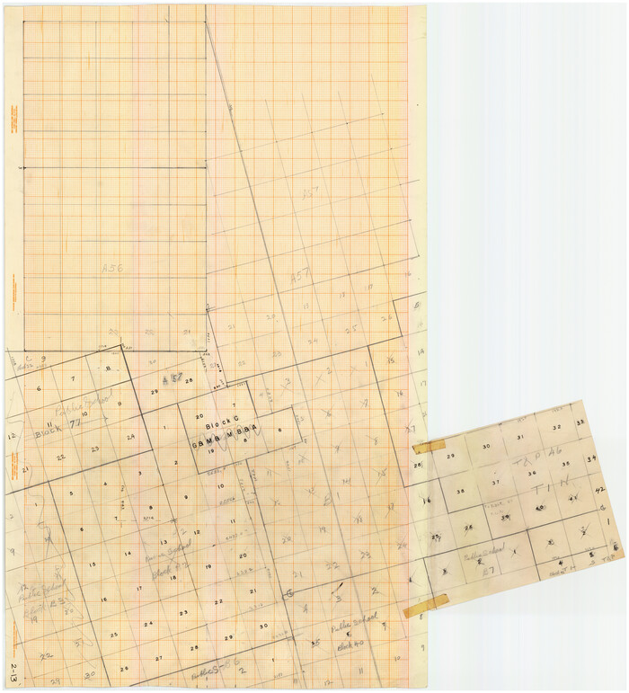
[PSL Blks. A55, A56, 77, B1, B2, B6 and and B10]
Print $40.00
- Digital $50.00
[PSL Blks. A55, A56, 77, B1, B2, B6 and and B10]
Size: 24.0 x 69.3 inches
89821
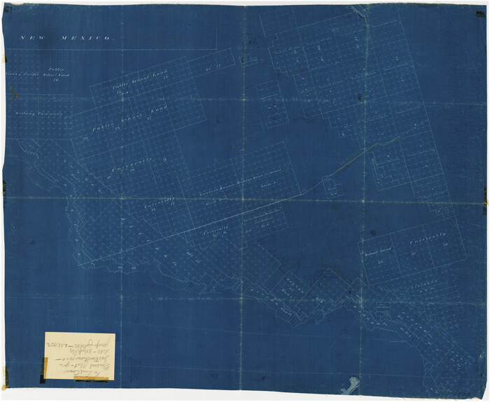
[Sketch showing unsurveyed land in West Texas as of 1902]
Print $20.00
- Digital $50.00
[Sketch showing unsurveyed land in West Texas as of 1902]
Size: 42.0 x 34.0 inches
89937
[PSL Blocks A57, 77; B1-B3, T. & P. Block 46, T-1-N]
Print $20.00
- Digital $50.00
[PSL Blocks A57, 77; B1-B3, T. & P. Block 46, T-1-N]
Size: 33.4 x 36.1 inches
90167
Ward County Rolled Sketch A
Print $40.00
- Digital $50.00
Ward County Rolled Sketch A
-
Size
42.6 x 56.3 inches
-
Map/Doc
10099
Ward County Rolled Sketch 4
Print $20.00
- Digital $50.00
Ward County Rolled Sketch 4
-
Size
39.3 x 47.2 inches
-
Map/Doc
10102
Winkler County Sketch File 3
Print $20.00
- Digital $50.00
Winkler County Sketch File 3
-
Size
38.6 x 33.8 inches
-
Map/Doc
10436
Winkler County Sketch File 13
Print $20.00
- Digital $50.00
Winkler County Sketch File 13
-
Size
15.9 x 19.7 inches
-
Map/Doc
12697
Winkler County Sketch File 14
Print $20.00
- Digital $50.00
Winkler County Sketch File 14
-
Size
29.4 x 24.3 inches
-
Map/Doc
12698
Winkler County Sketch File 4
Print $8.00
- Digital $50.00
Winkler County Sketch File 4
-
Size
14.3 x 8.8 inches
-
Map/Doc
40463
Revised Sectional Map No. 3 showing land surveys in counties of Loving, Reeves and Culberson and portions of Winkler, Ward, Pecos and Jeff Davis, Texas
Print $20.00
- Digital $50.00
Revised Sectional Map No. 3 showing land surveys in counties of Loving, Reeves and Culberson and portions of Winkler, Ward, Pecos and Jeff Davis, Texas
-
Size
19.0 x 24.7 inches
-
Map/Doc
4478
Revised Sectional Map showing land surveys in counties of Loving and Reeves
Print $20.00
- Digital $50.00
Revised Sectional Map showing land surveys in counties of Loving and Reeves
-
Size
18.0 x 17.7 inches
-
Map/Doc
5053
University Lands Blocks 1 to 11 Andrews-Martin-Gaines-Dawson-Winkler Counties
Print $6.00
- Digital $50.00
University Lands Blocks 1 to 11 Andrews-Martin-Gaines-Dawson-Winkler Counties
-
Size
30.9 x 35.3 inches
-
Map/Doc
62930
University Land, Winkler-Andrews-Gaines-Dawson-Martin Counties
Print $40.00
- Digital $50.00
University Land, Winkler-Andrews-Gaines-Dawson-Martin Counties
-
Size
42.8 x 53.2 inches
-
Map/Doc
62931
Reeves County Rolled Sketch 6
Print $20.00
- Digital $50.00
Reeves County Rolled Sketch 6
-
Size
22.6 x 29.0 inches
-
Map/Doc
7478
Texas Coordinate File 5
Print $4.00
- Digital $50.00
Texas Coordinate File 5
-
Size
11.2 x 8.7 inches
-
Map/Doc
75312
Lands of Gunter & Munson and Maddox Bros. & Anderson, Tom Green Co. Tex.
Print $20.00
- Digital $50.00
Lands of Gunter & Munson and Maddox Bros. & Anderson, Tom Green Co. Tex.
-
Size
20.4 x 30.7 inches
-
Map/Doc
75787
Andrews County Rolled Sketch 42
Print $20.00
- Digital $50.00
Andrews County Rolled Sketch 42
-
Size
27.3 x 36.0 inches
-
Map/Doc
77182
PSL Field Notes for Block B13 in Crane, Ector, Ward, and Winkler Counties, Blocks B14 and B16 in Crane and Ector Counties, Blocks B7 and B8 in Ector and Winkler Counties and Block B15 in Ector County
PSL Field Notes for Block B13 in Crane, Ector, Ward, and Winkler Counties, Blocks B14 and B16 in Crane and Ector Counties, Blocks B7 and B8 in Ector and Winkler Counties and Block B15 in Ector County
-
Map/Doc
81651
State University and PSL Blocks 1 through 77 in Andrews, Culberson, Crane, Ector, El Paso, Gaines, Loving, Martin, Reeves, Tom Green, Ward County, and Winkler Counties
State University and PSL Blocks 1 through 77 in Andrews, Culberson, Crane, Ector, El Paso, Gaines, Loving, Martin, Reeves, Tom Green, Ward County, and Winkler Counties
-
Map/Doc
81652
PSL Field Notes for Block B9 in Ector and Winkler Counties, Block B13 in Ector, Ward, and Winkler Counties, and Blocks A55, A56, A57, B1, B2, B3, B5, B6, B7, B10, B11, and B12 in Winkler County
PSL Field Notes for Block B9 in Ector and Winkler Counties, Block B13 in Ector, Ward, and Winkler Counties, and Blocks A55, A56, A57, B1, B2, B3, B5, B6, B7, B10, B11, and B12 in Winkler County
-
Map/Doc
81676
PSL Field Notes for Block C24 in Loving and Winkler Counties, and Blocks C22 and C23 in Winkler County
PSL Field Notes for Block C24 in Loving and Winkler Counties, and Blocks C22 and C23 in Winkler County
-
Map/Doc
81677
PSL Field Notes for Blocks 26 and 27 in Winkler County
PSL Field Notes for Blocks 26 and 27 in Winkler County
-
Map/Doc
81678
PSL Field Notes for Blocks 77, B2, B3, and A56 in Winkler County
PSL Field Notes for Blocks 77, B2, B3, and A56 in Winkler County
-
Map/Doc
81679
PSL Field Notes for Block C24 in Loving and Winkler Counties, and Blocks C25, C26, and C27 in Loving County
PSL Field Notes for Block C24 in Loving and Winkler Counties, and Blocks C25, C26, and C27 in Loving County
-
Map/Doc
81680
University Land Field Notes for Block 19 in Loving and Ward Counties, Block 20 in Loving, Ward, and Winkler Counties, Blocks 16 and 18 in Ward County, Block 17 in Ward and Winkler Counties, and Block 21 in Winkler County
University Land Field Notes for Block 19 in Loving and Ward Counties, Block 20 in Loving, Ward, and Winkler Counties, Blocks 16 and 18 in Ward County, Block 17 in Ward and Winkler Counties, and Block 21 in Winkler County
-
Map/Doc
81709
Winkler County Rolled Sketch 14
Print $20.00
- Digital $50.00
Winkler County Rolled Sketch 14
-
Size
25.9 x 38.4 inches
-
Map/Doc
8275
[Sketch showing Blocks B17-B29 and vicinity]
Print $40.00
- Digital $50.00
[Sketch showing Blocks B17-B29 and vicinity]
-
Size
61.8 x 28.6 inches
-
Map/Doc
89732
[T. & P. "B" Blocks, Tsp. 1S, Tsp. 2S, Tsp. 3S. And Tsp. 4S]
Print $40.00
- Digital $50.00
[T. & P. "B" Blocks, Tsp. 1S, Tsp. 2S, Tsp. 3S. And Tsp. 4S]
-
Size
56.1 x 43.3 inches
-
Map/Doc
89774
[PSL Blks. A55, A56, 77, B1, B2, B6 and and B10]
Print $40.00
- Digital $50.00
[PSL Blks. A55, A56, 77, B1, B2, B6 and and B10]
-
Size
24.0 x 69.3 inches
-
Map/Doc
89821
[Sketch showing unsurveyed land in West Texas as of 1902]
Print $20.00
- Digital $50.00
[Sketch showing unsurveyed land in West Texas as of 1902]
-
Size
42.0 x 34.0 inches
-
Map/Doc
89937
Loving County Boundary File 2

Print $40.00
- Digital $50.00
Loving County Boundary File 2
-
Map/Doc
90033
[PSL Blocks A57, 77; B1-B3, T. & P. Block 46, T-1-N]
Print $20.00
- Digital $50.00
[PSL Blocks A57, 77; B1-B3, T. & P. Block 46, T-1-N]
-
Size
33.4 x 36.1 inches
-
Map/Doc
90167