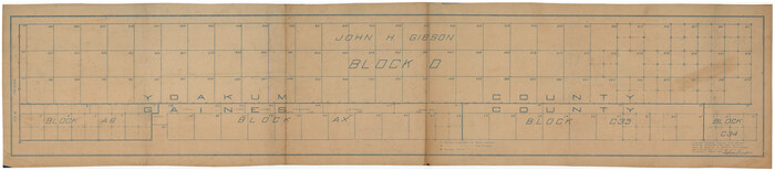
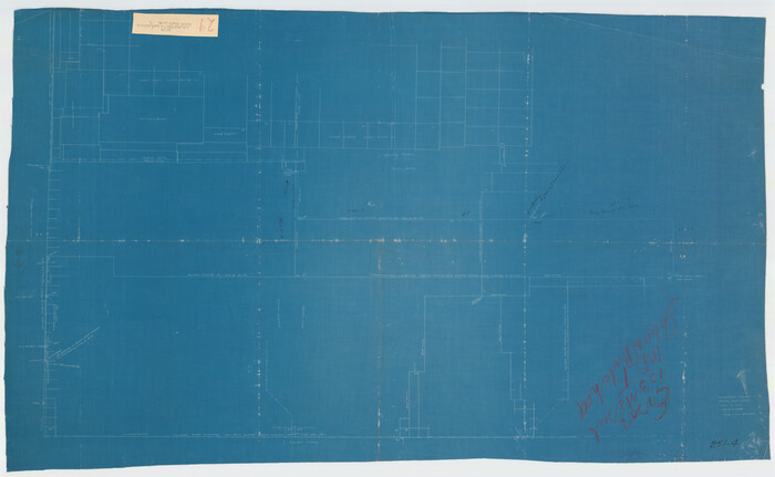
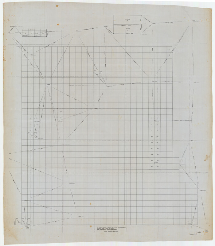
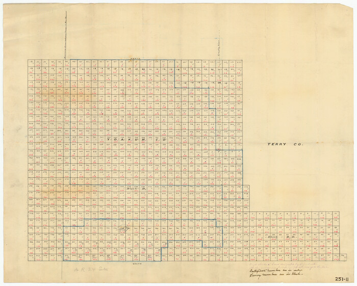
[Yoakum and Gaines County Line Along Block D in Yoakum and Blocks A6, AX, C35 and C34 in Gaines]
Print $40.00
- Digital $50.00
[Yoakum and Gaines County Line Along Block D in Yoakum and Blocks A6, AX, C35 and C34 in Gaines]
1924
Size: 54.9 x 12.3 inches
89691
[State Line from Southeast New Mexico to Yoakum County]
Print $20.00
- Digital $50.00
[State Line from Southeast New Mexico to Yoakum County]
Size: 32.3 x 11.7 inches
92013
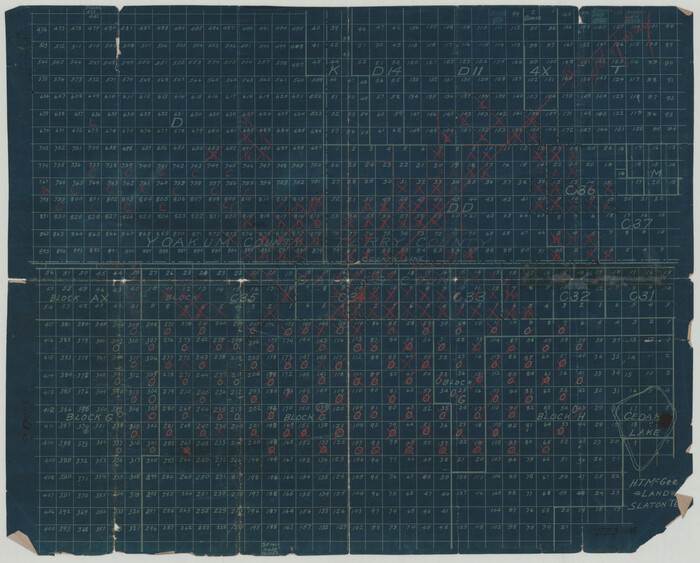
[Southeast part of Block D and Blocks DD, C31-C37, AX, G and H]
Print $20.00
- Digital $50.00
[Southeast part of Block D and Blocks DD, C31-C37, AX, G and H]
Size: 21.4 x 15.0 inches
92012
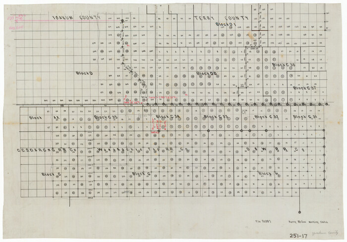
[Southeast Yoakum County, Southwest Terry County and North Gaines County]
Print $20.00
- Digital $50.00
[Southeast Yoakum County, Southwest Terry County and North Gaines County]
Size: 20.7 x 16.6 inches
91876
[Sketch showing PSL Block AX and C. C. S. D. & R. G. N. G. RR. Co. Block G]
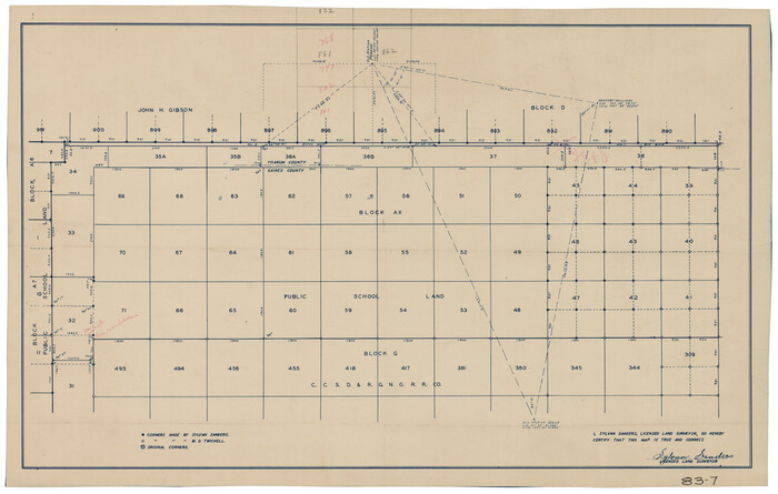
Print $20.00
- Digital $50.00
[Sketch showing PSL Block AX and C. C. S. D. & R. G. N. G. RR. Co. Block G]
Size: 25.8 x 16.6 inches
90838
[Sketch showing Block AX, North part of Block G, Block S and part of Block D]
Print $20.00
- Digital $50.00
[Sketch showing Block AX, North part of Block G, Block S and part of Block D]
Size: 33.2 x 44.1 inches
92018
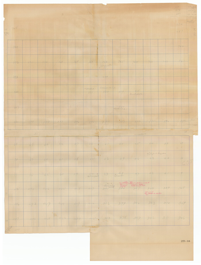
[Sections 302-313 and sections south of Blocks D and AX]
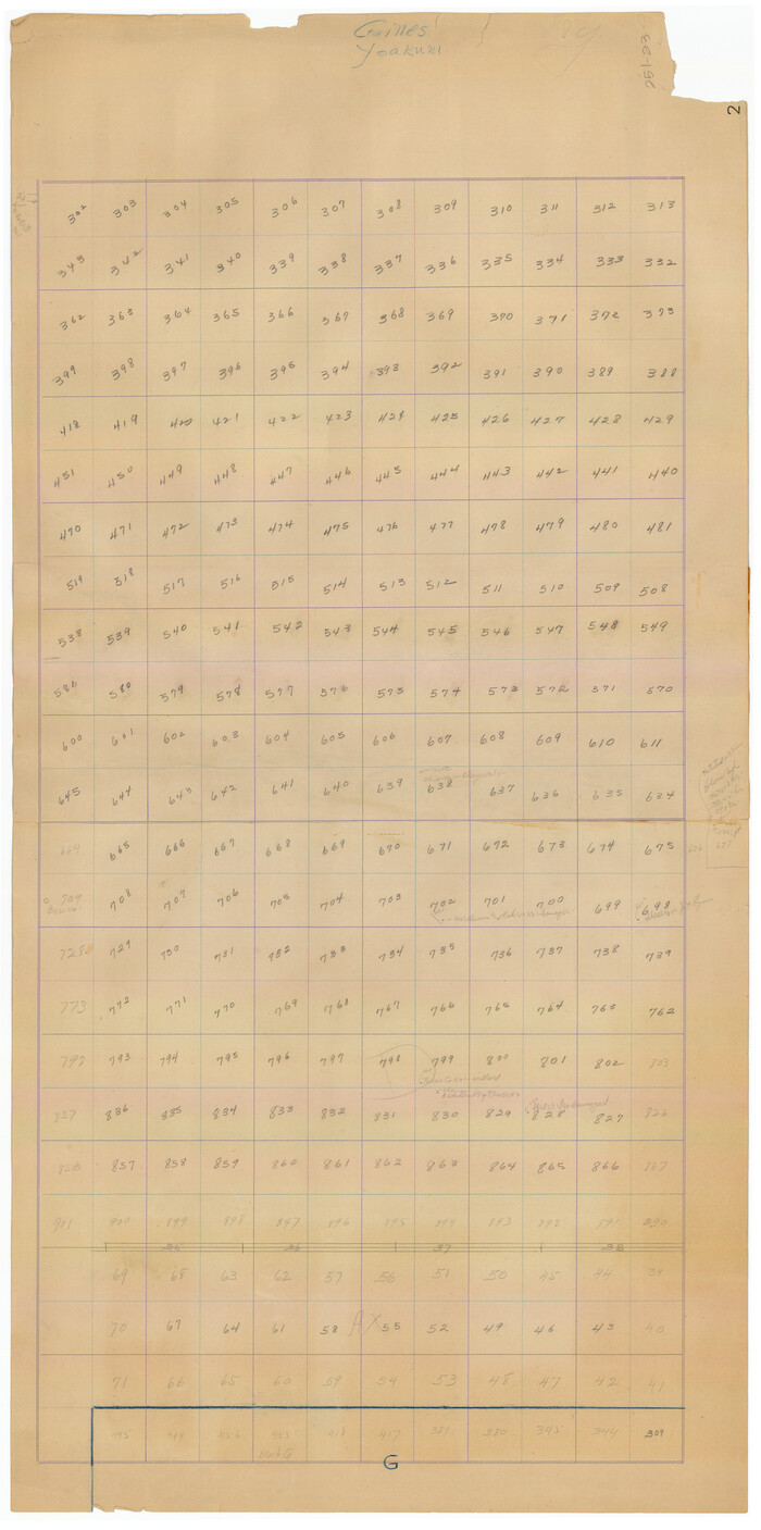
Print $20.00
- Digital $50.00
[Sections 302-313 and sections south of Blocks D and AX]
Size: 17.5 x 35.6 inches
92017
[SW Corner of Yoakum County]
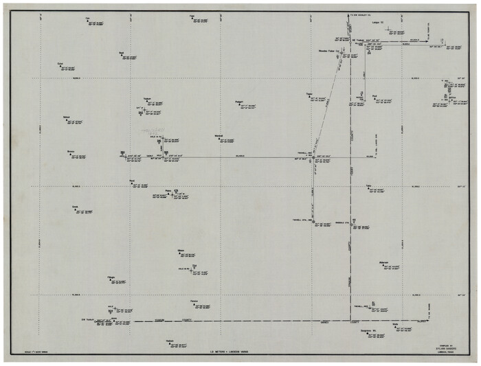
Print $20.00
- Digital $50.00
[SW Corner of Yoakum County]
Size: 24.2 x 18.5 inches
92443
[Report showing connections and corners made on ground in south part of Yoakum County and north part of Gaines County, Texas]

[Report showing connections and corners made on ground in south part of Yoakum County and north part of Gaines County, Texas]
1938
Size: 8.1 x 10.9 inches
93256
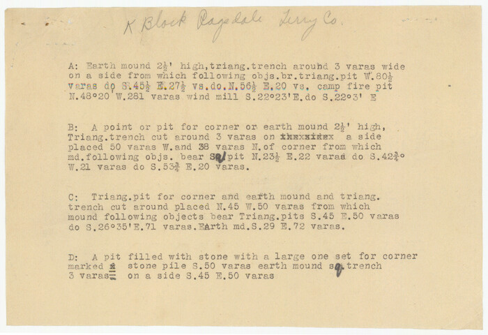
[Notes and map showing Public School Land Block K between Yoakum and Terry Counties]
Print $2.00
- Digital $50.00
[Notes and map showing Public School Land Block K between Yoakum and Terry Counties]
Size: 8.4 x 5.7 inches
92009
[Notes and map showing Public School Land Block K between Yoakum and Terry Counties]
Print $2.00
- Digital $50.00
[Notes and map showing Public School Land Block K between Yoakum and Terry Counties]
Size: 8.3 x 5.7 inches
92010
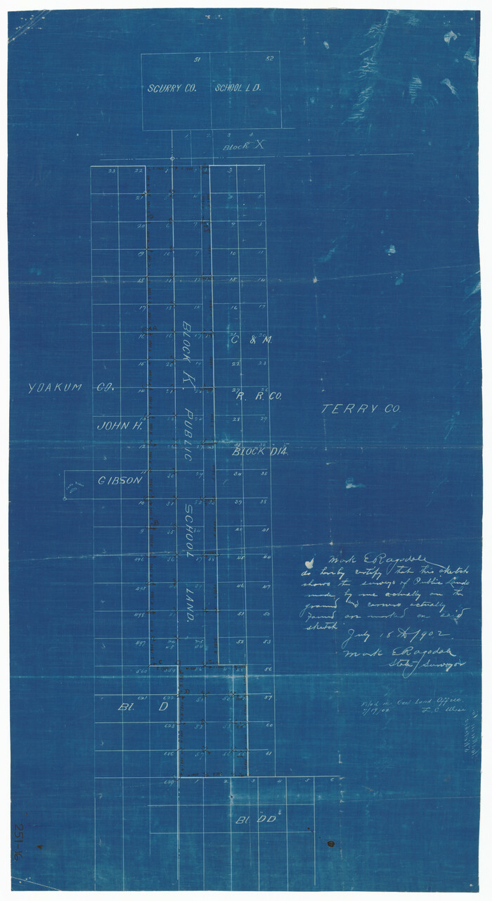
[Notes and map showing Public School Land Block K between Yoakum and Terry Counties]
Print $20.00
- Digital $50.00
[Notes and map showing Public School Land Block K between Yoakum and Terry Counties]
1902
Size: 17.1 x 30.9 inches
92011
[North half Dawson County, southwest quarter Lynn County, south half of Terry County, southeast quarter Yoakum County, north half Gaines County]
Print $40.00
- Digital $50.00
[North half Dawson County, southwest quarter Lynn County, south half of Terry County, southeast quarter Yoakum County, north half Gaines County]
Size: 79.8 x 45.3 inches
93133
[Map showing connecting line from New Mexico to Double Lakes]
Print $20.00
- Digital $50.00
[Map showing connecting line from New Mexico to Double Lakes]
1913
Size: 39.3 x 24.2 inches
91997
[Map showing connecting line from New Mexico to Double Lakes]
Print $20.00
- Digital $50.00
[Map showing connecting line from New Mexico to Double Lakes]
1913
Size: 39.6 x 24.2 inches
91998
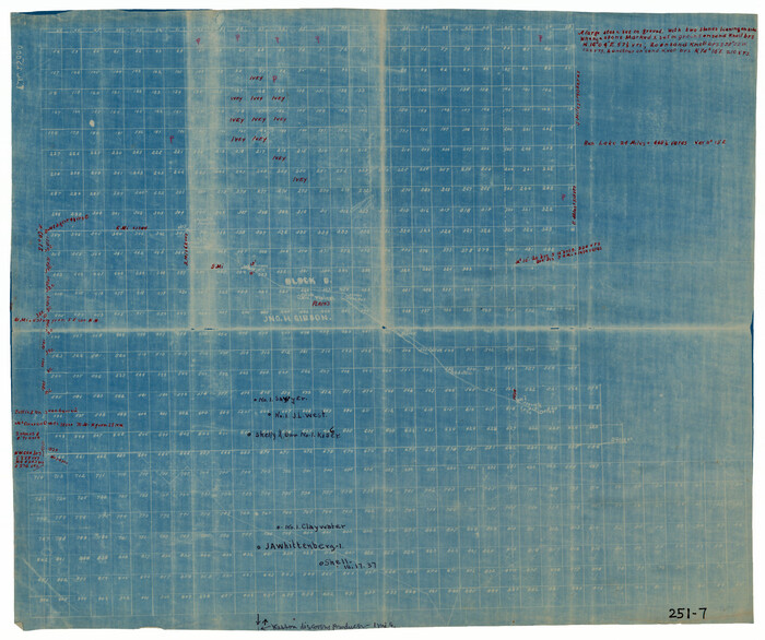
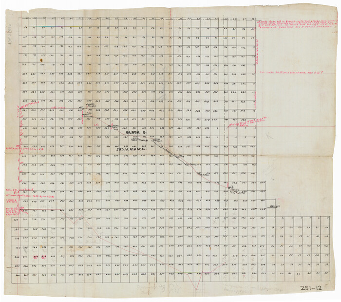
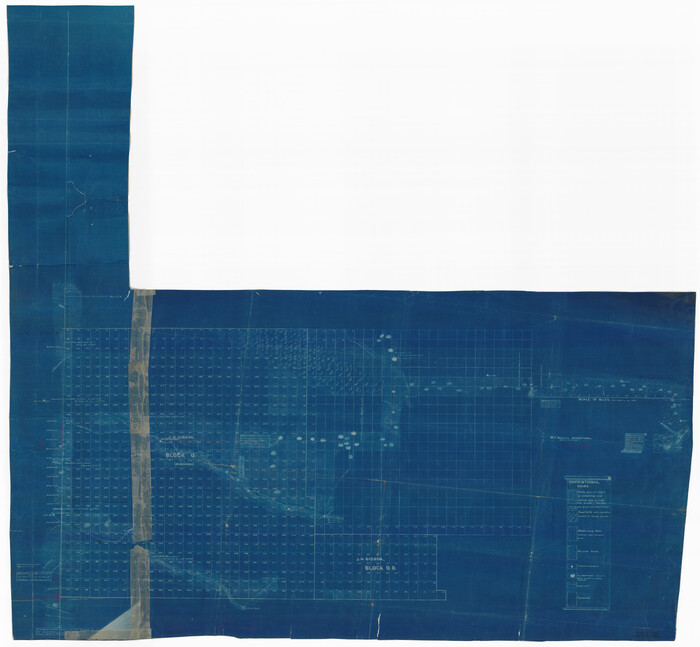
[Map showing Jno. H. Gibson Block D]
Print $20.00
- Digital $50.00
[Map showing Jno. H. Gibson Block D]
Size: 17.9 x 15.0 inches
92001
[Map showing Jno. H. Gibson Block D]
Print $20.00
- Digital $50.00
[Map showing Jno. H. Gibson Block D]
Size: 18.3 x 15.9 inches
92005
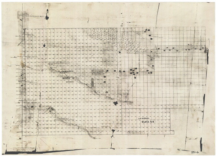
[Map showing J. H. Gibson Blocks D and DD]
Print $20.00
- Digital $50.00
[Map showing J. H. Gibson Blocks D and DD]
Size: 26.1 x 18.8 inches
92000
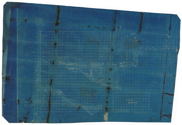
[Map showing J. H. Gibson Blocks D and DD]
Print $20.00
- Digital $50.00
[Map showing J. H. Gibson Blocks D and DD]
Size: 31.5 x 22.0 inches
92006
[Map showing J. H. Gibson Blocks D and DD and Double Lake Corner]
Print $20.00
- Digital $50.00
[Map showing J. H. Gibson Blocks D and DD and Double Lake Corner]
Size: 31.3 x 15.9 inches
91996
[Map showing J. H. Gibson Blocks D and DD and Double Lake Corner]
Print $20.00
- Digital $50.00
[Map showing J. H. Gibson Blocks D and DD and Double Lake Corner]
Size: 31.4 x 20.4 inches
92014
[Map showing J. H. Gibson Blocks D and DD and Double Lake Corner]
Print $20.00
- Digital $50.00
[Map showing J. H. Gibson Blocks D and DD and Double Lake Corner]
Size: 36.4 x 33.6 inches
92015
[Map showing J. H. Gibson Block D]
Print $20.00
- Digital $50.00
[Map showing J. H. Gibson Block D]
Size: 17.8 x 15.1 inches
92016
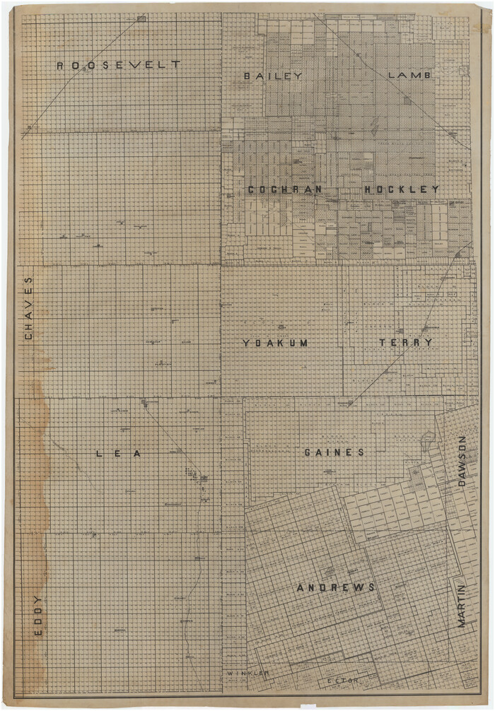
[Map showing Gaines, Dawson, Yoakum, Terry and Lynn Counties]
Print $20.00
- Digital $50.00
[Map showing Gaines, Dawson, Yoakum, Terry and Lynn Counties]
Size: 24.2 x 20.7 inches
92007
[Map of Texas Panhandle Counties and Adjacent New Mexico Counties]
Print $40.00
- Digital $50.00
[Map of Texas Panhandle Counties and Adjacent New Mexico Counties]
Size: 44.5 x 63.8 inches
89906
[Map Showing Distances from Marshall]
Print $40.00
- Digital $50.00
[Map Showing Distances from Marshall]
Size: 45.0 x 51.4 inches
89908
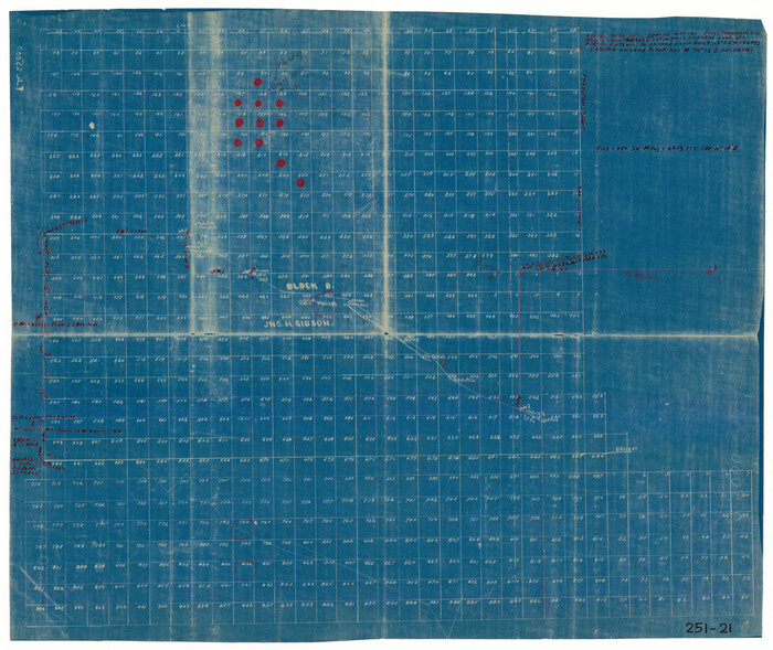
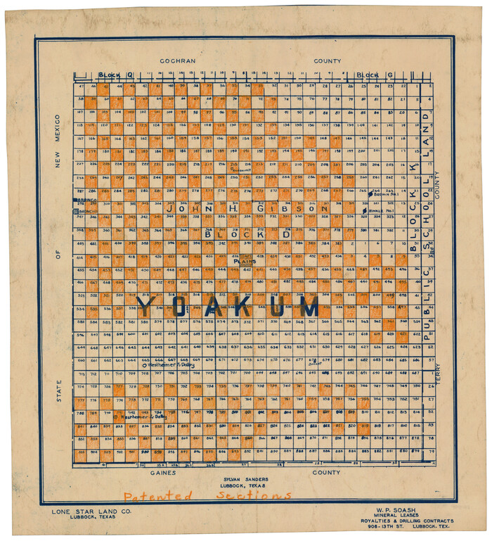
[John H. Gibson Block D Showing Patented Sections]
Print $20.00
- Digital $50.00
[John H. Gibson Block D Showing Patented Sections]
Size: 14.7 x 16.1 inches
92450
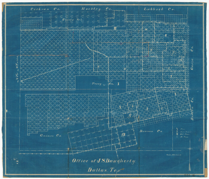
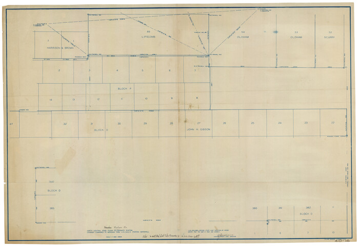
[Blocks P, D, and John H. Gibson]
Print $20.00
- Digital $50.00
[Blocks P, D, and John H. Gibson]
Size: 28.2 x 19.5 inches
90446
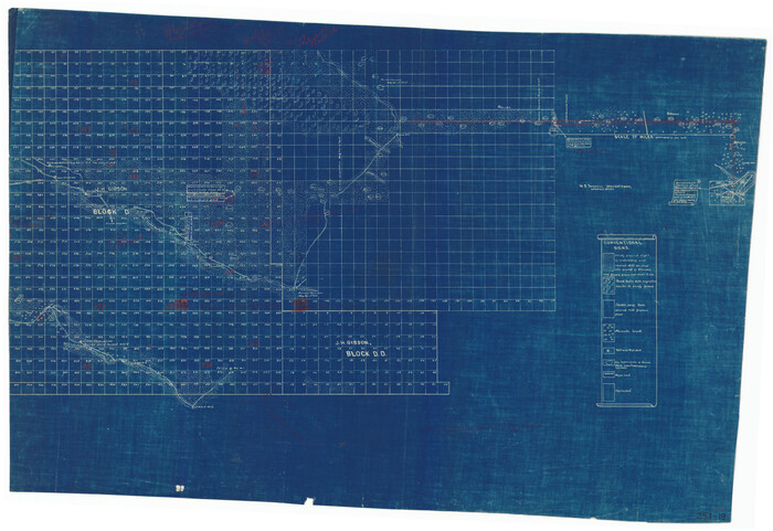
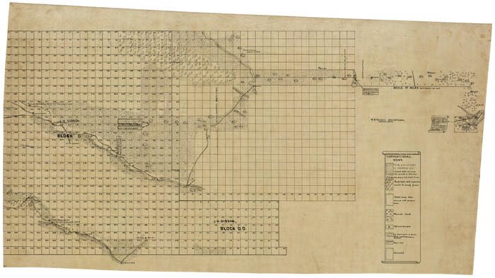
[Blocks D, DD Showing Terrain]
Print $20.00
- Digital $50.00
[Blocks D, DD Showing Terrain]
Size: 30.8 x 17.2 inches
92445
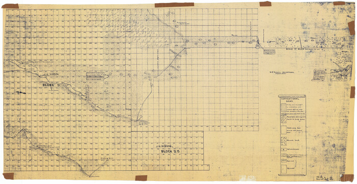
[Blocks D and DD, Yoakum County]
Print $20.00
- Digital $50.00
[Blocks D and DD, Yoakum County]
Size: 24.8 x 19.9 inches
92004
[Yoakum and Gaines County Line Along Block D in Yoakum and Blocks A6, AX, C35 and C34 in Gaines]
Print $40.00
- Digital $50.00
[Yoakum and Gaines County Line Along Block D in Yoakum and Blocks A6, AX, C35 and C34 in Gaines]
1924
-
Size
54.9 x 12.3 inches
-
Map/Doc
89691
-
Creation Date
1924
[State Line from Southeast New Mexico to Yoakum County]
Print $20.00
- Digital $50.00
[State Line from Southeast New Mexico to Yoakum County]
-
Size
32.3 x 11.7 inches
-
Map/Doc
92013
[Southeast part of Block D and Blocks DD, C31-C37, AX, G and H]
Print $20.00
- Digital $50.00
[Southeast part of Block D and Blocks DD, C31-C37, AX, G and H]
-
Size
21.4 x 15.0 inches
-
Map/Doc
92012
[Southeast Yoakum County, Southwest Terry County and North Gaines County]
Print $20.00
- Digital $50.00
[Southeast Yoakum County, Southwest Terry County and North Gaines County]
-
Size
20.7 x 16.6 inches
-
Map/Doc
91876
[Sketch showing PSL Block AX and C. C. S. D. & R. G. N. G. RR. Co. Block G]
Print $20.00
- Digital $50.00
[Sketch showing PSL Block AX and C. C. S. D. & R. G. N. G. RR. Co. Block G]
-
Size
25.8 x 16.6 inches
-
Map/Doc
90838
[Sketch showing Block AX, North part of Block G, Block S and part of Block D]
Print $20.00
- Digital $50.00
[Sketch showing Block AX, North part of Block G, Block S and part of Block D]
-
Size
33.2 x 44.1 inches
-
Map/Doc
92018
[Sections 302-313 and sections south of Blocks D and AX]
Print $20.00
- Digital $50.00
[Sections 302-313 and sections south of Blocks D and AX]
-
Size
17.5 x 35.6 inches
-
Map/Doc
92017
[SW Corner of Yoakum County]
Print $20.00
- Digital $50.00
[SW Corner of Yoakum County]
-
Size
24.2 x 18.5 inches
-
Map/Doc
92443
[Report showing connections and corners made on ground in south part of Yoakum County and north part of Gaines County, Texas]
[Report showing connections and corners made on ground in south part of Yoakum County and north part of Gaines County, Texas]
1938
-
Size
8.1 x 10.9 inches
-
Map/Doc
93256
-
Creation Date
1938
[Notes and map showing Public School Land Block K between Yoakum and Terry Counties]
Print $2.00
- Digital $50.00
[Notes and map showing Public School Land Block K between Yoakum and Terry Counties]
-
Size
8.4 x 5.7 inches
-
Map/Doc
92009
[Notes and map showing Public School Land Block K between Yoakum and Terry Counties]
Print $2.00
- Digital $50.00
[Notes and map showing Public School Land Block K between Yoakum and Terry Counties]
-
Size
8.3 x 5.7 inches
-
Map/Doc
92010
[Notes and map showing Public School Land Block K between Yoakum and Terry Counties]
Print $20.00
- Digital $50.00
[Notes and map showing Public School Land Block K between Yoakum and Terry Counties]
1902
-
Size
17.1 x 30.9 inches
-
Map/Doc
92011
-
Creation Date
1902
[North half Dawson County, southwest quarter Lynn County, south half of Terry County, southeast quarter Yoakum County, north half Gaines County]
Print $40.00
- Digital $50.00
[North half Dawson County, southwest quarter Lynn County, south half of Terry County, southeast quarter Yoakum County, north half Gaines County]
-
Size
79.8 x 45.3 inches
-
Map/Doc
93133
[Map showing connecting line from New Mexico to Double Lakes]
Print $20.00
- Digital $50.00
[Map showing connecting line from New Mexico to Double Lakes]
1913
-
Size
39.3 x 24.2 inches
-
Map/Doc
91997
-
Creation Date
1913
[Map showing connecting line from New Mexico to Double Lakes]
Print $20.00
- Digital $50.00
[Map showing connecting line from New Mexico to Double Lakes]
1913
-
Size
39.6 x 24.2 inches
-
Map/Doc
91998
-
Creation Date
1913
[Map showing Jno. H. Gibson Block D]
Print $20.00
- Digital $50.00
[Map showing Jno. H. Gibson Block D]
-
Size
17.9 x 15.0 inches
-
Map/Doc
92001
[Map showing Jno. H. Gibson Block D]
Print $20.00
- Digital $50.00
[Map showing Jno. H. Gibson Block D]
-
Size
18.3 x 15.9 inches
-
Map/Doc
92005
[Map showing J. H. Gibson Blocks D and DD]
Print $20.00
- Digital $50.00
[Map showing J. H. Gibson Blocks D and DD]
-
Size
26.1 x 18.8 inches
-
Map/Doc
92000
[Map showing J. H. Gibson Blocks D and DD]
Print $20.00
- Digital $50.00
[Map showing J. H. Gibson Blocks D and DD]
-
Size
31.5 x 22.0 inches
-
Map/Doc
92006
[Map showing J. H. Gibson Blocks D and DD and Double Lake Corner]
Print $20.00
- Digital $50.00
[Map showing J. H. Gibson Blocks D and DD and Double Lake Corner]
-
Size
31.3 x 15.9 inches
-
Map/Doc
91996
[Map showing J. H. Gibson Blocks D and DD and Double Lake Corner]
Print $20.00
- Digital $50.00
[Map showing J. H. Gibson Blocks D and DD and Double Lake Corner]
-
Size
31.4 x 20.4 inches
-
Map/Doc
92014
[Map showing J. H. Gibson Blocks D and DD and Double Lake Corner]
Print $20.00
- Digital $50.00
[Map showing J. H. Gibson Blocks D and DD and Double Lake Corner]
-
Size
36.4 x 33.6 inches
-
Map/Doc
92015
[Map showing J. H. Gibson Block D]
Print $20.00
- Digital $50.00
[Map showing J. H. Gibson Block D]
-
Size
17.8 x 15.1 inches
-
Map/Doc
92016
[Map showing Gaines, Dawson, Yoakum, Terry and Lynn Counties]
Print $20.00
- Digital $50.00
[Map showing Gaines, Dawson, Yoakum, Terry and Lynn Counties]
-
Size
24.2 x 20.7 inches
-
Map/Doc
92007
[Map of Texas Panhandle Counties and Adjacent New Mexico Counties]
Print $40.00
- Digital $50.00
[Map of Texas Panhandle Counties and Adjacent New Mexico Counties]
-
Size
44.5 x 63.8 inches
-
Map/Doc
89906
[Map Showing Distances from Marshall]
Print $40.00
- Digital $50.00
[Map Showing Distances from Marshall]
-
Size
45.0 x 51.4 inches
-
Map/Doc
89908
[John H. Gibson Block D Showing Patented Sections]
Print $20.00
- Digital $50.00
[John H. Gibson Block D Showing Patented Sections]
-
Size
14.7 x 16.1 inches
-
Map/Doc
92450
[Blocks P, D, and John H. Gibson]
Print $20.00
- Digital $50.00
[Blocks P, D, and John H. Gibson]
-
Size
28.2 x 19.5 inches
-
Map/Doc
90446
[Blocks D, DD Showing Terrain]
Print $20.00
- Digital $50.00
[Blocks D, DD Showing Terrain]
-
Size
30.8 x 17.2 inches
-
Map/Doc
92445
[Blocks D and DD, Yoakum County]
Print $20.00
- Digital $50.00
[Blocks D and DD, Yoakum County]
-
Size
24.8 x 19.9 inches
-
Map/Doc
92004