Vicinity map showing railroads serving the ports of Galveston, Houston and Texas City, Texas

Print $20.00
- Digital $50.00
Vicinity map showing railroads serving the ports of Galveston, Houston and Texas City, Texas
1924
Size: 9.3 x 14.8 inches
97164


The Texas Coast Country and What It Holds for You

The Texas Coast Country and What It Holds for You
1909
Size: 6.4 x 3.7 inches
97054
Texas Coast Country on the Southern Pacific Lines

Texas Coast Country on the Southern Pacific Lines
1917
Size: 9.4 x 6.4 inches
97061
Souvenir of Galveston the Sea Wall City

Souvenir of Galveston the Sea Wall City
Size: 5.7 x 7.6 inches
97051
Sketch K Showing the Progress of the Survey of the Columbia River, Oregon

Print $20.00
- Digital $50.00
Sketch K Showing the Progress of the Survey of the Columbia River, Oregon
1852
Size: 9.8 x 12.7 inches
97237
Sketch J Showing the progress of the Survey of the Western Coast

Print $20.00
- Digital $50.00
Sketch J Showing the progress of the Survey of the Western Coast
1849
Size: 12.3 x 10.0 inches
97228
Sketch J No. 2 Showing the Progress of the Survey of San Francisco Bay and Vicinity Section X From 1850 to 1852

Print $20.00
- Digital $50.00
Sketch J No. 2 Showing the Progress of the Survey of San Francisco Bay and Vicinity Section X From 1850 to 1852
1852
Size: 12.3 x 12.7 inches
97229
Sketch I: Showing the Progress of the Survey in Section No. 9 [Galveston Bay]
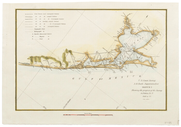
Print $20.00
- Digital $50.00
Sketch I: Showing the Progress of the Survey in Section No. 9 [Galveston Bay]
1852
Size: 9.4 x 13.4 inches
97133
Sketch H Showing the progress of the Survey in Section No. 8

Print $20.00
- Digital $50.00
Sketch H Showing the progress of the Survey in Section No. 8
1846
Size: 17.1 x 20.6 inches
97222
Sketch H No. V Showing the observed and computed Tidal Curves at Cat Island, Mississippi Sound in 1848 & 1849

Print $20.00
- Digital $50.00
Sketch H No. V Showing the observed and computed Tidal Curves at Cat Island, Mississippi Sound in 1848 & 1849
1852
Size: 12.3 x 19.5 inches
97226
Sketch G Showing the Progress of the Survey in Section VII From 1849 to 1852

Print $20.00
- Digital $50.00
Sketch G Showing the Progress of the Survey in Section VII From 1849 to 1852
1852
Size: 13.6 x 25.8 inches
97219
Sketch F No. 3 - Preliminary Chart of Key-West Harbor and Approaches

Print $20.00
- Digital $50.00
Sketch F No. 3 - Preliminary Chart of Key-West Harbor and Approaches
1852
Size: 17.7 x 21.1 inches
97218
Sketch F No. 2 Showing the progress of the Survey of Cedar Keys, Bahia Honda, Key Biscayne, Key West & Dry Tortugas In Section No. VI

Print $20.00
- Digital $50.00
Sketch F No. 2 Showing the progress of the Survey of Cedar Keys, Bahia Honda, Key Biscayne, Key West & Dry Tortugas In Section No. VI
1849
Size: 10.8 x 18.3 inches
97217
Sketch E. No. 2 Shewing the progress of the Survey in the vicinity of Savannah, Georgia

Print $20.00
- Digital $50.00
Sketch E. No. 2 Shewing the progress of the Survey in the vicinity of Savannah, Georgia
1850
Size: 11.0 x 9.9 inches
97214
Sketch E Showing the Progress of the Survey of Section V From 1847 to 1852

Print $20.00
- Digital $50.00
Sketch E Showing the Progress of the Survey of Section V From 1847 to 1852
1852
Size: 12.4 x 22.7 inches
97213
Sketch E No. 3 Shewing the progress of the Survey at North & South Edisto Rivers and St. Helena Sound, South Carolina

Print $20.00
- Digital $50.00
Sketch E No. 3 Shewing the progress of the Survey at North & South Edisto Rivers and St. Helena Sound, South Carolina
1852
Size: 10.9 x 19.5 inches
97215
Sketch D Showing the progress of Section IV 1845 to 1852

Print $20.00
- Digital $50.00
Sketch D Showing the progress of Section IV 1845 to 1852
1852
Size: 22.8 x 13.0 inches
97208
Sketch D No. 2 Showing the Progress of the Survey of Cape Fear and Vicinity in Sections No. IV & V

Digital $50.00
Sketch D No. 2 Showing the Progress of the Survey of Cape Fear and Vicinity in Sections No. IV & V
1852
Size: 12.3 x 10.0 inches
97209
Sketch C Showing the Progress of the Survey in Section III From 1843 to 1852

Print $20.00
- Digital $50.00
Sketch C Showing the Progress of the Survey in Section III From 1843 to 1852
1852
Size: 36.2 x 25.6 inches
97201
Sketch C Showing the Progress of the Survey in Section III From 1843 to 1851

Print $20.00
- Digital $50.00
Sketch C Showing the Progress of the Survey in Section III From 1843 to 1851
1851
Size: 35.7 x 23.0 inches
97205
Sketch B Showing the progress of Section No. 2

Print $20.00
- Digital $50.00
Sketch B Showing the progress of Section No. 2
1844
Size: 25.3 x 27.7 inches
97204
Sketch A Shewing the progress of the Survey in Section No. 1 From 1844 to 1852

Print $20.00
- Digital $50.00
Sketch A Shewing the progress of the Survey in Section No. 1 From 1844 to 1852
1852
Size: 38.1 x 25.3 inches
97200
Sketch A Shewing the progress of the Survey in Section No. 1 From 1844 to 1851

Print $20.00
- Digital $50.00
Sketch A Shewing the progress of the Survey in Section No. 1 From 1844 to 1851
1851
Size: 37.1 x 24.5 inches
97202
Report of the Superintendent of the Coast Survey showing the progress of the survey during the year 1852

Report of the Superintendent of the Coast Survey showing the progress of the survey during the year 1852
1853
81738
Port Series No. 6 - The Ports of Galveston, Houston, and Texas City, Texas

Port Series No. 6 - The Ports of Galveston, Houston, and Texas City, Texas
1924
97159
Vicinity map showing railroads serving the ports of Galveston, Houston and Texas City, Texas
Print $20.00
- Digital $50.00
Vicinity map showing railroads serving the ports of Galveston, Houston and Texas City, Texas
1924
-
Size
9.3 x 14.8 inches
-
Map/Doc
97164
-
Creation Date
1924
The Texas Gulf Coast

The Texas Gulf Coast
1940
-
Size
9.4 x 4.2 inches
-
Map/Doc
97066
-
Creation Date
1940
The Texas Coast Country and What It Holds for You
The Texas Coast Country and What It Holds for You
1909
-
Size
6.4 x 3.7 inches
-
Map/Doc
97054
-
Creation Date
1909
The Gulf Coast of Texas

The Gulf Coast of Texas
1906
-
Size
9.5 x 5.3 inches
-
Map/Doc
97053
-
Creation Date
1906
Texas Coast Country on the Southern Pacific Lines
Texas Coast Country on the Southern Pacific Lines
1917
-
Size
9.4 x 6.4 inches
-
Map/Doc
97061
-
Creation Date
1917
Souvenir of Galveston the Sea Wall City
Souvenir of Galveston the Sea Wall City
-
Size
5.7 x 7.6 inches
-
Map/Doc
97051
Souvenir of Galveston

Souvenir of Galveston
1896
-
Size
5.3 x 7.2 inches
-
Map/Doc
97049
-
Creation Date
1896
Sketch K Showing the Progress of the Survey of the Columbia River, Oregon
Print $20.00
- Digital $50.00
Sketch K Showing the Progress of the Survey of the Columbia River, Oregon
1852
-
Size
9.8 x 12.7 inches
-
Map/Doc
97237
-
Creation Date
1852
Sketch J Showing the progress of the Survey of the Western Coast
Print $20.00
- Digital $50.00
Sketch J Showing the progress of the Survey of the Western Coast
1849
-
Size
12.3 x 10.0 inches
-
Map/Doc
97228
-
Creation Date
1849
Sketch J No. 2 Showing the Progress of the Survey of San Francisco Bay and Vicinity Section X From 1850 to 1852
Print $20.00
- Digital $50.00
Sketch J No. 2 Showing the Progress of the Survey of San Francisco Bay and Vicinity Section X From 1850 to 1852
1852
-
Size
12.3 x 12.7 inches
-
Map/Doc
97229
-
Creation Date
1852
Sketch I: Showing the Progress of the Survey in Section No. 9 [Galveston Bay]
Print $20.00
- Digital $50.00
Sketch I: Showing the Progress of the Survey in Section No. 9 [Galveston Bay]
1852
-
Size
9.4 x 13.4 inches
-
Map/Doc
97133
-
Creation Date
1852
Sketch H Showing the progress of the Survey in Section No. 8
Print $20.00
- Digital $50.00
Sketch H Showing the progress of the Survey in Section No. 8
1846
-
Size
17.1 x 20.6 inches
-
Map/Doc
97222
-
Creation Date
1846
Sketch H No. V Showing the observed and computed Tidal Curves at Cat Island, Mississippi Sound in 1848 & 1849
Print $20.00
- Digital $50.00
Sketch H No. V Showing the observed and computed Tidal Curves at Cat Island, Mississippi Sound in 1848 & 1849
1852
-
Size
12.3 x 19.5 inches
-
Map/Doc
97226
-
Creation Date
1852
Sketch G Showing the Progress of the Survey in Section VII From 1849 to 1852
Print $20.00
- Digital $50.00
Sketch G Showing the Progress of the Survey in Section VII From 1849 to 1852
1852
-
Size
13.6 x 25.8 inches
-
Map/Doc
97219
-
Creation Date
1852
Sketch F No. 3 - Preliminary Chart of Key-West Harbor and Approaches
Print $20.00
- Digital $50.00
Sketch F No. 3 - Preliminary Chart of Key-West Harbor and Approaches
1852
-
Size
17.7 x 21.1 inches
-
Map/Doc
97218
-
Creation Date
1852
Sketch F No. 2 Showing the progress of the Survey of Cedar Keys, Bahia Honda, Key Biscayne, Key West & Dry Tortugas In Section No. VI
Print $20.00
- Digital $50.00
Sketch F No. 2 Showing the progress of the Survey of Cedar Keys, Bahia Honda, Key Biscayne, Key West & Dry Tortugas In Section No. VI
1849
-
Size
10.8 x 18.3 inches
-
Map/Doc
97217
-
Creation Date
1849
Sketch E. No. 2 Shewing the progress of the Survey in the vicinity of Savannah, Georgia
Print $20.00
- Digital $50.00
Sketch E. No. 2 Shewing the progress of the Survey in the vicinity of Savannah, Georgia
1850
-
Size
11.0 x 9.9 inches
-
Map/Doc
97214
-
Creation Date
1850
Sketch E Showing the Progress of the Survey of Section V From 1847 to 1852
Print $20.00
- Digital $50.00
Sketch E Showing the Progress of the Survey of Section V From 1847 to 1852
1852
-
Size
12.4 x 22.7 inches
-
Map/Doc
97213
-
Creation Date
1852
Sketch E No. 3 Shewing the progress of the Survey at North & South Edisto Rivers and St. Helena Sound, South Carolina
Print $20.00
- Digital $50.00
Sketch E No. 3 Shewing the progress of the Survey at North & South Edisto Rivers and St. Helena Sound, South Carolina
1852
-
Size
10.9 x 19.5 inches
-
Map/Doc
97215
-
Creation Date
1852
Sketch D Showing the progress of Section IV 1845 to 1852
Print $20.00
- Digital $50.00
Sketch D Showing the progress of Section IV 1845 to 1852
1852
-
Size
22.8 x 13.0 inches
-
Map/Doc
97208
-
Creation Date
1852
Sketch D No. 2 Showing the Progress of the Survey of Cape Fear and Vicinity in Sections No. IV & V
Digital $50.00
Sketch D No. 2 Showing the Progress of the Survey of Cape Fear and Vicinity in Sections No. IV & V
1852
-
Size
12.3 x 10.0 inches
-
Map/Doc
97209
-
Creation Date
1852
Sketch C Showing the Progress of the Survey in Section III From 1843 to 1852
Print $20.00
- Digital $50.00
Sketch C Showing the Progress of the Survey in Section III From 1843 to 1852
1852
-
Size
36.2 x 25.6 inches
-
Map/Doc
97201
-
Creation Date
1852
Sketch C Showing the Progress of the Survey in Section III From 1843 to 1851
Print $20.00
- Digital $50.00
Sketch C Showing the Progress of the Survey in Section III From 1843 to 1851
1851
-
Size
35.7 x 23.0 inches
-
Map/Doc
97205
-
Creation Date
1851
Sketch B Showing the progress of Section No. 2
Print $20.00
- Digital $50.00
Sketch B Showing the progress of Section No. 2
1844
-
Size
25.3 x 27.7 inches
-
Map/Doc
97204
-
Creation Date
1844
Sketch A Shewing the progress of the Survey in Section No. 1 From 1844 to 1852
Print $20.00
- Digital $50.00
Sketch A Shewing the progress of the Survey in Section No. 1 From 1844 to 1852
1852
-
Size
38.1 x 25.3 inches
-
Map/Doc
97200
-
Creation Date
1852
Sketch A Shewing the progress of the Survey in Section No. 1 From 1844 to 1851
Print $20.00
- Digital $50.00
Sketch A Shewing the progress of the Survey in Section No. 1 From 1844 to 1851
1851
-
Size
37.1 x 24.5 inches
-
Map/Doc
97202
-
Creation Date
1851
Report of the Superintendent of the Coast Survey showing the progress of the survey during the year 1852
Report of the Superintendent of the Coast Survey showing the progress of the survey during the year 1852
1853
-
Map/Doc
81738
-
Creation Date
1853
Port Series No. 6 - The Ports of Galveston, Houston, and Texas City, Texas
Port Series No. 6 - The Ports of Galveston, Houston, and Texas City, Texas
1924
-
Map/Doc
97159
-
Creation Date
1924