
Souvenir of Galveston the Sea Wall City
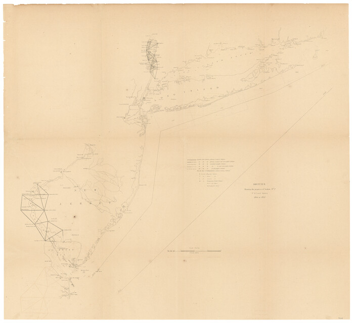
Sketch B Showing the progress of Section No. 2
1844
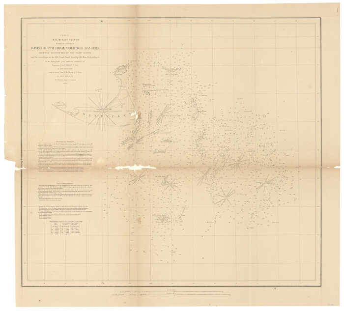
(A No. 2) Preliminary Sketch Showing the positions of Davis's South Shoal and other Dangers recently discovered by the Coast Survey and the soundings on the Old South Shoal, Bass Rip, Old Man, Pochick Rip &c.
1846

Sketch H Showing the progress of the Survey in Section No. 8
1846

Sketch F No. 2 Showing the progress of the Survey of Cedar Keys, Bahia Honda, Key Biscayne, Key West & Dry Tortugas In Section No. VI
1849
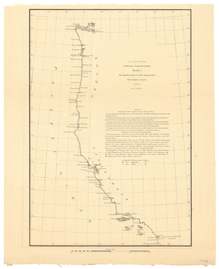
Sketch J Showing the progress of the Survey of the Western Coast
1849
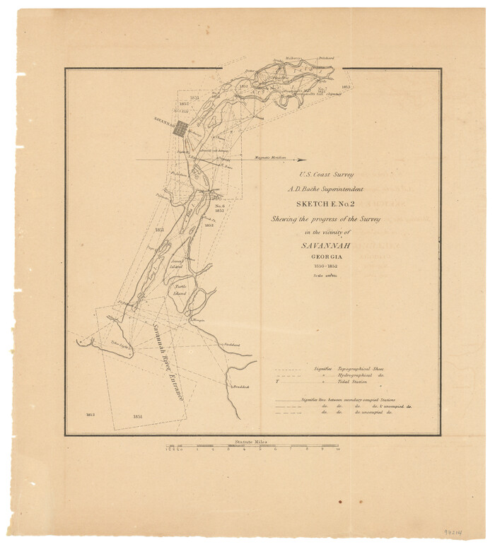
Sketch E. No. 2 Shewing the progress of the Survey in the vicinity of Savannah, Georgia
1850
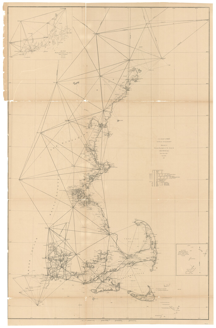
Sketch A Shewing the progress of the Survey in Section No. 1 From 1844 to 1851
1851

Sketch C Showing the Progress of the Survey in Section III From 1843 to 1851
1851
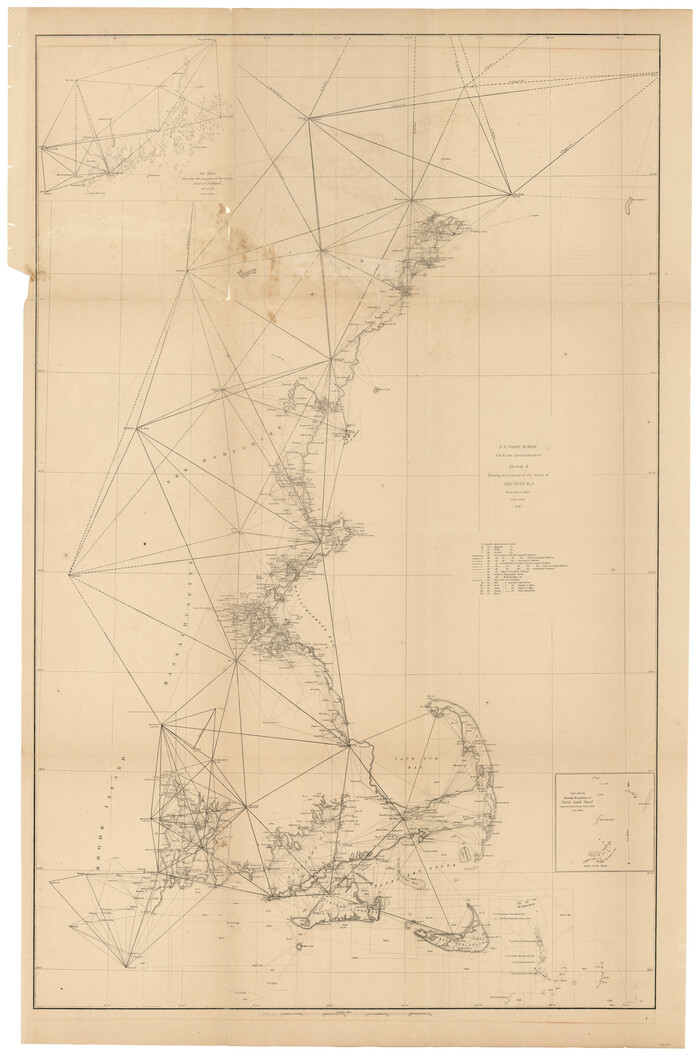
Sketch A Shewing the progress of the Survey in Section No. 1 From 1844 to 1852
1852

Sketch C Showing the Progress of the Survey in Section III From 1843 to 1852
1852

C No. 2 - Preliminary Sketch of Chincoteague Inlet and Shoals in the Vicinity - Sea Coast of Virginia
1852
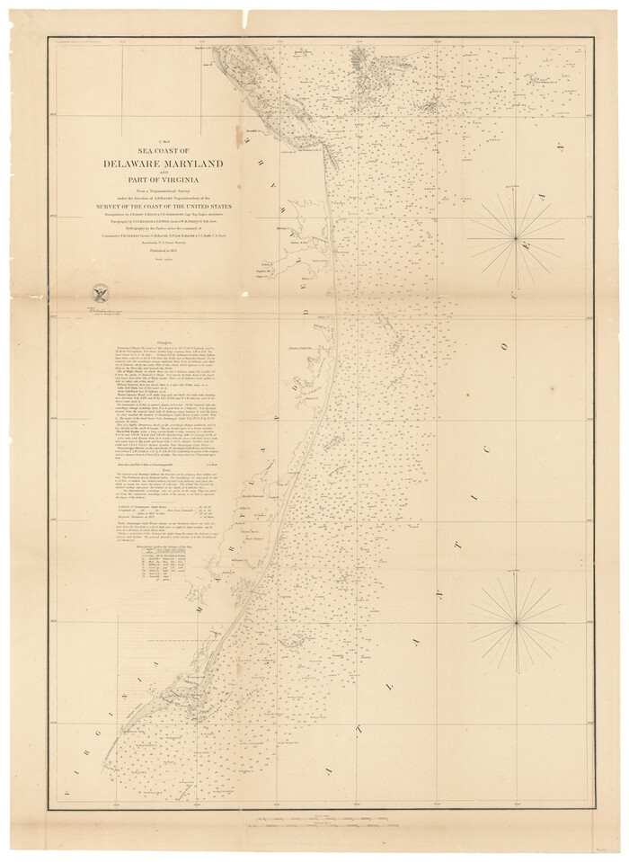
C No. 3 - Sea Coast of Delaware, Maryland, and part of Virginia
1852

Sketch D Showing the progress of Section IV 1845 to 1852
1852

Sketch D No. 2 Showing the Progress of the Survey of Cape Fear and Vicinity in Sections No. IV & V
1852

D No. 3 - Sketch of Ocracoke Inlet, North Carolina
1852

D No. 4 - Reconnaissance of New River and Bar, North Carolina
1852
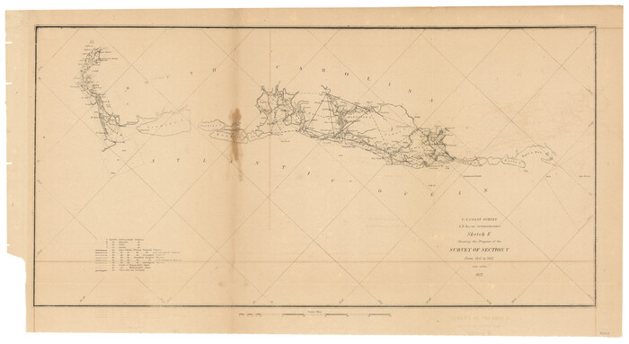
Sketch E Showing the Progress of the Survey of Section V From 1847 to 1852
1852
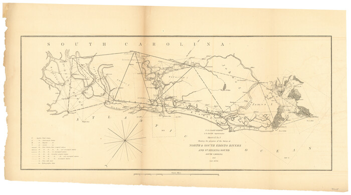
Sketch E No. 3 Shewing the progress of the Survey at North & South Edisto Rivers and St. Helena Sound, South Carolina
1852
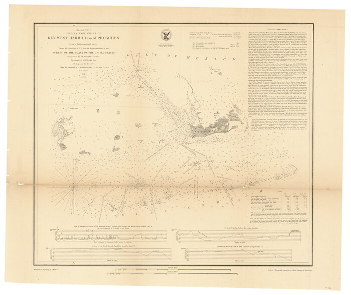
Sketch F No. 3 - Preliminary Chart of Key-West Harbor and Approaches
1852

Sketch G Showing the Progress of the Survey in Section VII From 1849 to 1852
1852
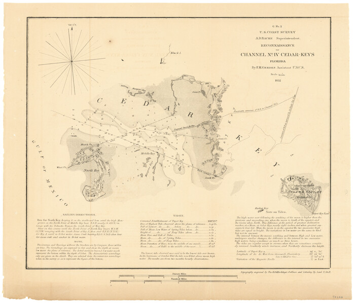
G No. 2 - Reconnaissance of Channel No. IV Cedar-Keys, Florida
1852
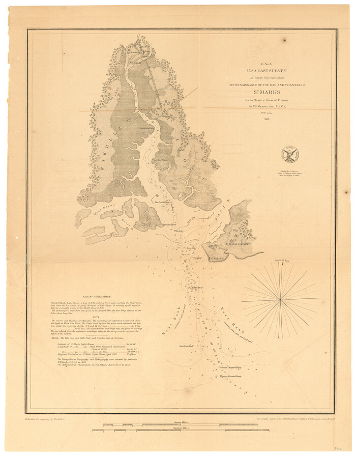
G No. 3 - Reconnaissance of the Bar and Channel of St. Marks On the Western Coast of Florida
1852
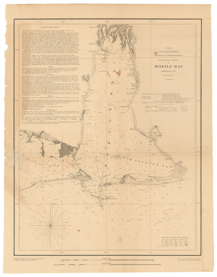
H No. 2 - Preliminary Sketch of Mobile Bay
1852
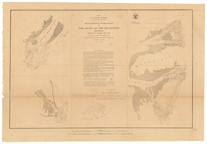
H No. 3 - Reconnoissance of the Passes of the Delta of the Mississippi, Louisiana showing the changes since 1839
1852
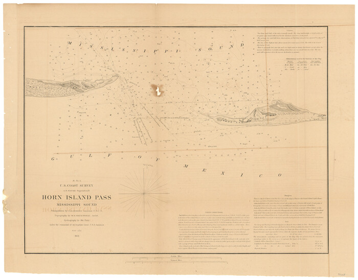
H No. 4 - Horn Island Pass, Mississippi Sound
1852
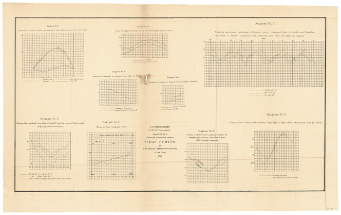
Sketch H No. V Showing the observed and computed Tidal Curves at Cat Island, Mississippi Sound in 1848 & 1849
1852

I No. 2 - Preliminary Sketch of Galveston Bay, Texas
1852
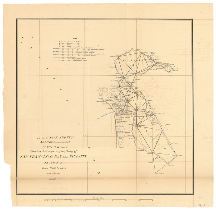
Sketch J No. 2 Showing the Progress of the Survey of San Francisco Bay and Vicinity Section X From 1850 to 1852
1852

Monterey Harbor, California
1852

Souvenir of Galveston the Sea Wall City
-
Size
5.7 x 7.6 inches
-
Map/Doc
97051

Sketch B Showing the progress of Section No. 2
1844
-
Size
25.3 x 27.7 inches
-
Map/Doc
97204
-
Creation Date
1844

(A No. 2) Preliminary Sketch Showing the positions of Davis's South Shoal and other Dangers recently discovered by the Coast Survey and the soundings on the Old South Shoal, Bass Rip, Old Man, Pochick Rip &c.
1846
-
Size
19.7 x 21.8 inches
-
Map/Doc
97203
-
Creation Date
1846

Sketch H Showing the progress of the Survey in Section No. 8
1846
-
Size
17.1 x 20.6 inches
-
Map/Doc
97222
-
Creation Date
1846

Sketch F No. 2 Showing the progress of the Survey of Cedar Keys, Bahia Honda, Key Biscayne, Key West & Dry Tortugas In Section No. VI
1849
-
Size
10.8 x 18.3 inches
-
Map/Doc
97217
-
Creation Date
1849

Sketch J Showing the progress of the Survey of the Western Coast
1849
-
Size
12.3 x 10.0 inches
-
Map/Doc
97228
-
Creation Date
1849

Sketch E. No. 2 Shewing the progress of the Survey in the vicinity of Savannah, Georgia
1850
-
Size
11.0 x 9.9 inches
-
Map/Doc
97214
-
Creation Date
1850

Sketch A Shewing the progress of the Survey in Section No. 1 From 1844 to 1851
1851
-
Size
37.1 x 24.5 inches
-
Map/Doc
97202
-
Creation Date
1851

Sketch C Showing the Progress of the Survey in Section III From 1843 to 1851
1851
-
Size
35.7 x 23.0 inches
-
Map/Doc
97205
-
Creation Date
1851

Sketch A Shewing the progress of the Survey in Section No. 1 From 1844 to 1852
1852
-
Size
38.1 x 25.3 inches
-
Map/Doc
97200
-
Creation Date
1852

Sketch C Showing the Progress of the Survey in Section III From 1843 to 1852
1852
-
Size
36.2 x 25.6 inches
-
Map/Doc
97201
-
Creation Date
1852

C No. 2 - Preliminary Sketch of Chincoteague Inlet and Shoals in the Vicinity - Sea Coast of Virginia
1852
-
Size
16.5 x 19.4 inches
-
Map/Doc
97206
-
Creation Date
1852

C No. 3 - Sea Coast of Delaware, Maryland, and part of Virginia
1852
-
Size
30.4 x 22.2 inches
-
Map/Doc
97207
-
Creation Date
1852

Sketch D Showing the progress of Section IV 1845 to 1852
1852
-
Size
22.8 x 13.0 inches
-
Map/Doc
97208
-
Creation Date
1852

Sketch D No. 2 Showing the Progress of the Survey of Cape Fear and Vicinity in Sections No. IV & V
1852
-
Size
12.3 x 10.0 inches
-
Map/Doc
97209
-
Creation Date
1852

D No. 3 - Sketch of Ocracoke Inlet, North Carolina
1852
-
Size
17.0 x 16.1 inches
-
Map/Doc
97210
-
Creation Date
1852

D No. 4 - Reconnaissance of New River and Bar, North Carolina
1852
-
Size
19.4 x 15.7 inches
-
Map/Doc
97211
-
Creation Date
1852

Sketch E Showing the Progress of the Survey of Section V From 1847 to 1852
1852
-
Size
12.4 x 22.7 inches
-
Map/Doc
97213
-
Creation Date
1852

Sketch E No. 3 Shewing the progress of the Survey at North & South Edisto Rivers and St. Helena Sound, South Carolina
1852
-
Size
10.9 x 19.5 inches
-
Map/Doc
97215
-
Creation Date
1852

Sketch F No. 3 - Preliminary Chart of Key-West Harbor and Approaches
1852
-
Size
17.7 x 21.1 inches
-
Map/Doc
97218
-
Creation Date
1852

Sketch G Showing the Progress of the Survey in Section VII From 1849 to 1852
1852
-
Size
13.6 x 25.8 inches
-
Map/Doc
97219
-
Creation Date
1852

G No. 2 - Reconnaissance of Channel No. IV Cedar-Keys, Florida
1852
-
Size
10.8 x 12.6 inches
-
Map/Doc
97220
-
Creation Date
1852

G No. 3 - Reconnaissance of the Bar and Channel of St. Marks On the Western Coast of Florida
1852
-
Size
18.6 x 14.5 inches
-
Map/Doc
97221
-
Creation Date
1852

H No. 2 - Preliminary Sketch of Mobile Bay
1852
-
Size
19.4 x 15.2 inches
-
Map/Doc
97223
-
Creation Date
1852

H No. 3 - Reconnoissance of the Passes of the Delta of the Mississippi, Louisiana showing the changes since 1839
1852
-
Size
15.9 x 22.8 inches
-
Map/Doc
97224
-
Creation Date
1852

H No. 4 - Horn Island Pass, Mississippi Sound
1852
-
Size
14.9 x 19.0 inches
-
Map/Doc
97225
-
Creation Date
1852

Sketch H No. V Showing the observed and computed Tidal Curves at Cat Island, Mississippi Sound in 1848 & 1849
1852
-
Size
12.3 x 19.5 inches
-
Map/Doc
97226
-
Creation Date
1852

I No. 2 - Preliminary Sketch of Galveston Bay, Texas
1852
-
Size
22.1 x 19.0 inches
-
Map/Doc
97227
-
Creation Date
1852

Sketch J No. 2 Showing the Progress of the Survey of San Francisco Bay and Vicinity Section X From 1850 to 1852
1852
-
Size
12.3 x 12.7 inches
-
Map/Doc
97229
-
Creation Date
1852

Monterey Harbor, California
1852
-
Size
15.7 x 13.8 inches
-
Map/Doc
97230
-
Creation Date
1852