"Old Three Hundred" Land Grants under Austin's First Contract


"Old Three Hundred" Land Grants under Austin's First Contract
2023
Size: 8.5 x 11.0 inches
97185
A Map of Austin's Colony and adjacent country in Texas drawn principally from actual survey by Stephen F. Austin


A Map of Austin's Colony and adjacent country in Texas drawn principally from actual survey by Stephen F. Austin
1820
Size: 13.8 x 17.0 inches
93353
Abstract of Land Titles in the Spanish Department of the General Land Office of the State of Texas - 1824-36


Abstract of Land Titles in the Spanish Department of the General Land Office of the State of Texas - 1824-36
1857
Size: 17.6 x 11.9 inches
94535
Atlas T - Titles to Frontier Settlers issued by the Commissioner Carlos S. Taylor


Atlas T - Titles to Frontier Settlers issued by the Commissioner Carlos S. Taylor
1834
94536
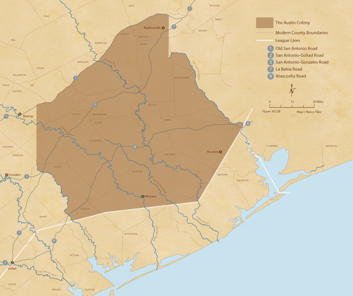
Austin Empresario Colony. April 27, 1825

Print $20.00
Austin Empresario Colony. April 27, 1825
2020
Size: 18.1 x 21.6 inches
95979
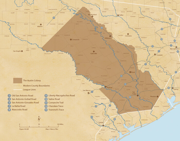
Austin Empresario Colony. February 25, 1831

Print $20.00
Austin Empresario Colony. February 25, 1831
2020
Size: 17.0 x 21.7 inches
95983
Austin Empresario Colony. January 17, 1821/February 18, 1823


Print $20.00
Austin Empresario Colony. January 17, 1821/February 18, 1823
2020
Size: 18.8 x 21.6 inches
95978
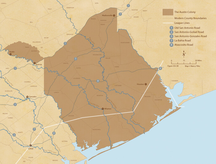
Austin Empresario Colony. July 9, 1828

Print $20.00
Austin Empresario Colony. July 9, 1828
2020
Size: 16.4 x 21.7 inches
95982
Austin Empresario Colony. March 27, 1827


Print $20.00
Austin Empresario Colony. March 27, 1827
2020
Size: 18.0 x 21.6 inches
95980
Austin Empresario Colony. November 20, 1827


Print $20.00
Austin Empresario Colony. November 20, 1827
2020
Size: 14.7 x 21.7 inches
95981
Austin's colony 1821-1836: In commemoration of the two hundredth birthday of Stephen F. Austin


Print $20.00
- Digital $50.00
Austin's colony 1821-1836: In commemoration of the two hundredth birthday of Stephen F. Austin
1993
Size: 24.6 x 34.5 inches
1675
Beales and Royuela Empresario Colony. March 14, 1832


Print $20.00
Beales and Royuela Empresario Colony. March 14, 1832
2020
Size: 19.4 x 21.6 inches
95984
Boundaries of Robertson's Colony and of Milam's Colony


Print $6.00
- Digital $50.00
Boundaries of Robertson's Colony and of Milam's Colony
1840
Size: 9.5 x 14.8 inches
1949
Burnet Empresario Colony. December 22, 1826


Print $20.00
Burnet Empresario Colony. December 22, 1826
2020
Size: 12.9 x 21.6 inches
95985
Cameron Empresario Colony. May 21, 1827


Print $20.00
Cameron Empresario Colony. May 21, 1827
2020
Size: 10.7 x 21.7 inches
95986
Cameron Empresario Colony. September 28, 1828


Print $20.00
Cameron Empresario Colony. September 28, 1828
2020
Size: 10.4 x 21.7 inches
95987
Connected Map of Austin's Colony


Print $40.00
- Digital $50.00
Connected Map of Austin's Colony
1837
Size: 90.6 x 80.9 inches
1943
Connected Map of Austin's Colony


Print $40.00
- Digital $50.00
Connected Map of Austin's Colony
1837
Size: 90.8 x 85.6 inches
1944
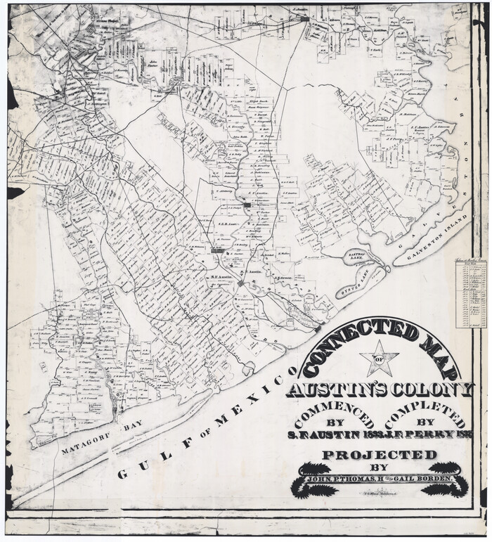
Connected Map of Austin's Colony

Print $20.00
- Digital $50.00
Connected Map of Austin's Colony
1892
Size: 47.1 x 42.8 inches
76073
Connected Map of Austin's Colony


Print $20.00
- Digital $50.00
Connected Map of Austin's Colony
1892
Size: 47.5 x 43.0 inches
76074
Connected Map of Austin's Colony


Print $20.00
- Digital $50.00
Connected Map of Austin's Colony
1892
Size: 47.3 x 43.3 inches
76075
Connected Map of Austin's Colony
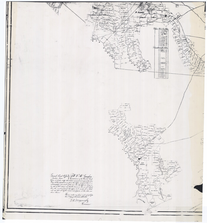

Print $20.00
- Digital $50.00
Connected Map of Austin's Colony
1892
Size: 46.9 x 43.5 inches
76076
Connected Map of Austin's Colony
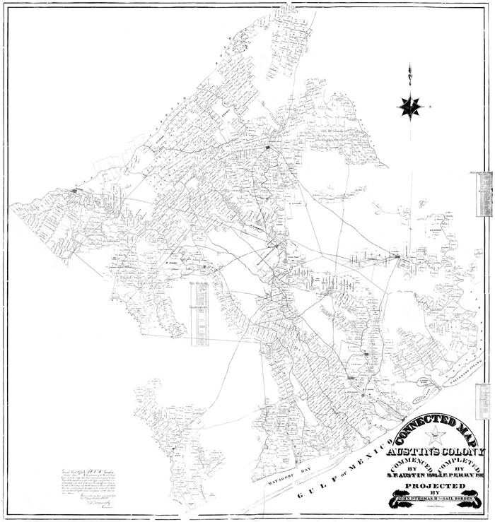

Print $20.00
- Digital $50.00
Connected Map of Austin's Colony
1833
Size: 38.1 x 36.1 inches
88999
Connected Map of Austin's Colony


Print $40.00
- Digital $50.00
Connected Map of Austin's Colony
1837
Size: 93.2 x 43.1 inches
93376
Connected Map of Austin's Colony


Print $40.00
- Digital $50.00
Connected Map of Austin's Colony
1837
Size: 93.2 x 43.7 inches
93377
"Old Three Hundred" Land Grants under Austin's First Contract


"Old Three Hundred" Land Grants under Austin's First Contract
2023
-
Size
8.5 x 11.0 inches
-
Map/Doc
97185
-
Creation Date
2023
A Map of Austin's Colony and adjacent country in Texas drawn principally from actual survey by Stephen F. Austin


A Map of Austin's Colony and adjacent country in Texas drawn principally from actual survey by Stephen F. Austin
1820
-
Size
13.8 x 17.0 inches
-
Map/Doc
93353
-
Creation Date
1820
Abstract of Land Titles in the Spanish Department of the General Land Office of the State of Texas - 1824-36


Abstract of Land Titles in the Spanish Department of the General Land Office of the State of Texas - 1824-36
1857
-
Size
17.6 x 11.9 inches
-
Map/Doc
94535
-
Creation Date
1857
Atlas B, 1-137, Burnet's Colony


Atlas B, 1-137, Burnet's Colony
-
Size
13.2 x 18.1 inches
-
Map/Doc
94537
Atlas T - Titles to Frontier Settlers issued by the Commissioner Carlos S. Taylor


Atlas T - Titles to Frontier Settlers issued by the Commissioner Carlos S. Taylor
1834
-
Map/Doc
94536
-
Creation Date
1834
Austin Empresario Colony. April 27, 1825


Print $20.00
Austin Empresario Colony. April 27, 1825
2020
-
Size
18.1 x 21.6 inches
-
Map/Doc
95979
-
Creation Date
2020
Austin Empresario Colony. February 25, 1831


Print $20.00
Austin Empresario Colony. February 25, 1831
2020
-
Size
17.0 x 21.7 inches
-
Map/Doc
95983
-
Creation Date
2020
Austin Empresario Colony. January 17, 1821/February 18, 1823


Print $20.00
Austin Empresario Colony. January 17, 1821/February 18, 1823
2020
-
Size
18.8 x 21.6 inches
-
Map/Doc
95978
-
Creation Date
2020
Austin Empresario Colony. July 9, 1828


Print $20.00
Austin Empresario Colony. July 9, 1828
2020
-
Size
16.4 x 21.7 inches
-
Map/Doc
95982
-
Creation Date
2020
Austin Empresario Colony. March 27, 1827


Print $20.00
Austin Empresario Colony. March 27, 1827
2020
-
Size
18.0 x 21.6 inches
-
Map/Doc
95980
-
Creation Date
2020
Austin Empresario Colony. November 20, 1827


Print $20.00
Austin Empresario Colony. November 20, 1827
2020
-
Size
14.7 x 21.7 inches
-
Map/Doc
95981
-
Creation Date
2020
Austin's colony 1821-1836: In commemoration of the two hundredth birthday of Stephen F. Austin


Print $20.00
- Digital $50.00
Austin's colony 1821-1836: In commemoration of the two hundredth birthday of Stephen F. Austin
1993
-
Size
24.6 x 34.5 inches
-
Map/Doc
1675
-
Creation Date
1993
Beales and Royuela Empresario Colony. March 14, 1832


Print $20.00
Beales and Royuela Empresario Colony. March 14, 1832
2020
-
Size
19.4 x 21.6 inches
-
Map/Doc
95984
-
Creation Date
2020
Boundaries of Robertson's Colony and of Milam's Colony


Print $6.00
- Digital $50.00
Boundaries of Robertson's Colony and of Milam's Colony
1840
-
Size
9.5 x 14.8 inches
-
Map/Doc
1949
-
Creation Date
1840
Burnet Empresario Colony. December 22, 1826


Print $20.00
Burnet Empresario Colony. December 22, 1826
2020
-
Size
12.9 x 21.6 inches
-
Map/Doc
95985
-
Creation Date
2020
Cameron Empresario Colony. May 21, 1827


Print $20.00
Cameron Empresario Colony. May 21, 1827
2020
-
Size
10.7 x 21.7 inches
-
Map/Doc
95986
-
Creation Date
2020
Cameron Empresario Colony. September 28, 1828


Print $20.00
Cameron Empresario Colony. September 28, 1828
2020
-
Size
10.4 x 21.7 inches
-
Map/Doc
95987
-
Creation Date
2020
Connected Map of Austin's Colony


Print $40.00
- Digital $50.00
Connected Map of Austin's Colony
1837
-
Size
90.6 x 80.9 inches
-
Map/Doc
1943
-
Creation Date
1837
Connected Map of Austin's Colony


Print $40.00
- Digital $50.00
Connected Map of Austin's Colony
1837
1892 certified tracing of 1833-1837 original
-
Size
90.8 x 85.6 inches
-
Map/Doc
1944
-
Creation Date
1837
Connected Map of Austin's Colony


Print $20.00
- Digital $50.00
Connected Map of Austin's Colony
1892
-
Size
47.1 x 42.8 inches
-
Map/Doc
76073
-
Creation Date
1892
Connected Map of Austin's Colony


Print $20.00
- Digital $50.00
Connected Map of Austin's Colony
1892
-
Size
47.5 x 43.0 inches
-
Map/Doc
76074
-
Creation Date
1892
Connected Map of Austin's Colony


Print $20.00
- Digital $50.00
Connected Map of Austin's Colony
1892
-
Size
47.3 x 43.3 inches
-
Map/Doc
76075
-
Creation Date
1892
Connected Map of Austin's Colony


Print $20.00
- Digital $50.00
Connected Map of Austin's Colony
1892
-
Size
46.9 x 43.5 inches
-
Map/Doc
76076
-
Creation Date
1892
Connected Map of Austin's Colony


Print $20.00
- Digital $50.00
Connected Map of Austin's Colony
1833
-
Size
38.1 x 36.1 inches
-
Map/Doc
88999
-
Creation Date
1833
Connected Map of Austin's Colony


Print $40.00
- Digital $50.00
Connected Map of Austin's Colony
1837
-
Size
93.2 x 43.1 inches
-
Map/Doc
93376
-
Creation Date
1837
Connected Map of Austin's Colony


Print $40.00
- Digital $50.00
Connected Map of Austin's Colony
1837
-
Size
93.2 x 43.7 inches
-
Map/Doc
93377
-
Creation Date
1837


