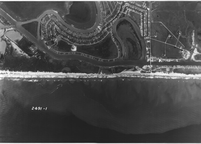
[Aerial photograph from Carancahua Bend of Caney Creek to Cedar Lake]
Print $20.00
- Digital $50.00
[Aerial photograph from Carancahua Bend of Caney Creek to Cedar Lake]
1991
Size: 24.4 x 34.0 inches
78639
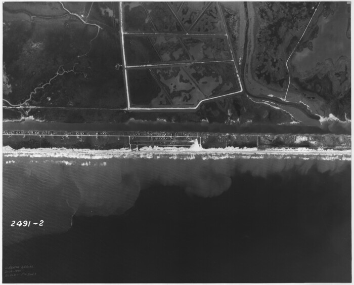
[Aerial photograph from Carancahua Bend of Caney Creek to Cedar Lake]
Print $20.00
- Digital $50.00
[Aerial photograph from Carancahua Bend of Caney Creek to Cedar Lake]
1991
Size: 24.4 x 30.3 inches
78640
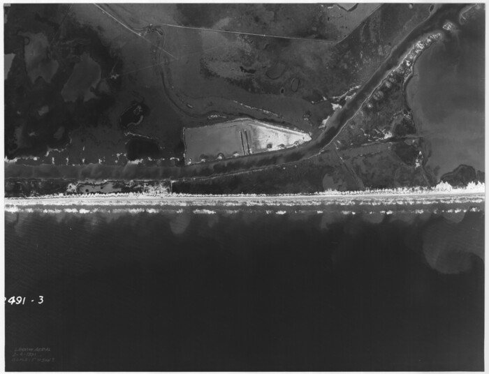
[Aerial photograph from Carancahua Bend of Caney Creek to Cedar Lake]
Print $20.00
- Digital $50.00
[Aerial photograph from Carancahua Bend of Caney Creek to Cedar Lake]
1991
Size: 24.5 x 31.9 inches
78641
Texas City Channel, Texas, Channel and Turning Basin Dredging - Sheet 6

Print $20.00
- Digital $50.00
Texas City Channel, Texas, Channel and Turning Basin Dredging - Sheet 6
1958
Size: 28.6 x 40.6 inches
61836
Texas City Channel, Texas, Channel and Turning Basin Dredging - Sheet 5

Print $20.00
- Digital $50.00
Texas City Channel, Texas, Channel and Turning Basin Dredging - Sheet 5
1958
Size: 28.2 x 40.9 inches
61835
Texas City Channel, Texas, Channel and Turning Basin Dredging - Sheet 4

Print $20.00
- Digital $50.00
Texas City Channel, Texas, Channel and Turning Basin Dredging - Sheet 4
1958
Size: 28.5 x 40.9 inches
61834
Texas City Channel, Texas, Channel and Turning Basin Dredging - Sheet 3

Print $20.00
- Digital $50.00
Texas City Channel, Texas, Channel and Turning Basin Dredging - Sheet 3
1958
Size: 28.4 x 40.6 inches
61833
Texas City Channel, Texas, Channel and Turning Basin Dredging - Sheet 2

Print $20.00
- Digital $50.00
Texas City Channel, Texas, Channel and Turning Basin Dredging - Sheet 2
1958
Size: 28.6 x 41.0 inches
61832
Texas City Channel, Texas, Channel and Turning Basin Dredging - Sheet 1

Print $20.00
- Digital $50.00
Texas City Channel, Texas, Channel and Turning Basin Dredging - Sheet 1
1958
Size: 29.3 x 40.8 inches
61831
Sketch of the Designation of Route of the Aransas Channel Harbor & Dock Company's Deep Water Channel

Print $3.00
- Digital $50.00
Sketch of the Designation of Route of the Aransas Channel Harbor & Dock Company's Deep Water Channel
Size: 13.2 x 10.0 inches
4495
Port Aransas-Corpus Christi Waterway, Texas, Avery Point Turning Basin to Vicinity of Tule Lake - Dredging

Print $20.00
- Digital $50.00
Port Aransas-Corpus Christi Waterway, Texas, Avery Point Turning Basin to Vicinity of Tule Lake - Dredging
1947
Size: 28.6 x 41.8 inches
1996
Port Aransas-Corpus Christi Waterway, Texas, Avery Point Turning Basin to Vicinity of Tule Lake - Dredging

Print $20.00
- Digital $50.00
Port Aransas-Corpus Christi Waterway, Texas, Avery Point Turning Basin to Vicinity of Tule Lake - Dredging
1947
Size: 28.5 x 41.4 inches
60301
Port Aransas-Corpus Christi Waterway, Texas, Avery Point Turning Basin to Vicinity of Tule Lake - Dredging

Print $20.00
- Digital $50.00
Port Aransas-Corpus Christi Waterway, Texas, Avery Point Turning Basin to Vicinity of Tule Lake - Dredging
1947
Size: 28.4 x 41.4 inches
60302
Navigation Maps of Gulf Intracoastal Waterway, Port Arthur to Brownsville, Texas

Print $20.00
- Digital $50.00
Navigation Maps of Gulf Intracoastal Waterway, Port Arthur to Brownsville, Texas
1951
Size: 16.7 x 21.4 inches
65417
Navigation Maps of Gulf Intracoastal Waterway, Port Arthur to Brownsville, Texas

Print $4.00
- Digital $50.00
Navigation Maps of Gulf Intracoastal Waterway, Port Arthur to Brownsville, Texas
1951
Size: 16.7 x 21.5 inches
65418
Navigation Maps of Gulf Intracoastal Waterway, Port Arthur to Brownsville, Texas

Print $4.00
- Digital $50.00
Navigation Maps of Gulf Intracoastal Waterway, Port Arthur to Brownsville, Texas
1951
Size: 16.8 x 21.6 inches
65419
Navigation Maps of Gulf Intracoastal Waterway, Port Arthur to Brownsville, Texas

Print $4.00
- Digital $50.00
Navigation Maps of Gulf Intracoastal Waterway, Port Arthur to Brownsville, Texas
1951
Size: 16.7 x 21.6 inches
65420
Navigation Maps of Gulf Intracoastal Waterway, Port Arthur to Brownsville, Texas

Print $4.00
- Digital $50.00
Navigation Maps of Gulf Intracoastal Waterway, Port Arthur to Brownsville, Texas
1951
Size: 16.7 x 21.5 inches
65421
Navigation Maps of Gulf Intracoastal Waterway, Port Arthur to Brownsville, Texas

Print $4.00
- Digital $50.00
Navigation Maps of Gulf Intracoastal Waterway, Port Arthur to Brownsville, Texas
1951
Size: 16.6 x 21.6 inches
65422
Navigation Maps of Gulf Intracoastal Waterway, Port Arthur to Brownsville, Texas

Print $4.00
- Digital $50.00
Navigation Maps of Gulf Intracoastal Waterway, Port Arthur to Brownsville, Texas
1951
Size: 16.7 x 21.4 inches
65423
Navigation Maps of Gulf Intracoastal Waterway, Port Arthur to Brownsville, Texas

Print $4.00
- Digital $50.00
Navigation Maps of Gulf Intracoastal Waterway, Port Arthur to Brownsville, Texas
1951
Size: 16.7 x 21.5 inches
65424
Navigation Maps of Gulf Intracoastal Waterway, Port Arthur to Brownsville, Texas

Print $4.00
- Digital $50.00
Navigation Maps of Gulf Intracoastal Waterway, Port Arthur to Brownsville, Texas
1951
Size: 16.7 x 21.4 inches
65425
Navigation Maps of Gulf Intracoastal Waterway, Port Arthur to Brownsville, Texas

Print $4.00
- Digital $50.00
Navigation Maps of Gulf Intracoastal Waterway, Port Arthur to Brownsville, Texas
1951
Size: 16.7 x 21.6 inches
65426
Navigation Maps of Gulf Intracoastal Waterway, Port Arthur to Brownsville, Texas

Print $4.00
- Digital $50.00
Navigation Maps of Gulf Intracoastal Waterway, Port Arthur to Brownsville, Texas
1951
Size: 16.6 x 21.5 inches
65427
Navigation Maps of Gulf Intracoastal Waterway, Port Arthur to Brownsville, Texas

Print $4.00
- Digital $50.00
Navigation Maps of Gulf Intracoastal Waterway, Port Arthur to Brownsville, Texas
1951
Size: 16.7 x 21.5 inches
65428
Navigation Maps of Gulf Intracoastal Waterway, Port Arthur to Brownsville, Texas

Print $4.00
- Digital $50.00
Navigation Maps of Gulf Intracoastal Waterway, Port Arthur to Brownsville, Texas
1951
Size: 16.6 x 21.6 inches
65429
Navigation Maps of Gulf Intracoastal Waterway, Port Arthur to Brownsville, Texas

Print $4.00
- Digital $50.00
Navigation Maps of Gulf Intracoastal Waterway, Port Arthur to Brownsville, Texas
1951
Size: 16.6 x 21.5 inches
65430
Navigation Maps of Gulf Intracoastal Waterway, Port Arthur to Brownsville, Texas

Print $4.00
- Digital $50.00
Navigation Maps of Gulf Intracoastal Waterway, Port Arthur to Brownsville, Texas
1951
Size: 16.6 x 21.3 inches
65431
Navigation Maps of Gulf Intracoastal Waterway, Port Arthur to Brownsville, Texas

Print $4.00
- Digital $50.00
Navigation Maps of Gulf Intracoastal Waterway, Port Arthur to Brownsville, Texas
1951
Size: 16.6 x 21.6 inches
65432
Navigation Maps of Gulf Intracoastal Waterway, Port Arthur to Brownsville, Texas

Print $4.00
- Digital $50.00
Navigation Maps of Gulf Intracoastal Waterway, Port Arthur to Brownsville, Texas
1951
Size: 16.7 x 21.4 inches
65433
[Aerial photograph from Carancahua Bend of Caney Creek to Cedar Lake]
Print $20.00
- Digital $50.00
[Aerial photograph from Carancahua Bend of Caney Creek to Cedar Lake]
1991
-
Size
24.4 x 34.0 inches
-
Map/Doc
78639
-
Creation Date
1991
[Aerial photograph from Carancahua Bend of Caney Creek to Cedar Lake]
Print $20.00
- Digital $50.00
[Aerial photograph from Carancahua Bend of Caney Creek to Cedar Lake]
1991
-
Size
24.4 x 30.3 inches
-
Map/Doc
78640
-
Creation Date
1991
[Aerial photograph from Carancahua Bend of Caney Creek to Cedar Lake]
Print $20.00
- Digital $50.00
[Aerial photograph from Carancahua Bend of Caney Creek to Cedar Lake]
1991
-
Size
24.5 x 31.9 inches
-
Map/Doc
78641
-
Creation Date
1991
Texas City Channel, Texas, Channel and Turning Basin Dredging - Sheet 6
Print $20.00
- Digital $50.00
Texas City Channel, Texas, Channel and Turning Basin Dredging - Sheet 6
1958
-
Size
28.6 x 40.6 inches
-
Map/Doc
61836
-
Creation Date
1958
Texas City Channel, Texas, Channel and Turning Basin Dredging - Sheet 5
Print $20.00
- Digital $50.00
Texas City Channel, Texas, Channel and Turning Basin Dredging - Sheet 5
1958
-
Size
28.2 x 40.9 inches
-
Map/Doc
61835
-
Creation Date
1958
Texas City Channel, Texas, Channel and Turning Basin Dredging - Sheet 4
Print $20.00
- Digital $50.00
Texas City Channel, Texas, Channel and Turning Basin Dredging - Sheet 4
1958
-
Size
28.5 x 40.9 inches
-
Map/Doc
61834
-
Creation Date
1958
Texas City Channel, Texas, Channel and Turning Basin Dredging - Sheet 3
Print $20.00
- Digital $50.00
Texas City Channel, Texas, Channel and Turning Basin Dredging - Sheet 3
1958
-
Size
28.4 x 40.6 inches
-
Map/Doc
61833
-
Creation Date
1958
Texas City Channel, Texas, Channel and Turning Basin Dredging - Sheet 2
Print $20.00
- Digital $50.00
Texas City Channel, Texas, Channel and Turning Basin Dredging - Sheet 2
1958
-
Size
28.6 x 41.0 inches
-
Map/Doc
61832
-
Creation Date
1958
Texas City Channel, Texas, Channel and Turning Basin Dredging - Sheet 1
Print $20.00
- Digital $50.00
Texas City Channel, Texas, Channel and Turning Basin Dredging - Sheet 1
1958
-
Size
29.3 x 40.8 inches
-
Map/Doc
61831
-
Creation Date
1958
Sketch of the Designation of Route of the Aransas Channel Harbor & Dock Company's Deep Water Channel
Print $3.00
- Digital $50.00
Sketch of the Designation of Route of the Aransas Channel Harbor & Dock Company's Deep Water Channel
-
Size
13.2 x 10.0 inches
-
Map/Doc
4495
Port Aransas-Corpus Christi Waterway, Texas, Avery Point Turning Basin to Vicinity of Tule Lake - Dredging
Print $20.00
- Digital $50.00
Port Aransas-Corpus Christi Waterway, Texas, Avery Point Turning Basin to Vicinity of Tule Lake - Dredging
1947
-
Size
28.6 x 41.8 inches
-
Map/Doc
1996
-
Creation Date
1947
Port Aransas-Corpus Christi Waterway, Texas, Avery Point Turning Basin to Vicinity of Tule Lake - Dredging
Print $20.00
- Digital $50.00
Port Aransas-Corpus Christi Waterway, Texas, Avery Point Turning Basin to Vicinity of Tule Lake - Dredging
1947
-
Size
28.5 x 41.4 inches
-
Map/Doc
60301
-
Creation Date
1947
Port Aransas-Corpus Christi Waterway, Texas, Avery Point Turning Basin to Vicinity of Tule Lake - Dredging
Print $20.00
- Digital $50.00
Port Aransas-Corpus Christi Waterway, Texas, Avery Point Turning Basin to Vicinity of Tule Lake - Dredging
1947
-
Size
28.4 x 41.4 inches
-
Map/Doc
60302
-
Creation Date
1947
Navigation Maps of Gulf Intracoastal Waterway, Port Arthur to Brownsville, Texas
Print $20.00
- Digital $50.00
Navigation Maps of Gulf Intracoastal Waterway, Port Arthur to Brownsville, Texas
1951
-
Size
16.7 x 21.4 inches
-
Map/Doc
65417
-
Creation Date
1951
Navigation Maps of Gulf Intracoastal Waterway, Port Arthur to Brownsville, Texas
Print $4.00
- Digital $50.00
Navigation Maps of Gulf Intracoastal Waterway, Port Arthur to Brownsville, Texas
1951
-
Size
16.7 x 21.5 inches
-
Map/Doc
65418
-
Creation Date
1951
Navigation Maps of Gulf Intracoastal Waterway, Port Arthur to Brownsville, Texas
Print $4.00
- Digital $50.00
Navigation Maps of Gulf Intracoastal Waterway, Port Arthur to Brownsville, Texas
1951
-
Size
16.8 x 21.6 inches
-
Map/Doc
65419
-
Creation Date
1951
Navigation Maps of Gulf Intracoastal Waterway, Port Arthur to Brownsville, Texas
Print $4.00
- Digital $50.00
Navigation Maps of Gulf Intracoastal Waterway, Port Arthur to Brownsville, Texas
1951
-
Size
16.7 x 21.6 inches
-
Map/Doc
65420
-
Creation Date
1951
Navigation Maps of Gulf Intracoastal Waterway, Port Arthur to Brownsville, Texas
Print $4.00
- Digital $50.00
Navigation Maps of Gulf Intracoastal Waterway, Port Arthur to Brownsville, Texas
1951
-
Size
16.7 x 21.5 inches
-
Map/Doc
65421
-
Creation Date
1951
Navigation Maps of Gulf Intracoastal Waterway, Port Arthur to Brownsville, Texas
Print $4.00
- Digital $50.00
Navigation Maps of Gulf Intracoastal Waterway, Port Arthur to Brownsville, Texas
1951
-
Size
16.6 x 21.6 inches
-
Map/Doc
65422
-
Creation Date
1951
Navigation Maps of Gulf Intracoastal Waterway, Port Arthur to Brownsville, Texas
Print $4.00
- Digital $50.00
Navigation Maps of Gulf Intracoastal Waterway, Port Arthur to Brownsville, Texas
1951
-
Size
16.7 x 21.4 inches
-
Map/Doc
65423
-
Creation Date
1951
Navigation Maps of Gulf Intracoastal Waterway, Port Arthur to Brownsville, Texas
Print $4.00
- Digital $50.00
Navigation Maps of Gulf Intracoastal Waterway, Port Arthur to Brownsville, Texas
1951
-
Size
16.7 x 21.5 inches
-
Map/Doc
65424
-
Creation Date
1951
Navigation Maps of Gulf Intracoastal Waterway, Port Arthur to Brownsville, Texas
Print $4.00
- Digital $50.00
Navigation Maps of Gulf Intracoastal Waterway, Port Arthur to Brownsville, Texas
1951
-
Size
16.7 x 21.4 inches
-
Map/Doc
65425
-
Creation Date
1951
Navigation Maps of Gulf Intracoastal Waterway, Port Arthur to Brownsville, Texas
Print $4.00
- Digital $50.00
Navigation Maps of Gulf Intracoastal Waterway, Port Arthur to Brownsville, Texas
1951
-
Size
16.7 x 21.6 inches
-
Map/Doc
65426
-
Creation Date
1951
Navigation Maps of Gulf Intracoastal Waterway, Port Arthur to Brownsville, Texas
Print $4.00
- Digital $50.00
Navigation Maps of Gulf Intracoastal Waterway, Port Arthur to Brownsville, Texas
1951
-
Size
16.6 x 21.5 inches
-
Map/Doc
65427
-
Creation Date
1951
Navigation Maps of Gulf Intracoastal Waterway, Port Arthur to Brownsville, Texas
Print $4.00
- Digital $50.00
Navigation Maps of Gulf Intracoastal Waterway, Port Arthur to Brownsville, Texas
1951
-
Size
16.7 x 21.5 inches
-
Map/Doc
65428
-
Creation Date
1951
Navigation Maps of Gulf Intracoastal Waterway, Port Arthur to Brownsville, Texas
Print $4.00
- Digital $50.00
Navigation Maps of Gulf Intracoastal Waterway, Port Arthur to Brownsville, Texas
1951
-
Size
16.6 x 21.6 inches
-
Map/Doc
65429
-
Creation Date
1951
Navigation Maps of Gulf Intracoastal Waterway, Port Arthur to Brownsville, Texas
Print $4.00
- Digital $50.00
Navigation Maps of Gulf Intracoastal Waterway, Port Arthur to Brownsville, Texas
1951
-
Size
16.6 x 21.5 inches
-
Map/Doc
65430
-
Creation Date
1951
Navigation Maps of Gulf Intracoastal Waterway, Port Arthur to Brownsville, Texas
Print $4.00
- Digital $50.00
Navigation Maps of Gulf Intracoastal Waterway, Port Arthur to Brownsville, Texas
1951
-
Size
16.6 x 21.3 inches
-
Map/Doc
65431
-
Creation Date
1951
Navigation Maps of Gulf Intracoastal Waterway, Port Arthur to Brownsville, Texas
Print $4.00
- Digital $50.00
Navigation Maps of Gulf Intracoastal Waterway, Port Arthur to Brownsville, Texas
1951
-
Size
16.6 x 21.6 inches
-
Map/Doc
65432
-
Creation Date
1951
Navigation Maps of Gulf Intracoastal Waterway, Port Arthur to Brownsville, Texas
Print $4.00
- Digital $50.00
Navigation Maps of Gulf Intracoastal Waterway, Port Arthur to Brownsville, Texas
1951
-
Size
16.7 x 21.4 inches
-
Map/Doc
65433
-
Creation Date
1951