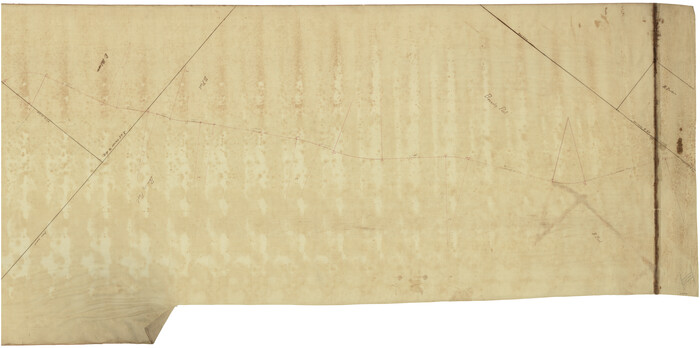
San Antonio and Aransas Pass Ry. from Survey Station 4852+100 to Survey Station 5280+00

Print $4.00
- Digital $50.00
San Antonio and Aransas Pass Ry. from Survey Station 4852+100 to Survey Station 5280+00
Size: 11.8 x 18.6 inches
62570
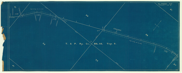
[Galveston, Harrisburg & San Antonio through El Paso County]
Print $20.00
- Digital $50.00
[Galveston, Harrisburg & San Antonio through El Paso County]
Size: 13.6 x 33.6 inches
64004
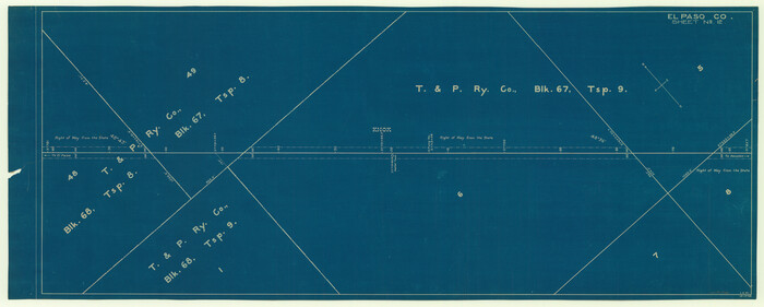
[Galveston, Harrisburg & San Antonio through El Paso County]
Print $20.00
- Digital $50.00
[Galveston, Harrisburg & San Antonio through El Paso County]
Size: 13.5 x 33.7 inches
64006
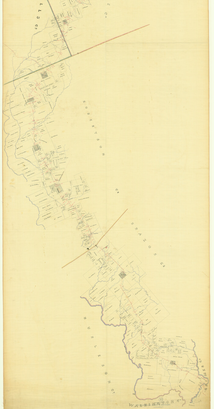
Map of the Houston & Texas Centr. R.R. from Corsicana, Navarro County, to Dallas, Dallas County

Print $40.00
- Digital $50.00
Map of the Houston & Texas Centr. R.R. from Corsicana, Navarro County, to Dallas, Dallas County
Size: 27.6 x 88.3 inches
64041
[Location St. L. & S. W. R. R. Through Cherokee County]
Print $40.00
- Digital $50.00
[Location St. L. & S. W. R. R. Through Cherokee County]
Size: 92.0 x 39.9 inches
64042
Location St. L. & S. W. R. R. Through Cherokee County

Print $40.00
- Digital $50.00
Location St. L. & S. W. R. R. Through Cherokee County
Size: 108.6 x 39.0 inches
64043
[Location St. L. & S. W. R. R. Through Cherokee County]
Print $40.00
- Digital $50.00
[Location St. L. & S. W. R. R. Through Cherokee County]
Size: 39.2 x 122.1 inches
64044
[Location St. L. & S. W. R. R. Through Cherokee County]
Print $40.00
- Digital $50.00
[Location St. L. & S. W. R. R. Through Cherokee County]
Size: 38.7 x 76.6 inches
64045
[Rio Grande & Eagle Pass - Stockdale to Cuero]
Print $40.00
- Digital $50.00
[Rio Grande & Eagle Pass - Stockdale to Cuero]
Size: 20.6 x 121.5 inches
64047
[Rio Grande & Eagle Pass - Stockdale to Cuero]
Print $40.00
- Digital $50.00
[Rio Grande & Eagle Pass - Stockdale to Cuero]
Size: 19.9 x 122.5 inches
64048
[Rio Grande & Eagle Pass - Stockdale to Cuero]
Print $40.00
- Digital $50.00
[Rio Grande & Eagle Pass - Stockdale to Cuero]
Size: 19.1 x 98.7 inches
64049
Located Line of the Panhandle & Gulf Ry. through State Lands, Public School and University, in Upton County Texas, Right of Way 200 feet wide

Print $40.00
- Digital $50.00
Located Line of the Panhandle & Gulf Ry. through State Lands, Public School and University, in Upton County Texas, Right of Way 200 feet wide
Size: 13.3 x 102.6 inches
64052
[T. & N. O. R.R. Jefferson Co. North]
Print $20.00
- Digital $50.00
[T. & N. O. R.R. Jefferson Co. North]
Size: 13.4 x 33.4 inches
64055
[Plat of Location and Right of Way from El Paso, Tex. To New Mexico Line, Rio Grande and El Paso R. R.]
Print $40.00
- Digital $50.00
[Plat of Location and Right of Way from El Paso, Tex. To New Mexico Line, Rio Grande and El Paso R. R.]
Size: 23.8 x 122.6 inches
64082
Plat of Location and Right of Way from El Paso, Tex. To New Mexico Line, Rio Grande and El Paso R. R.

Print $40.00
- Digital $50.00
Plat of Location and Right of Way from El Paso, Tex. To New Mexico Line, Rio Grande and El Paso R. R.
Size: 22.5 x 121.3 inches
64083
[Plat of Location and Right of Way from El Paso, Tex. To New Mexico Line, Rio Grande and El Paso R. R.]
Print $20.00
- Digital $50.00
[Plat of Location and Right of Way from El Paso, Tex. To New Mexico Line, Rio Grande and El Paso R. R.]
Size: 22.7 x 46.8 inches
64084
Map of Location and Right of Way from El Paso, Tex. To New Mexico Line, Rio Grande & El Paso R.R.

Print $20.00
- Digital $50.00
Map of Location and Right of Way from El Paso, Tex. To New Mexico Line, Rio Grande & El Paso R.R.
Size: 14.0 x 20.9 inches
64085
Map of the Line of the H. & Texas Cen. Railway from the Navasota River, 72 1/2 Miles from Houston, to Corsicana in Navarro Co., 211 mls from Houston

Print $40.00
- Digital $50.00
Map of the Line of the H. & Texas Cen. Railway from the Navasota River, 72 1/2 Miles from Houston, to Corsicana in Navarro Co., 211 mls from Houston
Size: 39.2 x 61.4 inches
64086
[Map of the Line of the H. & Texas Cen. Railway from the Navasota River, 72 1/2 Miles from Houston, to Corsicana in Navarro Co., 211 mls from Houston]
Print $40.00
- Digital $50.00
[Map of the Line of the H. & Texas Cen. Railway from the Navasota River, 72 1/2 Miles from Houston, to Corsicana in Navarro Co., 211 mls from Houston]
Size: 75.6 x 39.6 inches
64087
Map of Main Line Houston & Tex. Centr. Railway from Dallas to Red River City

Print $40.00
- Digital $50.00
Map of Main Line Houston & Tex. Centr. Railway from Dallas to Red River City
Size: 37.1 x 84.9 inches
64089
Map of Location of the Pecos & Northern Texas Railway from Station 5868+52 to Station 7879+36 = 38.08 Miles through Parmer County, Texas

Print $40.00
- Digital $50.00
Map of Location of the Pecos & Northern Texas Railway from Station 5868+52 to Station 7879+36 = 38.08 Miles through Parmer County, Texas
Size: 20.2 x 108.5 inches
64090
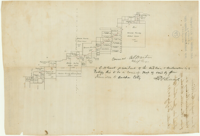
[Red River & Southwestern Ry. Co. from Henrietta to Archer City]
Print $20.00
- Digital $50.00
[Red River & Southwestern Ry. Co. from Henrietta to Archer City]
Size: 14.3 x 21.1 inches
64147
[New York, Texas & Mexican Railway]
Print $20.00
- Digital $50.00
[New York, Texas & Mexican Railway]
Size: 12.1 x 24.1 inches
64148
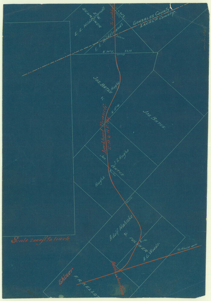
[San Antonio & Galveston RR]
Print $20.00
- Digital $50.00
[San Antonio & Galveston RR]
Size: 37.6 x 11.2 inches
64149
Map Location of the Pecos & Northern Texas Railway from [illegible] through Deaf Smith County

Print $40.00
- Digital $50.00
Map Location of the Pecos & Northern Texas Railway from [illegible] through Deaf Smith County
Size: 16.3 x 71.8 inches
64180
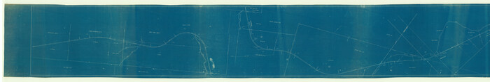
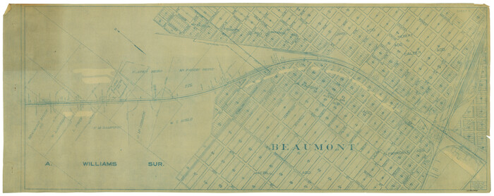
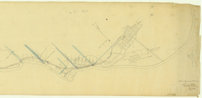
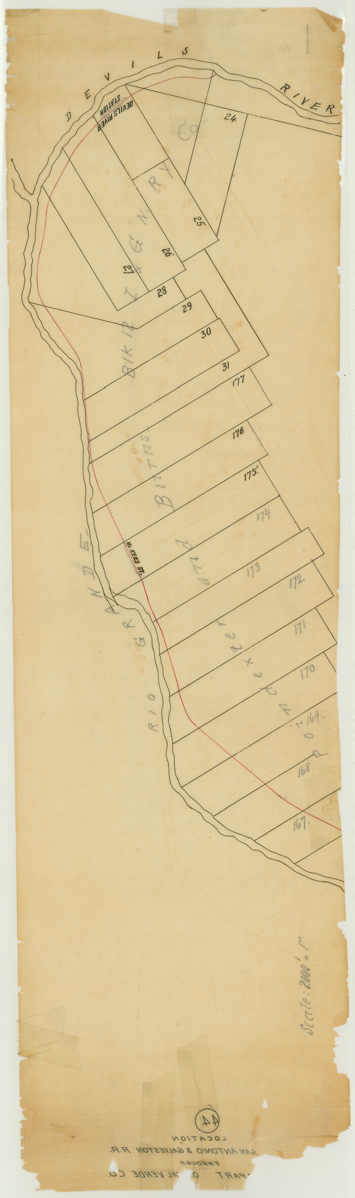
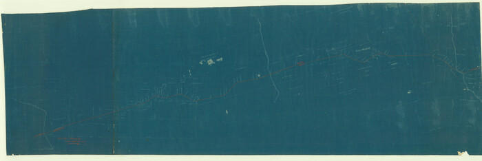
[San Antonio & Aransas Pass]
Print $40.00
- Digital $50.00
[San Antonio & Aransas Pass]
Size: 17.0 x 50.7 inches
64208
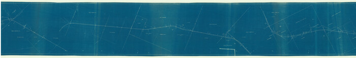
[San Antonio & Aransas Pass]
Print $20.00
- Digital $50.00
[San Antonio & Aransas Pass]
Size: 15.2 x 45.5 inches
64209
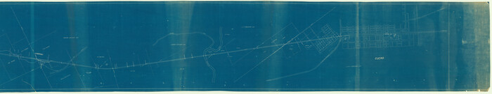
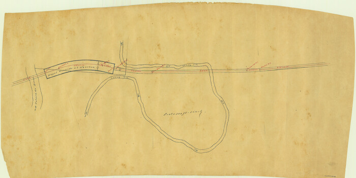
[San Antonio & Aransas Pass]
Print $20.00
- Digital $50.00
[San Antonio & Aransas Pass]
Size: 35.4 x 14.8 inches
64210
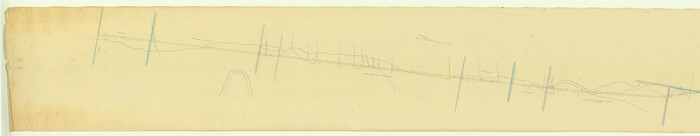
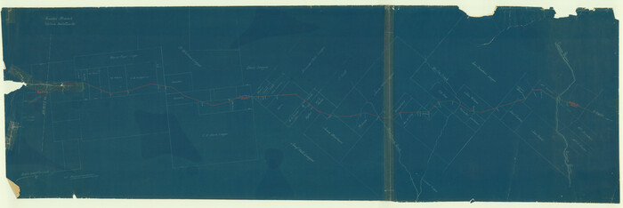
[San Antonio & Aransas Pass]
Print $2.00
- Digital $50.00
[San Antonio & Aransas Pass]
Size: 11.6 x 8.2 inches
64211
[Texas Central Railway through Callahan County]
Print $40.00
- Digital $50.00
[Texas Central Railway through Callahan County]
Size: 24.6 x 86.3 inches
64240
San Antonio and Aransas Pass Ry. from Survey Station 4852+100 to Survey Station 5280+00
Print $4.00
- Digital $50.00
San Antonio and Aransas Pass Ry. from Survey Station 4852+100 to Survey Station 5280+00
-
Size
11.8 x 18.6 inches
-
Map/Doc
62570
[Galveston, Harrisburg & San Antonio through El Paso County]
Print $20.00
- Digital $50.00
[Galveston, Harrisburg & San Antonio through El Paso County]
-
Size
13.6 x 33.6 inches
-
Map/Doc
64004
[Galveston, Harrisburg & San Antonio through El Paso County]
Print $20.00
- Digital $50.00
[Galveston, Harrisburg & San Antonio through El Paso County]
-
Size
13.5 x 33.7 inches
-
Map/Doc
64006
Map of the Houston & Texas Centr. R.R. from Corsicana, Navarro County, to Dallas, Dallas County
Print $40.00
- Digital $50.00
Map of the Houston & Texas Centr. R.R. from Corsicana, Navarro County, to Dallas, Dallas County
-
Size
27.6 x 88.3 inches
-
Map/Doc
64041
[Location St. L. & S. W. R. R. Through Cherokee County]
Print $40.00
- Digital $50.00
[Location St. L. & S. W. R. R. Through Cherokee County]
-
Size
92.0 x 39.9 inches
-
Map/Doc
64042
Location St. L. & S. W. R. R. Through Cherokee County
Print $40.00
- Digital $50.00
Location St. L. & S. W. R. R. Through Cherokee County
-
Size
108.6 x 39.0 inches
-
Map/Doc
64043
[Location St. L. & S. W. R. R. Through Cherokee County]
Print $40.00
- Digital $50.00
[Location St. L. & S. W. R. R. Through Cherokee County]
-
Size
39.2 x 122.1 inches
-
Map/Doc
64044
[Location St. L. & S. W. R. R. Through Cherokee County]
Print $40.00
- Digital $50.00
[Location St. L. & S. W. R. R. Through Cherokee County]
-
Size
38.7 x 76.6 inches
-
Map/Doc
64045
[Rio Grande & Eagle Pass - Stockdale to Cuero]
Print $40.00
- Digital $50.00
[Rio Grande & Eagle Pass - Stockdale to Cuero]
-
Size
20.6 x 121.5 inches
-
Map/Doc
64047
[Rio Grande & Eagle Pass - Stockdale to Cuero]
Print $40.00
- Digital $50.00
[Rio Grande & Eagle Pass - Stockdale to Cuero]
-
Size
19.9 x 122.5 inches
-
Map/Doc
64048
[Rio Grande & Eagle Pass - Stockdale to Cuero]
Print $40.00
- Digital $50.00
[Rio Grande & Eagle Pass - Stockdale to Cuero]
-
Size
19.1 x 98.7 inches
-
Map/Doc
64049
Located Line of the Panhandle & Gulf Ry. through State Lands, Public School and University, in Upton County Texas, Right of Way 200 feet wide
Print $40.00
- Digital $50.00
Located Line of the Panhandle & Gulf Ry. through State Lands, Public School and University, in Upton County Texas, Right of Way 200 feet wide
-
Size
13.3 x 102.6 inches
-
Map/Doc
64052
[T. & N. O. R.R. Jefferson Co. North]
Print $20.00
- Digital $50.00
[T. & N. O. R.R. Jefferson Co. North]
-
Size
13.4 x 33.4 inches
-
Map/Doc
64055
[Plat of Location and Right of Way from El Paso, Tex. To New Mexico Line, Rio Grande and El Paso R. R.]
Print $40.00
- Digital $50.00
[Plat of Location and Right of Way from El Paso, Tex. To New Mexico Line, Rio Grande and El Paso R. R.]
-
Size
23.8 x 122.6 inches
-
Map/Doc
64082
Plat of Location and Right of Way from El Paso, Tex. To New Mexico Line, Rio Grande and El Paso R. R.
Print $40.00
- Digital $50.00
Plat of Location and Right of Way from El Paso, Tex. To New Mexico Line, Rio Grande and El Paso R. R.
-
Size
22.5 x 121.3 inches
-
Map/Doc
64083
[Plat of Location and Right of Way from El Paso, Tex. To New Mexico Line, Rio Grande and El Paso R. R.]
Print $20.00
- Digital $50.00
[Plat of Location and Right of Way from El Paso, Tex. To New Mexico Line, Rio Grande and El Paso R. R.]
-
Size
22.7 x 46.8 inches
-
Map/Doc
64084
Map of Location and Right of Way from El Paso, Tex. To New Mexico Line, Rio Grande & El Paso R.R.
Print $20.00
- Digital $50.00
Map of Location and Right of Way from El Paso, Tex. To New Mexico Line, Rio Grande & El Paso R.R.
-
Size
14.0 x 20.9 inches
-
Map/Doc
64085
Map of the Line of the H. & Texas Cen. Railway from the Navasota River, 72 1/2 Miles from Houston, to Corsicana in Navarro Co., 211 mls from Houston
Print $40.00
- Digital $50.00
Map of the Line of the H. & Texas Cen. Railway from the Navasota River, 72 1/2 Miles from Houston, to Corsicana in Navarro Co., 211 mls from Houston
-
Size
39.2 x 61.4 inches
-
Map/Doc
64086
[Map of the Line of the H. & Texas Cen. Railway from the Navasota River, 72 1/2 Miles from Houston, to Corsicana in Navarro Co., 211 mls from Houston]
Print $40.00
- Digital $50.00
[Map of the Line of the H. & Texas Cen. Railway from the Navasota River, 72 1/2 Miles from Houston, to Corsicana in Navarro Co., 211 mls from Houston]
-
Size
75.6 x 39.6 inches
-
Map/Doc
64087
Map of Main Line Houston & Tex. Centr. Railway from Dallas to Red River City
Print $40.00
- Digital $50.00
Map of Main Line Houston & Tex. Centr. Railway from Dallas to Red River City
-
Size
37.1 x 84.9 inches
-
Map/Doc
64089
Map of Location of the Pecos & Northern Texas Railway from Station 5868+52 to Station 7879+36 = 38.08 Miles through Parmer County, Texas
Print $40.00
- Digital $50.00
Map of Location of the Pecos & Northern Texas Railway from Station 5868+52 to Station 7879+36 = 38.08 Miles through Parmer County, Texas
-
Size
20.2 x 108.5 inches
-
Map/Doc
64090
[Red River & Southwestern Ry. Co. from Henrietta to Archer City]
Print $20.00
- Digital $50.00
[Red River & Southwestern Ry. Co. from Henrietta to Archer City]
-
Size
14.3 x 21.1 inches
-
Map/Doc
64147
[New York, Texas & Mexican Railway]
Print $20.00
- Digital $50.00
[New York, Texas & Mexican Railway]
-
Size
12.1 x 24.1 inches
-
Map/Doc
64148
[San Antonio & Galveston RR]
Print $20.00
- Digital $50.00
[San Antonio & Galveston RR]
-
Size
37.6 x 11.2 inches
-
Map/Doc
64149
Map Location of the Pecos & Northern Texas Railway from [illegible] through Deaf Smith County
Print $40.00
- Digital $50.00
Map Location of the Pecos & Northern Texas Railway from [illegible] through Deaf Smith County
-
Size
16.3 x 71.8 inches
-
Map/Doc
64180
[San Antonio & Aransas Pass]
Print $40.00
- Digital $50.00
[San Antonio & Aransas Pass]
-
Size
17.0 x 50.7 inches
-
Map/Doc
64208
[San Antonio & Aransas Pass]
Print $20.00
- Digital $50.00
[San Antonio & Aransas Pass]
-
Size
15.2 x 45.5 inches
-
Map/Doc
64209
[San Antonio & Aransas Pass]
Print $20.00
- Digital $50.00
[San Antonio & Aransas Pass]
-
Size
35.4 x 14.8 inches
-
Map/Doc
64210
[San Antonio & Aransas Pass]
Print $2.00
- Digital $50.00
[San Antonio & Aransas Pass]
-
Size
11.6 x 8.2 inches
-
Map/Doc
64211
[Texas Central Railway through Callahan County]
Print $40.00
- Digital $50.00
[Texas Central Railway through Callahan County]
-
Size
24.6 x 86.3 inches
-
Map/Doc
64240