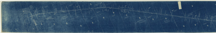
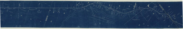
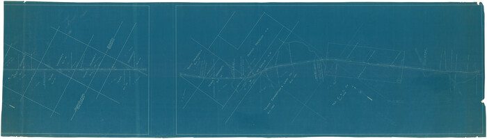
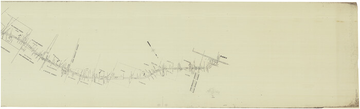
[Unidentified Railroad through Denton and Dallas County]

Print $40.00
- Digital $50.00
[Unidentified Railroad through Denton and Dallas County]
Size: 6.8 x 121.3 inches
64774
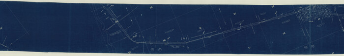
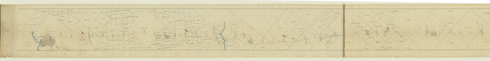
[Unidentified Railroad through Denton and Dallas County]

Print $40.00
- Digital $50.00
[Unidentified Railroad through Denton and Dallas County]
Size: 6.8 x 73.3 inches
64775
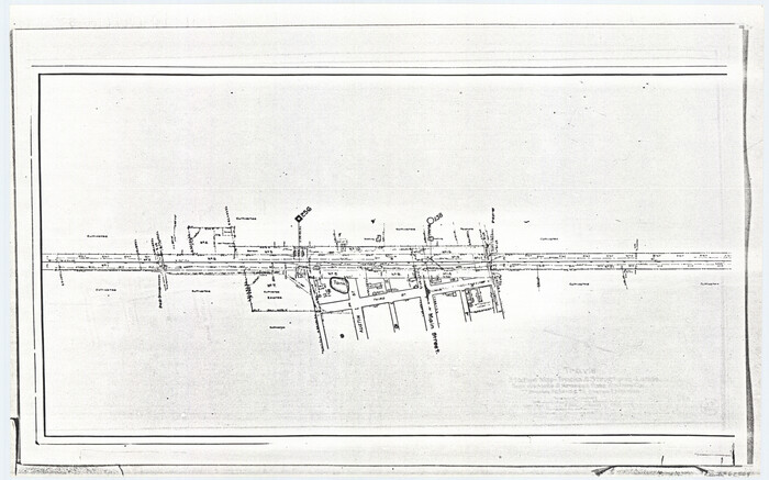
[Travis Station Map - Tracks and Structures - Lands. San Antonio & Aransas Pass Railway Co.]
Print $4.00
- Digital $50.00
[Travis Station Map - Tracks and Structures - Lands. San Antonio & Aransas Pass Railway Co.]
1919
Size: 11.7 x 18.7 inches
62564
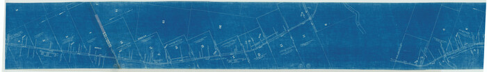
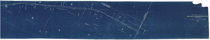
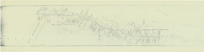
[The S.K. Ry. of Texas, State Line to Pecos, Reeves Co., Texas]
Print $40.00
- Digital $50.00
[The S.K. Ry. of Texas, State Line to Pecos, Reeves Co., Texas]
1910
Size: 18.9 x 120.1 inches
64158
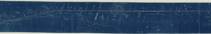
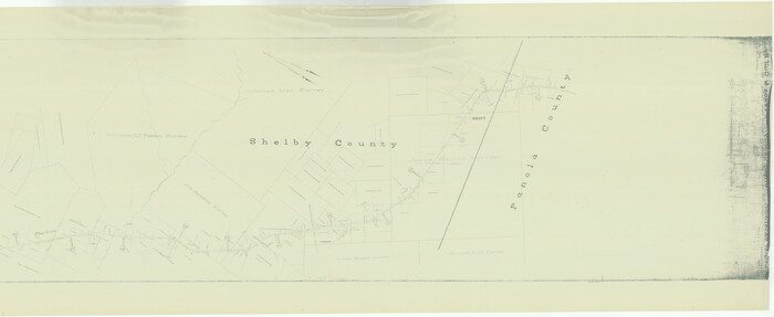
[The S.K. Ry. of Texas, State Line to Pecos, Reeves Co., Texas]
Print $40.00
- Digital $50.00
[The S.K. Ry. of Texas, State Line to Pecos, Reeves Co., Texas]
1910
Size: 19.4 x 130.6 inches
64159
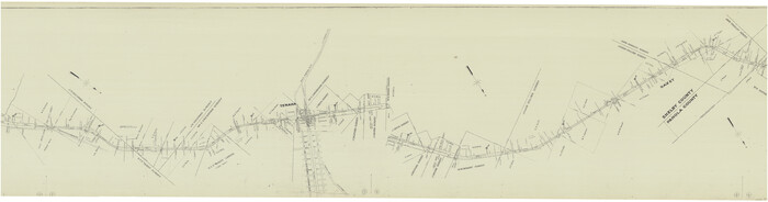
[The S.K. Ry. of Texas, State Line to Pecos, Reeves Co., Texas]
Print $40.00
- Digital $50.00
[The S.K. Ry. of Texas, State Line to Pecos, Reeves Co., Texas]
1910
Size: 19.5 x 119.7 inches
64160
[The S.K. Ry. of Texas, State Line to Pecos, Reeves Co., Texas]
Print $40.00
- Digital $50.00
[The S.K. Ry. of Texas, State Line to Pecos, Reeves Co., Texas]
1910
Size: 19.2 x 120.9 inches
64161
[The S.K. Ry. of Texas, State Line to Pecos, Reeves Co., Texas]
Print $40.00
- Digital $50.00
[The S.K. Ry. of Texas, State Line to Pecos, Reeves Co., Texas]
1910
Size: 19.8 x 120.7 inches
64162
[The S.K. Ry. of Texas, State Line to Pecos, Reeves Co., Texas]
Print $40.00
- Digital $50.00
[The S.K. Ry. of Texas, State Line to Pecos, Reeves Co., Texas]
1910
Size: 19.3 x 120.2 inches
64163
[The S.K. Ry. of Texas, State Line to Pecos, Reeves Co., Texas]
Print $40.00
- Digital $50.00
[The S.K. Ry. of Texas, State Line to Pecos, Reeves Co., Texas]
1910
Size: 18.7 x 95.8 inches
64164
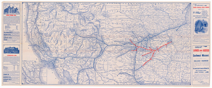
[The Frisco Line - St. Louis & San Francisco Railway through the Great West and South West]
Print $20.00
- Digital $50.00
[The Frisco Line - St. Louis & San Francisco Railway through the Great West and South West]
1893
Size: 16.8 x 40.2 inches
95794
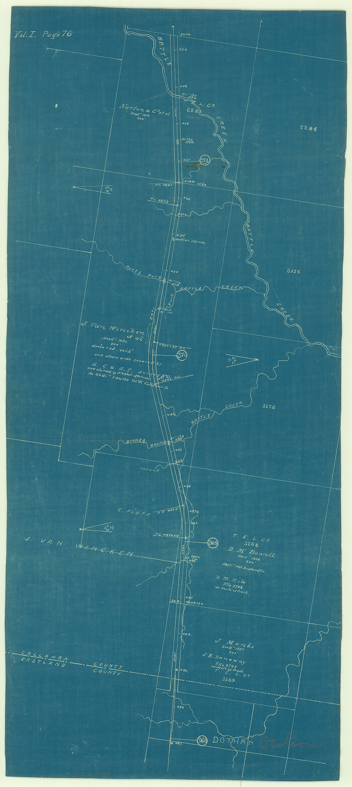
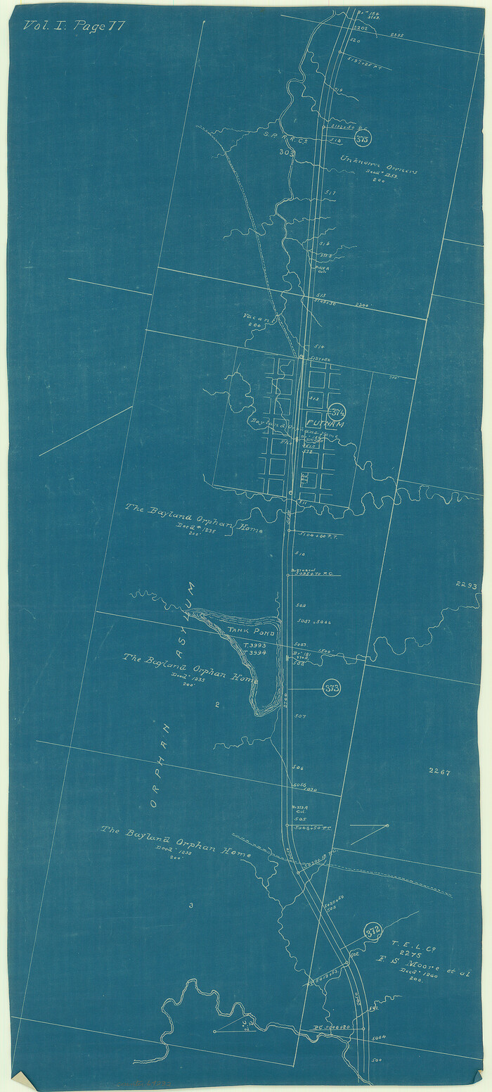
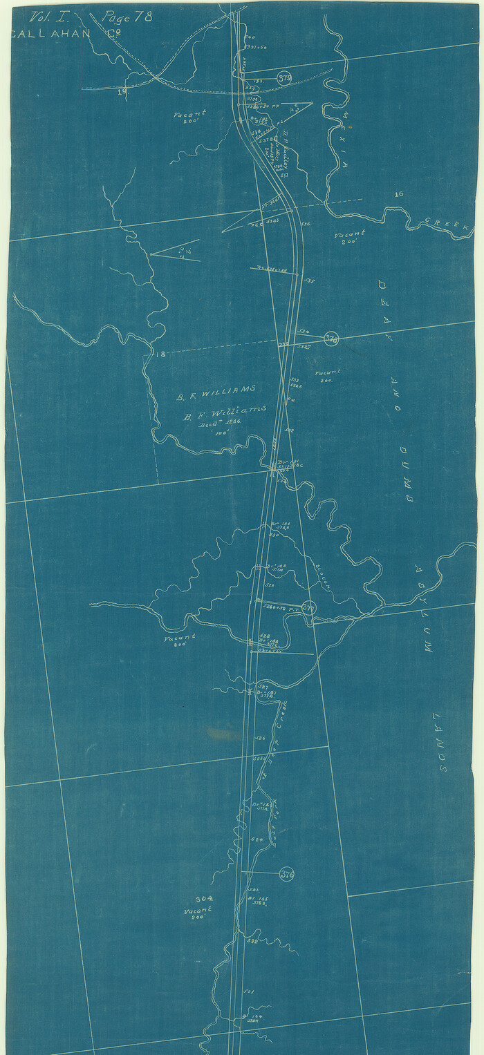
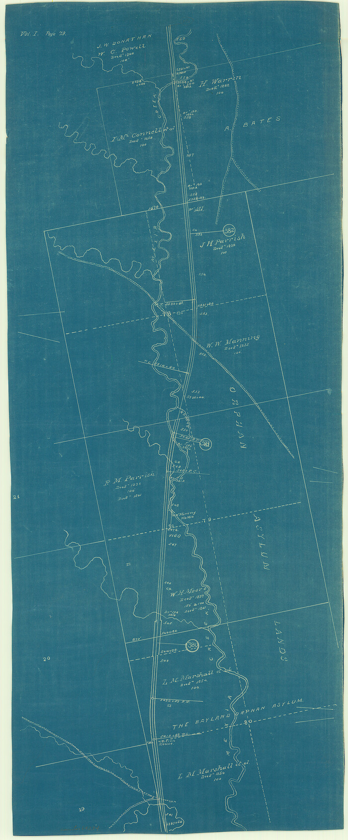
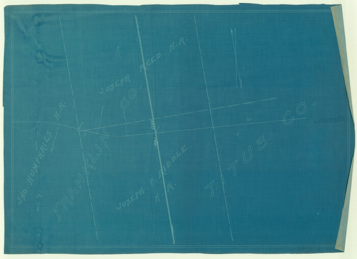
[Texas Central Railway through Callahan County]
Print $40.00
- Digital $50.00
[Texas Central Railway through Callahan County]
Size: 24.6 x 86.3 inches
64240
[Texas & Pacific Railway, Longview to Dallas]
Print $40.00
- Digital $50.00
[Texas & Pacific Railway, Longview to Dallas]
1873
Size: 15.5 x 124.0 inches
64097
[Texas & Pacific Railway, Longview to Dallas]
Print $40.00
- Digital $50.00
[Texas & Pacific Railway, Longview to Dallas]
1873
Size: 14.5 x 121.6 inches
64098
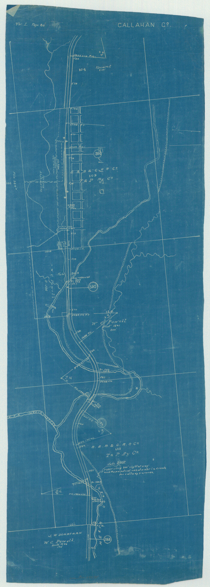
[Texas & Pacific Railway through Callahan County]
Print $20.00
- Digital $50.00
[Texas & Pacific Railway through Callahan County]
1918
Size: 21.2 x 9.5 inches
64231
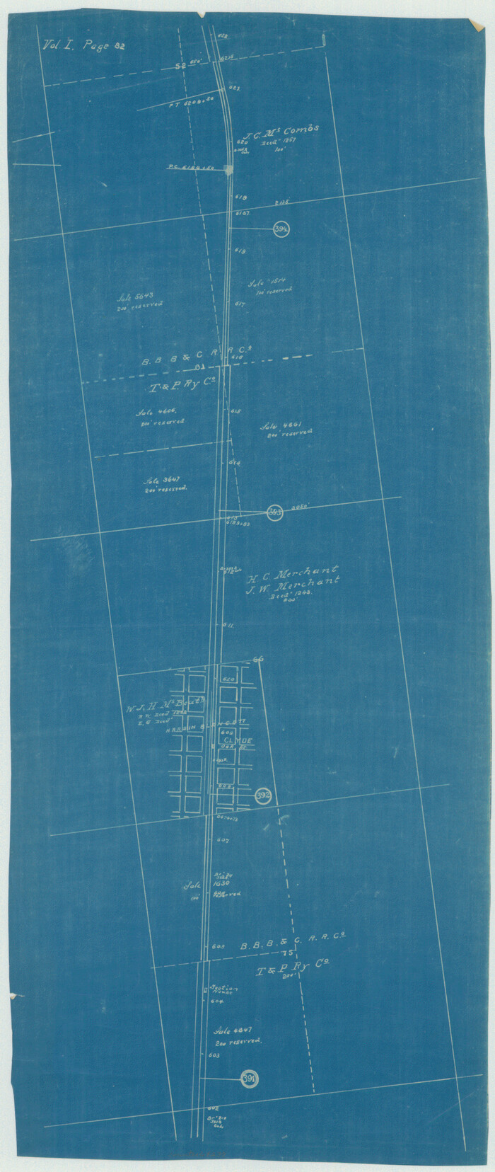
[Texas & Pacific Railway through Callahan County]
Print $20.00
- Digital $50.00
[Texas & Pacific Railway through Callahan County]
1918
Size: 20.8 x 9.4 inches
64232
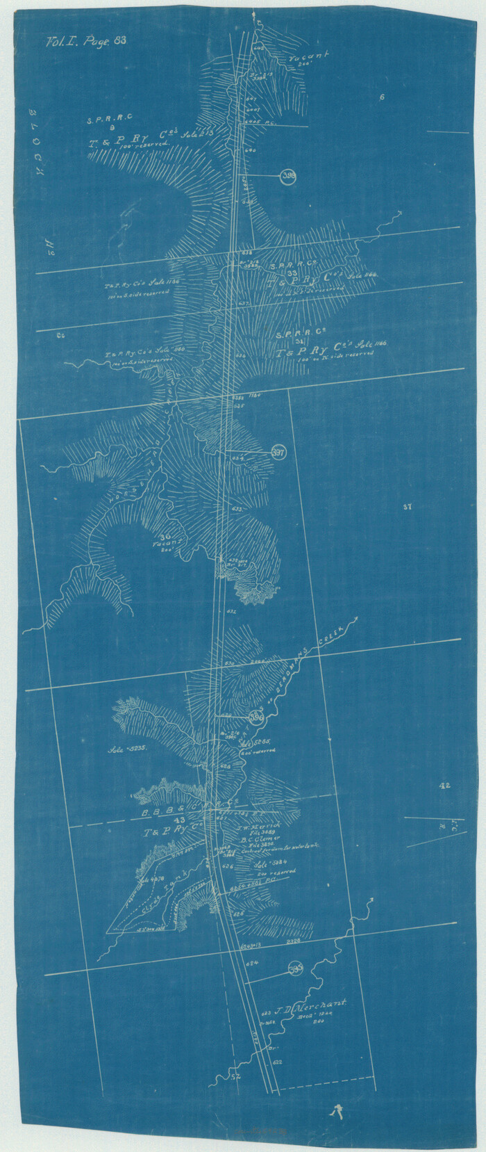
[Texas & Pacific Railway through Callahan County]
Print $20.00
- Digital $50.00
[Texas & Pacific Railway through Callahan County]
1918
Size: 20.5 x 9.4 inches
64233
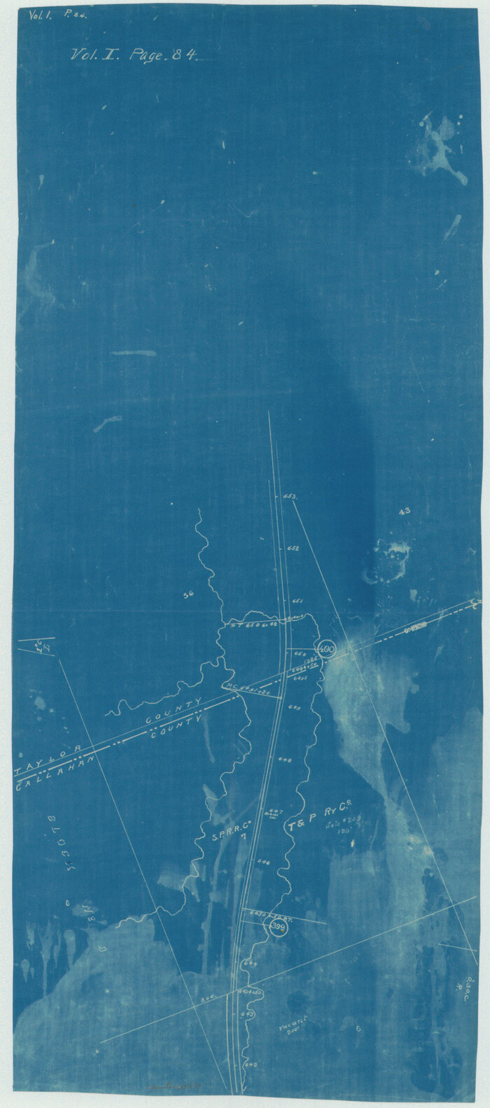
[Texas & Pacific Railway through Callahan County]
Print $20.00
- Digital $50.00
[Texas & Pacific Railway through Callahan County]
1918
Size: 21.3 x 8.8 inches
64234
[Texas & Pacific Railway through Callahan County]
Print $20.00
- Digital $50.00
[Texas & Pacific Railway through Callahan County]
1918
Size: 23.2 x 8.3 inches
64235
[Texas & Pacific Railway through Callahan County]

Print $20.00
- Digital $50.00
[Texas & Pacific Railway through Callahan County]
1918
Size: 22.9 x 8.8 inches
64236
[Texas & Pacific Railway through Callahan County]
Print $20.00
- Digital $50.00
[Texas & Pacific Railway through Callahan County]
1918
Size: 21.8 x 9.2 inches
64237
[Texas & Pacific Railway through Callahan County]
Print $20.00
- Digital $50.00
[Texas & Pacific Railway through Callahan County]
1918
Size: 22.4 x 9.4 inches
64238
[Texas & Pacific Railway through Callahan County]
Print $20.00
- Digital $50.00
[Texas & Pacific Railway through Callahan County]
1918
Size: 21.1 x 9.3 inches
64239
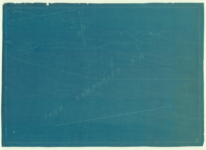
[T. & N. O. R.R. Jefferson Co. North]
Print $20.00
- Digital $50.00
[T. & N. O. R.R. Jefferson Co. North]
Size: 13.4 x 33.4 inches
64055
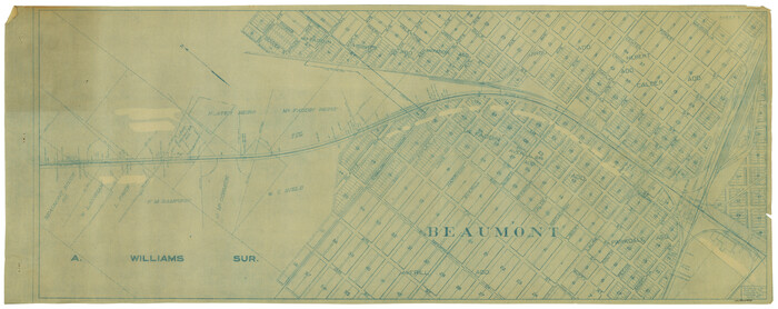
[T. & G. Ry. Main Line, Texas, Right of Way Map, Center to Gary]
Print $40.00
- Digital $50.00
[T. & G. Ry. Main Line, Texas, Right of Way Map, Center to Gary]
1917
Size: 31.0 x 121.2 inches
64568
[T. & G. Ry. Main Line, Texas, Right of Way Map, Center to Gary]
Print $40.00
- Digital $50.00
[T. & G. Ry. Main Line, Texas, Right of Way Map, Center to Gary]
1917
Size: 31.5 x 76.7 inches
64569
[T. & G. Ry. Main Line, Texas, Right of Way Map, Center to Gary]
Print $40.00
- Digital $50.00
[T. & G. Ry. Main Line, Texas, Right of Way Map, Center to Gary]
1917
Size: 31.9 x 121.1 inches
64571
[T. & G. Ry. Main Line, Texas, Right of Way Map, Center to Gary]
Print $40.00
- Digital $50.00
[T. & G. Ry. Main Line, Texas, Right of Way Map, Center to Gary]
1917
Size: 31.9 x 104.6 inches
64572
[St. Louis & Southwestern]
Print $20.00
- Digital $50.00
[St. Louis & Southwestern]
Size: 20.8 x 28.6 inches
64275
[St. Louis & Southwestern]
Print $20.00
- Digital $50.00
[St. Louis & Southwestern]
Size: 20.9 x 28.7 inches
64276
[Unidentified Railroad through Denton and Dallas County]
Print $40.00
- Digital $50.00
[Unidentified Railroad through Denton and Dallas County]
-
Size
6.8 x 121.3 inches
-
Map/Doc
64774
[Unidentified Railroad through Denton and Dallas County]
Print $40.00
- Digital $50.00
[Unidentified Railroad through Denton and Dallas County]
-
Size
6.8 x 73.3 inches
-
Map/Doc
64775
[Travis Station Map - Tracks and Structures - Lands. San Antonio & Aransas Pass Railway Co.]
Print $4.00
- Digital $50.00
[Travis Station Map - Tracks and Structures - Lands. San Antonio & Aransas Pass Railway Co.]
1919
-
Size
11.7 x 18.7 inches
-
Map/Doc
62564
-
Creation Date
1919
[The S.K. Ry. of Texas, State Line to Pecos, Reeves Co., Texas]
Print $40.00
- Digital $50.00
[The S.K. Ry. of Texas, State Line to Pecos, Reeves Co., Texas]
1910
-
Size
18.9 x 120.1 inches
-
Map/Doc
64158
-
Creation Date
1910
[The S.K. Ry. of Texas, State Line to Pecos, Reeves Co., Texas]
Print $40.00
- Digital $50.00
[The S.K. Ry. of Texas, State Line to Pecos, Reeves Co., Texas]
1910
-
Size
19.4 x 130.6 inches
-
Map/Doc
64159
-
Creation Date
1910
[The S.K. Ry. of Texas, State Line to Pecos, Reeves Co., Texas]
Print $40.00
- Digital $50.00
[The S.K. Ry. of Texas, State Line to Pecos, Reeves Co., Texas]
1910
-
Size
19.5 x 119.7 inches
-
Map/Doc
64160
-
Creation Date
1910
[The S.K. Ry. of Texas, State Line to Pecos, Reeves Co., Texas]
Print $40.00
- Digital $50.00
[The S.K. Ry. of Texas, State Line to Pecos, Reeves Co., Texas]
1910
-
Size
19.2 x 120.9 inches
-
Map/Doc
64161
-
Creation Date
1910
[The S.K. Ry. of Texas, State Line to Pecos, Reeves Co., Texas]
Print $40.00
- Digital $50.00
[The S.K. Ry. of Texas, State Line to Pecos, Reeves Co., Texas]
1910
-
Size
19.8 x 120.7 inches
-
Map/Doc
64162
-
Creation Date
1910
[The S.K. Ry. of Texas, State Line to Pecos, Reeves Co., Texas]
Print $40.00
- Digital $50.00
[The S.K. Ry. of Texas, State Line to Pecos, Reeves Co., Texas]
1910
-
Size
19.3 x 120.2 inches
-
Map/Doc
64163
-
Creation Date
1910
[The S.K. Ry. of Texas, State Line to Pecos, Reeves Co., Texas]
Print $40.00
- Digital $50.00
[The S.K. Ry. of Texas, State Line to Pecos, Reeves Co., Texas]
1910
-
Size
18.7 x 95.8 inches
-
Map/Doc
64164
-
Creation Date
1910
[The Frisco Line - St. Louis & San Francisco Railway through the Great West and South West]
Print $20.00
- Digital $50.00
[The Frisco Line - St. Louis & San Francisco Railway through the Great West and South West]
1893
-
Size
16.8 x 40.2 inches
-
Map/Doc
95794
-
Creation Date
1893
[Texas Central Railway through Callahan County]
Print $40.00
- Digital $50.00
[Texas Central Railway through Callahan County]
-
Size
24.6 x 86.3 inches
-
Map/Doc
64240
[Texas & Pacific Railway, Longview to Dallas]
Print $40.00
- Digital $50.00
[Texas & Pacific Railway, Longview to Dallas]
1873
-
Size
15.5 x 124.0 inches
-
Map/Doc
64097
-
Creation Date
1873
[Texas & Pacific Railway, Longview to Dallas]
Print $40.00
- Digital $50.00
[Texas & Pacific Railway, Longview to Dallas]
1873
-
Size
14.5 x 121.6 inches
-
Map/Doc
64098
-
Creation Date
1873
[Texas & Pacific Railway through Callahan County]
Print $20.00
- Digital $50.00
[Texas & Pacific Railway through Callahan County]
1918
-
Size
21.2 x 9.5 inches
-
Map/Doc
64231
-
Creation Date
1918
[Texas & Pacific Railway through Callahan County]
Print $20.00
- Digital $50.00
[Texas & Pacific Railway through Callahan County]
1918
-
Size
20.8 x 9.4 inches
-
Map/Doc
64232
-
Creation Date
1918
[Texas & Pacific Railway through Callahan County]
Print $20.00
- Digital $50.00
[Texas & Pacific Railway through Callahan County]
1918
-
Size
20.5 x 9.4 inches
-
Map/Doc
64233
-
Creation Date
1918
[Texas & Pacific Railway through Callahan County]
Print $20.00
- Digital $50.00
[Texas & Pacific Railway through Callahan County]
1918
-
Size
21.3 x 8.8 inches
-
Map/Doc
64234
-
Creation Date
1918
[Texas & Pacific Railway through Callahan County]
Print $20.00
- Digital $50.00
[Texas & Pacific Railway through Callahan County]
1918
-
Size
23.2 x 8.3 inches
-
Map/Doc
64235
-
Creation Date
1918
[Texas & Pacific Railway through Callahan County]
Print $20.00
- Digital $50.00
[Texas & Pacific Railway through Callahan County]
1918
-
Size
22.9 x 8.8 inches
-
Map/Doc
64236
-
Creation Date
1918
[Texas & Pacific Railway through Callahan County]
Print $20.00
- Digital $50.00
[Texas & Pacific Railway through Callahan County]
1918
-
Size
21.8 x 9.2 inches
-
Map/Doc
64237
-
Creation Date
1918
[Texas & Pacific Railway through Callahan County]
Print $20.00
- Digital $50.00
[Texas & Pacific Railway through Callahan County]
1918
-
Size
22.4 x 9.4 inches
-
Map/Doc
64238
-
Creation Date
1918
[Texas & Pacific Railway through Callahan County]
Print $20.00
- Digital $50.00
[Texas & Pacific Railway through Callahan County]
1918
-
Size
21.1 x 9.3 inches
-
Map/Doc
64239
-
Creation Date
1918
[T. & N. O. R.R. Jefferson Co. North]
Print $20.00
- Digital $50.00
[T. & N. O. R.R. Jefferson Co. North]
-
Size
13.4 x 33.4 inches
-
Map/Doc
64055
[T. & G. Ry. Main Line, Texas, Right of Way Map, Center to Gary]
Print $40.00
- Digital $50.00
[T. & G. Ry. Main Line, Texas, Right of Way Map, Center to Gary]
1917
-
Size
31.0 x 121.2 inches
-
Map/Doc
64568
-
Creation Date
1917
[T. & G. Ry. Main Line, Texas, Right of Way Map, Center to Gary]
Print $40.00
- Digital $50.00
[T. & G. Ry. Main Line, Texas, Right of Way Map, Center to Gary]
1917
-
Size
31.5 x 76.7 inches
-
Map/Doc
64569
-
Creation Date
1917
[T. & G. Ry. Main Line, Texas, Right of Way Map, Center to Gary]
Print $40.00
- Digital $50.00
[T. & G. Ry. Main Line, Texas, Right of Way Map, Center to Gary]
1917
-
Size
31.9 x 121.1 inches
-
Map/Doc
64571
-
Creation Date
1917
[T. & G. Ry. Main Line, Texas, Right of Way Map, Center to Gary]
Print $40.00
- Digital $50.00
[T. & G. Ry. Main Line, Texas, Right of Way Map, Center to Gary]
1917
-
Size
31.9 x 104.6 inches
-
Map/Doc
64572
-
Creation Date
1917
[St. Louis & Southwestern]
Print $20.00
- Digital $50.00
[St. Louis & Southwestern]
-
Size
20.8 x 28.6 inches
-
Map/Doc
64275
[St. Louis & Southwestern]
Print $20.00
- Digital $50.00
[St. Louis & Southwestern]
-
Size
20.9 x 28.7 inches
-
Map/Doc
64276