A Plat of 23 Miles of the Colorado River
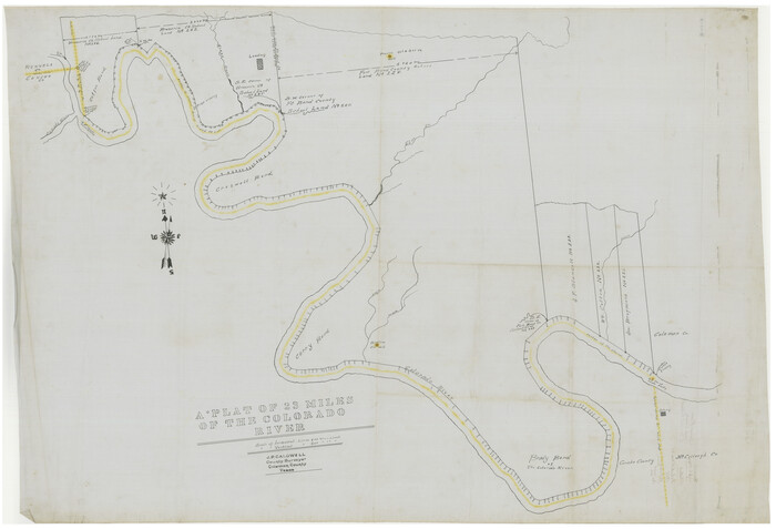
Print $40.00
- Digital $50.00
A Plat of 23 Miles of the Colorado River
1918
Size: 38.3 x 56.7 inches
65651
A Portion of the State's Submerged Oil Field, Goose Creek - Harris County - Texas

Print $20.00
- Digital $50.00
A Portion of the State's Submerged Oil Field, Goose Creek - Harris County - Texas
1919
Size: 14.2 x 17.3 inches
3165
A sketch of the San Antonio River collected from the Land Office surveys

Print $20.00
- Digital $50.00
A sketch of the San Antonio River collected from the Land Office surveys
1853
Size: 27.2 x 16.3 inches
73010
Amistad International Reservoir on Rio Grande 100

Print $20.00
- Digital $50.00
Amistad International Reservoir on Rio Grande 100
1950
Size: 28.5 x 40.8 inches
75531
Amistad International Reservoir on Rio Grande 61

Print $20.00
- Digital $50.00
Amistad International Reservoir on Rio Grande 61
1949
Size: 28.4 x 39.4 inches
73346
Amistad International Reservoir on Rio Grande 62

Print $20.00
- Digital $50.00
Amistad International Reservoir on Rio Grande 62
1949
Size: 28.2 x 39.6 inches
73347
Amistad International Reservoir on Rio Grande 63

Print $20.00
- Digital $50.00
Amistad International Reservoir on Rio Grande 63
1949
Size: 28.2 x 39.5 inches
73348
Amistad International Reservoir on Rio Grande 64

Print $20.00
- Digital $50.00
Amistad International Reservoir on Rio Grande 64
1949
Size: 28.4 x 39.6 inches
73349
Amistad International Reservoir on Rio Grande 65

Print $20.00
- Digital $50.00
Amistad International Reservoir on Rio Grande 65
1949
Size: 28.2 x 39.8 inches
73350
Amistad International Reservoir on Rio Grande 66

Print $20.00
- Digital $50.00
Amistad International Reservoir on Rio Grande 66
1949
Size: 28.5 x 39.6 inches
73351
Amistad International Reservoir on Rio Grande 67

Print $20.00
- Digital $50.00
Amistad International Reservoir on Rio Grande 67
1949
Size: 28.3 x 39.5 inches
73352
Amistad International Reservoir on Rio Grande 68

Print $20.00
- Digital $50.00
Amistad International Reservoir on Rio Grande 68
1949
Size: 28.4 x 39.4 inches
73353
Amistad International Reservoir on Rio Grande 68a

Print $20.00
- Digital $50.00
Amistad International Reservoir on Rio Grande 68a
1949
Size: 28.4 x 39.6 inches
73354
Amistad International Reservoir on Rio Grande 69

Print $20.00
- Digital $50.00
Amistad International Reservoir on Rio Grande 69
1949
Size: 28.4 x 39.4 inches
73355
Amistad International Reservoir on Rio Grande 70

Print $20.00
- Digital $50.00
Amistad International Reservoir on Rio Grande 70
1949
Size: 28.4 x 39.7 inches
73356
Amistad International Reservoir on Rio Grande 70a

Print $20.00
- Digital $50.00
Amistad International Reservoir on Rio Grande 70a
1949
Size: 28.5 x 39.5 inches
73357
Amistad International Reservoir on Rio Grande 71

Print $20.00
- Digital $50.00
Amistad International Reservoir on Rio Grande 71
1949
Size: 28.3 x 39.5 inches
73358
Amistad International Reservoir on Rio Grande 71a

Print $20.00
- Digital $50.00
Amistad International Reservoir on Rio Grande 71a
1949
Size: 28.4 x 39.6 inches
73359
Amistad International Reservoir on Rio Grande 72

Print $20.00
- Digital $50.00
Amistad International Reservoir on Rio Grande 72
1949
Size: 28.4 x 39.6 inches
73360
Amistad International Reservoir on Rio Grande 72a

Print $20.00
- Digital $50.00
Amistad International Reservoir on Rio Grande 72a
1949
Size: 28.3 x 39.6 inches
73361
Amistad International Reservoir on Rio Grande 73

Print $20.00
- Digital $50.00
Amistad International Reservoir on Rio Grande 73
1949
Size: 28.5 x 40.1 inches
73362
Amistad International Reservoir on Rio Grande Key Sheet

Print $20.00
- Digital $50.00
Amistad International Reservoir on Rio Grande Key Sheet
1960
Size: 13.0 x 32.4 inches
73345
Angelina River, Mud Creek, Sheet 1

Print $4.00
- Digital $50.00
Angelina River, Mud Creek, Sheet 1
1937
Size: 26.2 x 18.5 inches
65075
Angelina River, Mud Creek, Sheet 2

Print $4.00
- Digital $50.00
Angelina River, Mud Creek, Sheet 2
1937
Size: 26.4 x 18.9 inches
65076
Angelina River, Mud Creek, Sheet 3

Print $4.00
- Digital $50.00
Angelina River, Mud Creek, Sheet 3
1937
Size: 18.7 x 26.6 inches
65077
Angelina River, Mud Creek, Sheet 4

Print $4.00
- Digital $50.00
Angelina River, Mud Creek, Sheet 4
1937
Size: 25.4 x 18.5 inches
65078
Arroyo Colorado, La Feria Sheet

Print $40.00
- Digital $50.00
Arroyo Colorado, La Feria Sheet
1929
Size: 24.6 x 58.5 inches
65128
Arroyo Colorado, Rio Hondo Sheet

Print $40.00
- Digital $50.00
Arroyo Colorado, Rio Hondo Sheet
1929
Size: 35.0 x 52.6 inches
65129
Blanco River, Austin Girl Scouts Council

Print $6.00
- Digital $50.00
Blanco River, Austin Girl Scouts Council
1938
Size: 18.5 x 31.6 inches
65058
A Plat of 23 Miles of the Colorado River
Print $40.00
- Digital $50.00
A Plat of 23 Miles of the Colorado River
1918
-
Size
38.3 x 56.7 inches
-
Map/Doc
65651
-
Creation Date
1918
A Portion of the State's Submerged Oil Field, Goose Creek - Harris County - Texas
Print $20.00
- Digital $50.00
A Portion of the State's Submerged Oil Field, Goose Creek - Harris County - Texas
1919
-
Size
14.2 x 17.3 inches
-
Map/Doc
3165
-
Creation Date
1919
A sketch of the San Antonio River collected from the Land Office surveys
Print $20.00
- Digital $50.00
A sketch of the San Antonio River collected from the Land Office surveys
1853
-
Size
27.2 x 16.3 inches
-
Map/Doc
73010
-
Creation Date
1853
Amistad International Reservoir on Rio Grande 100
Print $20.00
- Digital $50.00
Amistad International Reservoir on Rio Grande 100
1950
-
Size
28.5 x 40.8 inches
-
Map/Doc
75531
-
Creation Date
1950
Amistad International Reservoir on Rio Grande 61
Print $20.00
- Digital $50.00
Amistad International Reservoir on Rio Grande 61
1949
-
Size
28.4 x 39.4 inches
-
Map/Doc
73346
-
Creation Date
1949
Amistad International Reservoir on Rio Grande 62
Print $20.00
- Digital $50.00
Amistad International Reservoir on Rio Grande 62
1949
-
Size
28.2 x 39.6 inches
-
Map/Doc
73347
-
Creation Date
1949
Amistad International Reservoir on Rio Grande 63
Print $20.00
- Digital $50.00
Amistad International Reservoir on Rio Grande 63
1949
-
Size
28.2 x 39.5 inches
-
Map/Doc
73348
-
Creation Date
1949
Amistad International Reservoir on Rio Grande 64
Print $20.00
- Digital $50.00
Amistad International Reservoir on Rio Grande 64
1949
-
Size
28.4 x 39.6 inches
-
Map/Doc
73349
-
Creation Date
1949
Amistad International Reservoir on Rio Grande 65
Print $20.00
- Digital $50.00
Amistad International Reservoir on Rio Grande 65
1949
-
Size
28.2 x 39.8 inches
-
Map/Doc
73350
-
Creation Date
1949
Amistad International Reservoir on Rio Grande 66
Print $20.00
- Digital $50.00
Amistad International Reservoir on Rio Grande 66
1949
-
Size
28.5 x 39.6 inches
-
Map/Doc
73351
-
Creation Date
1949
Amistad International Reservoir on Rio Grande 67
Print $20.00
- Digital $50.00
Amistad International Reservoir on Rio Grande 67
1949
-
Size
28.3 x 39.5 inches
-
Map/Doc
73352
-
Creation Date
1949
Amistad International Reservoir on Rio Grande 68
Print $20.00
- Digital $50.00
Amistad International Reservoir on Rio Grande 68
1949
-
Size
28.4 x 39.4 inches
-
Map/Doc
73353
-
Creation Date
1949
Amistad International Reservoir on Rio Grande 68a
Print $20.00
- Digital $50.00
Amistad International Reservoir on Rio Grande 68a
1949
-
Size
28.4 x 39.6 inches
-
Map/Doc
73354
-
Creation Date
1949
Amistad International Reservoir on Rio Grande 69
Print $20.00
- Digital $50.00
Amistad International Reservoir on Rio Grande 69
1949
-
Size
28.4 x 39.4 inches
-
Map/Doc
73355
-
Creation Date
1949
Amistad International Reservoir on Rio Grande 70
Print $20.00
- Digital $50.00
Amistad International Reservoir on Rio Grande 70
1949
-
Size
28.4 x 39.7 inches
-
Map/Doc
73356
-
Creation Date
1949
Amistad International Reservoir on Rio Grande 70a
Print $20.00
- Digital $50.00
Amistad International Reservoir on Rio Grande 70a
1949
-
Size
28.5 x 39.5 inches
-
Map/Doc
73357
-
Creation Date
1949
Amistad International Reservoir on Rio Grande 71
Print $20.00
- Digital $50.00
Amistad International Reservoir on Rio Grande 71
1949
-
Size
28.3 x 39.5 inches
-
Map/Doc
73358
-
Creation Date
1949
Amistad International Reservoir on Rio Grande 71a
Print $20.00
- Digital $50.00
Amistad International Reservoir on Rio Grande 71a
1949
-
Size
28.4 x 39.6 inches
-
Map/Doc
73359
-
Creation Date
1949
Amistad International Reservoir on Rio Grande 72
Print $20.00
- Digital $50.00
Amistad International Reservoir on Rio Grande 72
1949
-
Size
28.4 x 39.6 inches
-
Map/Doc
73360
-
Creation Date
1949
Amistad International Reservoir on Rio Grande 72a
Print $20.00
- Digital $50.00
Amistad International Reservoir on Rio Grande 72a
1949
-
Size
28.3 x 39.6 inches
-
Map/Doc
73361
-
Creation Date
1949
Amistad International Reservoir on Rio Grande 73
Print $20.00
- Digital $50.00
Amistad International Reservoir on Rio Grande 73
1949
-
Size
28.5 x 40.1 inches
-
Map/Doc
73362
-
Creation Date
1949
Amistad International Reservoir on Rio Grande Key Sheet
Print $20.00
- Digital $50.00
Amistad International Reservoir on Rio Grande Key Sheet
1960
-
Size
13.0 x 32.4 inches
-
Map/Doc
73345
-
Creation Date
1960
Angelina River, Mud Creek, Sheet 1
Print $4.00
- Digital $50.00
Angelina River, Mud Creek, Sheet 1
1937
-
Size
26.2 x 18.5 inches
-
Map/Doc
65075
-
Creation Date
1937
Angelina River, Mud Creek, Sheet 2
Print $4.00
- Digital $50.00
Angelina River, Mud Creek, Sheet 2
1937
-
Size
26.4 x 18.9 inches
-
Map/Doc
65076
-
Creation Date
1937
Angelina River, Mud Creek, Sheet 3
Print $4.00
- Digital $50.00
Angelina River, Mud Creek, Sheet 3
1937
-
Size
18.7 x 26.6 inches
-
Map/Doc
65077
-
Creation Date
1937
Angelina River, Mud Creek, Sheet 4
Print $4.00
- Digital $50.00
Angelina River, Mud Creek, Sheet 4
1937
-
Size
25.4 x 18.5 inches
-
Map/Doc
65078
-
Creation Date
1937
Arroyo Colorado, La Feria Sheet
Print $40.00
- Digital $50.00
Arroyo Colorado, La Feria Sheet
1929
-
Size
24.6 x 58.5 inches
-
Map/Doc
65128
-
Creation Date
1929
Arroyo Colorado, Rio Hondo Sheet
Print $40.00
- Digital $50.00
Arroyo Colorado, Rio Hondo Sheet
1929
-
Size
35.0 x 52.6 inches
-
Map/Doc
65129
-
Creation Date
1929
Blanco River, Austin Girl Scouts Council
Print $6.00
- Digital $50.00
Blanco River, Austin Girl Scouts Council
1938
-
Size
18.5 x 31.6 inches
-
Map/Doc
65058
-
Creation Date
1938
Brassos Santiago

Print $20.00
- Digital $50.00
Brassos Santiago
1853
-
Size
25.3 x 18.3 inches
-
Map/Doc
72913
-
Creation Date
1853