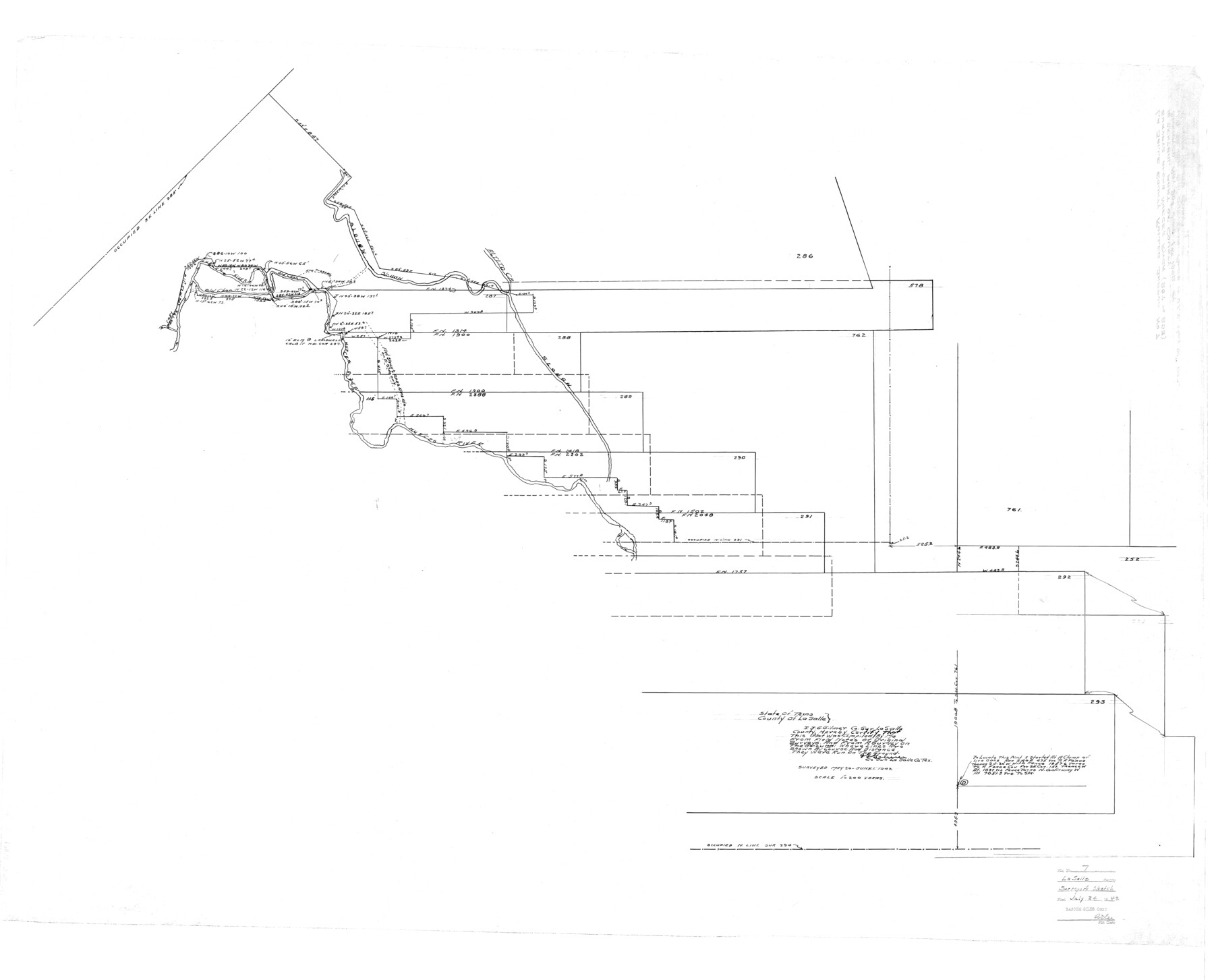
La Salle County Rolled Sketch 7
[Sketch of surveys along Nueces River in central part of La Salle County, Texas]
-
Map/Doc
10652
-
Collection
General Map Collection
-
Object Dates
1942/6/1 (Survey Date)
1942/7/24 (File Date)
-
People and Organizations
J.G. Gilmer (Surveyor/Engineer)
-
Counties
La Salle
-
Subjects
Surveying Rolled Sketch
-
Height x Width
38.7 x 48.0 inches
98.3 x 121.9 cm
-
Scale
1" = 200 varas
Part of: General Map Collection
Flight Mission No. BRA-7M, Frame 193, Jefferson County

Print $20.00
- Digital $50.00
Flight Mission No. BRA-7M, Frame 193, Jefferson County
1953
Size 18.7 x 22.4 inches
Map/Doc 85561
Cass County Working Sketch 9

Print $20.00
- Digital $50.00
Cass County Working Sketch 9
1937
Size 28.4 x 32.7 inches
Map/Doc 67912
Flight Mission No. DQO-7K, Frame 102, Galveston County

Print $20.00
- Digital $50.00
Flight Mission No. DQO-7K, Frame 102, Galveston County
1952
Size 18.6 x 22.5 inches
Map/Doc 85117
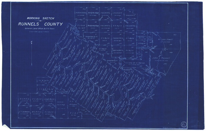
Runnels County Working Sketch 6
Print $20.00
- Digital $50.00
Runnels County Working Sketch 6
1907
Size 19.5 x 31.0 inches
Map/Doc 63602
Flight Mission No. DQO-6K, Frame 23, Galveston County

Print $20.00
- Digital $50.00
Flight Mission No. DQO-6K, Frame 23, Galveston County
1952
Size 18.8 x 22.5 inches
Map/Doc 85096
Leon County Working Sketch 2

Print $20.00
- Digital $50.00
Leon County Working Sketch 2
Size 17.3 x 17.0 inches
Map/Doc 70401
Smith County Sketch File 1

Print $4.00
- Digital $50.00
Smith County Sketch File 1
Size 9.0 x 10.5 inches
Map/Doc 36746
Randall County Sketch File 7

Print $14.00
- Digital $50.00
Randall County Sketch File 7
1931
Size 7.3 x 8.9 inches
Map/Doc 34963
Flight Mission No. DIX-5P, Frame 102, Aransas County

Print $20.00
- Digital $50.00
Flight Mission No. DIX-5P, Frame 102, Aransas County
1956
Size 17.7 x 18.0 inches
Map/Doc 83780
Map of Smith County

Print $20.00
- Digital $50.00
Map of Smith County
1905
Size 29.8 x 29.7 inches
Map/Doc 4041
Gillespie County Sketch File 2

Print $40.00
- Digital $50.00
Gillespie County Sketch File 2
1847
Size 12.8 x 15.5 inches
Map/Doc 24127
Flight Mission No. CUG-1P, Frame 160, Kleberg County

Print $20.00
- Digital $50.00
Flight Mission No. CUG-1P, Frame 160, Kleberg County
1956
Size 18.5 x 22.4 inches
Map/Doc 86167
You may also like
Colorado County Working Sketch 20

Print $20.00
- Digital $50.00
Colorado County Working Sketch 20
1963
Size 27.9 x 24.7 inches
Map/Doc 68120
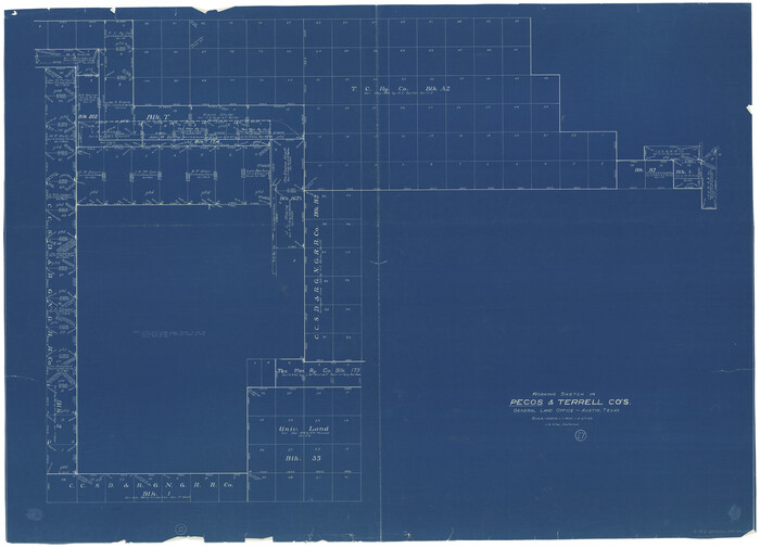
Pecos County Working Sketch 27
Print $40.00
- Digital $50.00
Pecos County Working Sketch 27
1929
Size 36.9 x 50.8 inches
Map/Doc 71498
Refugio County Boundary File 3

Print $4.00
- Digital $50.00
Refugio County Boundary File 3
Size 14.0 x 8.7 inches
Map/Doc 58244
Sketch Showing Correction of Field Notes and Surveys

Print $3.00
- Digital $50.00
Sketch Showing Correction of Field Notes and Surveys
1886
Size 13.0 x 10.8 inches
Map/Doc 90270
[Leagues 11 and 22]
![91111, [Leagues 11 and 22], Twichell Survey Records](https://historictexasmaps.com/wmedia_w700/maps/91111-1.tif.jpg)
Print $20.00
- Digital $50.00
[Leagues 11 and 22]
1925
Size 14.0 x 13.6 inches
Map/Doc 91111
Pecos County Working Sketch 89.5

Print $40.00
- Digital $50.00
Pecos County Working Sketch 89.5
1965
Size 80.5 x 32.5 inches
Map/Doc 71561
[BIock D13, north part H. & G. N. Block 2]
![90378, [BIock D13, north part H. & G. N. Block 2], Twichell Survey Records](https://historictexasmaps.com/wmedia_w700/maps/90378-1.tif.jpg)
Print $20.00
- Digital $50.00
[BIock D13, north part H. & G. N. Block 2]
Size 14.9 x 20.5 inches
Map/Doc 90378
Panhandle of Texas

Print $20.00
- Digital $50.00
Panhandle of Texas
1907
Size 11.4 x 14.4 inches
Map/Doc 95889
Lamar County Working Sketch Graphic Index

Print $20.00
- Digital $50.00
Lamar County Working Sketch Graphic Index
1934
Size 47.9 x 37.5 inches
Map/Doc 76612

Webb County Rolled Sketch 35

Print $20.00
- Digital $50.00
Webb County Rolled Sketch 35
1939
Size 23.1 x 12.7 inches
Map/Doc 8190
Flight Mission No. DQN-7K, Frame 40, Calhoun County

Print $20.00
- Digital $50.00
Flight Mission No. DQN-7K, Frame 40, Calhoun County
1953
Size 18.5 x 22.2 inches
Map/Doc 84478