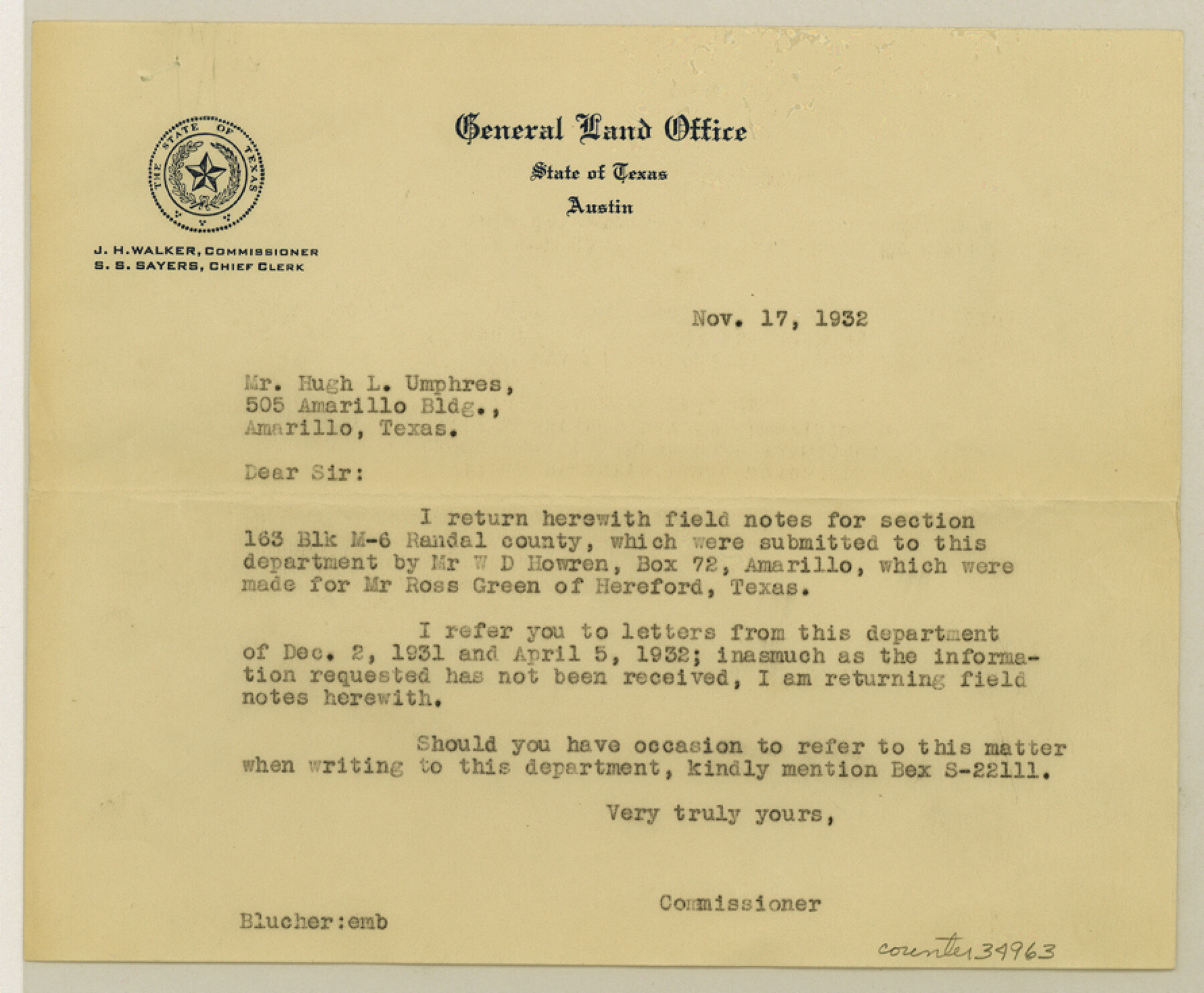
Randall County Sketch File 7
[Multiple letters regarding Block M6, S. K. & K. section 163]
-
Map/Doc
34963
-
Collection
General Map Collection
-
Object Dates
1931-1932 (Creation Date)
11/17/1932 (File Date)
11/23/1931 (Correspondence Date)
11/26/1931 (Correspondence Date)
12/2/1931 (Correspondence Date)
12/8/1931 (Correspondence Date)
4/5/1932 (Correspondence Date)
11/17/1932 (Correspondence Date)
-
People and Organizations
W.D. Howren (Surveyor/Engineer)
Hugh L. Umphres (Attorney)
-
Counties
Randall
-
Subjects
Surveying Sketch File
-
Height x Width
7.3 x 8.9 inches
18.5 x 22.6 cm
-
Medium
paper, print
Part of: General Map Collection

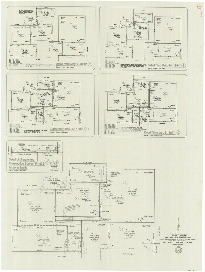
Cooke County Working Sketch 38
Print $40.00
- Digital $50.00
Cooke County Working Sketch 38
1997
Size 48.2 x 36.6 inches
Map/Doc 68275
Callahan County Sketch File 6a

Print $24.00
- Digital $50.00
Callahan County Sketch File 6a
Size 8.0 x 6.8 inches
Map/Doc 35860
Val Verde County Rolled Sketch ECS

Print $20.00
- Digital $50.00
Val Verde County Rolled Sketch ECS
1935
Size 45.6 x 35.6 inches
Map/Doc 10079
Harris County Rolled Sketch O

Print $20.00
- Digital $50.00
Harris County Rolled Sketch O
Size 19.3 x 28.9 inches
Map/Doc 6141
Pecos County Sketch File 78

Print $6.00
- Digital $50.00
Pecos County Sketch File 78
1943
Size 11.1 x 8.8 inches
Map/Doc 33911
Freestone County Working Sketch 20

Print $40.00
- Digital $50.00
Freestone County Working Sketch 20
1980
Size 52.4 x 39.6 inches
Map/Doc 69262
Chambers County Sketch File 25

Print $8.00
- Digital $50.00
Chambers County Sketch File 25
Size 14.1 x 8.7 inches
Map/Doc 17602
Flight Mission No. DQN-3K, Frame 66, Calhoun County

Print $20.00
- Digital $50.00
Flight Mission No. DQN-3K, Frame 66, Calhoun County
1953
Size 18.7 x 22.5 inches
Map/Doc 84357
Brazos River, Brazos River Sheet 3

Print $6.00
- Digital $50.00
Brazos River, Brazos River Sheet 3
1926
Size 23.6 x 35.2 inches
Map/Doc 65295
Midland County Working Sketch 4

Print $20.00
- Digital $50.00
Midland County Working Sketch 4
Size 20.3 x 44.3 inches
Map/Doc 70984
Boundary and Ownership map, Laguna Atascosa National Wildlife Refuge, Cameron and Willacy Counties, Texas

Print $40.00
- Digital $50.00
Boundary and Ownership map, Laguna Atascosa National Wildlife Refuge, Cameron and Willacy Counties, Texas
1968
Size 73.9 x 43.2 inches
Map/Doc 60395
You may also like
Intracoastal Waterway in Texas - Corpus Christi to Point Isabel including Arroyo Colorado to Mo. Pac. R.R. Bridge Near Harlingen

Print $20.00
- Digital $50.00
Intracoastal Waterway in Texas - Corpus Christi to Point Isabel including Arroyo Colorado to Mo. Pac. R.R. Bridge Near Harlingen
1933
Size 28.0 x 40.8 inches
Map/Doc 61849
Map of Hays County

Print $20.00
- Digital $50.00
Map of Hays County
1877
Size 21.2 x 19.8 inches
Map/Doc 3646
Taylor County

Print $20.00
- Digital $50.00
Taylor County
1934
Size 44.4 x 38.9 inches
Map/Doc 73299
Flight Mission No. CLL-1N, Frame 13, Willacy County

Print $20.00
- Digital $50.00
Flight Mission No. CLL-1N, Frame 13, Willacy County
1954
Size 18.3 x 22.0 inches
Map/Doc 87000
Harris County Rolled Sketch 81

Print $28.00
- Digital $50.00
Harris County Rolled Sketch 81
1956
Size 31.1 x 22.2 inches
Map/Doc 6117
[Blocks D and P]
![92490, [Blocks D and P], Twichell Survey Records](https://historictexasmaps.com/wmedia_w700/maps/92490-1.tif.jpg)
Print $20.00
- Digital $50.00
[Blocks D and P]
Size 41.8 x 29.1 inches
Map/Doc 92490
General Highway Map, Navarro County, Texas

Print $20.00
General Highway Map, Navarro County, Texas
1939
Size 24.7 x 18.4 inches
Map/Doc 79206
County of Galveston, Texas

Print $20.00
- Digital $50.00
County of Galveston, Texas
1845
Size 22.9 x 32.2 inches
Map/Doc 3574
Hockley County Sketch File 2

Print $20.00
- Digital $50.00
Hockley County Sketch File 2
1900
Size 13.2 x 18.1 inches
Map/Doc 11768
La Salle County Rolled Sketch 5

Print $20.00
- Digital $50.00
La Salle County Rolled Sketch 5
1937
Size 17.8 x 27.4 inches
Map/Doc 6570
Flight Mission No. DQO-8K, Frame 55, Galveston County

Print $20.00
- Digital $50.00
Flight Mission No. DQO-8K, Frame 55, Galveston County
1952
Size 18.7 x 22.5 inches
Map/Doc 85162
Tyler County Rolled Sketch 10

Print $40.00
- Digital $50.00
Tyler County Rolled Sketch 10
1982
Size 48.7 x 35.4 inches
Map/Doc 10032