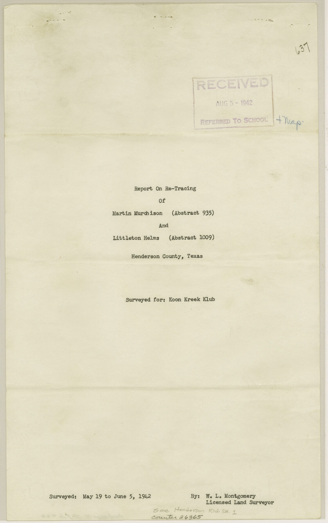
Henderson County Sketch File 22
Report on re-tracing of Martin Murchison (abstract 935) and Littleton Helms (abstract 1009)
-
Map/Doc
26365
-
Collection
General Map Collection
-
Object Dates
6/5/1942 (Creation Date)
8/5/1942 (File Date)
5/19/1942 (Survey Date)
6/5/1942 (Survey Date)
1903 (Survey Date)
1934 (Survey Date)
7/20/1880 (Survey Date)
4/4/1881 (Survey Date)
9/18/1884 (Survey Date)
-
People and Organizations
Jo. J. White (Surveyor/Engineer)
R.A. Turner (Surveyor/Engineer)
R.B. Smitherman (Surveyor/Engineer)
J.T. Meredity ()
B.F. McQuistion (Surveyor/Engineer)
Thomas J. McEvoy (Chainman)
Alvis Henry (Chainman)
W.L. Montgomery (Surveyor/Engineer)
-
Counties
Henderson
-
Subjects
Surveying Sketch File
-
Height x Width
14.2 x 8.9 inches
36.1 x 22.6 cm
-
Medium
paper, print
-
Comments
See Henderson County Rolled Sketch 1 (9159) for sketch.
-
Features
Black Lake
Big Lake
Related maps
Henderson County Rolled Sketch 1

Print $20.00
- Digital $50.00
Henderson County Rolled Sketch 1
1942
Size 34.0 x 38.3 inches
Map/Doc 9159
Part of: General Map Collection
Cottle County Rolled Sketch 14

Print $741.00
- Digital $50.00
Cottle County Rolled Sketch 14
1882
Size 10.8 x 16.0 inches
Map/Doc 42369
Polk County Working Sketch 1

Print $20.00
- Digital $50.00
Polk County Working Sketch 1
Size 13.1 x 16.4 inches
Map/Doc 71616
Garza County Working Sketch 4

Print $20.00
- Digital $50.00
Garza County Working Sketch 4
1916
Size 19.5 x 23.1 inches
Map/Doc 63151
Flight Mission No. DCL-7C, Frame 67, Kenedy County

Print $20.00
- Digital $50.00
Flight Mission No. DCL-7C, Frame 67, Kenedy County
1943
Size 15.5 x 15.3 inches
Map/Doc 86053
Karnes County Rolled Sketch 1

Print $20.00
- Digital $50.00
Karnes County Rolled Sketch 1
1943
Size 27.5 x 25.7 inches
Map/Doc 6452
Coke County Boundary File 6

Print $62.00
- Digital $50.00
Coke County Boundary File 6
Size 7.2 x 37.9 inches
Map/Doc 51615
Crockett County Rolled Sketch 95

Print $20.00
- Digital $50.00
Crockett County Rolled Sketch 95
1985
Size 24.6 x 28.8 inches
Map/Doc 5634
Flight Mission No. BRA-3M, Frame 196, Jefferson County

Print $20.00
- Digital $50.00
Flight Mission No. BRA-3M, Frame 196, Jefferson County
1953
Size 18.6 x 22.4 inches
Map/Doc 85411
Menard County Working Sketch 1

Print $20.00
- Digital $50.00
Menard County Working Sketch 1
1905
Size 23.3 x 18.9 inches
Map/Doc 70948
Flight Mission No. DIX-7P, Frame 86, Aransas County

Print $20.00
- Digital $50.00
Flight Mission No. DIX-7P, Frame 86, Aransas County
1956
Size 18.7 x 22.5 inches
Map/Doc 83880
Travis County Sketch File 4A

Print $8.00
- Digital $50.00
Travis County Sketch File 4A
1855
Size 8.4 x 11.2 inches
Map/Doc 38280
Orange County Rolled Sketch 30

Print $20.00
- Digital $50.00
Orange County Rolled Sketch 30
1960
Size 32.4 x 34.9 inches
Map/Doc 9650
You may also like
Texas City. First and Second Division

Print $20.00
- Digital $50.00
Texas City. First and Second Division
1892
Size 24.3 x 19.1 inches
Map/Doc 95355
Pecos County Working Sketch 78

Print $20.00
- Digital $50.00
Pecos County Working Sketch 78
1960
Size 29.4 x 34.4 inches
Map/Doc 71550
Menard County Boundary File 12a

Print $14.00
- Digital $50.00
Menard County Boundary File 12a
Size 14.2 x 8.8 inches
Map/Doc 57114
The Republic County of Harris. January 21, 1841

Print $20.00
The Republic County of Harris. January 21, 1841
2020
Size 17.7 x 21.7 inches
Map/Doc 96166
[Capitol and School Lands in Lamb County]
![91068, [Capitol and School Lands in Lamb County], Twichell Survey Records](https://historictexasmaps.com/wmedia_w700/maps/91068-1.tif.jpg)
Print $20.00
- Digital $50.00
[Capitol and School Lands in Lamb County]
Size 19.2 x 20.5 inches
Map/Doc 91068
![94196, New Mexico [Recto], General Map Collection](https://historictexasmaps.com/wmedia_w700/maps/94196.tif.jpg)
Runnels County Sketch File 3

Print $4.00
Runnels County Sketch File 3
1871
Size 13.0 x 8.1 inches
Map/Doc 35432
Frio County Rolled Sketch 11

Print $20.00
- Digital $50.00
Frio County Rolled Sketch 11
1948
Size 44.4 x 43.8 inches
Map/Doc 8903
Right-of-Way and Track Map, Texas State Railroad operated by the T. and N. O. R.R. Co.

Print $40.00
- Digital $50.00
Right-of-Way and Track Map, Texas State Railroad operated by the T. and N. O. R.R. Co.
1917
Size 24.6 x 55.8 inches
Map/Doc 64175
Fayette County Working Sketch 10

Print $20.00
- Digital $50.00
Fayette County Working Sketch 10
1985
Size 27.1 x 38.5 inches
Map/Doc 69174
Dallas County Sketch File 18

Print $6.00
- Digital $50.00
Dallas County Sketch File 18
1871
Size 15.8 x 11.0 inches
Map/Doc 20437
Bell County Working Sketch 5

Print $20.00
- Digital $50.00
Bell County Working Sketch 5
1942
Size 26.9 x 21.0 inches
Map/Doc 67345