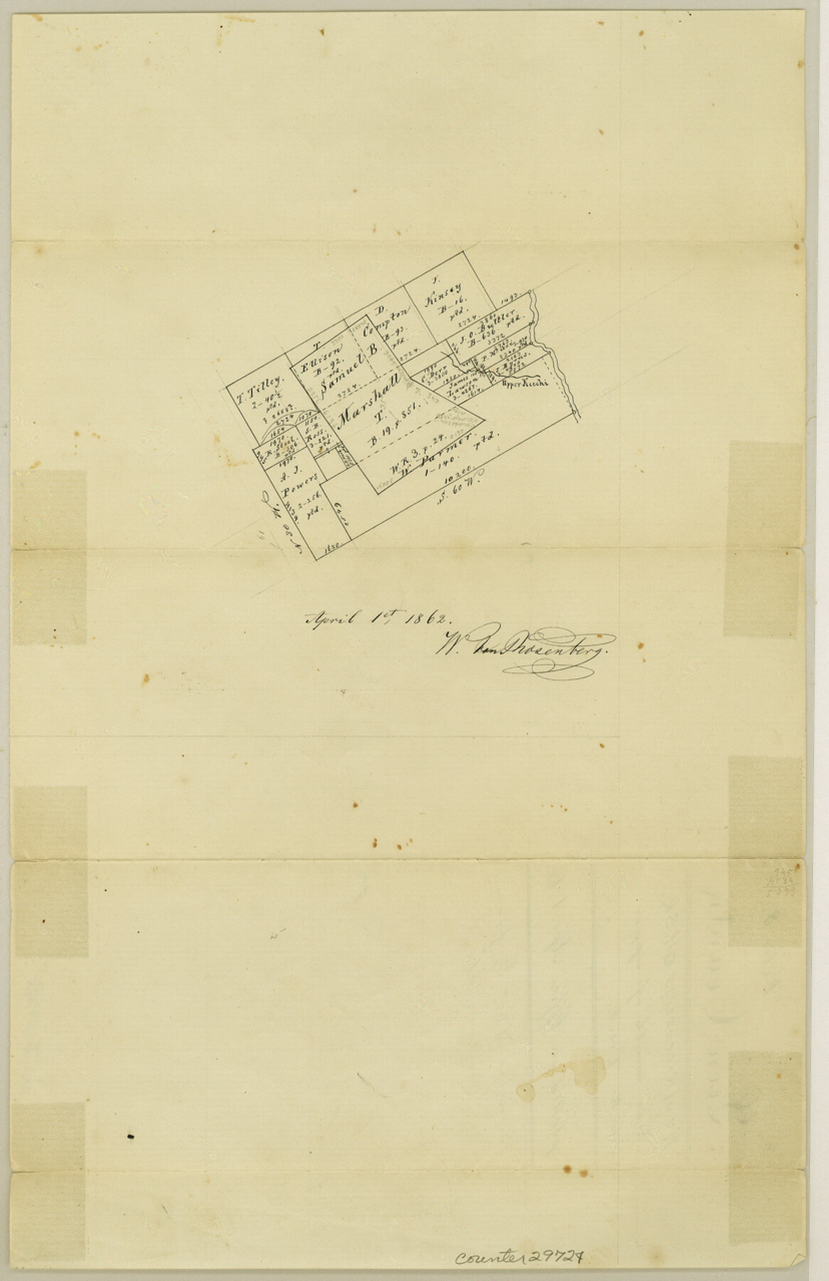
Leon County Sketch File 8
[Sketch near mouth of upper Keechi Creek]
-
Map/Doc
29724
-
Collection
General Map Collection
-
Object Dates
4/1/1862 (Creation Date)
-
People and Organizations
W. von Rosenberg (Surveyor/Engineer)
-
Counties
Leon
-
Subjects
Surveying Sketch File
-
Height x Width
12.8 x 8.3 inches
32.5 x 21.1 cm
-
Medium
paper, manuscript
Part of: General Map Collection
Crockett County Rolled Sketch 27

Print $20.00
- Digital $50.00
Crockett County Rolled Sketch 27
1925
Size 20.8 x 38.0 inches
Map/Doc 5586
Stephens County Working Sketch 31

Print $20.00
- Digital $50.00
Stephens County Working Sketch 31
1978
Size 41.9 x 30.8 inches
Map/Doc 63974
Right of Way and Track Map, the Missouri, Kansas and Texas Ry. of Texas - Henrietta Division

Print $20.00
- Digital $50.00
Right of Way and Track Map, the Missouri, Kansas and Texas Ry. of Texas - Henrietta Division
1918
Size 11.8 x 26.8 inches
Map/Doc 64755
Concho County Sketch File 10

Print $20.00
- Digital $50.00
Concho County Sketch File 10
1887
Size 23.1 x 33.8 inches
Map/Doc 11150
Kendall County Boundary File 54

Print $16.00
- Digital $50.00
Kendall County Boundary File 54
Size 8.6 x 3.5 inches
Map/Doc 55769
Harris County NRC Article 33.136 Sketch 19

Print $50.00
- Digital $50.00
Harris County NRC Article 33.136 Sketch 19
2014
Size 24.6 x 36.6 inches
Map/Doc 95334
Flight Mission No. CLL-1N, Frame 187, Willacy County

Print $20.00
- Digital $50.00
Flight Mission No. CLL-1N, Frame 187, Willacy County
1954
Size 18.4 x 22.1 inches
Map/Doc 87057
Dimmit County Working Sketch 8

Print $20.00
- Digital $50.00
Dimmit County Working Sketch 8
1930
Size 35.8 x 29.9 inches
Map/Doc 68669
Map of Europe engraved to illustrate Mitchell's school and family geography

Print $20.00
- Digital $50.00
Map of Europe engraved to illustrate Mitchell's school and family geography
1839
Size 9.5 x 11.8 inches
Map/Doc 93502
Terrell County Working Sketch 1

Print $20.00
- Digital $50.00
Terrell County Working Sketch 1
1886
Size 27.5 x 24.4 inches
Map/Doc 62149
Guadalupe County

Print $20.00
- Digital $50.00
Guadalupe County
1854
Size 25.0 x 21.1 inches
Map/Doc 3609
Atascosa County Sketch File 30

Print $18.00
- Digital $50.00
Atascosa County Sketch File 30
1900
Size 11.2 x 8.8 inches
Map/Doc 13816
You may also like
The Republic County of Bexar. South View. Proposed, Fall 1837-December 31, 1838

Print $20.00
The Republic County of Bexar. South View. Proposed, Fall 1837-December 31, 1838
2020
Size 14.7 x 22.3 inches
Map/Doc 96095
Coke County Rolled Sketch 19

Print $20.00
- Digital $50.00
Coke County Rolled Sketch 19
1954
Size 18.5 x 25.8 inches
Map/Doc 5519
Somervell County

Print $20.00
- Digital $50.00
Somervell County
1941
Size 27.5 x 26.7 inches
Map/Doc 63042
Wharton County Rolled Sketch 9

Print $20.00
- Digital $50.00
Wharton County Rolled Sketch 9
1970
Size 30.1 x 41.3 inches
Map/Doc 8233
Gulf Coast of the United States, Key West to Rio Grande

Print $20.00
- Digital $50.00
Gulf Coast of the United States, Key West to Rio Grande
1892
Size 27.5 x 18.3 inches
Map/Doc 72669
Webb County Rolled Sketch 42

Print $20.00
- Digital $50.00
Webb County Rolled Sketch 42
1941
Size 25.2 x 37.1 inches
Map/Doc 8197
Coke County Sketch File 13a

Print $20.00
- Digital $50.00
Coke County Sketch File 13a
Size 20.3 x 19.5 inches
Map/Doc 11107
Map of Chicago, Rock Island & Texas Railway through Wise and Tarrant County, Texas

Print $40.00
- Digital $50.00
Map of Chicago, Rock Island & Texas Railway through Wise and Tarrant County, Texas
1893
Size 19.4 x 121.0 inches
Map/Doc 64428
General Highway Map, Upton County, Texas

Print $20.00
General Highway Map, Upton County, Texas
1940
Size 24.8 x 18.1 inches
Map/Doc 79265
Zavala County Sketch File 4

Print $20.00
- Digital $50.00
Zavala County Sketch File 4
1852
Size 17.7 x 14.7 inches
Map/Doc 12726
Dawson County Sketch File 19

Print $20.00
- Digital $50.00
Dawson County Sketch File 19
1951
Size 18.5 x 24.7 inches
Map/Doc 11295
Flight Mission No. DQN-3K, Frame 63, Calhoun County

Print $20.00
- Digital $50.00
Flight Mission No. DQN-3K, Frame 63, Calhoun County
1953
Size 18.4 x 22.3 inches
Map/Doc 84354