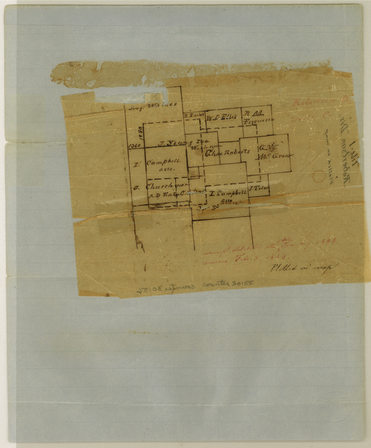
Limestone County Sketch File 1
[Sketch of area on Steel's Creek]
-
Map/Doc
30155
-
Collection
General Map Collection
-
Object Dates
2/3/1848 (File Date)
-
Counties
Limestone Robertson
-
Subjects
Surveying Sketch File
-
Height x Width
9.8 x 8.1 inches
24.9 x 20.6 cm
-
Medium
paper, manuscript
-
Features
Steel's Creek
Part of: General Map Collection
McMullen County Working Sketch 61

Print $20.00
- Digital $50.00
McMullen County Working Sketch 61
1990
Size 25.2 x 19.8 inches
Map/Doc 70762
Newton County Sketch File 1

Print $6.00
- Digital $50.00
Newton County Sketch File 1
Size 7.5 x 5.4 inches
Map/Doc 32355
Flight Mission No. CRC-3R, Frame 22, Chambers County

Print $20.00
- Digital $50.00
Flight Mission No. CRC-3R, Frame 22, Chambers County
1956
Size 18.6 x 22.3 inches
Map/Doc 84796
Brewster County Working Sketch 62

Print $20.00
- Digital $50.00
Brewster County Working Sketch 62
1956
Size 22.7 x 20.2 inches
Map/Doc 67663
Stonewall County Working Sketch 8

Print $20.00
- Digital $50.00
Stonewall County Working Sketch 8
1950
Size 23.5 x 23.2 inches
Map/Doc 62315
Texas City Channel, Texas, Channel and Turning Basin Dredging - Sheet 2

Print $20.00
- Digital $50.00
Texas City Channel, Texas, Channel and Turning Basin Dredging - Sheet 2
1958
Size 28.6 x 41.0 inches
Map/Doc 61832
Lavaca County Working Sketch 4

Print $20.00
- Digital $50.00
Lavaca County Working Sketch 4
1938
Size 27.7 x 42.4 inches
Map/Doc 70357
Washington County

Print $40.00
- Digital $50.00
Washington County
1920
Size 33.5 x 48.8 inches
Map/Doc 1900
Webb County Boundary File 3b

Print $82.00
- Digital $50.00
Webb County Boundary File 3b
Size 20.3 x 50.8 inches
Map/Doc 59758
Brewster County Sketch File N-19

Print $40.00
- Digital $50.00
Brewster County Sketch File N-19
1946
Size 18.7 x 26.2 inches
Map/Doc 10966
Brown County Sketch File 17

Print $40.00
- Digital $50.00
Brown County Sketch File 17
Size 15.6 x 12.7 inches
Map/Doc 16614
Harris County Working Sketch 44

Print $20.00
- Digital $50.00
Harris County Working Sketch 44
1941
Size 24.9 x 38.3 inches
Map/Doc 65936
You may also like
Brazoria County Working Sketch 2

Print $20.00
- Digital $50.00
Brazoria County Working Sketch 2
1907
Size 20.9 x 20.8 inches
Map/Doc 67487

Lampasas County Boundary File 4a

Print $12.00
- Digital $50.00
Lampasas County Boundary File 4a
Size 12.8 x 8.2 inches
Map/Doc 56122
Shelby County Working Sketch 31a

Print $40.00
- Digital $50.00
Shelby County Working Sketch 31a
2003
Size 32.6 x 70.2 inches
Map/Doc 78643
Energy Map of Texas

Print $20.00
- Digital $50.00
Energy Map of Texas
2020
Size 36.0 x 36.0 inches
Map/Doc 96436
Lavaca County Working Sketch 4
Print $20.00
- Digital $50.00
Lavaca County Working Sketch 4
1938
Size 27.7 x 42.4 inches
Map/Doc 70357
Bexar County Rolled Sketch 6

Print $40.00
- Digital $50.00
Bexar County Rolled Sketch 6
Size 36.6 x 54.9 inches
Map/Doc 81902
Floyd County Working Sketch 3

Print $20.00
- Digital $50.00
Floyd County Working Sketch 3
1948
Size 27.4 x 22.8 inches
Map/Doc 69182
Flight Mission No. BRA-16M, Frame 107, Jefferson County

Print $20.00
- Digital $50.00
Flight Mission No. BRA-16M, Frame 107, Jefferson County
1953
Size 18.5 x 22.3 inches
Map/Doc 85719
[Sketch for Mineral Application 13440]
![65673, [Sketch for Mineral Application 13440], General Map Collection](https://historictexasmaps.com/wmedia_w700/maps/65673-1.tif.jpg)
Print $40.00
- Digital $50.00
[Sketch for Mineral Application 13440]
Size 42.4 x 66.0 inches
Map/Doc 65673
Lee County Sketch File 9

Print $4.00
- Digital $50.00
Lee County Sketch File 9
Size 8.8 x 8.2 inches
Map/Doc 29709
Liberty County Working Sketch 47

Print $20.00
- Digital $50.00
Liberty County Working Sketch 47
1954
Size 28.3 x 24.6 inches
Map/Doc 70506