![315, [Surveys in the Bexar District along the Frio River], General Map Collection](https://historictexasmaps.com/wmedia_w1800h1800/maps/315.tif.jpg)
[Surveys in the Bexar District along the Frio River]
Atlas G, Page 2, Sketch 33 (G-2-33)
G-2-33
-
Map/Doc
315
-
Collection
General Map Collection
-
Object Dates
1847 (Creation Date)
-
People and Organizations
John James (Surveyor/Engineer)
Charles de Montel (Draftsman)
-
Counties
Medina Frio Uvalde Zavala
-
Subjects
Atlas
-
Height x Width
15.8 x 9.2 inches
40.1 x 23.4 cm
-
Medium
paper, manuscript
-
Scale
1:4000
-
Comments
Conserved in 2004.
-
Features
Sabine River
Rio Frio
Presidio Road
Part of: General Map Collection
Pecos County Sketch File 105

Print $4.00
- Digital $50.00
Pecos County Sketch File 105
1965
Size 14.3 x 8.8 inches
Map/Doc 34028
Colonists' and Emigrants' Route to Texas

Print $20.00
- Digital $50.00
Colonists' and Emigrants' Route to Texas
1878
Size 14.8 x 24.0 inches
Map/Doc 94033
Liberty County Rolled Sketch F

Print $20.00
- Digital $50.00
Liberty County Rolled Sketch F
Size 24.9 x 25.5 inches
Map/Doc 6621
McCulloch County Sketch File 15, 15a, 15b

Print $34.00
- Digital $50.00
McCulloch County Sketch File 15, 15a, 15b
1993
Size 11.2 x 8.8 inches
Map/Doc 31207
Texas Official Travel Map [Major Metropolitan Areas]
![96830, Texas Official Travel Map [Major Metropolitan Areas], General Map Collection](https://historictexasmaps.com/wmedia_w700/maps/96830.tif.jpg)
Texas Official Travel Map [Major Metropolitan Areas]
2008
Size 33.2 x 36.1 inches
Map/Doc 96830
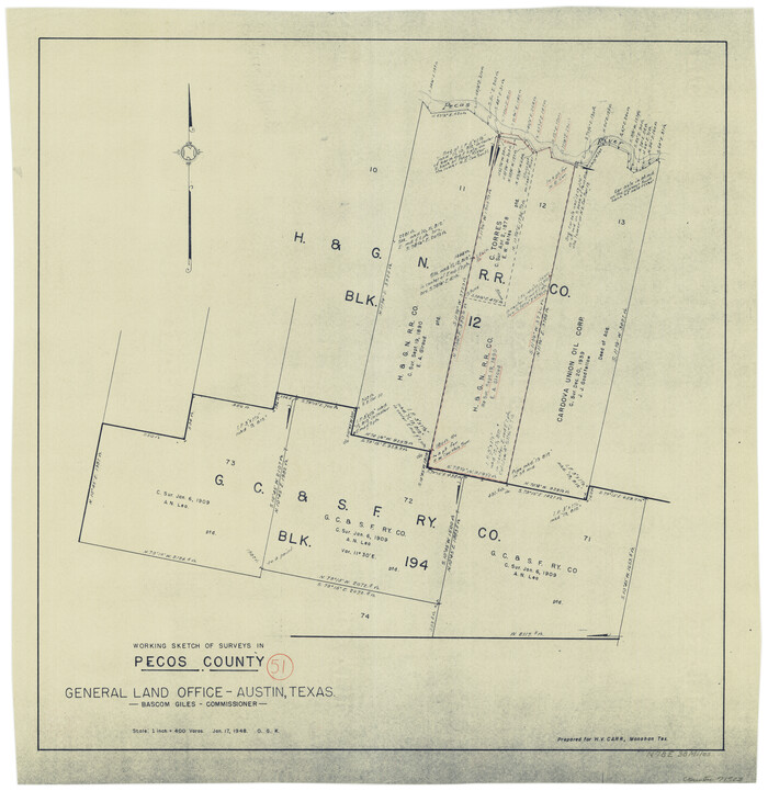
Pecos County Working Sketch 51
Print $20.00
- Digital $50.00
Pecos County Working Sketch 51
1948
Size 22.5 x 21.9 inches
Map/Doc 71523
Marion County Working Sketch 38

Print $20.00
- Digital $50.00
Marion County Working Sketch 38
1991
Size 35.5 x 39.9 inches
Map/Doc 70814
Panola County Sketch File 29

Print $7.00
- Digital $50.00
Panola County Sketch File 29
1842
Size 10.0 x 8.1 inches
Map/Doc 33502
[Fractional Township No. 7 South Range No. 17 East of the Indian Meridian, Indian Territory]
![75231, [Fractional Township No. 7 South Range No. 17 East of the Indian Meridian, Indian Territory], General Map Collection](https://historictexasmaps.com/wmedia_w700/maps/75231.tif.jpg)
Print $20.00
- Digital $50.00
[Fractional Township No. 7 South Range No. 17 East of the Indian Meridian, Indian Territory]
Size 19.2 x 24.3 inches
Map/Doc 75231
Archer County Sketch File 28-2

Print $40.00
- Digital $50.00
Archer County Sketch File 28-2
Size 21.4 x 16.9 inches
Map/Doc 10835
Presidio County Working Sketch 42

Print $40.00
- Digital $50.00
Presidio County Working Sketch 42
1948
Size 90.9 x 38.2 inches
Map/Doc 71719
Flight Mission No. CRC-4R, Frame 67, Chambers County

Print $20.00
- Digital $50.00
Flight Mission No. CRC-4R, Frame 67, Chambers County
1956
Size 18.8 x 22.5 inches
Map/Doc 84871
You may also like
[Surveys in Robertson's Colony]
![78358, [Surveys in Robertson's Colony], General Map Collection](https://historictexasmaps.com/wmedia_w700/maps/78358.tif.jpg)
Print $20.00
- Digital $50.00
[Surveys in Robertson's Colony]
Size 18.6 x 26.5 inches
Map/Doc 78358
Stephens County Sketch File 10b

Print $8.00
- Digital $50.00
Stephens County Sketch File 10b
1890
Size 8.5 x 7.8 inches
Map/Doc 37048
Erath County Sketch File 22

Print $4.00
- Digital $50.00
Erath County Sketch File 22
1853
Size 8.4 x 8.4 inches
Map/Doc 22304
Location of the Southern Kansas Railway of Texas, Carson County, Texas

Print $40.00
- Digital $50.00
Location of the Southern Kansas Railway of Texas, Carson County, Texas
1887
Size 20.5 x 84.3 inches
Map/Doc 64035
Hays County Sketch File 29

Print $20.00
- Digital $50.00
Hays County Sketch File 29
1938
Size 21.3 x 31.7 inches
Map/Doc 11751
Foard County Sketch File 18

Print $6.00
- Digital $50.00
Foard County Sketch File 18
1888
Size 13.0 x 8.5 inches
Map/Doc 22834
Flight Mission No. CRK-3P, Frame 68, Refugio County

Print $20.00
- Digital $50.00
Flight Mission No. CRK-3P, Frame 68, Refugio County
1956
Size 18.7 x 22.5 inches
Map/Doc 86910
Van Zandt County Sketch File 5

Print $22.00
- Digital $50.00
Van Zandt County Sketch File 5
Size 20.5 x 6.3 inches
Map/Doc 39371
Shelby County Sketch File 12

Print $4.00
- Digital $50.00
Shelby County Sketch File 12
Size 8.2 x 10.3 inches
Map/Doc 36619
Kendall County Sketch File 14

Print $4.00
- Digital $50.00
Kendall County Sketch File 14
1860
Size 8.1 x 10.2 inches
Map/Doc 28701
Hutchinson Co.

Print $20.00
- Digital $50.00
Hutchinson Co.
1891
Size 27.5 x 21.3 inches
Map/Doc 4986
Harris County Sketch File F

Print $4.00
- Digital $50.00
Harris County Sketch File F
1860
Size 10.1 x 5.1 inches
Map/Doc 25317