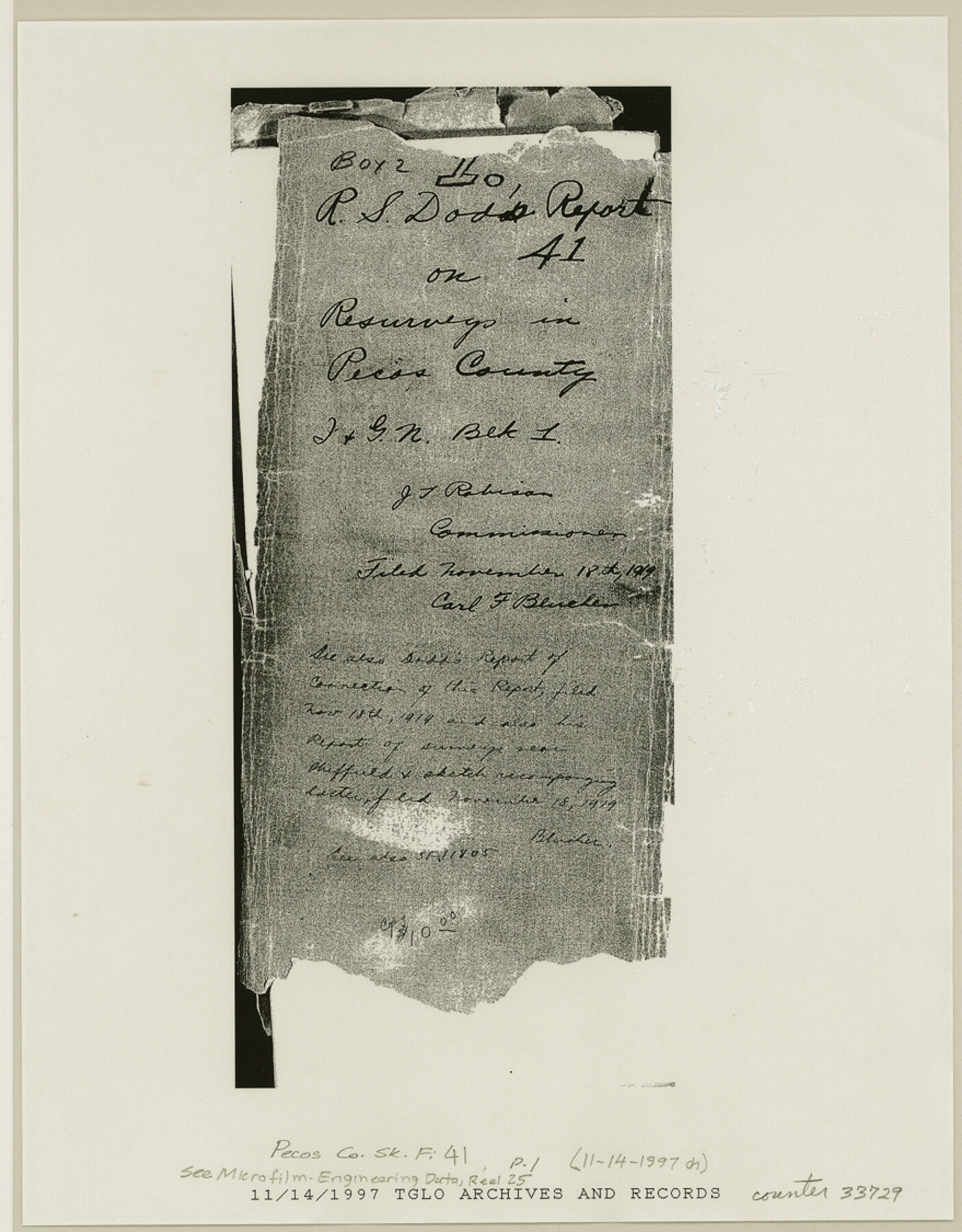
Pecos County Sketch File 41
[Report on resurveys in Pecos County]
-
Map/Doc
33729
-
Collection
General Map Collection
-
Object Dates
1919/8/5 (Creation Date)
1919/11/18 (File Date)
1919/8/5 (Correspondence Date)
1919/11/22 (Correspondence Date)
-
People and Organizations
R.S. Dod (Surveyor/Engineer)
Williams (Surveyor/Engineer)
Jacob Kuechler (Surveyor/Engineer)
-
Counties
Pecos
-
Subjects
Surveying Sketch File
-
Height x Width
11.2 x 8.8 inches
28.4 x 22.4 cm
-
Medium
photostat
-
Features
Pecos Spring
Pecos River
Pontoon
Lancaster
Old San Antonio Road
Part of: General Map Collection
Foard County Rolled Sketch 16

Print $40.00
- Digital $50.00
Foard County Rolled Sketch 16
1889
Size 36.9 x 72.8 inches
Map/Doc 8893
Map of the State of Texas [West Part]
![81921, Map of the State of Texas [West Part], General Map Collection](https://historictexasmaps.com/wmedia_w700/maps/81921.tif.jpg)
Print $40.00
- Digital $50.00
Map of the State of Texas [West Part]
1938
Size 68.7 x 38.2 inches
Map/Doc 81921
El Paso County

Print $40.00
- Digital $50.00
El Paso County
1881
Size 52.0 x 36.8 inches
Map/Doc 89059
Eastland County Working Sketch 17

Print $20.00
- Digital $50.00
Eastland County Working Sketch 17
1919
Size 18.3 x 16.2 inches
Map/Doc 68798
Drainage Basins of Texas Streams

Print $20.00
- Digital $50.00
Drainage Basins of Texas Streams
Size 17.0 x 19.3 inches
Map/Doc 65269
Jim Hogg Co. / Brooks Co.

Print $20.00
- Digital $50.00
Jim Hogg Co. / Brooks Co.
1912
Size 33.0 x 43.6 inches
Map/Doc 4894
Texas Highway Map Points of Interest, Recreational Facilities Guide, Special Events Calendar [Verso]
![94188, Texas Highway Map Points of Interest, Recreational Facilities Guide, Special Events Calendar [Verso], General Map Collection](https://historictexasmaps.com/wmedia_w700/maps/94188.tif.jpg)
Texas Highway Map Points of Interest, Recreational Facilities Guide, Special Events Calendar [Verso]
1963
Size 31.0 x 18.3 inches
Map/Doc 94188
Jeff Davis County Working Sketch 27

Print $20.00
- Digital $50.00
Jeff Davis County Working Sketch 27
1960
Size 18.1 x 24.3 inches
Map/Doc 66522
Brewster County Boundary File 1b

Print $32.00
- Digital $50.00
Brewster County Boundary File 1b
Size 9.2 x 11.3 inches
Map/Doc 50740
McCulloch County Rolled Sketch 10

Print $20.00
- Digital $50.00
McCulloch County Rolled Sketch 10
Size 45.9 x 33.7 inches
Map/Doc 6720
Burleson County Working Sketch 20

Print $20.00
- Digital $50.00
Burleson County Working Sketch 20
1980
Size 19.5 x 16.6 inches
Map/Doc 67739
Red River County Sketch File 15

Print $4.00
- Digital $50.00
Red River County Sketch File 15
1863
Size 12.1 x 7.2 inches
Map/Doc 35137
You may also like
Sketch showing subdivision of surveys in Webb Co., Texas

Print $20.00
- Digital $50.00
Sketch showing subdivision of surveys in Webb Co., Texas
1933
Size 18.2 x 20.1 inches
Map/Doc 459
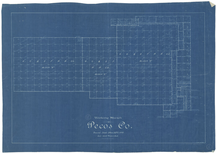
Pecos County Working Sketch 12
Print $20.00
- Digital $50.00
Pecos County Working Sketch 12
1912
Size 21.3 x 30.0 inches
Map/Doc 71482
Presidio County Working Sketch 135

Print $20.00
- Digital $50.00
Presidio County Working Sketch 135
1988
Size 23.6 x 24.4 inches
Map/Doc 71813
Lampasas County Sketch File 3

Print $4.00
- Digital $50.00
Lampasas County Sketch File 3
1856
Size 12.1 x 7.6 inches
Map/Doc 29392
Red River County Working Sketch 62

Print $20.00
- Digital $50.00
Red River County Working Sketch 62
1973
Size 27.1 x 40.0 inches
Map/Doc 72045
McCulloch County Working Sketch 19

Print $20.00
- Digital $50.00
McCulloch County Working Sketch 19
2010
Size 32.6 x 27.0 inches
Map/Doc 89260
Flight Mission No. DQO-3K, Frame 39, Galveston County

Print $20.00
- Digital $50.00
Flight Mission No. DQO-3K, Frame 39, Galveston County
1952
Size 18.8 x 22.5 inches
Map/Doc 85080
Angelina County Working Sketch 23

Print $20.00
- Digital $50.00
Angelina County Working Sketch 23
1953
Size 19.8 x 32.6 inches
Map/Doc 67105
Panola County Rolled Sketch 4

Print $20.00
- Digital $50.00
Panola County Rolled Sketch 4
1951
Size 25.4 x 26.1 inches
Map/Doc 7198
Wood County Working Sketch 21

Print $20.00
- Digital $50.00
Wood County Working Sketch 21
1962
Size 40.6 x 35.7 inches
Map/Doc 62021
Montague County Working Sketch 24

Print $20.00
- Digital $50.00
Montague County Working Sketch 24
1953
Size 21.9 x 27.6 inches
Map/Doc 71090
Van Zandt County Sketch File 47

Print $7.00
- Digital $50.00
Van Zandt County Sketch File 47
Size 10.0 x 8.1 inches
Map/Doc 39504