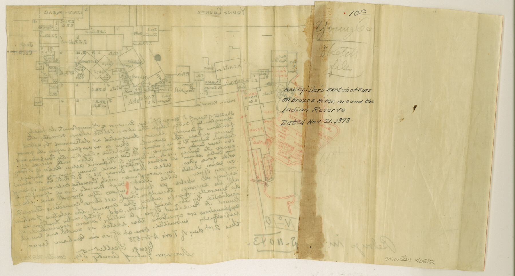
Young County Sketch File 10c
[Sketch of surveys on Brazos River around the Indian Reserve]
-
Map/Doc
40872
-
Collection
General Map Collection
-
Object Dates
1878/11/21 (Creation Date)
1878/11/21 (Creation Date)
-
People and Organizations
George Spiller (Surveyor/Engineer)
-
Counties
Young
-
Subjects
Surveying Sketch File
-
Height x Width
8.2 x 15.4 inches
20.8 x 39.1 cm
-
Medium
paper, manuscript
-
Features
Brazos River
Indian Reservation
Part of: General Map Collection

Sabine County Working Sketch 10

Print $20.00
- Digital $50.00
Sabine County Working Sketch 10
1925
Size 18.6 x 24.2 inches
Map/Doc 63681
Travis County Working Sketch 40

Print $20.00
- Digital $50.00
Travis County Working Sketch 40
1974
Size 31.7 x 32.1 inches
Map/Doc 69424
A How to Get From Here to There Map and Water Too of Metropolitan Houston

A How to Get From Here to There Map and Water Too of Metropolitan Houston
Size 36.6 x 25.5 inches
Map/Doc 94361
Houston County Sketch File 3

Print $6.00
- Digital $50.00
Houston County Sketch File 3
Size 13.1 x 8.2 inches
Map/Doc 26748
Bee County Sketch File 29

Print $6.00
- Digital $50.00
Bee County Sketch File 29
1887
Size 14.0 x 8.8 inches
Map/Doc 14338
Harris County Working Sketch 63

Print $20.00
- Digital $50.00
Harris County Working Sketch 63
1954
Size 34.0 x 36.8 inches
Map/Doc 65955
Jack County Sketch File 13

Print $4.00
- Digital $50.00
Jack County Sketch File 13
Size 10.3 x 8.0 inches
Map/Doc 27537
Dickens County Sketch File N

Print $4.00
- Digital $50.00
Dickens County Sketch File N
1903
Size 8.3 x 13.6 inches
Map/Doc 20942
Hutchinson County Sketch File 2

Print $8.00
- Digital $50.00
Hutchinson County Sketch File 2
1882
Size 14.2 x 8.7 inches
Map/Doc 27173
Pecos County Working Sketch 89

Print $20.00
- Digital $50.00
Pecos County Working Sketch 89
1964
Size 46.5 x 34.2 inches
Map/Doc 78216
Sketch C Showing the Progress of the Survey in Section III From 1843 to 1851

Print $20.00
- Digital $50.00
Sketch C Showing the Progress of the Survey in Section III From 1843 to 1851
1851
Size 35.7 x 23.0 inches
Map/Doc 97205
You may also like
General Highway Map, Camp County, Morris County, Titus County, Texas

Print $20.00
General Highway Map, Camp County, Morris County, Titus County, Texas
1961
Size 24.7 x 18.1 inches
Map/Doc 79400
Flight Mission No. CLL-1N, Frame 183, Willacy County

Print $20.00
- Digital $50.00
Flight Mission No. CLL-1N, Frame 183, Willacy County
1954
Size 18.3 x 22.0 inches
Map/Doc 87053
Cass County Rolled Sketch WDC

Print $20.00
- Digital $50.00
Cass County Rolled Sketch WDC
Size 20.8 x 32.9 inches
Map/Doc 5416
Harris County Working Sketch 121

Print $20.00
- Digital $50.00
Harris County Working Sketch 121
1985
Size 34.4 x 18.6 inches
Map/Doc 66013
Dallas County Sketch File 20

Print $4.00
- Digital $50.00
Dallas County Sketch File 20
Size 12.2 x 7.8 inches
Map/Doc 20441
Harris County Working Sketch 24

Print $20.00
- Digital $50.00
Harris County Working Sketch 24
1928
Size 29.3 x 15.9 inches
Map/Doc 65916
Burleson County Working Sketch 9

Print $20.00
- Digital $50.00
Burleson County Working Sketch 9
1980
Size 26.2 x 25.2 inches
Map/Doc 67728
Bee County Sketch File 32

Print $4.00
- Digital $50.00
Bee County Sketch File 32
Size 7.9 x 12.6 inches
Map/Doc 14347
Donley County Rolled Sketch 4

Print $20.00
- Digital $50.00
Donley County Rolled Sketch 4
1972
Size 16.0 x 17.4 inches
Map/Doc 5731

Calhoun County Rolled Sketch 33

Print $73.00
- Digital $50.00
Calhoun County Rolled Sketch 33
1979
Size 10.0 x 15.2 inches
Map/Doc 43687
Cottle County Sketch File 8

Print $20.00
- Digital $50.00
Cottle County Sketch File 8
1894
Size 37.6 x 17.6 inches
Map/Doc 11192