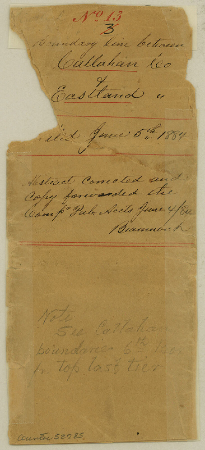
Eastland County Boundary File 13
Boundary line between Callahan Co. & Eastland [Co.]
-
Map/Doc
52785
-
Collection
General Map Collection
-
Counties
Eastland
-
Subjects
County Boundaries
-
Height x Width
8.0 x 3.7 inches
20.3 x 9.4 cm
Part of: General Map Collection
Brazos County Sketch File 5
![15559, Brazos County Sketch File 5, General Map Collection](https://historictexasmaps.com/wmedia_w700/pdf_converted_jpg/qi_pdf_thumbnail_9586.jpg)
Print $34.00
- Digital $50.00
Brazos County Sketch File 5
1935
Size 8.2 x 7.1 inches
Map/Doc 15559
Bastrop County Sketch File 5
![14048, Bastrop County Sketch File 5, General Map Collection](https://historictexasmaps.com/wmedia_w700/pdf_converted_jpg/qi_pdf_thumbnail_9254.jpg)
Print $4.00
- Digital $50.00
Bastrop County Sketch File 5
Size 8.1 x 10.2 inches
Map/Doc 14048
Old Miscellaneous File 4
![75416, Old Miscellaneous File 4, General Map Collection](https://historictexasmaps.com/wmedia_w700/pdf_converted_jpg/qi_pdf_thumbnail_28013.jpg)
Print $22.00
- Digital $50.00
Old Miscellaneous File 4
1845
Size 16.5 x 20.8 inches
Map/Doc 75416
Kimble County Working Sketch 75
![70143, Kimble County Working Sketch 75, General Map Collection](https://historictexasmaps.com/wmedia_w700/maps/70143.tif.jpg)
Print $6.00
- Digital $50.00
Kimble County Working Sketch 75
Size 32.0 x 35.7 inches
Map/Doc 70143
Val Verde County Rolled Sketch 59
![10078, Val Verde County Rolled Sketch 59, General Map Collection](https://historictexasmaps.com/wmedia_w700/maps/10078.tif.jpg)
Print $20.00
- Digital $50.00
Val Verde County Rolled Sketch 59
1947
Size 45.2 x 23.6 inches
Map/Doc 10078
Rains County Sketch File 9
![34960, Rains County Sketch File 9, General Map Collection](https://historictexasmaps.com/wmedia_w700/pdf_converted_jpg/qi_pdf_thumbnail_13795.jpg)
Print $20.00
- Digital $50.00
Rains County Sketch File 9
Size 14.2 x 16.3 inches
Map/Doc 34960
Tom Green County Rolled Sketch 8
![7996, Tom Green County Rolled Sketch 8, General Map Collection](https://historictexasmaps.com/wmedia_w700/maps/7996.tif.jpg)
Print $20.00
- Digital $50.00
Tom Green County Rolled Sketch 8
Size 18.3 x 26.0 inches
Map/Doc 7996
Bastrop County Rolled Sketch 6
![93716, Bastrop County Rolled Sketch 6, General Map Collection](https://historictexasmaps.com/wmedia_w700/maps/93716.tif.jpg)
Print $20.00
- Digital $50.00
Bastrop County Rolled Sketch 6
2013
Size 42.3 x 32.1 inches
Map/Doc 93716
Crosby County Sketch File 21
![20087, Crosby County Sketch File 21, General Map Collection](https://historictexasmaps.com/wmedia_w700/pdf_converted_jpg/qi_pdf_thumbnail_10547.jpg)
Print $6.00
- Digital $50.00
Crosby County Sketch File 21
Size 13.8 x 8.8 inches
Map/Doc 20087
Railroad Track Map, H&TCRRCo., Falls County, Texas
![62844, Railroad Track Map, H&TCRRCo., Falls County, Texas, General Map Collection](https://historictexasmaps.com/wmedia_w700/maps/62844.tif.jpg)
Print $4.00
- Digital $50.00
Railroad Track Map, H&TCRRCo., Falls County, Texas
1918
Size 11.8 x 18.6 inches
Map/Doc 62844
Eastland County Working Sketch 14
![68795, Eastland County Working Sketch 14, General Map Collection](https://historictexasmaps.com/wmedia_w700/maps/68795.tif.jpg)
Print $20.00
- Digital $50.00
Eastland County Working Sketch 14
Size 18.2 x 17.1 inches
Map/Doc 68795
Gillespie County Sketch File 7
![24141, Gillespie County Sketch File 7, General Map Collection](https://historictexasmaps.com/wmedia_w700/pdf_converted_jpg/qi_pdf_thumbnail_11372.jpg)
Print $4.00
- Digital $50.00
Gillespie County Sketch File 7
1872
Size 7.7 x 7.3 inches
Map/Doc 24141
You may also like
Irion County Rolled Sketch 18A
![6327, Irion County Rolled Sketch 18A, General Map Collection](https://historictexasmaps.com/wmedia_w700/maps/6327.tif.jpg)
Print $20.00
- Digital $50.00
Irion County Rolled Sketch 18A
Size 45.5 x 29.8 inches
Map/Doc 6327
Presidio County Sketch File P
![34552, Presidio County Sketch File P, General Map Collection](https://historictexasmaps.com/wmedia_w700/pdf_converted_jpg/qi_pdf_thumbnail_13717.jpg)
Print $8.00
- Digital $50.00
Presidio County Sketch File P
1916
Size 14.4 x 8.8 inches
Map/Doc 34552
Edwards County Rolled Sketch 33
![5815, Edwards County Rolled Sketch 33, General Map Collection](https://historictexasmaps.com/wmedia_w700/maps/5815.tif.jpg)
Print $20.00
- Digital $50.00
Edwards County Rolled Sketch 33
1890
Size 25.0 x 25.8 inches
Map/Doc 5815
Flight Mission No. CRC-3R, Frame 29, Chambers County
![84804, Flight Mission No. CRC-3R, Frame 29, Chambers County, General Map Collection](https://historictexasmaps.com/wmedia_w700/pdf_converted_jpg/qi_pdf_thumbnail_32019.jpg)
Print $20.00
- Digital $50.00
Flight Mission No. CRC-3R, Frame 29, Chambers County
1956
Size 18.6 x 22.3 inches
Map/Doc 84804
Map of Padre Island Showing Location of Zoning Districts
![4809, Map of Padre Island Showing Location of Zoning Districts, General Map Collection](https://historictexasmaps.com/wmedia_w700/maps/4809.tif.jpg)
Print $20.00
- Digital $50.00
Map of Padre Island Showing Location of Zoning Districts
1971
Size 18.8 x 26.7 inches
Map/Doc 4809
Val Verde County Working Sketch 67
![72202, Val Verde County Working Sketch 67, General Map Collection](https://historictexasmaps.com/wmedia_w700/maps/72202.tif.jpg)
Print $40.00
- Digital $50.00
Val Verde County Working Sketch 67
Size 48.4 x 42.1 inches
Map/Doc 72202
Zavala County Working Sketch 1
![62076, Zavala County Working Sketch 1, General Map Collection](https://historictexasmaps.com/wmedia_w700/maps/62076.tif.jpg)
Print $20.00
- Digital $50.00
Zavala County Working Sketch 1
Size 21.2 x 16.3 inches
Map/Doc 62076
Harrison County Sketch File 11
![26052, Harrison County Sketch File 11, General Map Collection](https://historictexasmaps.com/wmedia_w700/pdf_converted_jpg/qi_pdf_thumbnail_11783.jpg)
Print $22.00
- Digital $50.00
Harrison County Sketch File 11
1904
Size 9.2 x 9.3 inches
Map/Doc 26052
Flight Mission No. BQR-22K, Frame 38, Brazoria County
![84122, Flight Mission No. BQR-22K, Frame 38, Brazoria County, General Map Collection](https://historictexasmaps.com/wmedia_w700/pdf_converted_jpg/qi_pdf_thumbnail_31339.jpg)
Print $20.00
- Digital $50.00
Flight Mission No. BQR-22K, Frame 38, Brazoria County
1953
Size 18.5 x 22.3 inches
Map/Doc 84122
General Highway Map, Martin County, Texas
![79185, General Highway Map, Martin County, Texas, Texas State Library and Archives](https://historictexasmaps.com/wmedia_w700/maps/79185.tif.jpg)
Print $20.00
General Highway Map, Martin County, Texas
1940
Size 18.2 x 24.6 inches
Map/Doc 79185
[Map of Portion of Pecos County as Surveyed by F. F. Friend]
![91562, [Map of Portion of Pecos County as Surveyed by F. F. Friend], Twichell Survey Records](https://historictexasmaps.com/wmedia_w700/maps/91562-1.tif.jpg)
Print $3.00
- Digital $50.00
[Map of Portion of Pecos County as Surveyed by F. F. Friend]
1926
Size 17.0 x 11.4 inches
Map/Doc 91562
Carte Générale du Royaume de la Nouvelle Espagne depuis le Parallele de 16° jusqu'au Parallele de 38° (Latitude Nord) dressée sur des Observations Astronomiques et sur l'ensemble des Matériaux qui existoient à Mexico, au commencement de l'année 1804
![93782, Carte Générale du Royaume de la Nouvelle Espagne depuis le Parallele de 16° jusqu'au Parallele de 38° (Latitude Nord) dressée sur des Observations Astronomiques et sur l'ensemble des Matériaux qui existoient à Mexico, au commencement de l'année 1804, Texana Foundation Collection](https://historictexasmaps.com/wmedia_w700/maps/93782.tif.jpg)
Print $20.00
- Digital $50.00
Carte Générale du Royaume de la Nouvelle Espagne depuis le Parallele de 16° jusqu'au Parallele de 38° (Latitude Nord) dressée sur des Observations Astronomiques et sur l'ensemble des Matériaux qui existoient à Mexico, au commencement de l'année 1804
1809
Size 21.6 x 32.5 inches
Map/Doc 93782