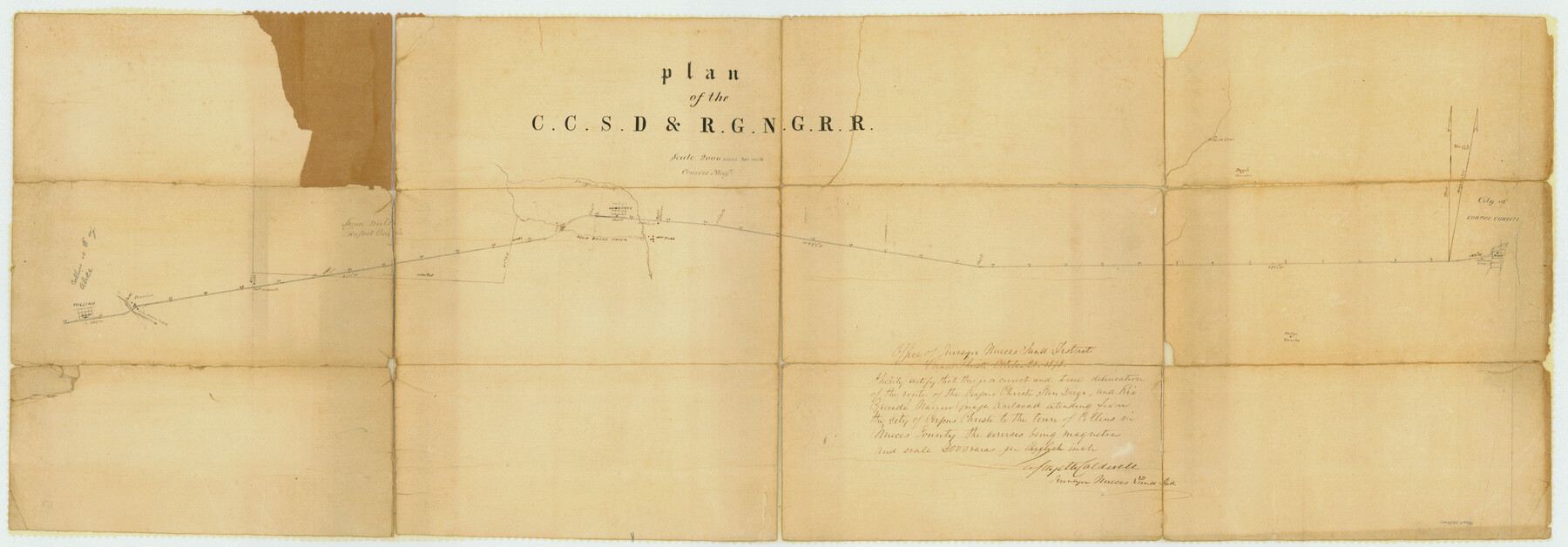
Plan of the C. C. S. D. & R. G. N. G. R.R.
Z-2-142
-
Map/Doc
64481
-
Collection
General Map Collection
-
Object Dates
1878/10/20 (Creation Date)
-
People and Organizations
Lafayette Caldwell (Surveyor/Engineer)
-
Counties
Nueces
-
Subjects
Railroads
-
Height x Width
14.3 x 40.9 inches
36.3 x 103.9 cm
-
Medium
paper, manuscript
-
Scale
2000 varas per inch
-
Comments
From Corpus Christi to Collins Help Save Texas History - Adopt Me!
-
Features
Collins
Agua Dulce Creek
Banquete Creek
Rabb
Banquete
Corpus Christi
Part of: General Map Collection
Map of Bee County

Print $20.00
- Digital $50.00
Map of Bee County
1879
Size 25.3 x 22.8 inches
Map/Doc 3288
Controlled Mosaic by Jack Amman Photogrammetric Engineers, Inc - Sheet 53

Print $20.00
- Digital $50.00
Controlled Mosaic by Jack Amman Photogrammetric Engineers, Inc - Sheet 53
1954
Size 20.0 x 24.0 inches
Map/Doc 83512
Anderson County

Print $40.00
- Digital $50.00
Anderson County
1942
Size 54.8 x 48.8 inches
Map/Doc 95415
Rachford's Complete Map of the City of Beaumont

Print $20.00
- Digital $50.00
Rachford's Complete Map of the City of Beaumont
1897
Size 33.4 x 23.6 inches
Map/Doc 97355
Howard County Boundary File 2c

Print $44.00
- Digital $50.00
Howard County Boundary File 2c
Size 5.0 x 8.9 inches
Map/Doc 55126
Flight Mission No. BRA-16M, Frame 73, Jefferson County

Print $20.00
- Digital $50.00
Flight Mission No. BRA-16M, Frame 73, Jefferson County
1953
Size 18.7 x 22.3 inches
Map/Doc 85690
Carta General de la República Mexicana Formada en vista de los datos mas recientes y exactos que se han reunido con tal objeto, y constan en la noticia presentada al Exmo. Sr. Ministro de Fomento, por Antonio García y Cubas

Print $20.00
- Digital $50.00
Carta General de la República Mexicana Formada en vista de los datos mas recientes y exactos que se han reunido con tal objeto, y constan en la noticia presentada al Exmo. Sr. Ministro de Fomento, por Antonio García y Cubas
Size 23.3 x 29.2 inches
Map/Doc 95824
Flight Mission No. BRE-3P, Frame 79, Nueces County

Print $20.00
- Digital $50.00
Flight Mission No. BRE-3P, Frame 79, Nueces County
1956
Size 18.6 x 22.5 inches
Map/Doc 86820
Jack County Working Sketch 22

Print $20.00
- Digital $50.00
Jack County Working Sketch 22
1995
Size 23.9 x 36.7 inches
Map/Doc 66448
Red River County Working Sketch 50

Print $20.00
- Digital $50.00
Red River County Working Sketch 50
1970
Size 24.6 x 24.1 inches
Map/Doc 72033
Kaufman County

Print $20.00
- Digital $50.00
Kaufman County
1896
Size 44.0 x 28.0 inches
Map/Doc 3751
Map of Nacogdoches County

Print $20.00
- Digital $50.00
Map of Nacogdoches County
1881
Size 24.5 x 21.5 inches
Map/Doc 4600
You may also like
Sketch Showing Block 33, Township 5 North, T. & P. RR. Surveys

Print $20.00
- Digital $50.00
Sketch Showing Block 33, Township 5 North, T. & P. RR. Surveys
1921
Size 23.2 x 22.7 inches
Map/Doc 90635
Hays County Sketch File 13a

Print $40.00
- Digital $50.00
Hays County Sketch File 13a
Size 12.3 x 15.0 inches
Map/Doc 26223
Donley County Working Sketch 9

Print $20.00
- Digital $50.00
Donley County Working Sketch 9
1982
Size 24.7 x 42.2 inches
Map/Doc 68742
Carta Geografica Della Florida Nell America Settentrionale

Print $20.00
- Digital $50.00
Carta Geografica Della Florida Nell America Settentrionale
1740
Size 14.1 x 18.5 inches
Map/Doc 89222
Palo Pinto County Sketch File 25a

Print $6.00
- Digital $50.00
Palo Pinto County Sketch File 25a
Size 11.0 x 11.4 inches
Map/Doc 33417
Presidio County Working Sketch 35

Print $20.00
- Digital $50.00
Presidio County Working Sketch 35
1947
Size 25.7 x 47.3 inches
Map/Doc 71712
Flight Mission No. BRA-7M, Frame 26, Jefferson County

Print $20.00
- Digital $50.00
Flight Mission No. BRA-7M, Frame 26, Jefferson County
1953
Size 18.4 x 22.2 inches
Map/Doc 85477
El Paso County Boundary File 13

Print $37.00
- Digital $50.00
El Paso County Boundary File 13
Size 11.1 x 8.6 inches
Map/Doc 53161
Panola County Working Sketch 31

Print $20.00
- Digital $50.00
Panola County Working Sketch 31
1981
Map/Doc 71440
Lampasas County

Print $20.00
- Digital $50.00
Lampasas County
1972
Size 34.4 x 43.4 inches
Map/Doc 73214
Presidio County Sketch File 37A

Print $18.00
- Digital $50.00
Presidio County Sketch File 37A
Size 11.4 x 8.8 inches
Map/Doc 34499
Calhoun County NRC Article 33.136 Sketch 6

Print $24.00
- Digital $50.00
Calhoun County NRC Article 33.136 Sketch 6
2014
Size 18.0 x 24.0 inches
Map/Doc 94462