![64713, [Atchison, Topeka & Santa Fe from Paisano to south of Plata], General Map Collection](https://historictexasmaps.com/wmedia_w1800h1800/maps/64713-1.tif.jpg)
[Atchison, Topeka & Santa Fe from Paisano to south of Plata]
Z-2-200
-
Map/Doc
64713
-
Collection
General Map Collection
-
Counties
Presidio
-
Subjects
Railroads
-
Height x Width
32.2 x 116.3 inches
81.8 x 295.4 cm
-
Medium
blueprint/diazo
-
Comments
See 64709 through 64713 for all segments of the map.
-
Features
AT&SF
Paisano
Part of: General Map Collection
Coast Chart No. 202 - Calcasieu Pass to Sabine Light, Louisiana

Print $20.00
- Digital $50.00
Coast Chart No. 202 - Calcasieu Pass to Sabine Light, Louisiana
1905
Size 40.7 x 34.4 inches
Map/Doc 69803
Wood County Sketch File 5

Print $4.00
- Digital $50.00
Wood County Sketch File 5
1848
Size 10.7 x 9.0 inches
Map/Doc 40637
Harris County Sketch File 20

Print $6.00
- Digital $50.00
Harris County Sketch File 20
1862
Size 8.6 x 7.9 inches
Map/Doc 25368
Sectional Map No. 3 of the lands and of the line of the Texas & Pacific Ry. Co. in Reeves and parts of Tom Green, Pecos, Presidio & El Paso Cos.

Print $20.00
- Digital $50.00
Sectional Map No. 3 of the lands and of the line of the Texas & Pacific Ry. Co. in Reeves and parts of Tom Green, Pecos, Presidio & El Paso Cos.
1885
Size 24.2 x 18.9 inches
Map/Doc 4858
Taylor County Sketch File 11

Print $20.00
- Digital $50.00
Taylor County Sketch File 11
Size 34.8 x 28.3 inches
Map/Doc 10384
Map of Texas Gulf Coast and Continental Shelf showing Natural Gas Pipe Lines

Print $40.00
- Digital $50.00
Map of Texas Gulf Coast and Continental Shelf showing Natural Gas Pipe Lines
1979
Size 40.9 x 59.3 inches
Map/Doc 75905
[Galveston, Harrisburg & San Antonio through El Paso County]
![64001, [Galveston, Harrisburg & San Antonio through El Paso County], General Map Collection](https://historictexasmaps.com/wmedia_w700/maps/64001.tif.jpg)
Print $20.00
- Digital $50.00
[Galveston, Harrisburg & San Antonio through El Paso County]
1907
Size 13.6 x 33.7 inches
Map/Doc 64001
Presidio County Rolled Sketch 113

Print $20.00
- Digital $50.00
Presidio County Rolled Sketch 113
1978
Size 22.2 x 27.8 inches
Map/Doc 7389
Zapata County Boundary File 2

Print $12.00
- Digital $50.00
Zapata County Boundary File 2
Size 14.4 x 8.8 inches
Map/Doc 60228
Flight Mission No. DAG-24K, Frame 52, Matagorda County

Print $20.00
- Digital $50.00
Flight Mission No. DAG-24K, Frame 52, Matagorda County
1953
Size 17.0 x 15.8 inches
Map/Doc 86539
Pecos County Working Sketch 83
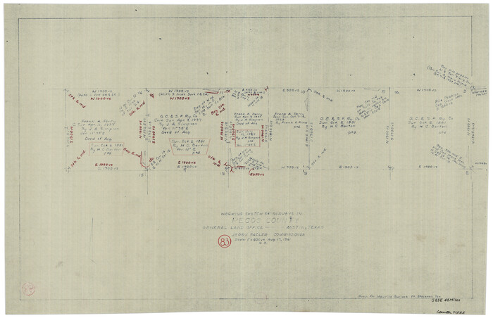
Print $20.00
- Digital $50.00
Pecos County Working Sketch 83
1961
Size 18.7 x 28.7 inches
Map/Doc 71555
Harris County Working Sketch 106

Print $40.00
- Digital $50.00
Harris County Working Sketch 106
1981
Size 48.0 x 25.0 inches
Map/Doc 65998
You may also like
San Jacinto County Sketch File 12

Print $4.00
San Jacinto County Sketch File 12
1873
Size 9.7 x 8.2 inches
Map/Doc 35720
Irion County Rolled Sketch 10

Print $20.00
- Digital $50.00
Irion County Rolled Sketch 10
1942
Size 29.8 x 29.1 inches
Map/Doc 6322
[Sketch for Mineral Application 36425 - Jefferson County, Ley C. Moore]
![65616, [Sketch for Mineral Application 36425 - Jefferson County, Ley C. Moore], General Map Collection](https://historictexasmaps.com/wmedia_w700/maps/65616.tif.jpg)
Print $40.00
- Digital $50.00
[Sketch for Mineral Application 36425 - Jefferson County, Ley C. Moore]
1942
Size 49.2 x 35.0 inches
Map/Doc 65616
Hidalgo County Rolled Sketch 14

Print $40.00
- Digital $50.00
Hidalgo County Rolled Sketch 14
1963
Size 68.5 x 40.7 inches
Map/Doc 9169
La Louisiane, Suivant les Nouvelles Observations de Messrs de l'Academie Royale des Sciences

Print $20.00
La Louisiane, Suivant les Nouvelles Observations de Messrs de l'Academie Royale des Sciences
1735
Size 9.1 x 11.9 inches
Map/Doc 95279
General Highway Map, Hale County, Texas

Print $20.00
- Digital $50.00
General Highway Map, Hale County, Texas
1949
Size 18.8 x 25.9 inches
Map/Doc 92661
Sketch Terrell and Val Verde Counties

Print $20.00
- Digital $50.00
Sketch Terrell and Val Verde Counties
1932
Size 41.2 x 18.2 inches
Map/Doc 92800
Uvalde County Sketch File 20a

Print $20.00
- Digital $50.00
Uvalde County Sketch File 20a
1911
Size 22.7 x 23.8 inches
Map/Doc 12532
Orange County Aerial Photograph Index Sheet 1

Print $20.00
- Digital $50.00
Orange County Aerial Photograph Index Sheet 1
1957
Size 24.1 x 20.4 inches
Map/Doc 83740
Intracoastal Waterway in Texas - Corpus Christi to Point Isabel including Arroyo Colorado to Mo. Pac. R.R. Bridge Near Harlingen

Print $20.00
- Digital $50.00
Intracoastal Waterway in Texas - Corpus Christi to Point Isabel including Arroyo Colorado to Mo. Pac. R.R. Bridge Near Harlingen
1933
Size 27.8 x 40.9 inches
Map/Doc 61861
Val Verde County Rolled Sketch 33

Print $20.00
- Digital $50.00
Val Verde County Rolled Sketch 33
1891
Size 27.8 x 28.2 inches
Map/Doc 8112
Central & Montgomery

Print $40.00
- Digital $50.00
Central & Montgomery
1941
Size 25.6 x 122.2 inches
Map/Doc 64522