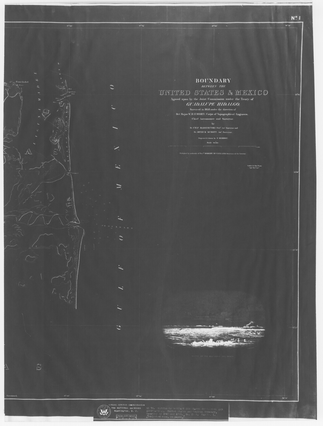
Boundary Between the United States & Mexico Agreed Upon by the Joint Commission under the Treaty of Guadalupe Hidalgo
K-7-67e; K.7.67f
-
Map/Doc
65397
-
Collection
General Map Collection
-
Object Dates
1853 (Creation Date)
-
People and Organizations
F. Herbst (Draftsman)
Arthur Schott (Surveyor/Engineer)
Chas. Radziminski (Surveyor/Engineer)
W.H. Emory (Surveyor/Engineer)
-
Counties
Cameron
-
Subjects
Texas Boundaries
-
Height x Width
24.2 x 18.4 inches
61.5 x 46.7 cm
-
Comments
A composite map of the mouth of the Rio Grande.
From the National Archives, Washington D. C.
Part of: General Map Collection
Hockley County Rolled Sketch 9

Print $20.00
- Digital $50.00
Hockley County Rolled Sketch 9
1947
Size 21.2 x 16.5 inches
Map/Doc 6218
Anderson County Sketch File 25

Print $40.00
- Digital $50.00
Anderson County Sketch File 25
1969
Size 40.9 x 21.9 inches
Map/Doc 10316
Flight Mission No. DIX-3P, Frame 168, Aransas County

Print $20.00
- Digital $50.00
Flight Mission No. DIX-3P, Frame 168, Aransas County
1956
Size 17.7 x 18.3 inches
Map/Doc 83774
Navarro County Working Sketch 16

Print $20.00
- Digital $50.00
Navarro County Working Sketch 16
1993
Size 15.8 x 17.7 inches
Map/Doc 71246
Flight Mission No. BRE-1P, Frame 99, Nueces County

Print $20.00
- Digital $50.00
Flight Mission No. BRE-1P, Frame 99, Nueces County
1956
Size 18.4 x 22.2 inches
Map/Doc 86670
Starr County Sketch File 28

Print $12.00
- Digital $50.00
Starr County Sketch File 28
1933
Size 11.2 x 8.8 inches
Map/Doc 36948
Eastland County Working Sketch 60

Print $20.00
- Digital $50.00
Eastland County Working Sketch 60
1989
Size 25.5 x 19.5 inches
Map/Doc 68841
Gallup's Map of Texas

Print $20.00
- Digital $50.00
Gallup's Map of Texas
1920
Size 22.4 x 31.9 inches
Map/Doc 95696
Brazoria County NRC Article 33.136 Location Key Sheet

Print $20.00
- Digital $50.00
Brazoria County NRC Article 33.136 Location Key Sheet
1965
Size 27.0 x 22.0 inches
Map/Doc 77007
Controlled Mosaic by Jack Amman Photogrammetric Engineers, Inc - Sheet 28

Print $20.00
- Digital $50.00
Controlled Mosaic by Jack Amman Photogrammetric Engineers, Inc - Sheet 28
1954
Size 20.0 x 24.0 inches
Map/Doc 83479
Lee County Working Sketch 14

Print $20.00
- Digital $50.00
Lee County Working Sketch 14
1981
Size 17.9 x 11.4 inches
Map/Doc 70393
Jasper County Working Sketch 28

Print $20.00
- Digital $50.00
Jasper County Working Sketch 28
1955
Size 22.6 x 15.6 inches
Map/Doc 66490
You may also like
Harris County Working Sketch 44

Print $20.00
- Digital $50.00
Harris County Working Sketch 44
1941
Size 24.9 x 38.3 inches
Map/Doc 65936
Presidio County Working Sketch 16

Print $20.00
- Digital $50.00
Presidio County Working Sketch 16
1942
Size 22.0 x 41.4 inches
Map/Doc 71692
Smith County Rolled Sketch 1

Print $20.00
- Digital $50.00
Smith County Rolled Sketch 1
Size 42.4 x 34.8 inches
Map/Doc 9932
Brooks County Sketch File 3b

Print $12.00
- Digital $50.00
Brooks County Sketch File 3b
1939
Size 14.3 x 9.1 inches
Map/Doc 16544
Eastland County Boundary File 1

Print $10.00
- Digital $50.00
Eastland County Boundary File 1
Size 11.1 x 8.5 inches
Map/Doc 52780
Brazos River, Brazos River Sheet 2

Print $20.00
- Digital $50.00
Brazos River, Brazos River Sheet 2
1926
Size 25.2 x 31.0 inches
Map/Doc 78265
Harris County Boundary File 39 (22)

Print $40.00
- Digital $50.00
Harris County Boundary File 39 (22)
Size 12.6 x 16.1 inches
Map/Doc 54368
Coast Chart No. 212 - From Latitude 26° 33' to the Rio Grande Texas

Print $20.00
- Digital $50.00
Coast Chart No. 212 - From Latitude 26° 33' to the Rio Grande Texas
1886
Size 18.3 x 24.1 inches
Map/Doc 72835
The Judicial District/County of Burleson. Abolished, Spring 1842

Print $20.00
The Judicial District/County of Burleson. Abolished, Spring 1842
2020
Size 14.1 x 21.7 inches
Map/Doc 96321
[Surveys near Crabapple Creek in the Bexar District]
![87, [Surveys near Crabapple Creek in the Bexar District], General Map Collection](https://historictexasmaps.com/wmedia_w700/maps/87.tif.jpg)
Print $2.00
- Digital $50.00
[Surveys near Crabapple Creek in the Bexar District]
1846
Size 9.1 x 7.0 inches
Map/Doc 87
Castro County Sketch File 4d

Print $4.00
- Digital $50.00
Castro County Sketch File 4d
Size 13.6 x 8.8 inches
Map/Doc 17471
Bexar County Working Sketch 21

Print $20.00
- Digital $50.00
Bexar County Working Sketch 21
1984
Size 21.3 x 28.8 inches
Map/Doc 67337