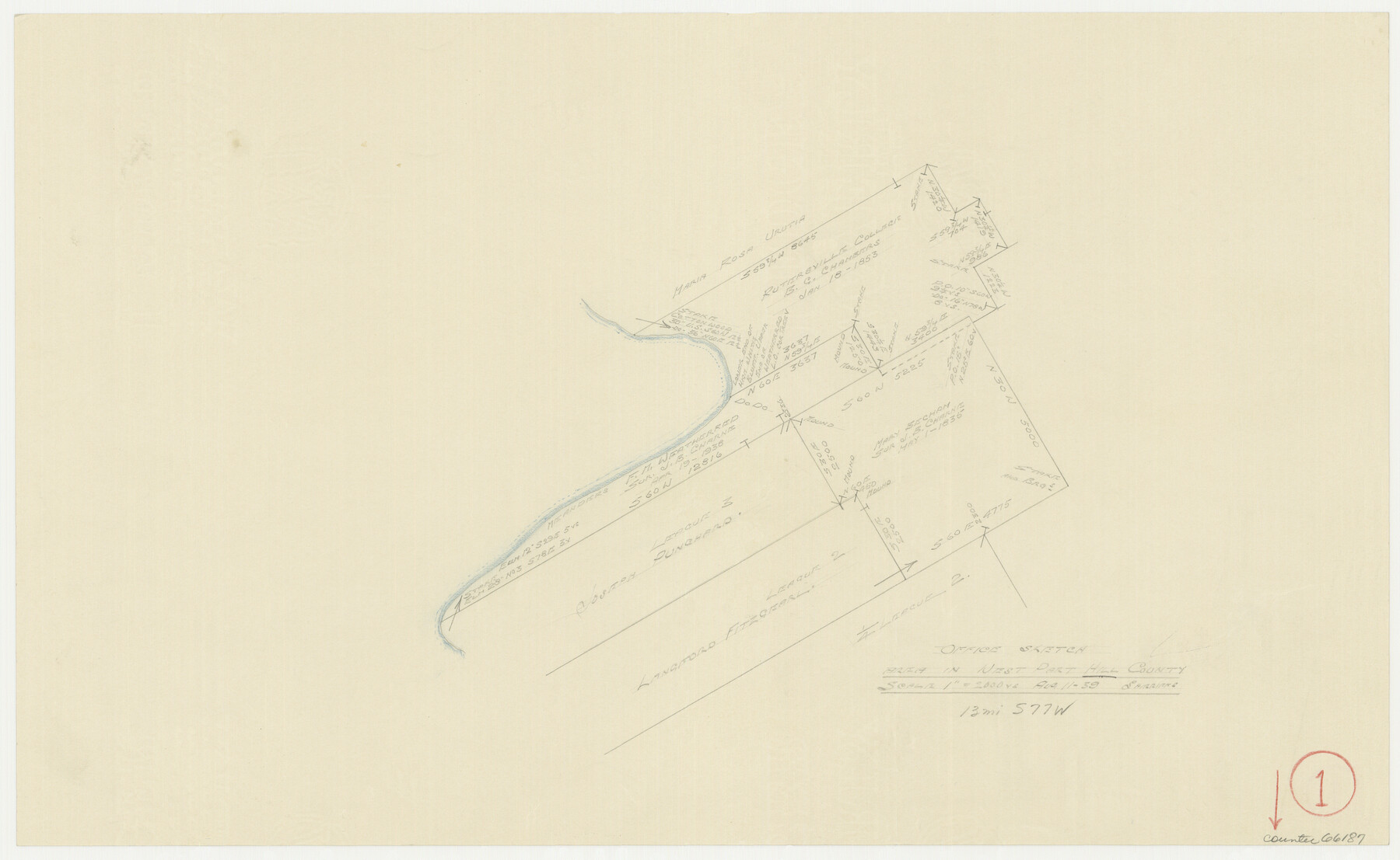
Hill County Working Sketch 1
-
Map/Doc
66187
-
Collection
General Map Collection
-
Object Dates
8/11/1939 (Creation Date)
-
People and Organizations
William Shirriffs (Draftsman)
-
Counties
Hill
-
Subjects
Surveying Working Sketch
-
Height x Width
11.0 x 17.8 inches
27.9 x 45.2 cm
-
Scale
1" = 2000 varas
Part of: General Map Collection
Brazoria County Rolled Sketch 49

Print $20.00
- Digital $50.00
Brazoria County Rolled Sketch 49
1948
Size 23.8 x 36.1 inches
Map/Doc 5182

Jeff Davis County Rolled Sketch 38

Print $20.00
- Digital $50.00
Jeff Davis County Rolled Sketch 38
1994
Size 26.1 x 35.1 inches
Map/Doc 6381
Aransas County Rolled Sketch 1

Print $40.00
- Digital $50.00
Aransas County Rolled Sketch 1
1930
Size 11.5 x 49.5 inches
Map/Doc 10685
Current Miscellaneous File 4

Print $8.00
- Digital $50.00
Current Miscellaneous File 4
1947
Size 11.5 x 9.1 inches
Map/Doc 73723
Garza County Sketch File 31

Print $10.00
- Digital $50.00
Garza County Sketch File 31
1914
Size 13.4 x 8.9 inches
Map/Doc 24104
Mexico and Guatemala

Print $20.00
- Digital $50.00
Mexico and Guatemala
1850
Size 14.6 x 17.9 inches
Map/Doc 93652
Panola County Sketch File 21

Print $10.00
- Digital $50.00
Panola County Sketch File 21
Size 11.2 x 8.7 inches
Map/Doc 33487
Intracoastal Waterway in Texas - Corpus Christi to Point Isabel including Arroyo Colorado to Mo. Pac. R.R. Bridge Near Harlingen

Print $20.00
- Digital $50.00
Intracoastal Waterway in Texas - Corpus Christi to Point Isabel including Arroyo Colorado to Mo. Pac. R.R. Bridge Near Harlingen
1934
Size 21.8 x 32.7 inches
Map/Doc 61885
Kimble County Sketch File 27

Print $6.00
- Digital $50.00
Kimble County Sketch File 27
1913
Size 11.4 x 9.7 inches
Map/Doc 28971
Red River County Working Sketch 70

Print $20.00
- Digital $50.00
Red River County Working Sketch 70
1977
Size 22.6 x 24.0 inches
Map/Doc 72053
Tom Green County Sketch File 3

Print $20.00
- Digital $50.00
Tom Green County Sketch File 3
Size 29.7 x 40.5 inches
Map/Doc 10400
You may also like
Old Miscellaneous File 19

Print $32.00
- Digital $50.00
Old Miscellaneous File 19
Size 14.2 x 8.8 inches
Map/Doc 75499
Flight Mission No. DQO-6K, Frame 32, Galveston County

Print $20.00
- Digital $50.00
Flight Mission No. DQO-6K, Frame 32, Galveston County
1952
Size 18.7 x 22.4 inches
Map/Doc 85098
North Part Brewster Co.

Print $40.00
- Digital $50.00
North Part Brewster Co.
1914
Size 40.6 x 49.2 inches
Map/Doc 66729
Navigation Maps of Gulf Intracoastal Waterway, Port Arthur to Brownsville, Texas

Print $4.00
- Digital $50.00
Navigation Maps of Gulf Intracoastal Waterway, Port Arthur to Brownsville, Texas
1951
Size 16.7 x 21.5 inches
Map/Doc 65442
Coryell County Rolled Sketch 2

Print $20.00
- Digital $50.00
Coryell County Rolled Sketch 2
1951
Size 15.7 x 19.1 inches
Map/Doc 5566
Flight Mission No. BRE-1P, Frame 54, Nueces County

Print $20.00
- Digital $50.00
Flight Mission No. BRE-1P, Frame 54, Nueces County
1956
Size 18.4 x 22.2 inches
Map/Doc 86643
Dickens County Working Sketch Graphic Index

Print $20.00
- Digital $50.00
Dickens County Working Sketch Graphic Index
1963
Size 42.5 x 33.6 inches
Map/Doc 76523
W. W. Watts' Ranch in Crosby County, Texas

Print $20.00
- Digital $50.00
W. W. Watts' Ranch in Crosby County, Texas
1904
Size 17.7 x 28.9 inches
Map/Doc 90485
Matagorda County Sketch File 33

Print $6.00
- Digital $50.00
Matagorda County Sketch File 33
1938
Size 14.2 x 8.8 inches
Map/Doc 30817
Ownership Map Midland Co., Texas

Ownership Map Midland Co., Texas
1951
Size 43.2 x 45.3 inches
Map/Doc 89914
Wilbarger County Working Sketch 21

Print $20.00
- Digital $50.00
Wilbarger County Working Sketch 21
1979
Size 37.4 x 37.8 inches
Map/Doc 72559
Concho County

Print $20.00
- Digital $50.00
Concho County
1947
Size 46.8 x 36.9 inches
Map/Doc 73115