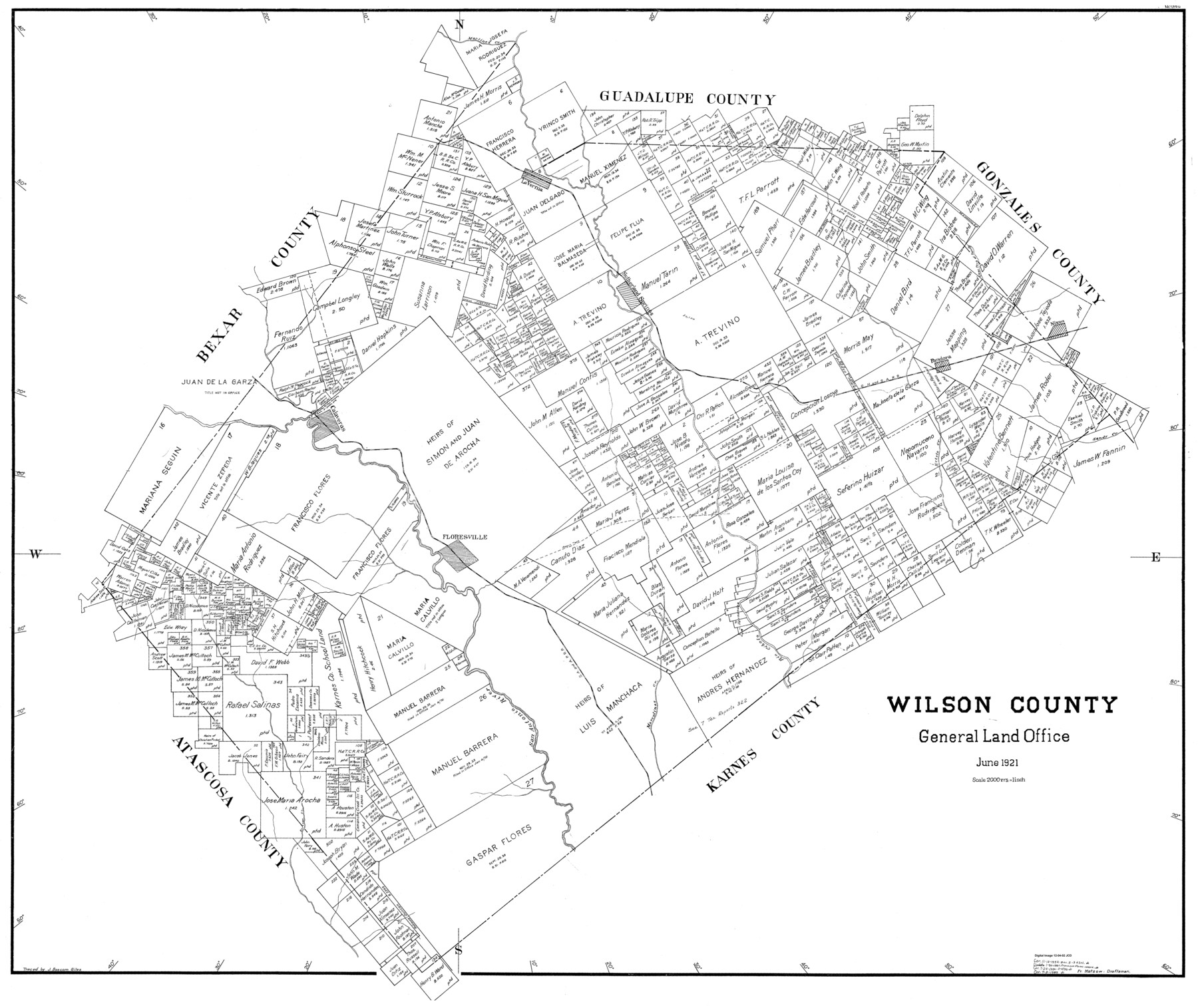
Wilson County
-
Map/Doc
77461
-
Collection
General Map Collection
-
Object Dates
1921 (Creation Date)
-
People and Organizations
Fr. Matzow (Draftsman)
-
Counties
Wilson
-
Subjects
County
-
Height x Width
38.9 x 46.2 inches
98.8 x 117.3 cm
Part of: General Map Collection

Val Verde County Working Sketch 55

Print $20.00
- Digital $50.00
Val Verde County Working Sketch 55
1957
Size 20.1 x 28.6 inches
Map/Doc 72190
Brewster County Sketch File 53

Print $94.00
- Digital $50.00
Brewster County Sketch File 53
1910
Size 13.3 x 8.9 inches
Map/Doc 16361
San Patricio County Sketch File 23

Print $20.00
San Patricio County Sketch File 23
1910
Size 22.9 x 12.9 inches
Map/Doc 12286
Runnels County Working Sketch 29

Print $20.00
- Digital $50.00
Runnels County Working Sketch 29
1959
Size 27.1 x 30.0 inches
Map/Doc 63625
Bailey County Working Sketch 1

Print $20.00
- Digital $50.00
Bailey County Working Sketch 1
1920
Size 28.9 x 10.5 inches
Map/Doc 67588
Starr County Rolled Sketch 23

Print $20.00
- Digital $50.00
Starr County Rolled Sketch 23
1938
Size 36.8 x 24.9 inches
Map/Doc 7807
Howard County Working Sketch 11

Print $20.00
- Digital $50.00
Howard County Working Sketch 11
1962
Size 20.5 x 20.3 inches
Map/Doc 66279
Atascosa County Working Sketch 17

Print $20.00
- Digital $50.00
Atascosa County Working Sketch 17
1945
Size 25.6 x 29.9 inches
Map/Doc 67213
Oldham County Sketch File 7

Print $86.00
- Digital $50.00
Oldham County Sketch File 7
1885
Size 9.4 x 9.1 inches
Map/Doc 33236
Jack County Sketch File 9a

Print $6.00
- Digital $50.00
Jack County Sketch File 9a
1857
Size 12.5 x 7.8 inches
Map/Doc 27522
Flight Mission No. CGI-1N, Frame 166, Cameron County

Print $20.00
- Digital $50.00
Flight Mission No. CGI-1N, Frame 166, Cameron County
1955
Size 18.5 x 22.2 inches
Map/Doc 84501
You may also like
Floyd County Sketch File A1

Print $4.00
- Digital $50.00
Floyd County Sketch File A1
Size 9.2 x 7.9 inches
Map/Doc 22686
Jasper County Working Sketch 24

Print $40.00
- Digital $50.00
Jasper County Working Sketch 24
1948
Size 44.2 x 54.9 inches
Map/Doc 69651
Erath County Working Sketch 13

Print $20.00
- Digital $50.00
Erath County Working Sketch 13
1952
Size 31.4 x 27.1 inches
Map/Doc 69094
Travis County Appraisal District Plat Map 3_0721

Print $20.00
- Digital $50.00
Travis County Appraisal District Plat Map 3_0721
Size 21.5 x 26.3 inches
Map/Doc 94227
Kimble County Working Sketch 24

Print $20.00
- Digital $50.00
Kimble County Working Sketch 24
1930
Size 23.3 x 17.4 inches
Map/Doc 70092
Pecos County Rolled Sketch 163

Print $20.00
- Digital $50.00
Pecos County Rolled Sketch 163
Size 28.2 x 23.9 inches
Map/Doc 7286
Refugio County
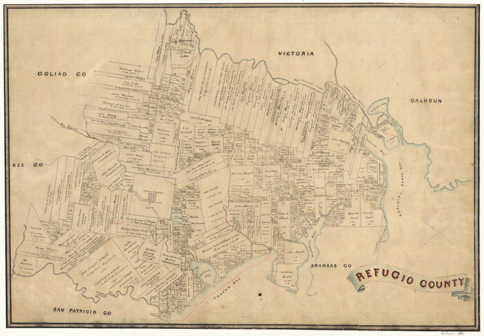
Print $20.00
- Digital $50.00
Refugio County
1883
Size 20.1 x 28.9 inches
Map/Doc 3984
Dimmit County Working Sketch 4

Print $20.00
- Digital $50.00
Dimmit County Working Sketch 4
1911
Size 24.9 x 12.3 inches
Map/Doc 68665
Chambers County Working Sketch 9

Print $20.00
- Digital $50.00
Chambers County Working Sketch 9
1946
Size 43.9 x 29.8 inches
Map/Doc 67992
Jeff Davis County Working Sketch 1

Print $20.00
- Digital $50.00
Jeff Davis County Working Sketch 1
Size 26.6 x 19.6 inches
Map/Doc 66496
La Salle County Sketch File 7

Print $22.00
- Digital $50.00
La Salle County Sketch File 7
Size 8.0 x 12.3 inches
Map/Doc 29456
Flight Mission No. DQN-3K, Frame 73, Calhoun County

Print $20.00
- Digital $50.00
Flight Mission No. DQN-3K, Frame 73, Calhoun County
1953
Size 18.6 x 22.4 inches
Map/Doc 84364