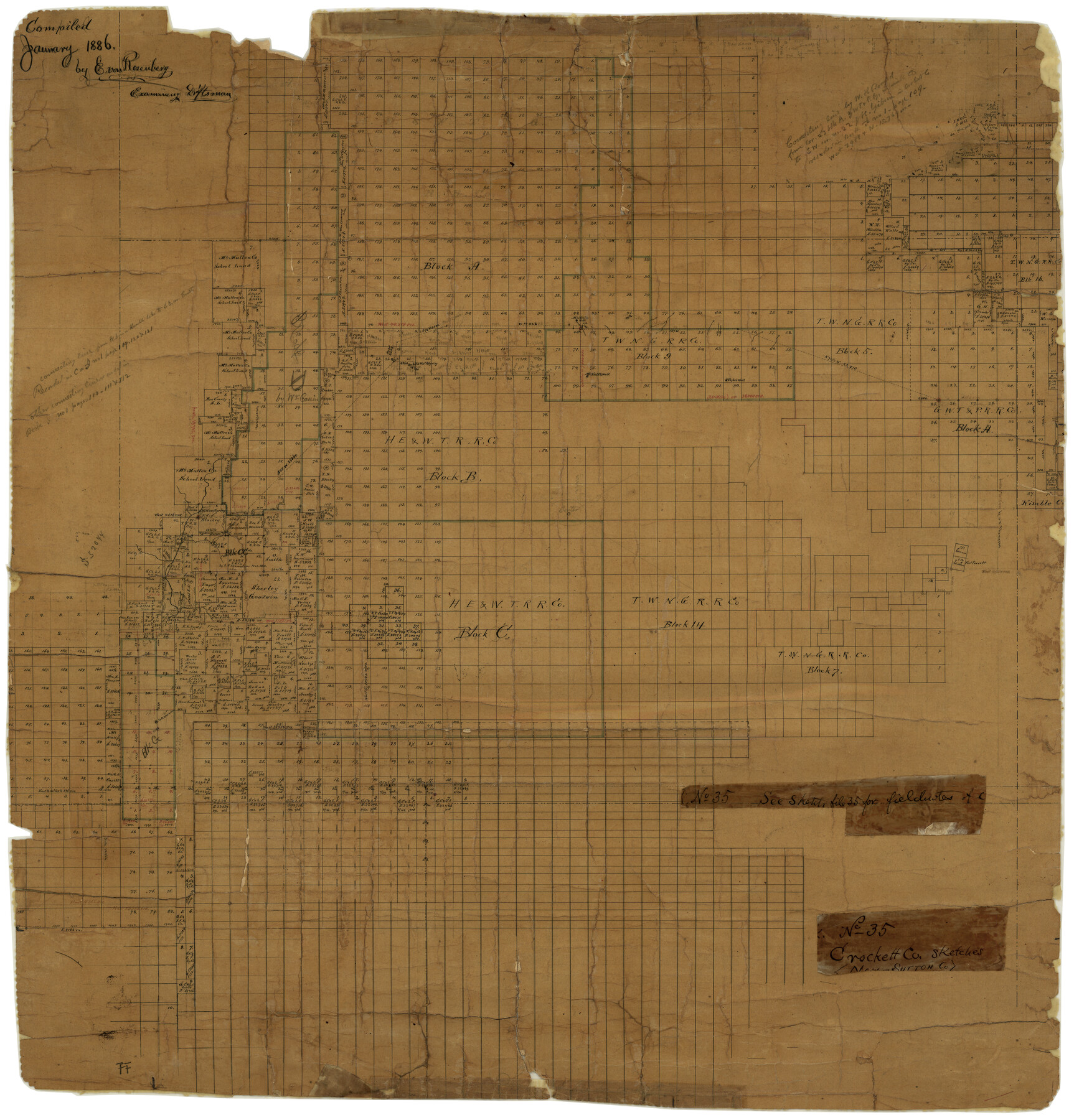
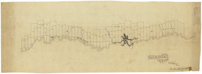
Sutton County Rolled Sketch 35
[Sketch of Sutton County]
-
Map/Doc
7879
-
Collection
General Map Collection
-
Object Dates
1/1886 (Creation Date)
-
People and Organizations
E. von Rosenberg (Draftsman)
-
Counties
Sutton
-
Subjects
Surveying Rolled Sketch
-
Height x Width
30.3 x 28.4 inches
77.0 x 72.1 cm
-
Medium
paper, manuscript
Part of: General Map Collection
Erath County Working Sketch 40

Print $20.00
- Digital $50.00
Erath County Working Sketch 40
1977
Size 26.2 x 14.9 inches
Map/Doc 69121
Flight Mission No. DIX-6P, Frame 196, Aransas County

Print $20.00
- Digital $50.00
Flight Mission No. DIX-6P, Frame 196, Aransas County
1956
Size 18.9 x 22.6 inches
Map/Doc 83858
Hudspeth County Rolled Sketch 13
Print $40.00
- Digital $50.00
Hudspeth County Rolled Sketch 13
1885
Size 22.6 x 62.1 inches
Map/Doc 9201
Haskell County Sketch File 23

Print $40.00
- Digital $50.00
Haskell County Sketch File 23
1939
Size 23.2 x 13.5 inches
Map/Doc 11745
[Sketch for Mineral Application 1487 -Big Wichita River, Ernest R. Smith]
![65685, [Sketch for Mineral Application 1487 -Big Wichita River, Ernest R. Smith], General Map Collection](https://historictexasmaps.com/wmedia_w700/maps/65685.tif.jpg)
Print $40.00
- Digital $50.00
[Sketch for Mineral Application 1487 -Big Wichita River, Ernest R. Smith]
1918
Size 129.3 x 31.5 inches
Map/Doc 65685
Freestone County Working Sketch 18

Print $20.00
- Digital $50.00
Freestone County Working Sketch 18
1980
Size 43.3 x 46.9 inches
Map/Doc 69260
Map of the State of Coahuila and Texas

Map of the State of Coahuila and Texas
1834
Size 13.3 x 14.9 inches
Map/Doc 96969

Runnels County Sketch File 10

Print $46.00
Runnels County Sketch File 10
1882
Size 7.3 x 8.2 inches
Map/Doc 35445
Bee County Sketch File 13

Print $4.00
- Digital $50.00
Bee County Sketch File 13
1876
Size 12.6 x 8.1 inches
Map/Doc 14295
Die Eisenbahm von dem Missisippi nach dem stillen Ocean (Californien)

Print $20.00
- Digital $50.00
Die Eisenbahm von dem Missisippi nach dem stillen Ocean (Californien)
1856
Size 14.0 x 14.8 inches
Map/Doc 94075
Burleson County Working Sketch 26

Print $20.00
- Digital $50.00
Burleson County Working Sketch 26
1981
Size 10.1 x 30.5 inches
Map/Doc 67745
You may also like
Dimmit County Rolled Sketch 21

Print $20.00
- Digital $50.00
Dimmit County Rolled Sketch 21
2013
Size 25.5 x 22.5 inches
Map/Doc 93488
Cooke County Sketch File 22

Print $6.00
- Digital $50.00
Cooke County Sketch File 22
1870
Size 6.4 x 8.2 inches
Map/Doc 19267
Americae Nova Descriptio

Print $20.00
- Digital $50.00
Americae Nova Descriptio
1663
Size 14.5 x 18.0 inches
Map/Doc 95708
Topographical Map of the Rio Grande, Sheet No. 12

Print $20.00
- Digital $50.00
Topographical Map of the Rio Grande, Sheet No. 12
1912
Map/Doc 89536
El Paso County Rolled Sketch 57B

Print $40.00
- Digital $50.00
El Paso County Rolled Sketch 57B
1984
Size 49.0 x 37.1 inches
Map/Doc 8880
Maverick County Working Sketch 9

Print $20.00
- Digital $50.00
Maverick County Working Sketch 9
1959
Size 43.8 x 42.2 inches
Map/Doc 70901

Dimmit County Boundary File 7

Print $14.00
- Digital $50.00
Dimmit County Boundary File 7
Size 12.8 x 8.4 inches
Map/Doc 52590
Red River County Working Sketch 42

Print $20.00
- Digital $50.00
Red River County Working Sketch 42
1968
Size 28.7 x 36.8 inches
Map/Doc 72025
Lubbock County Boundary File 6

Print $58.00
- Digital $50.00
Lubbock County Boundary File 6
Size 4.7 x 7.0 inches
Map/Doc 56494
Williamson County Working Sketch 19

Print $20.00
- Digital $50.00
Williamson County Working Sketch 19
1991
Size 31.2 x 40.0 inches
Map/Doc 72579
El Paso County Sketch File 35 (1)

Print $8.00
- Digital $50.00
El Paso County Sketch File 35 (1)
Size 13.0 x 8.3 inches
Map/Doc 22166