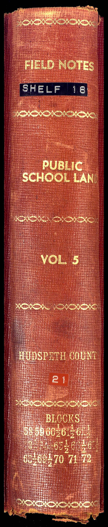
PSL Field Notes for Blocks 58, 59, 60 1/2, 61 1/2, 62 1/2, 63 1/2, 64 1/2, 65 1/2, 66 1/2, 67 1/2, 68 1/2, 69 1/2, 70, 71, and 72 in Hudspeth County
-
Map/Doc
81662
-
Collection
General Map Collection
-
People and Organizations
A.S. Albro (Surveyor/Engineer)
Charles Rogan (GLO Commissioner)
A.H. Parker (Surveyor/Engineer)
-
Counties
Hudspeth
-
Subjects
Bound Volume Public School Land
-
Medium
paper, bound volume
-
Comments
See the following surveying items related to this PSL field note volume: Hudspeth County Rolled Sketch 23; Hudspeth County Sketch Files 1, 2, 7, 9, 10, 12, and 36.
See 97176 for an index to the Public School Land field note volumes.
Related maps
Hudspeth County Sketch File 1
![26880, Hudspeth County Sketch File 1, General Map Collection](https://historictexasmaps.com/wmedia_w700/pdf_converted_jpg/qi_pdf_thumbnail_12023.jpg)
Print $8.00
- Digital $50.00
Hudspeth County Sketch File 1
1900
Size 11.3 x 8.8 inches
Map/Doc 26880
Hudspeth County Sketch File 2
![26884, Hudspeth County Sketch File 2, General Map Collection](https://historictexasmaps.com/wmedia_w700/pdf_converted_jpg/qi_pdf_thumbnail_12024.jpg)
Print $10.00
- Digital $50.00
Hudspeth County Sketch File 2
1900
Size 13.4 x 8.6 inches
Map/Doc 26884
Hudspeth County Sketch File 7
![26892, Hudspeth County Sketch File 7, General Map Collection](https://historictexasmaps.com/wmedia_w700/pdf_converted_jpg/qi_pdf_thumbnail_12027.jpg)
Print $6.00
- Digital $50.00
Hudspeth County Sketch File 7
1900
Size 14.2 x 8.7 inches
Map/Doc 26892
Hudspeth County Sketch File 9
![26895, Hudspeth County Sketch File 9, General Map Collection](https://historictexasmaps.com/wmedia_w700/pdf_converted_jpg/qi_pdf_thumbnail_12028.jpg)
Print $8.00
- Digital $50.00
Hudspeth County Sketch File 9
1900
Size 11.3 x 8.8 inches
Map/Doc 26895
Hudspeth County Sketch File 10
![26899, Hudspeth County Sketch File 10, General Map Collection](https://historictexasmaps.com/wmedia_w700/pdf_converted_jpg/qi_pdf_thumbnail_12029.jpg)
Print $4.00
- Digital $50.00
Hudspeth County Sketch File 10
1900
Size 11.2 x 8.8 inches
Map/Doc 26899
Hudspeth County Sketch File 12
![26924, Hudspeth County Sketch File 12, General Map Collection](https://historictexasmaps.com/wmedia_w700/pdf_converted_jpg/qi_pdf_thumbnail_12035.jpg)
Print $10.00
- Digital $50.00
Hudspeth County Sketch File 12
1901
Size 14.2 x 8.7 inches
Map/Doc 26924
Hudspeth County Sketch File 36
![27003, Hudspeth County Sketch File 36, General Map Collection](https://historictexasmaps.com/wmedia_w700/pdf_converted_jpg/qi_pdf_thumbnail_12053.jpg)
Print $12.00
- Digital $50.00
Hudspeth County Sketch File 36
1901
Size 10.5 x 8.2 inches
Map/Doc 27003
Hudspeth County Rolled Sketch 23
![9207, Hudspeth County Rolled Sketch 23, General Map Collection](https://historictexasmaps.com/wmedia_w700/maps/9207.tif.jpg)
Print $40.00
- Digital $50.00
Hudspeth County Rolled Sketch 23
Size 43.7 x 70.3 inches
Map/Doc 9207
Public School Land Field Note Volume Index
![](https://historictexasmaps.com/wmedia_w700/pdf_converted_jpg/qi_pdf_thumbnail_68269.jpg)
Public School Land Field Note Volume Index
2023
Size 8.5 x 11.0 inches
Map/Doc 97176
Part of: General Map Collection
Flight Mission No. DQN-7K, Frame 6, Calhoun County
![84457, Flight Mission No. DQN-7K, Frame 6, Calhoun County, General Map Collection](https://historictexasmaps.com/wmedia_w700/pdf_converted_jpg/qi_pdf_thumbnail_31674.jpg)
Print $20.00
- Digital $50.00
Flight Mission No. DQN-7K, Frame 6, Calhoun County
1953
Size 18.8 x 22.4 inches
Map/Doc 84457
Montague County Boundary File 2
![57406, Montague County Boundary File 2, General Map Collection](https://historictexasmaps.com/wmedia_w700/pdf_converted_jpg/qi_pdf_thumbnail_16591.jpg)
Print $8.00
- Digital $50.00
Montague County Boundary File 2
Size 8.9 x 6.9 inches
Map/Doc 57406
Mills County Rolled Sketch 2
![6780, Mills County Rolled Sketch 2, General Map Collection](https://historictexasmaps.com/wmedia_w700/maps/6780.tif.jpg)
Print $20.00
- Digital $50.00
Mills County Rolled Sketch 2
1974
Size 24.1 x 22.8 inches
Map/Doc 6780
Outer Continental Shelf Leasing Maps (Louisiana Offshore Operations)
![76101, Outer Continental Shelf Leasing Maps (Louisiana Offshore Operations), General Map Collection](https://historictexasmaps.com/wmedia_w700/maps/76101.tif.jpg)
Print $20.00
- Digital $50.00
Outer Continental Shelf Leasing Maps (Louisiana Offshore Operations)
1959
Size 17.9 x 13.8 inches
Map/Doc 76101
Kimble County Working Sketch 62
![70130, Kimble County Working Sketch 62, General Map Collection](https://historictexasmaps.com/wmedia_w700/maps/70130.tif.jpg)
Print $20.00
- Digital $50.00
Kimble County Working Sketch 62
Size 38.0 x 29.7 inches
Map/Doc 70130
Baylor County Boundary File 12
![50423, Baylor County Boundary File 12, General Map Collection](https://historictexasmaps.com/wmedia_w700/pdf_converted_jpg/qi_pdf_thumbnail_15639.jpg)
Print $2.00
- Digital $50.00
Baylor County Boundary File 12
Size 11.1 x 8.6 inches
Map/Doc 50423
Flight Mission No. DJV-3P, Frame 15, Ellis County
![84977, Flight Mission No. DJV-3P, Frame 15, Ellis County, General Map Collection](https://historictexasmaps.com/wmedia_w700/pdf_converted_jpg/qi_pdf_thumbnail_32189.jpg)
Print $20.00
- Digital $50.00
Flight Mission No. DJV-3P, Frame 15, Ellis County
1956
Size 18.8 x 22.4 inches
Map/Doc 84977
International and Great Northern Railroad Lone Star Route and Connections
![93462, International and Great Northern Railroad Lone Star Route and Connections, General Map Collection](https://historictexasmaps.com/wmedia_w700/maps/93462.tif.jpg)
Print $20.00
- Digital $50.00
International and Great Northern Railroad Lone Star Route and Connections
1877
Size 17.3 x 23.2 inches
Map/Doc 93462
Crockett County Rolled Sketch E
![5636, Crockett County Rolled Sketch E, General Map Collection](https://historictexasmaps.com/wmedia_w700/maps/5636.tif.jpg)
Print $20.00
- Digital $50.00
Crockett County Rolled Sketch E
1907
Size 26.2 x 27.7 inches
Map/Doc 5636
Township 9 South Range 13 West, South Western District, Louisiana
![65852, Township 9 South Range 13 West, South Western District, Louisiana, General Map Collection](https://historictexasmaps.com/wmedia_w700/maps/65852.tif.jpg)
Print $20.00
- Digital $50.00
Township 9 South Range 13 West, South Western District, Louisiana
1858
Size 19.8 x 24.8 inches
Map/Doc 65852
Pecos County Sketch File 28a
![12169, Pecos County Sketch File 28a, General Map Collection](https://historictexasmaps.com/wmedia_w700/pdf_converted_jpg/qi_pdf_thumbnail_8506.jpg)
Print $20.00
- Digital $50.00
Pecos County Sketch File 28a
Size 24.3 x 26.6 inches
Map/Doc 12169
You may also like
Navarro County Working Sketch 3
![71233, Navarro County Working Sketch 3, General Map Collection](https://historictexasmaps.com/wmedia_w700/maps/71233.tif.jpg)
Print $40.00
- Digital $50.00
Navarro County Working Sketch 3
Size 43.8 x 64.6 inches
Map/Doc 71233
Kinney County Working Sketch 29
![70211, Kinney County Working Sketch 29, General Map Collection](https://historictexasmaps.com/wmedia_w700/maps/70211-1.tif.jpg)
Print $20.00
- Digital $50.00
Kinney County Working Sketch 29
Size 37.8 x 33.8 inches
Map/Doc 70211
Newton County Aerial Photograph Index Sheet 6
![83735, Newton County Aerial Photograph Index Sheet 6, General Map Collection](https://historictexasmaps.com/wmedia_w700/pdf_converted_jpg/qi_pdf_thumbnail_30956.jpg)
Print $20.00
- Digital $50.00
Newton County Aerial Photograph Index Sheet 6
1953
Size 24.0 x 18.4 inches
Map/Doc 83735
Right of Way and Track Map, Galveston, Harrisburg & San Antonio Ry. operated by the T. & N. O. R.R. Co., Victoria Division, Rosenberg to Beeville
![76157, Right of Way and Track Map, Galveston, Harrisburg & San Antonio Ry. operated by the T. & N. O. R.R. Co., Victoria Division, Rosenberg to Beeville, General Map Collection](https://historictexasmaps.com/wmedia_w700/maps/76157.tif.jpg)
Print $40.00
- Digital $50.00
Right of Way and Track Map, Galveston, Harrisburg & San Antonio Ry. operated by the T. & N. O. R.R. Co., Victoria Division, Rosenberg to Beeville
1918
Size 25.1 x 57.9 inches
Map/Doc 76157
La Salle County Sketch File 29
![29561, La Salle County Sketch File 29, General Map Collection](https://historictexasmaps.com/wmedia_w700/pdf_converted_jpg/qi_pdf_thumbnail_12596.jpg)
Print $4.00
- Digital $50.00
La Salle County Sketch File 29
1889
Size 9.0 x 13.6 inches
Map/Doc 29561
Flight Mission No. DIX-10P, Frame 146, Aransas County
![83948, Flight Mission No. DIX-10P, Frame 146, Aransas County, General Map Collection - 1](https://historictexasmaps.com/wmedia_w700/maps/83948.tif.jpg)
Print $20.00
- Digital $50.00
Flight Mission No. DIX-10P, Frame 146, Aransas County
1956
Size 18.6 x 22.4 inches
Map/Doc 83948
Grayson County Working Sketch 4
![63243, Grayson County Working Sketch 4, General Map Collection](https://historictexasmaps.com/wmedia_w700/maps/63243.tif.jpg)
Print $20.00
- Digital $50.00
Grayson County Working Sketch 4
Size 27.6 x 41.0 inches
Map/Doc 63243
Kerr County Working Sketch 15
![70046, Kerr County Working Sketch 15, General Map Collection](https://historictexasmaps.com/wmedia_w700/maps/70046.tif.jpg)
Print $20.00
- Digital $50.00
Kerr County Working Sketch 15
Size 36.2 x 38.6 inches
Map/Doc 70046
Reeves County
![95624, Reeves County, General Map Collection](https://historictexasmaps.com/wmedia_w700/maps/95624-1.tif.jpg)
Print $40.00
- Digital $50.00
Reeves County
1945
Size 49.4 x 40.8 inches
Map/Doc 95624
The Peters Colony. January 29, 1844
![96366, The Peters Colony. January 29, 1844, Nancy and Jim Tiller Digital Collection](https://historictexasmaps.com/wmedia_w700/maps/96366.tif.jpg)
Print $20.00
- Digital $50.00
The Peters Colony. January 29, 1844
2020
Size 8.6 x 10.8 inches
Map/Doc 96366
Presidio County Sketch File 69a
![34664, Presidio County Sketch File 69a, General Map Collection](https://historictexasmaps.com/wmedia_w700/pdf_converted_jpg/qi_pdf_thumbnail_13743.jpg)
Print $6.00
- Digital $50.00
Presidio County Sketch File 69a
1923
Size 17.0 x 11.0 inches
Map/Doc 34664
United States - Gulf Coast - Padre I. and Laguna Madre Lat. 27° 12' to Lat. 26° 33' Texas
![72819, United States - Gulf Coast - Padre I. and Laguna Madre Lat. 27° 12' to Lat. 26° 33' Texas, General Map Collection](https://historictexasmaps.com/wmedia_w700/maps/72819.tif.jpg)
Print $20.00
- Digital $50.00
United States - Gulf Coast - Padre I. and Laguna Madre Lat. 27° 12' to Lat. 26° 33' Texas
1913
Size 27.0 x 18.3 inches
Map/Doc 72819