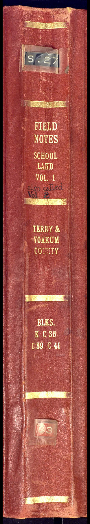
PSL Field Notes for Blocks C36 and C37 in Gaines and Terry Counties, Block C38 in Dawson, Gaines, and Terry Counties, Blocks C39 and C41 in Dawson and Terry Counties, Block K in Yoakum and Terry Counties
-
Map/Doc
81674
-
Collection
General Map Collection
-
People and Organizations
Charles Rogan (GLO Commissioner)
A.L. Harris (Surveyor/Engineer)
Sylvan Sanders (Surveyor/Engineer)
Mark E. Ragsdale (Surveyor/Engineer)
W.D. Twichell (Surveyor/Engineer)
-
Counties
Gaines Dawson Yoakum Terry
-
Subjects
Bound Volume Public School Land
-
Medium
paper, bound volume
-
Comments
See Gaines County Rolled Sketch J for sketch.
See 97176 for an index to the Public School Land field note volumes.
Related maps
Gaines County Rolled Sketch J

Print $40.00
- Digital $50.00
Gaines County Rolled Sketch J
Size 26.6 x 73.8 inches
Map/Doc 9013
Public School Land Field Note Volume Index

Public School Land Field Note Volume Index
2023
Size 8.5 x 11.0 inches
Map/Doc 97176
Part of: General Map Collection
Flight Mission No. CLL-1N, Frame 28, Willacy County

Print $20.00
- Digital $50.00
Flight Mission No. CLL-1N, Frame 28, Willacy County
1954
Size 18.5 x 22.1 inches
Map/Doc 87009
Delta County Sketch File 3

Print $6.00
- Digital $50.00
Delta County Sketch File 3
Size 10.2 x 12.6 inches
Map/Doc 20672
Maps of Gulf Intracoastal Waterway, Texas - Sabine River to the Rio Grande and connecting waterways including ship channels

Print $20.00
- Digital $50.00
Maps of Gulf Intracoastal Waterway, Texas - Sabine River to the Rio Grande and connecting waterways including ship channels
1966
Size 14.6 x 22.2 inches
Map/Doc 61958
Cottle County Sketch File A and C

Print $68.00
- Digital $50.00
Cottle County Sketch File A and C
1902
Size 12.7 x 8.0 inches
Map/Doc 19422
Houston County Sketch File 6a

Print $4.00
- Digital $50.00
Houston County Sketch File 6a
Size 10.2 x 8.1 inches
Map/Doc 26762
Cottle County Sketch File 15

Print $4.00
- Digital $50.00
Cottle County Sketch File 15
1891
Size 11.2 x 9.0 inches
Map/Doc 19516

Visitors' Map of Galveston also showing County Shell Road to Houston

Print $20.00
- Digital $50.00
Visitors' Map of Galveston also showing County Shell Road to Houston
Size 19.6 x 23.9 inches
Map/Doc 95319
Flight Mission No. DAG-22K, Frame 89, Matagorda County

Print $20.00
- Digital $50.00
Flight Mission No. DAG-22K, Frame 89, Matagorda County
1953
Size 18.5 x 22.4 inches
Map/Doc 86473
Live Oak County Rolled Sketch 1

Print $20.00
- Digital $50.00
Live Oak County Rolled Sketch 1
1943
Size 25.6 x 42.4 inches
Map/Doc 6631
Flight Mission No. DQO-1K, Frame 145, Galveston County

Print $20.00
- Digital $50.00
Flight Mission No. DQO-1K, Frame 145, Galveston County
1952
Size 18.9 x 22.6 inches
Map/Doc 84998
Flight Mission No. DQO-2K, Frame 87, Galveston County

Print $20.00
- Digital $50.00
Flight Mission No. DQO-2K, Frame 87, Galveston County
1952
Size 18.7 x 22.5 inches
Map/Doc 85014
You may also like

Baylor County, Texas

Print $20.00
- Digital $50.00
Baylor County, Texas
Size 21.7 x 18.9 inches
Map/Doc 525
Ward County Rolled Sketch 10

Print $20.00
- Digital $50.00
Ward County Rolled Sketch 10
1936
Size 24.4 x 35.7 inches
Map/Doc 8155
Map of Oceanica engraved to illustrate Mitchell's new intermediate geography

Print $20.00
- Digital $50.00
Map of Oceanica engraved to illustrate Mitchell's new intermediate geography
1885
Size 9.0 x 12.2 inches
Map/Doc 93531
Red River County Working Sketch 81-4

Print $20.00
- Digital $50.00
Red River County Working Sketch 81-4
1987
Size 21.8 x 16.7 inches
Map/Doc 72067
Flight Mission No. BRA-16M, Frame 131, Jefferson County

Print $20.00
- Digital $50.00
Flight Mission No. BRA-16M, Frame 131, Jefferson County
1953
Size 18.4 x 22.5 inches
Map/Doc 85741
San Patricio County Sketch File 48

Print $88.00
- Digital $50.00
San Patricio County Sketch File 48
Size 9.0 x 9.0 inches
Map/Doc 36285
Flight Mission No. DIX-6P, Frame 191, Aransas County

Print $20.00
- Digital $50.00
Flight Mission No. DIX-6P, Frame 191, Aransas County
1956
Size 19.0 x 22.7 inches
Map/Doc 83853
Hardin County Rolled Sketch WS

Print $20.00
- Digital $50.00
Hardin County Rolled Sketch WS
1936
Size 25.4 x 43.9 inches
Map/Doc 9104
Flight Mission No. CGI-3N, Frame 42, Cameron County

Print $20.00
- Digital $50.00
Flight Mission No. CGI-3N, Frame 42, Cameron County
1954
Size 18.5 x 22.1 inches
Map/Doc 84548
La Salle County Rolled Sketch 33

Print $20.00
- Digital $50.00
La Salle County Rolled Sketch 33
2015
Size 17.6 x 27.6 inches
Map/Doc 95306
Map of Cameron County

Print $20.00
- Digital $50.00
Map of Cameron County
1873
Size 42.2 x 22.5 inches
Map/Doc 3364