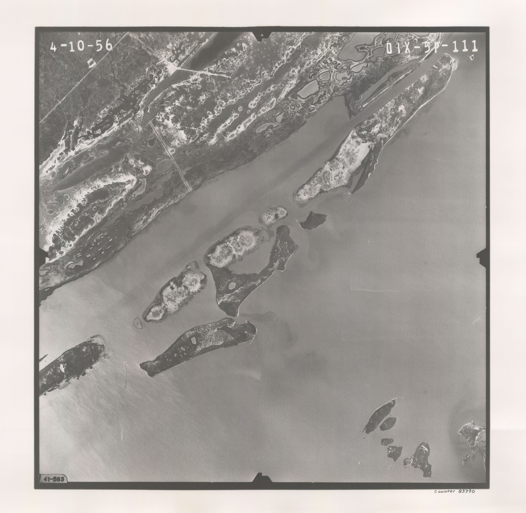
Flight Mission No. DIX-5P, Frame 111, Aransas County
DIX-5P-111
- 
                          Map/Doc83790
- 
                            CollectionGeneral Map Collection
- 
                            Object Dates1956/4/10 (Creation Date)
- 
                            People and OrganizationsU. S. Department of Agriculture (Publisher)
- 
                            CountiesAransas
- 
                            SubjectsAerial Photograph
- 
                            Height x Width17.6 x 18.0 inches44.7 x 45.7 cm
- 
                            CommentsFlown by V. L. Beavers and Associates of San Antonio, Texas.
Part of: General Map Collection
            Culberson County Rolled Sketch 29


                                            Print $20.00                    
                                             -                         Digital $50.00                                    
                Culberson County Rolled Sketch 29
Size 44.3 x 21.4 inches
                                Map/Doc 8745
            
            Map of Matagorda County


                                            Print $20.00                    
                                             -                         Digital $50.00                                    
                Map of Matagorda County
1883
Size 29.4 x 26.6 inches
                                Map/Doc 3840
            
            Map of part of Matagorda Island


                                            Print $20.00                    
                                             -                         Digital $50.00                                    
                Map of part of Matagorda Island
1859
Size 30.2 x 32.0 inches
                                Map/Doc 69982
            
            Sherman County Working Sketch Graphic Index


                                            Print $20.00                    
                                             -                         Digital $50.00                                    
                Sherman County Working Sketch Graphic Index
1932
Size 41.5 x 36.9 inches
                                Map/Doc 76698
            
            Throckmorton County


                                            Print $20.00                    
                                             -                         Digital $50.00                                    
                Throckmorton County
1885
Size 24.9 x 18.7 inches
                                Map/Doc 4080
            
            Brazos County Working Sketch 3


                                            Print $20.00                    
                                             -                         Digital $50.00                                    
                Brazos County Working Sketch 3
1976
Size 22.0 x 18.4 inches
                                Map/Doc 67478
            
            Grayson County Sketch File 3a


                                            Print $20.00                    
                                             -                         Digital $50.00                                    
                Grayson County Sketch File 3a
1855
Size 19.6 x 25.5 inches
                                Map/Doc 11580
            
            Briscoe County


                                            Print $20.00                    
                                             -                         Digital $50.00                                    
                Briscoe County
1930
Size 42.3 x 35.8 inches
                                Map/Doc 95439
            
            Sutton County Working Sketch Graphic Index, Sheet 1 (Sketches 1 to 24)


                                            Print $40.00                    
                                             -                         Digital $50.00                                    
                Sutton County Working Sketch Graphic Index, Sheet 1 (Sketches 1 to 24)
1941
Size 41.9 x 55.3 inches
                                Map/Doc 76705
            
            Harris County Sketch File 1b


                                            Print $3.00                    
                                             -                         Digital $50.00                                    
                Harris County Sketch File 1b
Size 15.3 x 10.4 inches
                                Map/Doc 25330
            
            Flight Mission No. DAH-10M, Frame 40, Orange County


                                            Print $20.00                    
                                             -                         Digital $50.00                                    
                Flight Mission No. DAH-10M, Frame 40, Orange County
1953
Size 18.8 x 22.6 inches
                                Map/Doc 86875
            You may also like
            Working Sketch Fisher County School Land [Leagues 105-108]
            
                                    ![90294, Working Sketch Fisher County School Land [Leagues 105-108], Twichell Survey Records](https://historictexasmaps.com/wmedia_w700/maps/90294-1.tif.jpg) 


    ![90294, Working Sketch Fisher County School Land [Leagues 105-108], Twichell Survey Records](https://historictexasmaps.com/wmedia_w700/maps/90294-1.tif.jpg) 
                                
            
                                            Print $20.00                    
                                             -                         Digital $50.00                                    
                Working Sketch Fisher County School Land [Leagues 105-108]
Size 12.9 x 16.7 inches
                                Map/Doc 90294
            
            Nueces County Aerial Photograph Index Sheet 23


                                            Print $20.00                    
                                             -                         Digital $50.00                                    
                Nueces County Aerial Photograph Index Sheet 23
1938
Size 24.4 x 20.3 inches
                                Map/Doc 86844
            
            Llano County Sketch File 8


                                            Print $10.00                    
                                             -                         Digital $50.00                                    
                Llano County Sketch File 8
1885
Size 14.1 x 8.8 inches
                                Map/Doc 30364
            
            The Judicial District/County of Neches. Created, January 29, 1842


                                            Print $20.00                    
                                    
                The Judicial District/County of Neches. Created, January 29, 1842
2020
Size 15.5 x 21.7 inches
                                Map/Doc 96338
            
            [Area along North line of McLennan County School Land]
            
                                    ![90928, [Area along North line of McLennan County School Land], Twichell Survey Records](https://historictexasmaps.com/wmedia_w700/maps/90928-1.tif.jpg) 


    ![90928, [Area along North line of McLennan County School Land], Twichell Survey Records](https://historictexasmaps.com/wmedia_w700/maps/90928-1.tif.jpg) 
                                
            
                                            Print $2.00                    
                                             -                         Digital $50.00                                    
                [Area along North line of McLennan County School Land]
1920
Size 5.5 x 14.9 inches
                                Map/Doc 90928
            
            Irion County Sketch File 5


                                            Print $16.00                    
                                             -                         Digital $50.00                                    
                Irion County Sketch File 5
1900
Size 14.4 x 8.9 inches
                                Map/Doc 27463
            
            Lindner Subdivision out of the Baker Subdivision of the Cucharia Tract being Lots 11 and 14, San Salvador del Tule Grant Hidalgo Co. Texas and also showing the Ehlert-Krausse Sub. and the Townsite of Alsonia


                                            Print $20.00                    
                                             -                         Digital $50.00                                    
                Lindner Subdivision out of the Baker Subdivision of the Cucharia Tract being Lots 11 and 14, San Salvador del Tule Grant Hidalgo Co. Texas and also showing the Ehlert-Krausse Sub. and the Townsite of Alsonia
1927
Size 22.3 x 35.3 inches
                                Map/Doc 77093
            
            [I. Killough and Hiram Cates surveys and vicinity]
            
                                    ![91851, [I. Killough and Hiram Cates surveys and vicinity], Twichell Survey Records](https://historictexasmaps.com/wmedia_w700/maps/91851-1.tif.jpg) 


    ![91851, [I. Killough and Hiram Cates surveys and vicinity], Twichell Survey Records](https://historictexasmaps.com/wmedia_w700/maps/91851-1.tif.jpg) 
                                
            
                                            Print $20.00                    
                                             -                         Digital $50.00                                    
                [I. Killough and Hiram Cates surveys and vicinity]
Size 27.5 x 9.2 inches
                                Map/Doc 91851
            
            Orange County Working Sketch 44


                                            Print $20.00                    
                                             -                         Digital $50.00                                    
                Orange County Working Sketch 44
1980
Size 16.5 x 22.0 inches
                                Map/Doc 71376
            
            Kendall County Sketch File 1


                                            Print $4.00                    
                                             -                         Digital $50.00                                    
                Kendall County Sketch File 1
Size 9.6 x 8.3 inches
                                Map/Doc 28671
            
            Right of Way and Track Map of The Missouri, Kansas & Texas Railway of Texas


                                            Print $40.00                    
                                             -                         Digital $50.00                                    
                Right of Way and Track Map of The Missouri, Kansas & Texas Railway of Texas
1918
Size 25.4 x 75.5 inches
                                Map/Doc 64533
             
                             
                                