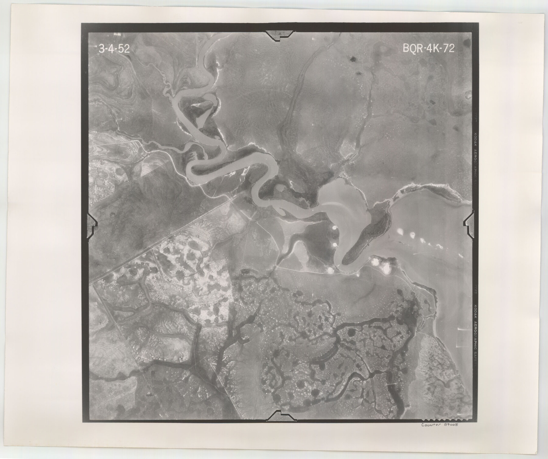
Flight Mission No. BQR-4K, Frame 72, Brazoria County
BQR-4K-72
-
Map/Doc
84005
-
Collection
General Map Collection
-
Object Dates
1952/3/4 (Creation Date)
-
People and Organizations
U. S. Department of Agriculture (Publisher)
-
Counties
Brazoria
-
Subjects
Aerial Photograph
-
Height x Width
18.8 x 22.5 inches
47.8 x 57.2 cm
-
Comments
Flown by Aero Exploration Company of Tulsa, Oklahoma.
Part of: General Map Collection
Pecos County Rolled Sketch 119

Print $20.00
- Digital $50.00
Pecos County Rolled Sketch 119
1945
Size 20.5 x 21.5 inches
Map/Doc 7261
[St. Louis & Southwestern]
![64278, [St. Louis & Southwestern], General Map Collection](https://historictexasmaps.com/wmedia_w700/maps/64278.tif.jpg)
Print $20.00
- Digital $50.00
[St. Louis & Southwestern]
Size 20.8 x 28.9 inches
Map/Doc 64278
Hansford County Boundary File 1

Print $24.00
- Digital $50.00
Hansford County Boundary File 1
Size 9.2 x 8.6 inches
Map/Doc 54232
Liberty County Sketch File 28

Print $6.00
- Digital $50.00
Liberty County Sketch File 28
Size 5.2 x 8.0 inches
Map/Doc 29952
Intracoastal Waterway in Texas - Corpus Christi to Point Isabel including Arroyo Colorado to Mo. Pac. R.R. Bridge Near Harlingen

Print $20.00
- Digital $50.00
Intracoastal Waterway in Texas - Corpus Christi to Point Isabel including Arroyo Colorado to Mo. Pac. R.R. Bridge Near Harlingen
1933
Size 28.0 x 40.8 inches
Map/Doc 61849
Kimble County Working Sketch 19

Print $20.00
- Digital $50.00
Kimble County Working Sketch 19
1926
Size 38.7 x 34.8 inches
Map/Doc 70087
Reagan County Rolled Sketch 8

Print $20.00
- Digital $50.00
Reagan County Rolled Sketch 8
Size 30.2 x 26.7 inches
Map/Doc 7436
[Drawings of individual counties for Pressler and Langermann's 1879 Map of Texas]
![[Drawings of individual counties for Pressler and Langermann's 1879 Map of Texas]](https://historictexasmaps.com/wmedia_w700/maps/4864.tif.jpg)
Print $20.00
- Digital $50.00
[Drawings of individual counties for Pressler and Langermann's 1879 Map of Texas]
1878
Size 38.3 x 26.8 inches
Map/Doc 4864
Jefferson County Rolled Sketch 44

Print $20.00
- Digital $50.00
Jefferson County Rolled Sketch 44
1957
Size 26.9 x 25.5 inches
Map/Doc 6401
Real County Rolled Sketch 12

Print $40.00
- Digital $50.00
Real County Rolled Sketch 12
Size 42.7 x 54.6 inches
Map/Doc 9836
Lindner Subdivision out of the Baker Subdivision of the Cucharia Tract being Lots 11 and 14, San Salvador del Tule Grant Hidalgo Co. Texas and also showing the Ehlert-Krausse Sub. and the Townsite of Alsonia

Print $20.00
- Digital $50.00
Lindner Subdivision out of the Baker Subdivision of the Cucharia Tract being Lots 11 and 14, San Salvador del Tule Grant Hidalgo Co. Texas and also showing the Ehlert-Krausse Sub. and the Townsite of Alsonia
1927
Size 22.3 x 35.3 inches
Map/Doc 77093
United States - Gulf Coast - From Latitude 26° 33' to the Rio Grande Texas

Print $20.00
- Digital $50.00
United States - Gulf Coast - From Latitude 26° 33' to the Rio Grande Texas
1919
Size 27.5 x 18.2 inches
Map/Doc 72853
You may also like
Galveston County Rolled Sketch 37

Print $20.00
- Digital $50.00
Galveston County Rolled Sketch 37
Size 26.8 x 16.5 inches
Map/Doc 5971
Hood County Working Sketch 9

Print $20.00
- Digital $50.00
Hood County Working Sketch 9
1972
Size 28.0 x 31.7 inches
Map/Doc 66203
Culberson County Working Sketch 20

Print $40.00
- Digital $50.00
Culberson County Working Sketch 20
1935
Size 76.6 x 44.3 inches
Map/Doc 68472
Liberty County Working Sketch 54

Print $20.00
- Digital $50.00
Liberty County Working Sketch 54
1962
Size 29.8 x 29.5 inches
Map/Doc 70514
Val Verde County Sketch File Z9

Print $20.00
- Digital $50.00
Val Verde County Sketch File Z9
1891
Size 15.9 x 24.8 inches
Map/Doc 12554
English Field Notes of the Spanish Archives - Book 1

English Field Notes of the Spanish Archives - Book 1
1833
Map/Doc 96527
Morris County Rolled Sketch 2A

Print $20.00
- Digital $50.00
Morris County Rolled Sketch 2A
Size 24.0 x 18.8 inches
Map/Doc 10237
Harris County

Print $40.00
- Digital $50.00
Harris County
1896
Size 44.8 x 67.5 inches
Map/Doc 66856
Comanche County Sketch File 2

Print $40.00
- Digital $50.00
Comanche County Sketch File 2
1849
Size 16.0 x 12.9 inches
Map/Doc 19053
Trinity County Working Sketch 22

Print $40.00
- Digital $50.00
Trinity County Working Sketch 22
2009
Size 32.0 x 52.1 inches
Map/Doc 89068
Map of the Lands Surveyed by the Memphis, El Paso & Pacific R.R. Company

Print $20.00
- Digital $50.00
Map of the Lands Surveyed by the Memphis, El Paso & Pacific R.R. Company
1859
Size 19.7 x 23.3 inches
Map/Doc 4847
Uvalde County Rolled Sketch B

Print $20.00
- Digital $50.00
Uvalde County Rolled Sketch B
1847
Size 28.8 x 22.4 inches
Map/Doc 8105